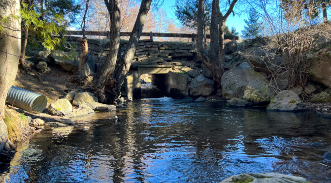
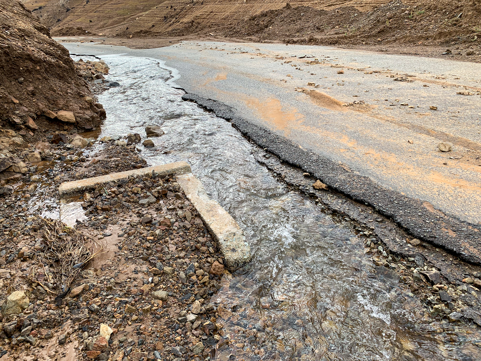
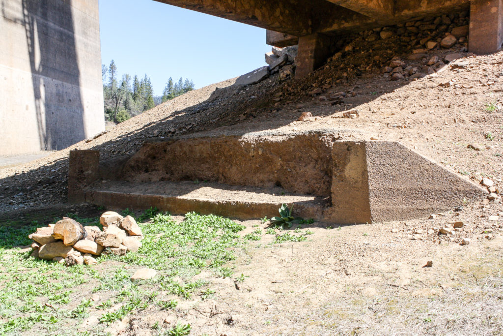
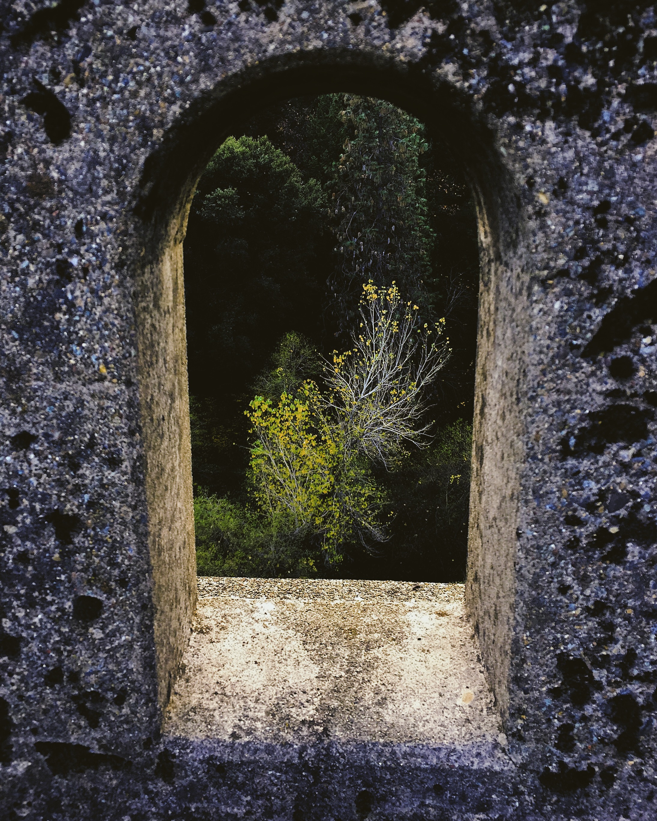
Above photo: Boles Creek flows under Grove Street in Weed. Grove Street carried the first routing of US 97 into Weed.
A little bit of this, a little bit of that
During the past couple of months, I have spent what little bit of free time I’ve had chasing down some benchmarks, determining the early routing of US 97 through Weed, California, and doing a little exploration of former US 99W and US 99E. I still have some research to do on the aforementioned section of US 97, as well as some pictures to take, but I hope to have a post up in the next month or so on that subject. If you are a member of the Facebook group “California Historic Highways” you’ve seen some results of my research already posted to that group in the past few weeks.
Segment of first routing of the Pacific Highway, then US 99, then US 99W, just south of Yolo County Line Road, just east of Interstate 5. This pavement probably dates from 1925. I haven’t yet researched when the more modern and straighter alignment was built to the left, but I suspect sometime around the late 1930s. Photo taken 24 February 2022.
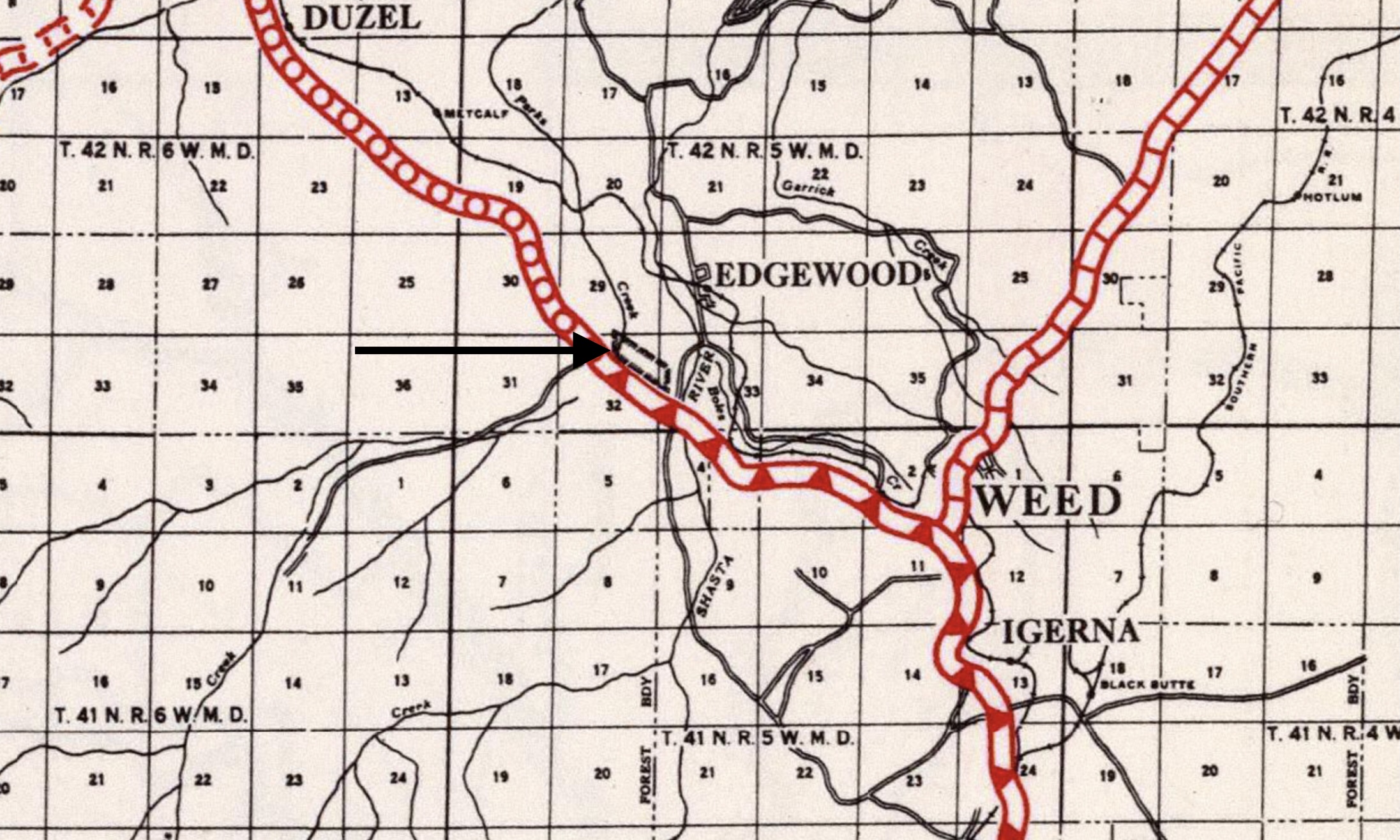
Benchmarks: I added benchmark W 494 to the Siskiyou County, California Survey Marks page. This benchmark is near the first routing of US 97 outside of Weed, after the southern terminus of 97 was moved from Ashland, Oregon, to Weed in 1934.
I also added new pages for Butte and Tehama counties in California. The first benchmark listed in the Butte County page is near the crossing of an abandoned branch of the Sacramento Northern Railway over CA State Route 99 (ex-US 99E).
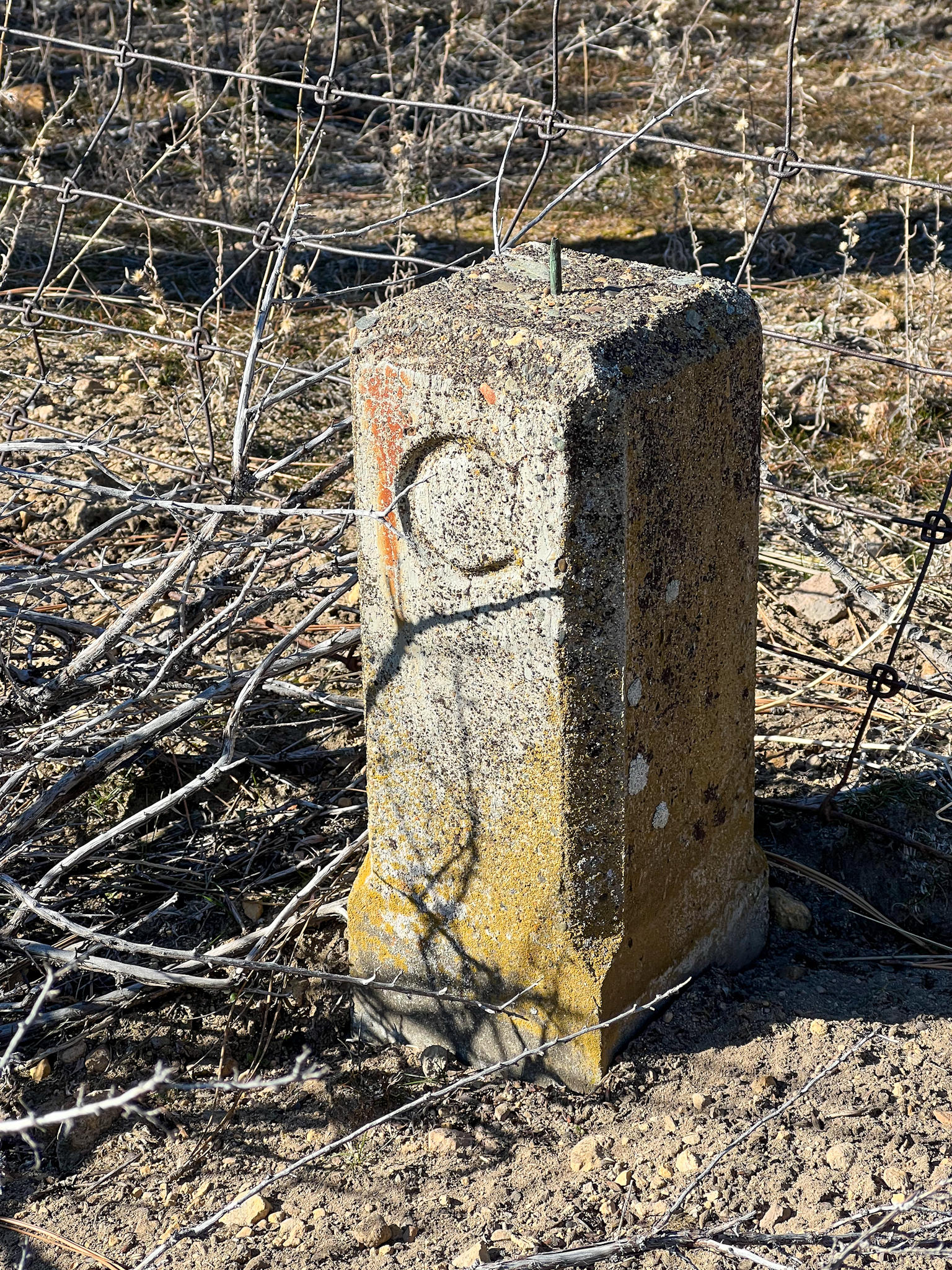
“C post” right-of-way marker used by the California Department of Highways from the mid-1910s to the late 1930s. This one is found near benchmark W 494 along US 97 north of Weed.
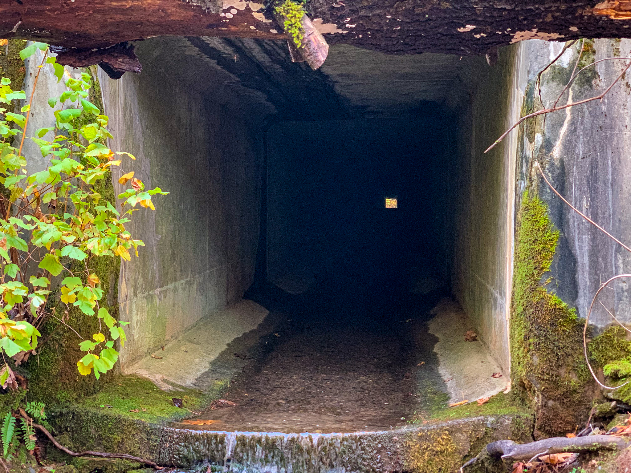
New blog post: Lake Shasta Artifacts, 9 December 2021. A visit to a segment of historical US 99 left high and dry by the receding waters of Lake Shasta, as well as a railroad tunnel that is also accessible.
Update to the Union Pacific Railroad: Black Butte Subdivision page in the Abandoned Railroad Infrastructure section. I’ve identified a number of straightened curves between Dunsmuir and the Black Butte siding that I’m checking out.
All photographs by Denis Fabbrini unless otherwise indicated.
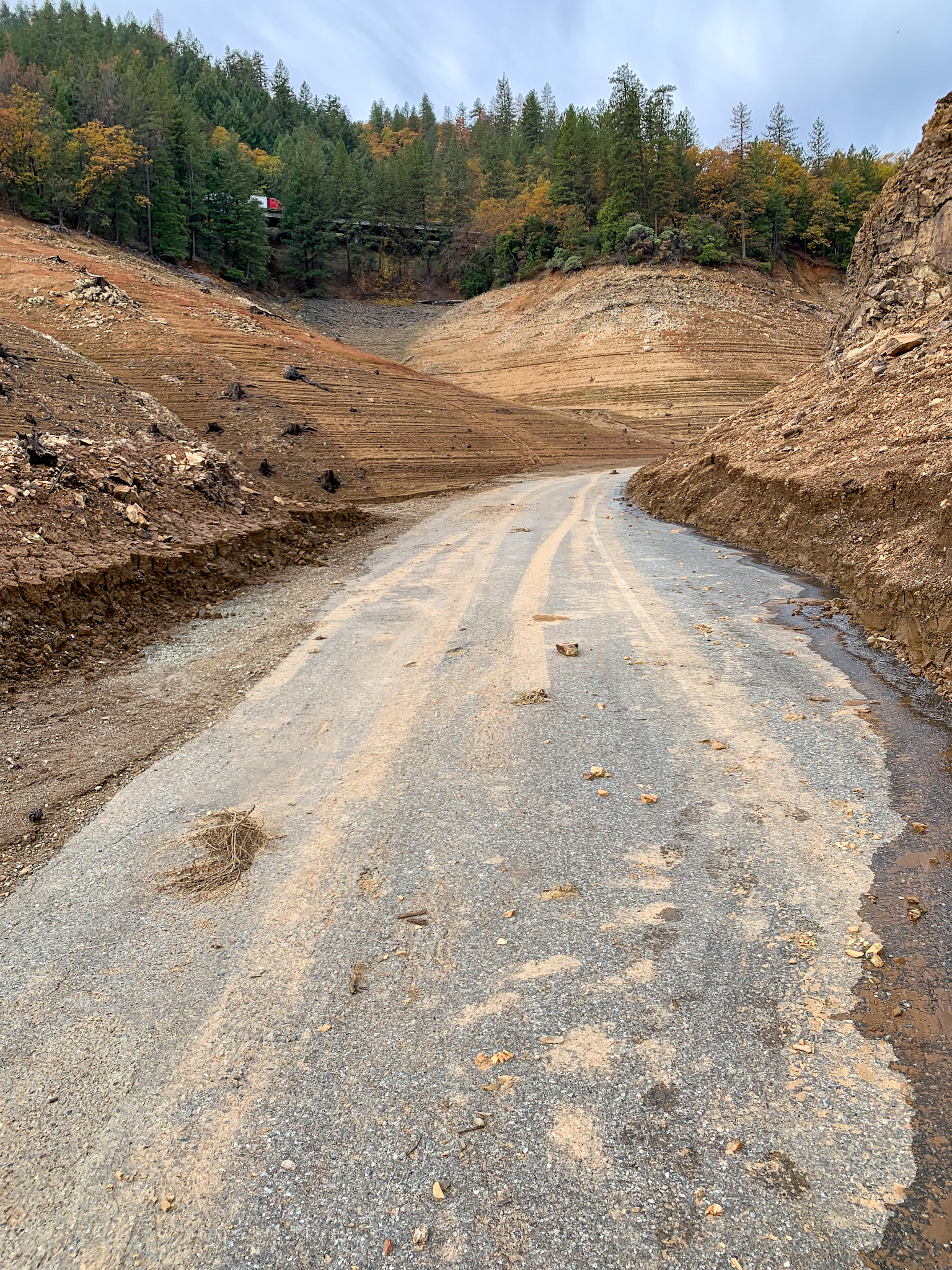
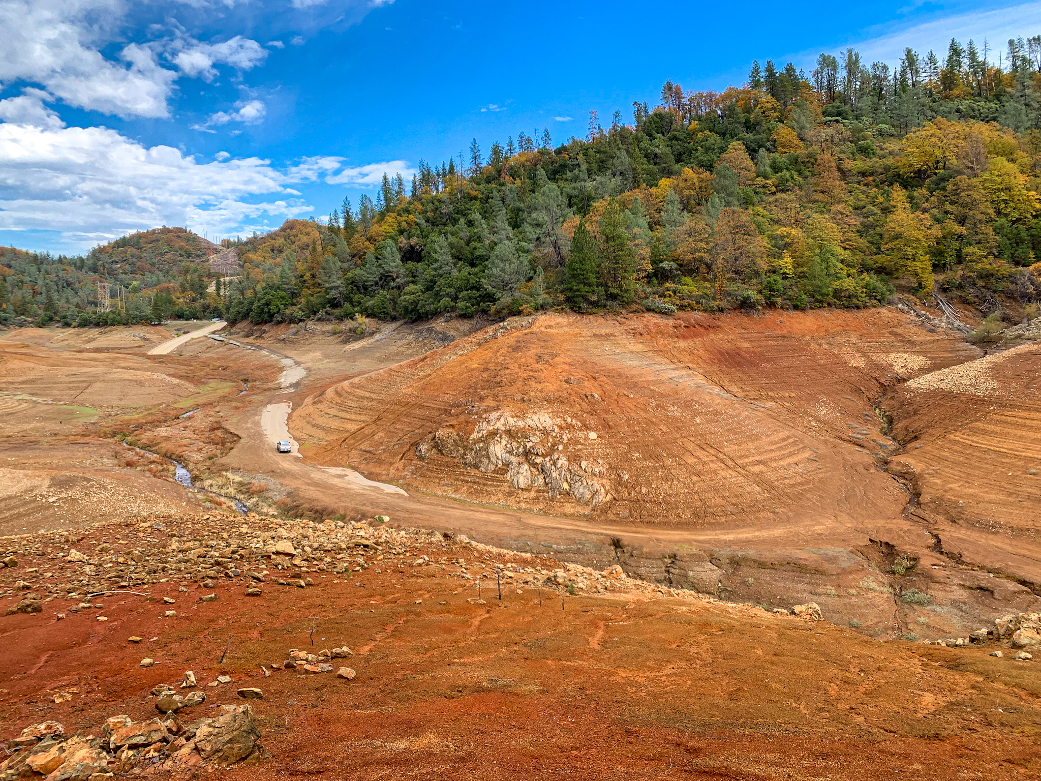
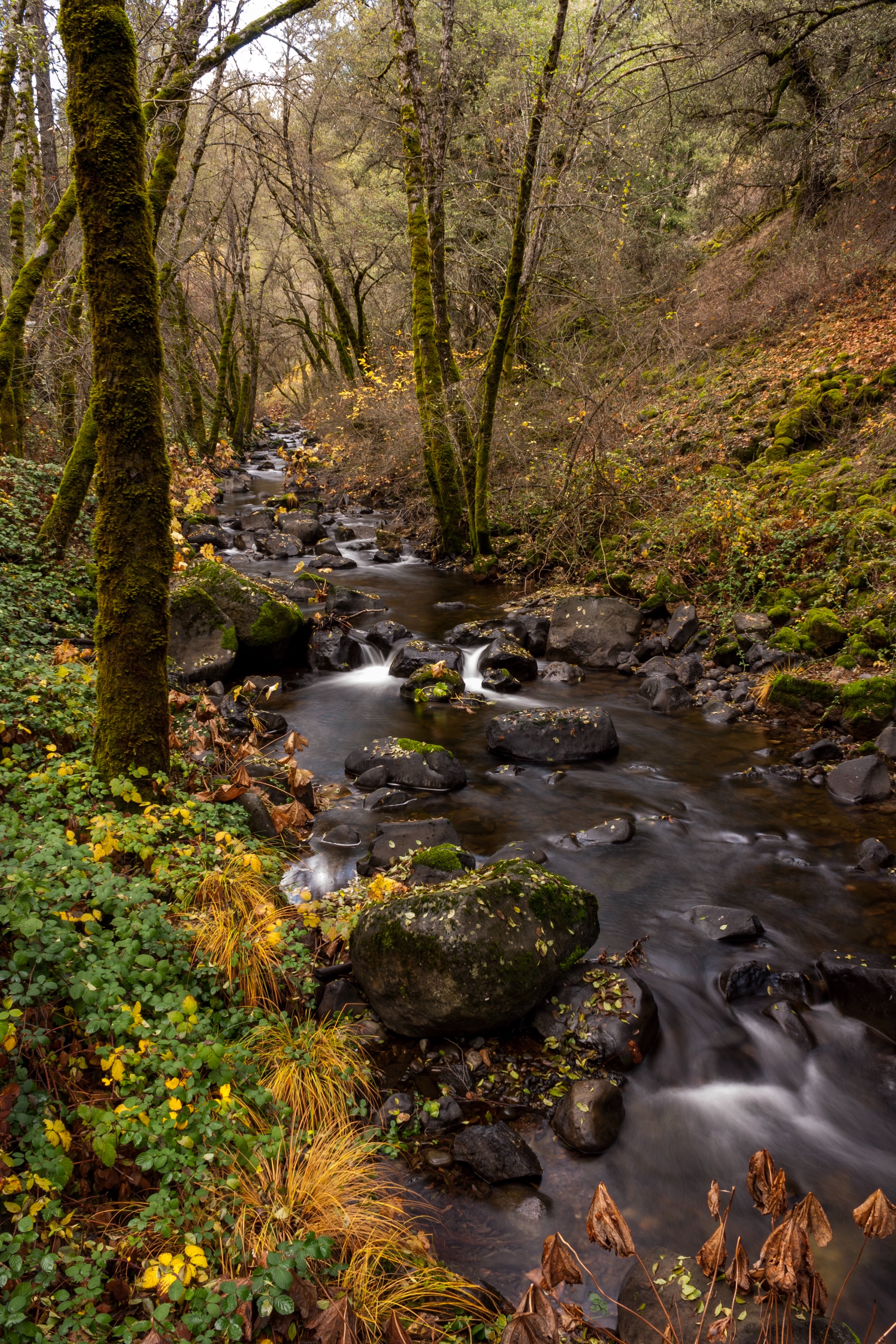
At the beginning of November, I made a trip down to Lake Shasta to explore some of the old infrastructure uncovered by the drought conditions much of the West has been suffering from in the past couple of years. Lake Shasta has been a levels only really seen in the past decades – 2014, I believe, and the great drought of 1976-77. Stuff that has emerged from the waters include old highways, bridges, and railroad beds and tunnels. Unfortunately, much of the area surrounding the lake was engulfed in wildfires throughout this past summer, with national forest closures making access to much of the lake and these historic sites pretty tough.
At the beginning of November, I was finally able to make it down to the lake and spend a few hours exploring a couple of sites of interest with a fellow roadgeeker, Eric Hall, from Redding.
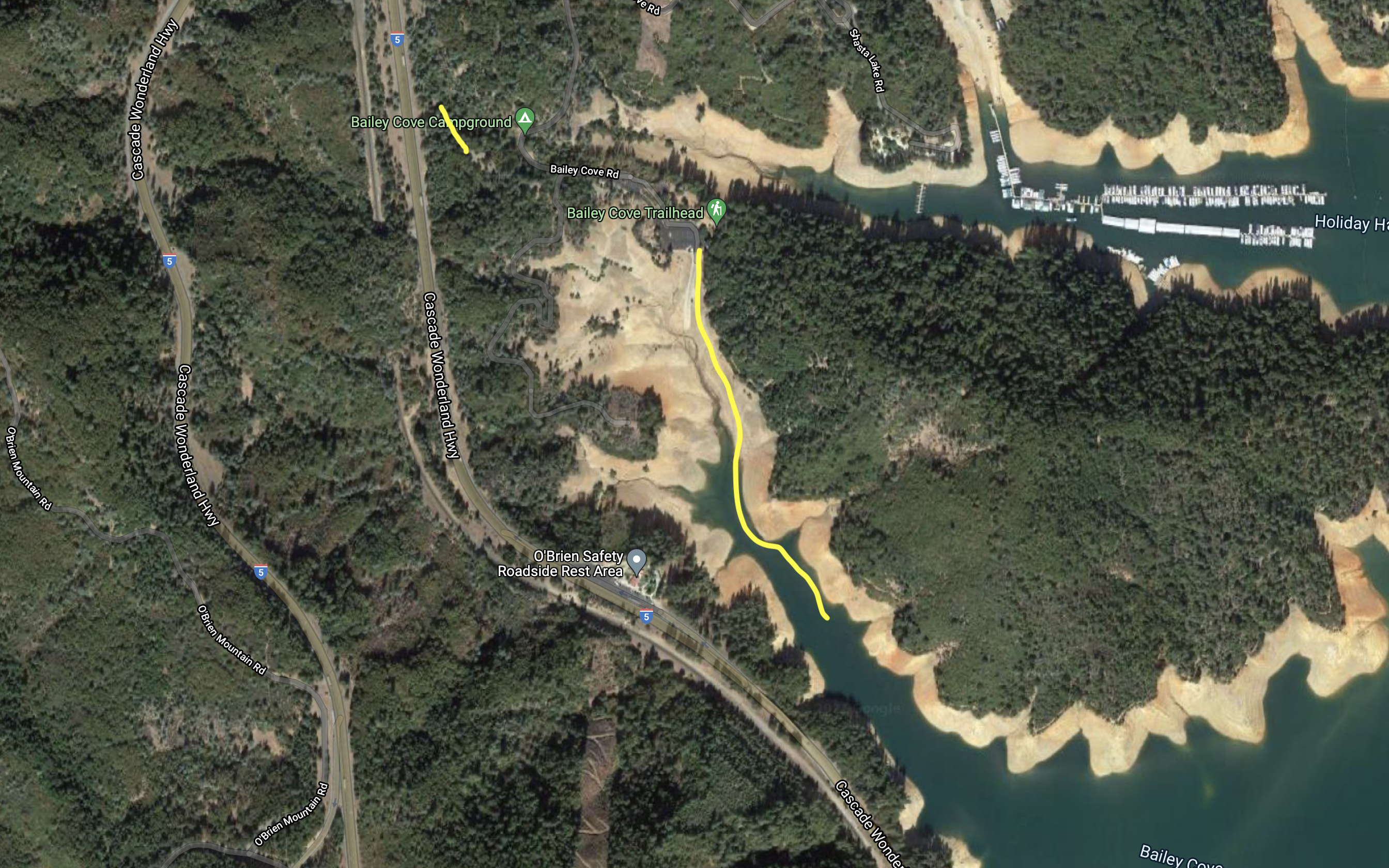
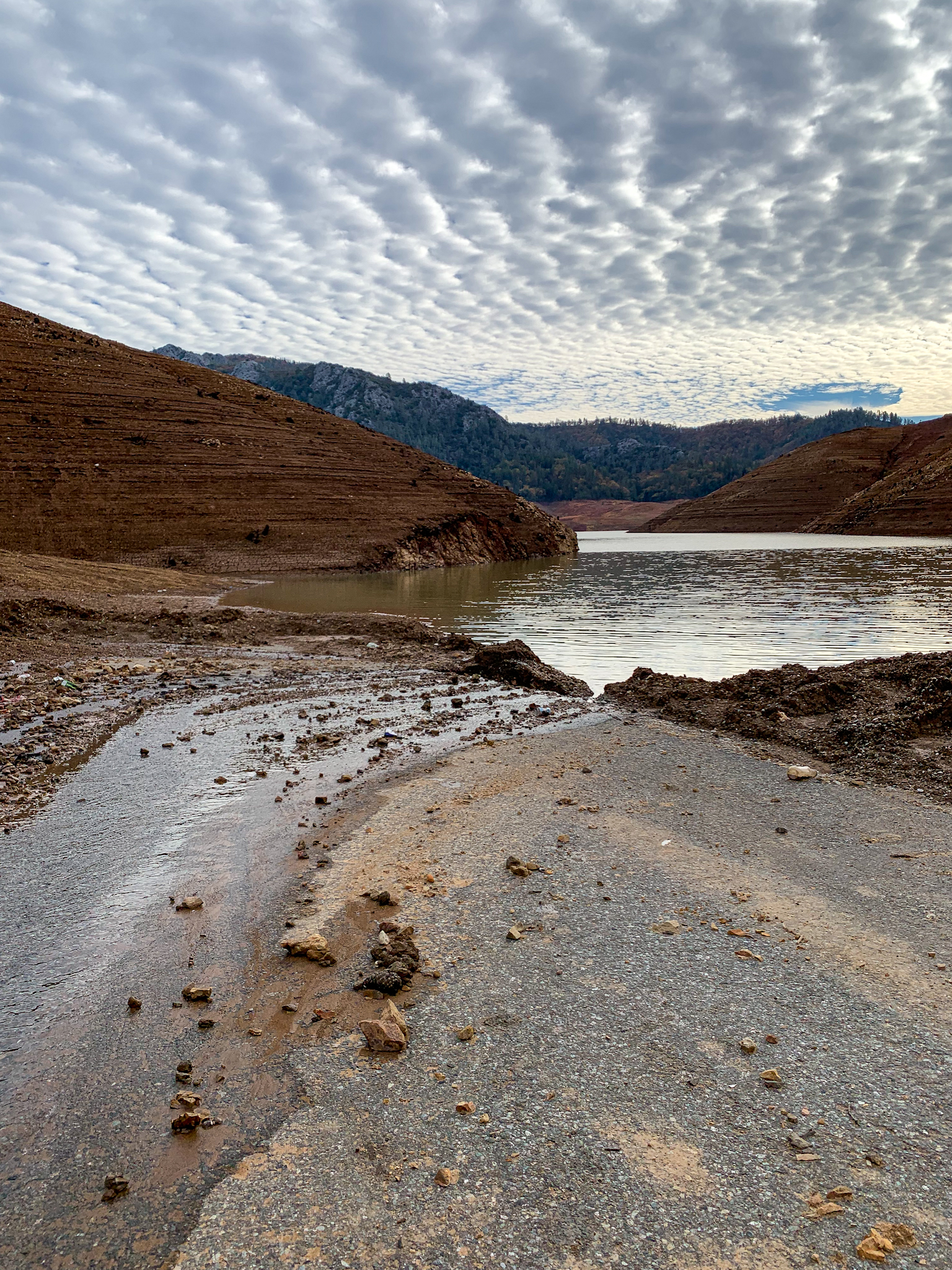
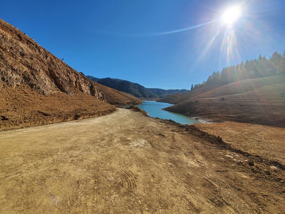
Bailey Cove
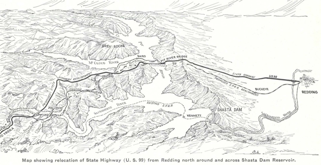
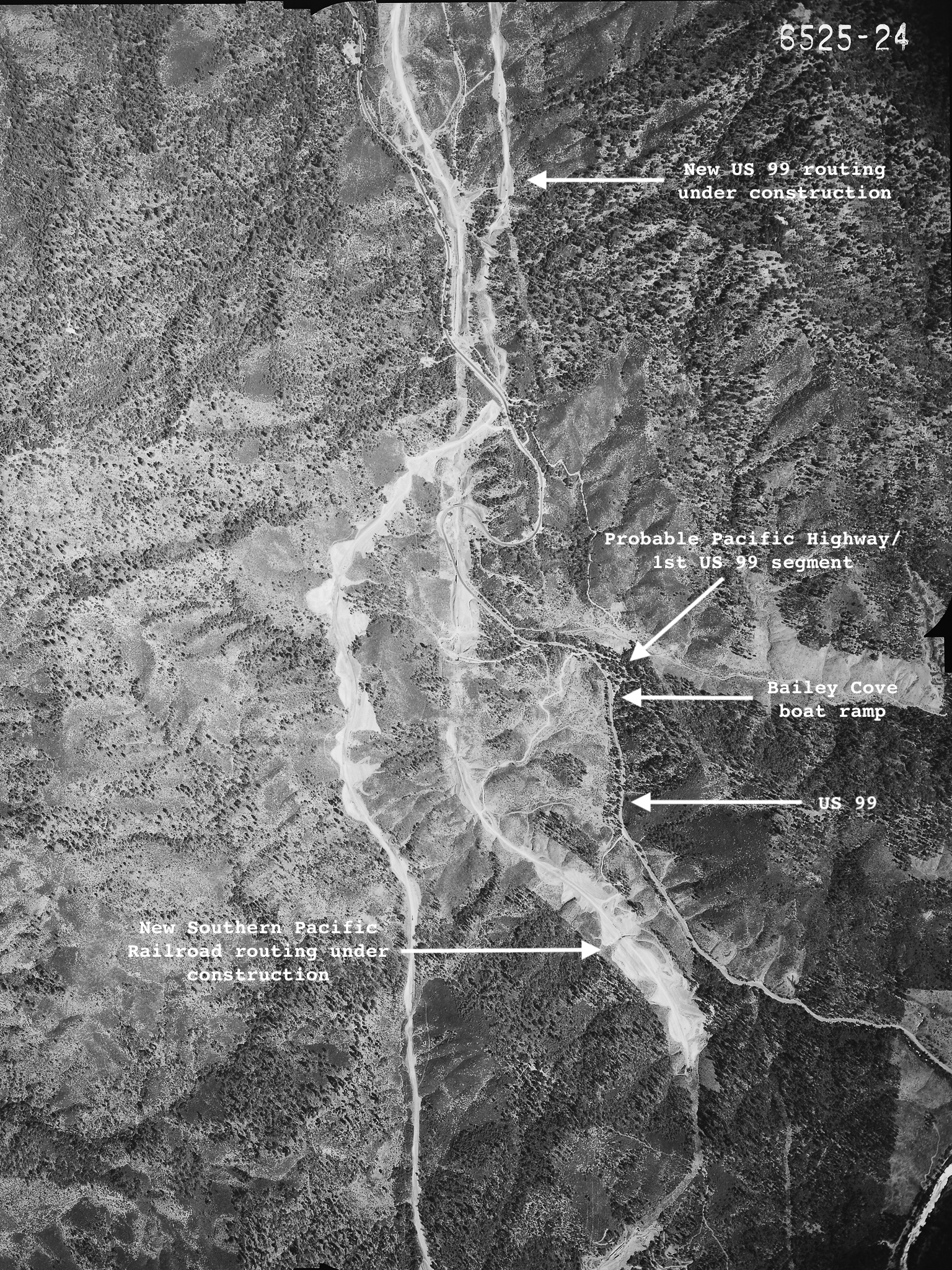
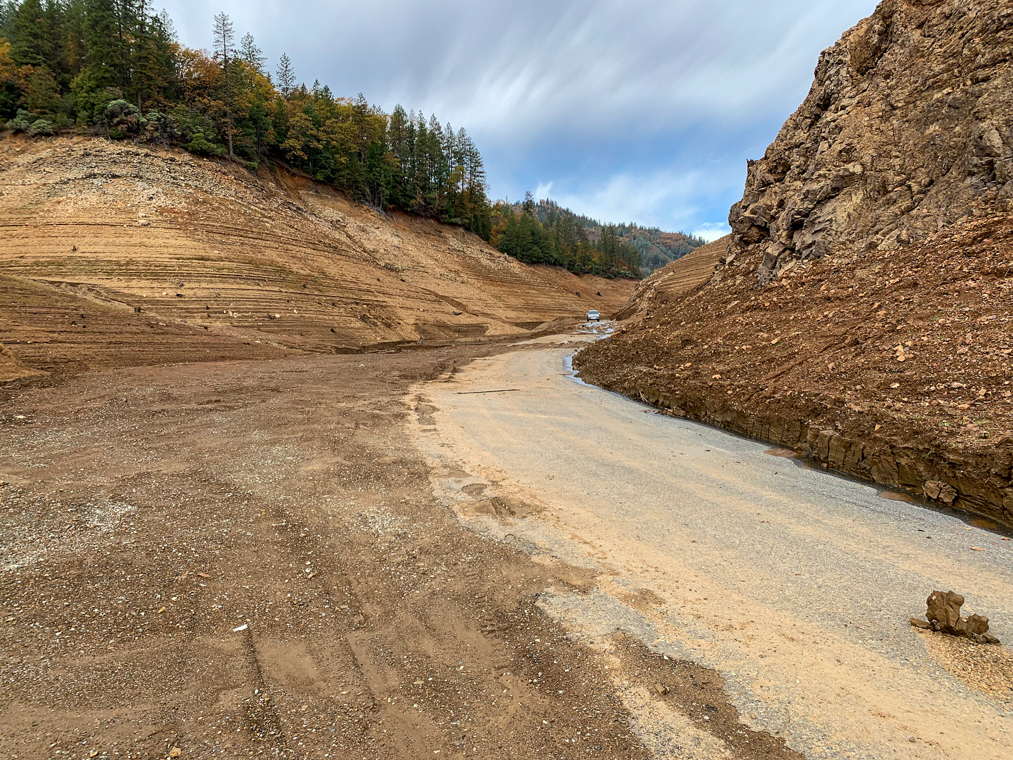
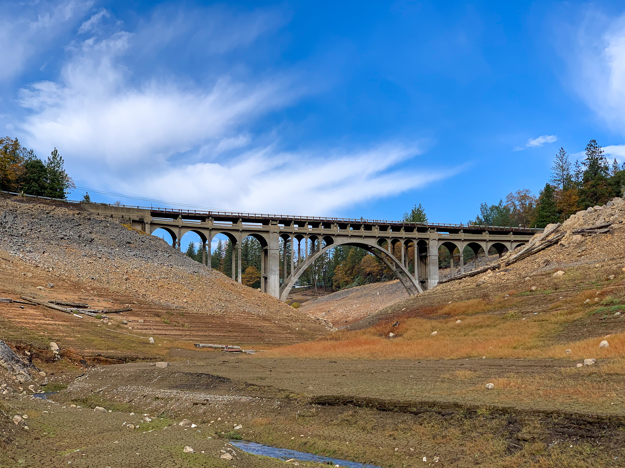
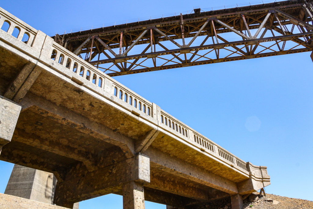
This spot is located in a drainage off the west side of the McCloud River Arm of Lake Shasta. The 1915 Pacific Highway and the 1926 US 99 routing drops off a ridge heading south down to the McCloud River, then along the north side of the Pit River, until it crossed the Pit near what is now Bridge Bay, under the shadow of the present I-5 Pit River Bridge. This routing was replaced when Shasta Dam was built and required that US 99 be moved to higher ground, along with 26 miles of Southern Pacific trackage. The new routing opened in January 1943.
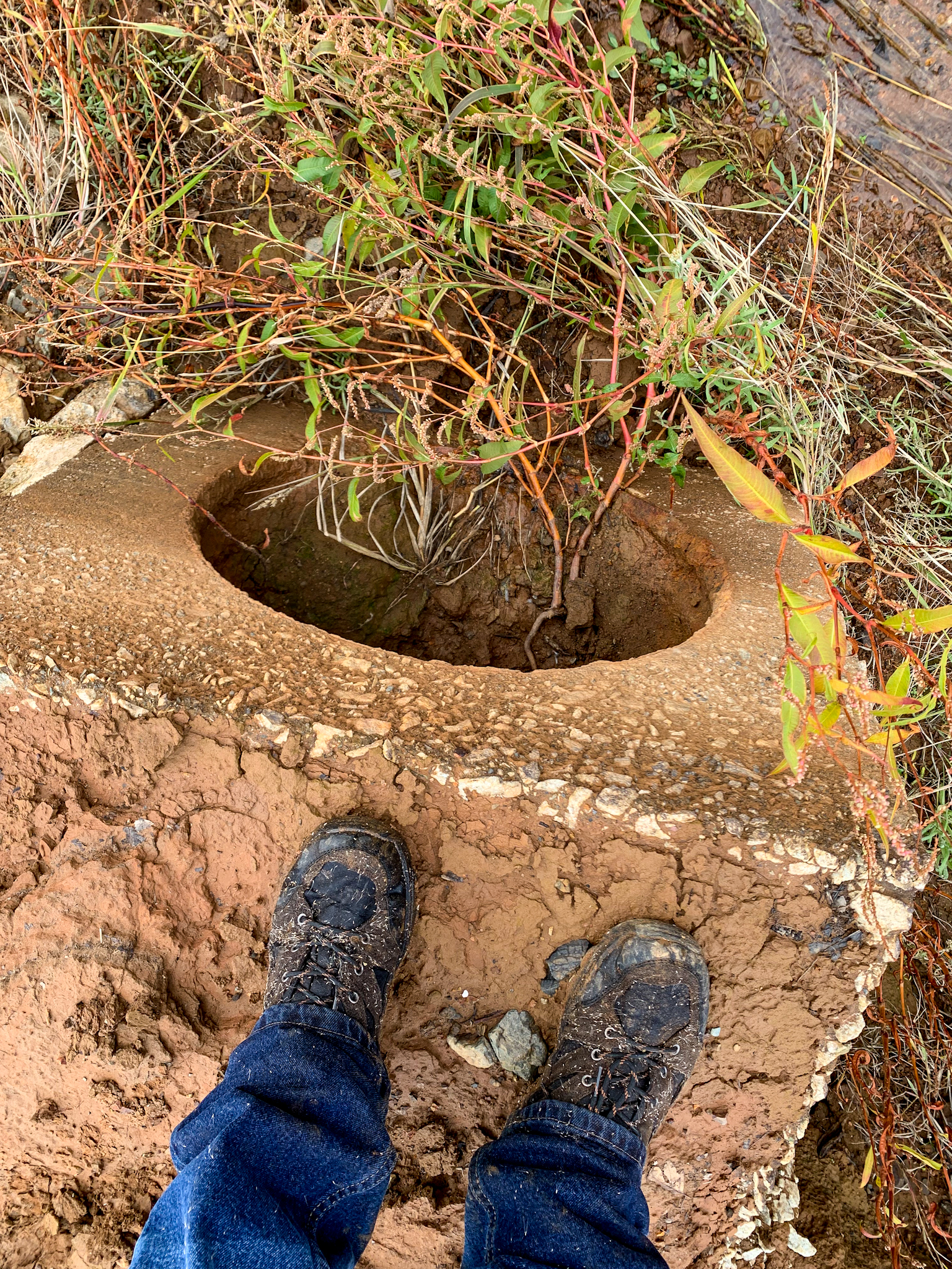
We found this segment from the Bailey Cove boat ramp down to the water level of that day to be in remarkable condition. Some stretches were nearly intact, while other pieces were partially washed away or still covered in 10 to 12 feet of silt deposits. Eric and I believe that part of the road had been uncovered by grading over the summer to allow boaters to reach the receding waters.
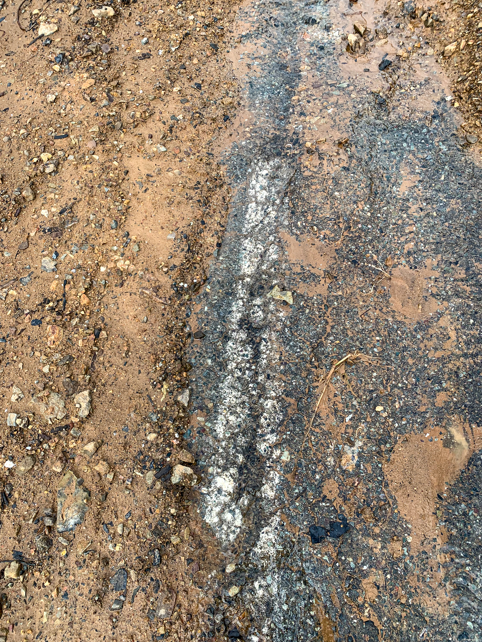
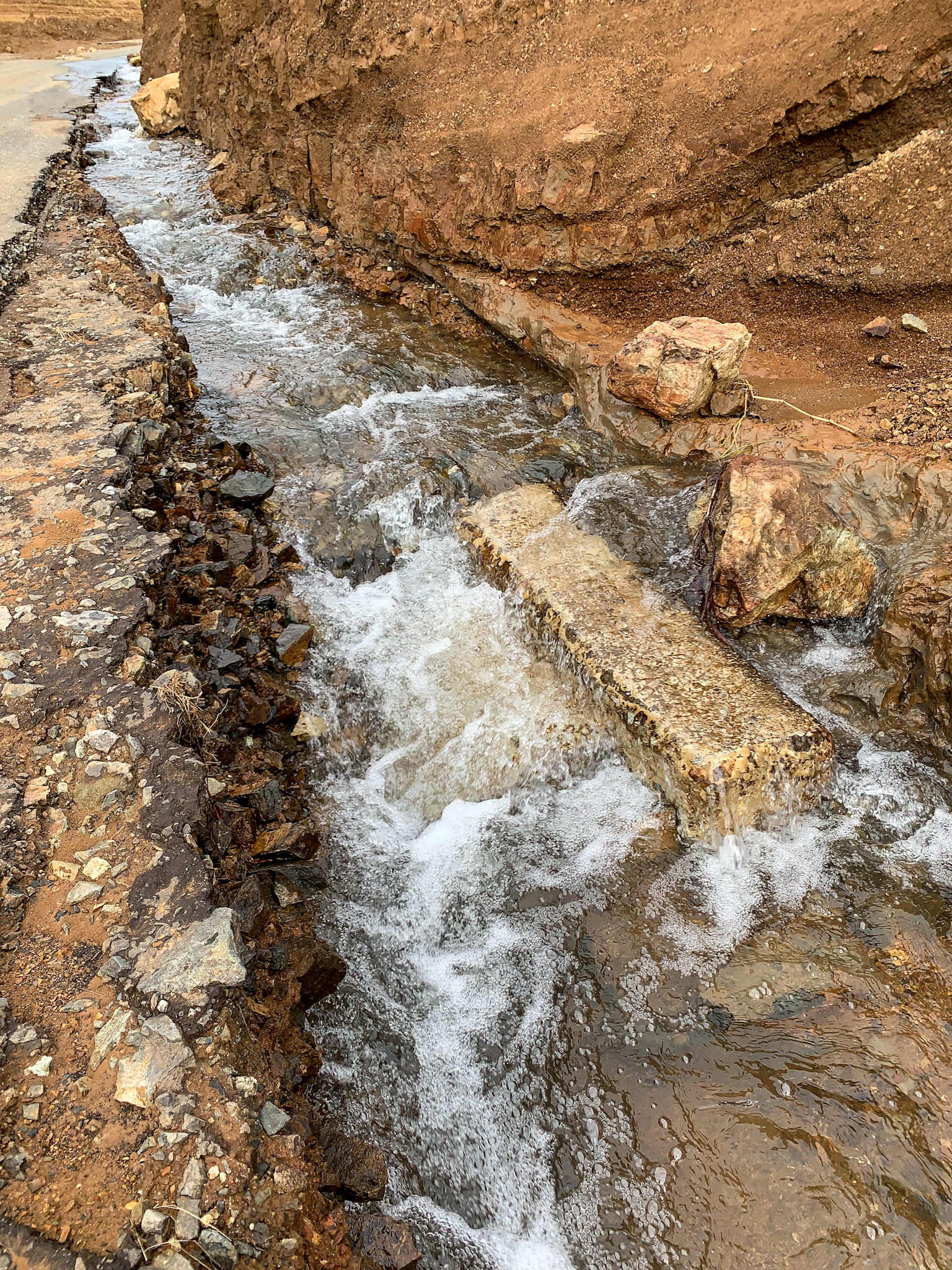
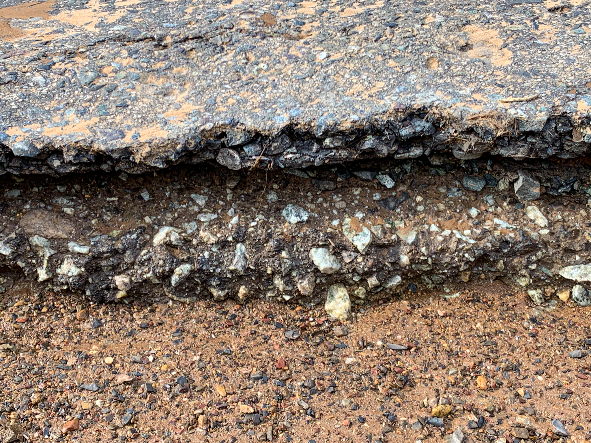
Google Maps. Google Satellite screenshot of the Bailey Cove area. The longer yellow line is the location of the normally submerged section of the Pacific HIghway/1926 US 99 that we explored. The shorter line by the campground area is a blackberry and poison oak covered segment that we also checked out.Map from the November 1939 issue of California Highways and Public Works magazine, showing the current US 99 at the time, and the proposed rerouting of US 99 and the Southern Pacific Railroad, due to the construction of the Shasta Dam. This view is looking east.Aerial photograph from 1940 showing the replacement route under construction, as well as the construction of new routing for the Southern Pacific Railroad. Photo: Flight C-6525, frame 24, July 12, 1940, Courtesy of UCSB Library Geospatial CollectionLooking south towards the McCloud River Arm. Photograph by Eric Hall, from a trip he made to this area on October 12. The lake level was about 20 feet higher on this date.Highway stripe still evident after nearly 80 years.Looking north. Interstate 5 is in the upper lefthand corner.Continuing north. A major storm a few days before our trip washed out part of the road where my truck is parked.Looking north from where I had parked. Photograph by Eric Hall.One of 3 culverts we found. I suspect that dates to around 1926, when the route was designated US 99 and improved and paved.Pavement layers. My hunch is the bottom layer dates to the mid-20’s, while the top layer is probably early 1930’s.Remnants of a utility pole just below the full lake level on the east side of the highway. A string of these cut off poles could be seen along the canyon. The second culvert.We climbed the west side of this small canyon because we thought we saw some old stonework, but we found this box culvert a buried a couple of hundred feet below northbound Interstate 5.Looking through to the other side of the cut and fill that makes up northbound Interstate 5.Looking south down Bailey Cove from a point just below the culvert in previous photo.Looking north towards the boat ramp from the same spot.The third culvert we found as Eric and I were making our way back down to the road.Back up at the picnic grounds above the boat ramp, this area in the right of the photo was probably the 1915 Pacific Highway routing. The curve was straightened a bit an moved a couple of hundred yards to the west, now under the marina parking lot.Eric walking in the road cut adjacent to the campground. This segment is indicated by the shorter yellow line in the Google Sat image at the beginning of this post.
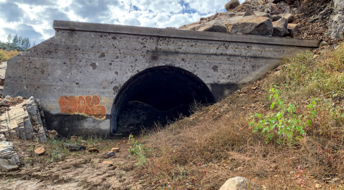
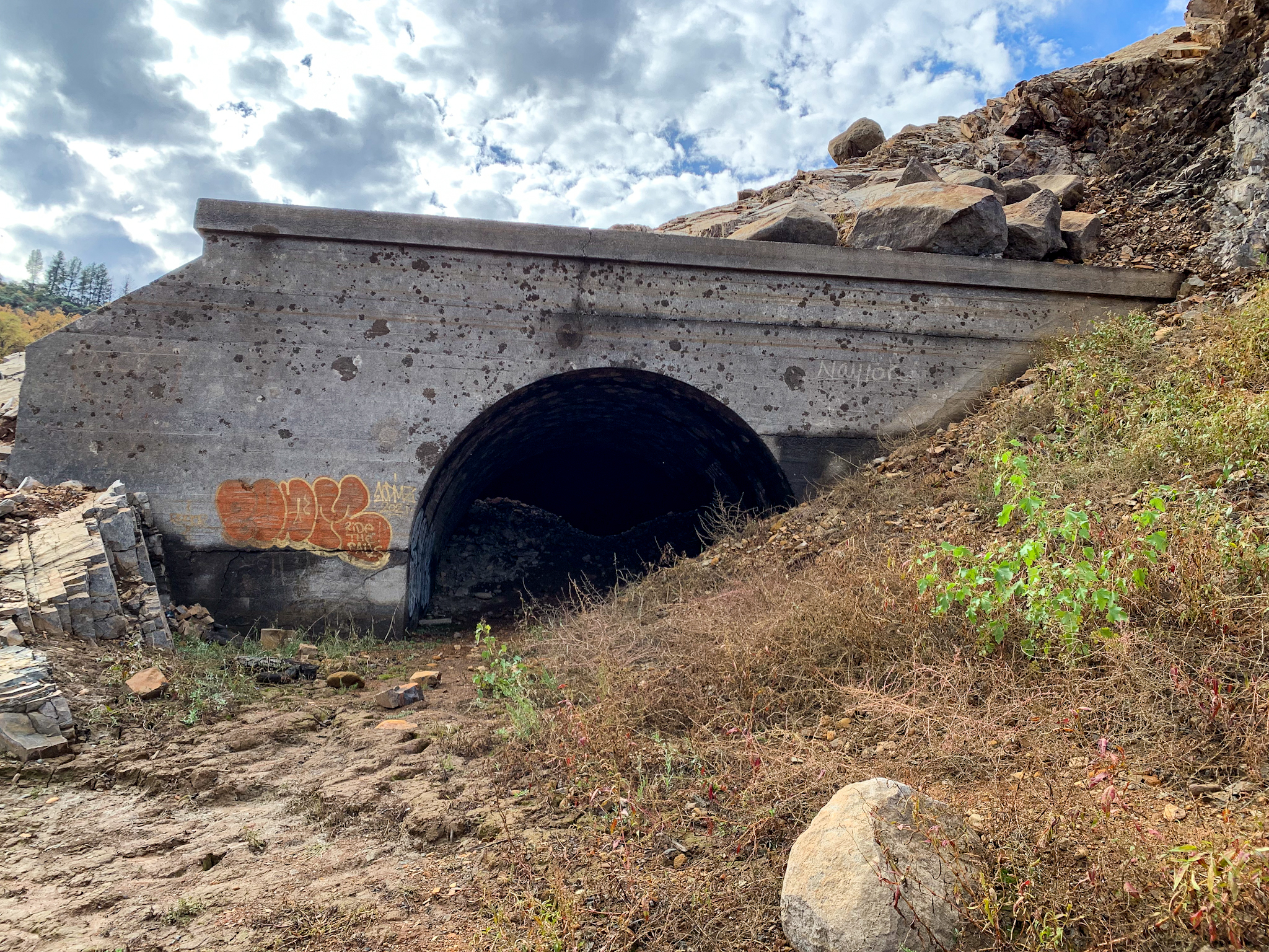
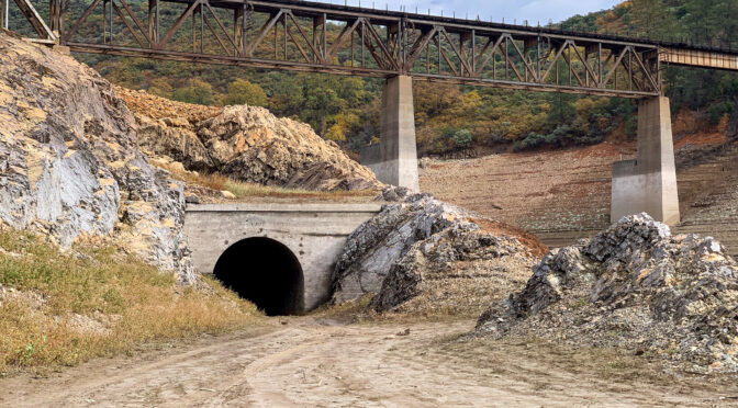
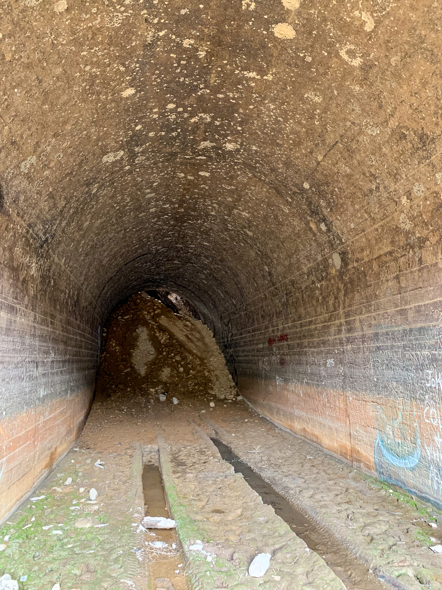
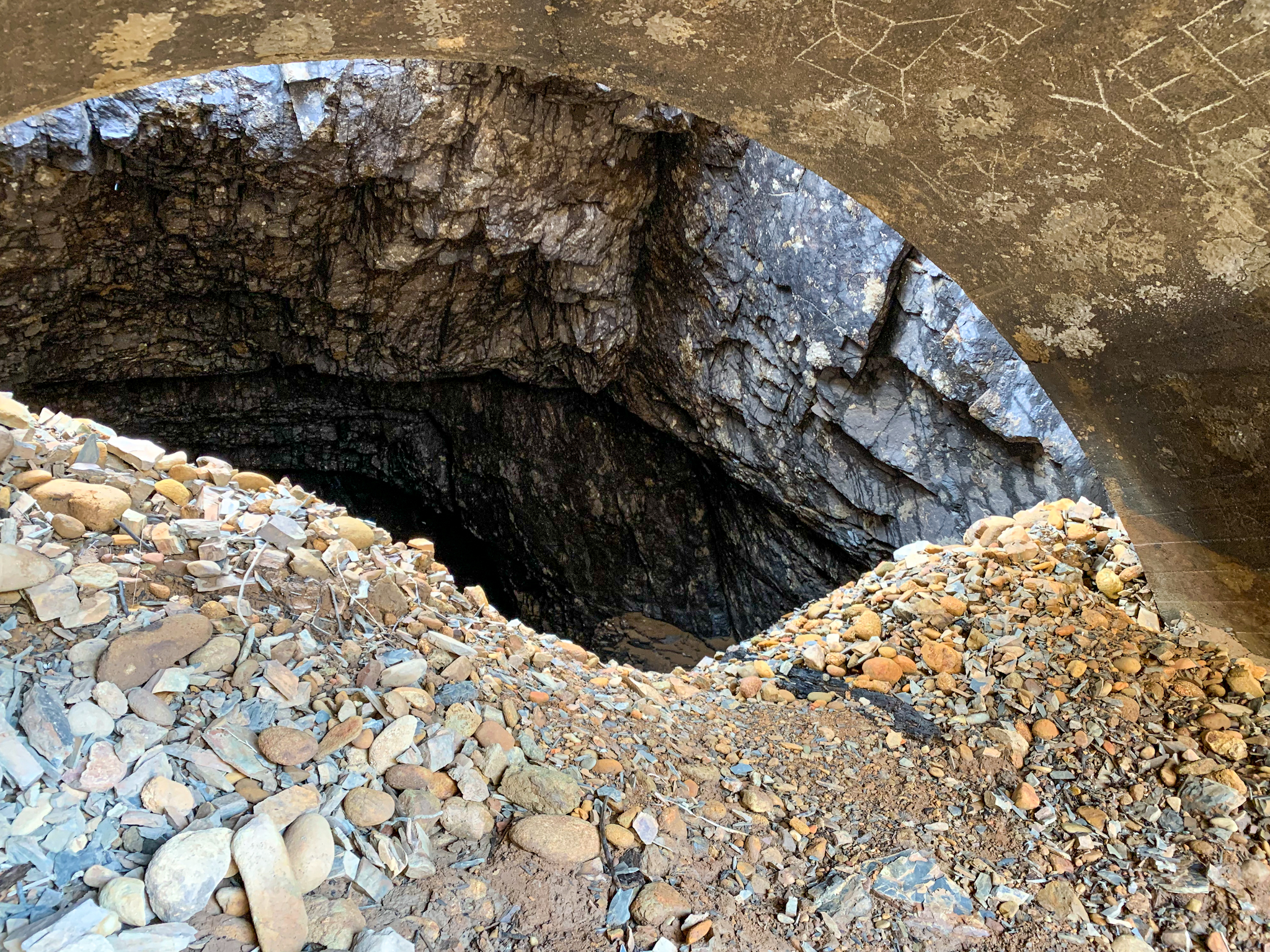
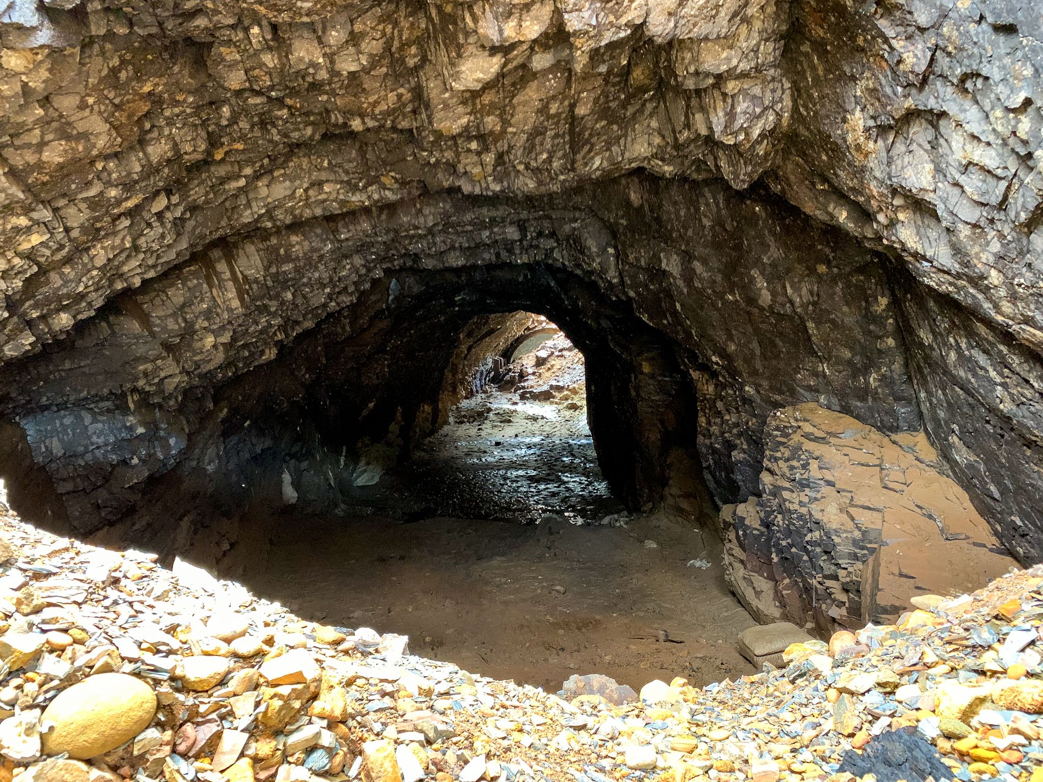
Southern Pacific Railroad Tunnel 6
After concluding our exploration of the Bailey Cove area, we drove up Interstate 5 to Antlers to check out one of the old railroad tunnels exposed by the receding waters. Tunnel 6 is located just north of what was the confluence of the Sacramento River and Charlie Creek. Today, the tunnel can be reached by driving south on Lakeshore Drive south of Antlers about 1 mile. After passing the US Forest Service Lakeshore Station, make a hard left just before crossing the Charlie Creek Bridge. A high clearance vehicle is recommended to travel down the river canyon slope to reach the tunnel.
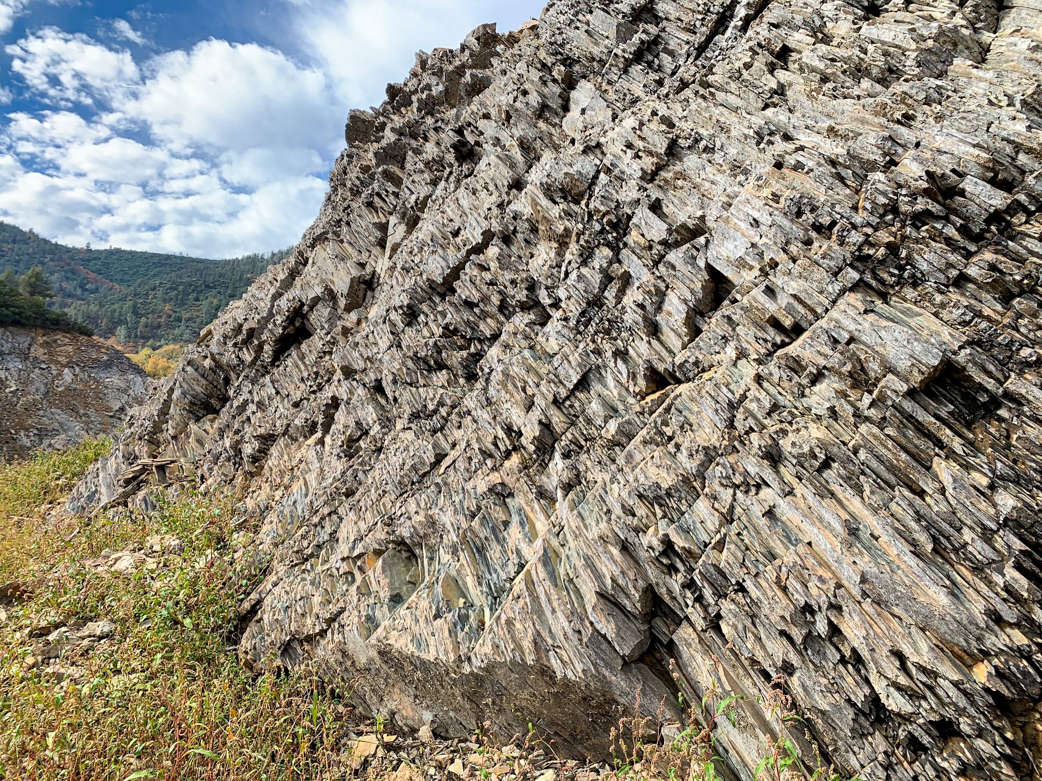
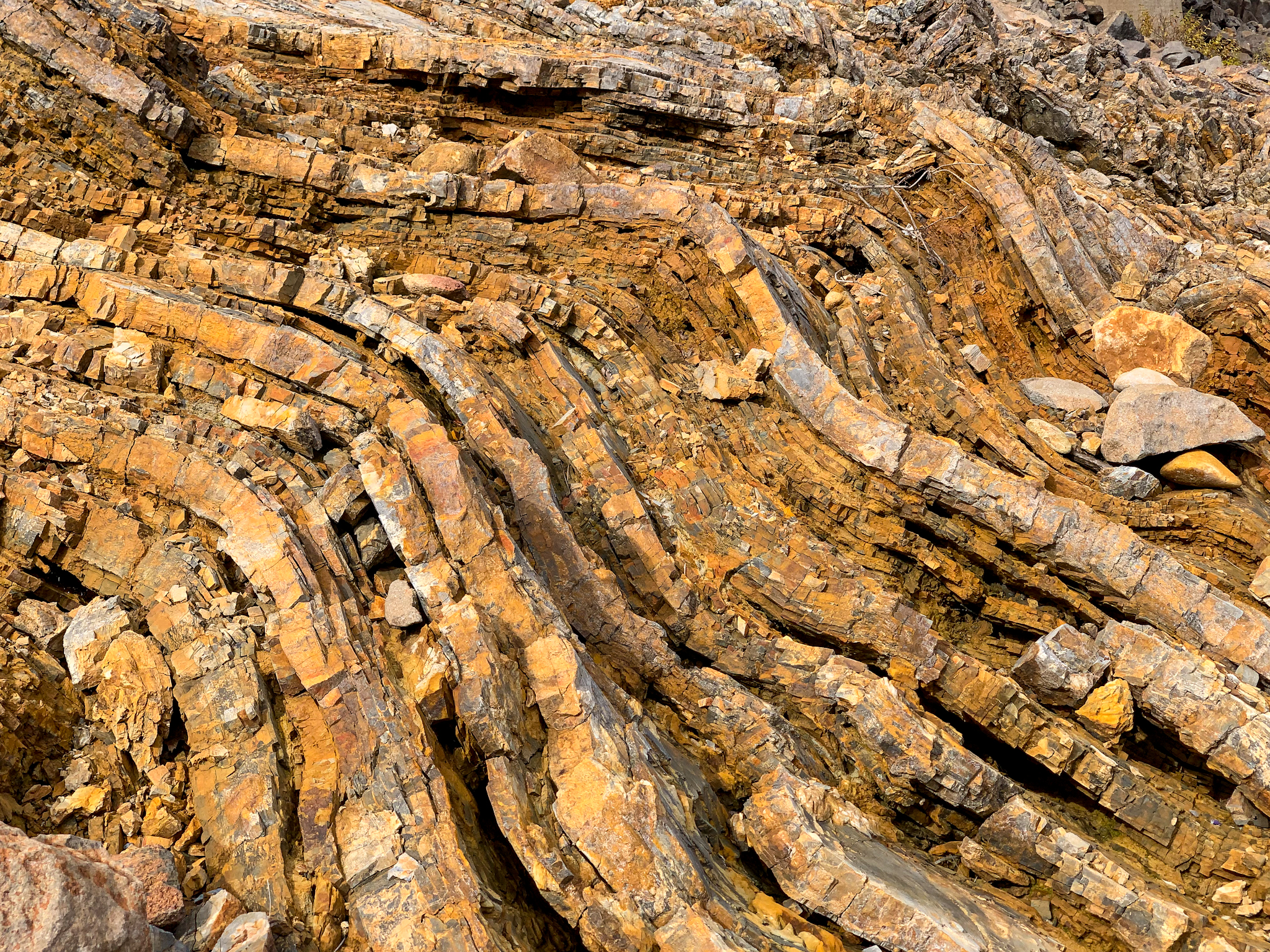
When built by Southern Pacific predecessor Central Pacific in 1884, it was a just basically a hole dug through rock until sometime in the 1920s when concrete headwalls were added. The south end of the tunnel is lined for about 50 feet, whereas the north portal is not. Since being first inundated in 1948, the tunnel has partly filled with silt, raising the floor probably about 10 feet or more. The tunnel is situated in highly metamorphosed shale and slate, more than likely from some old island arc slammed up against the North American plate many millions of years ago. Also impressive is the the trestle high above the canyon that replaced the tunnel necessitated by the flooding the Sacramento River by the Shasta Dam.
South entrance of Tunnel 6. Current Union Pacific (ex-Southern Pacific) trestle looms high above. The Sacramento River arm is to the right.The south entrance was lined for about 75 feet somewhere around the late 1920s, along with the addition of concrete headwalls at the entrances. The rest of the tunnel is exposed rock.The river-facing side of the tunnel. The shelf-like area I’m standing on alongside the tunnel was graded to allow for construction of the overhead trestle.The north entrance. The amount of silt that has been deposited for the decades is evident, as the current clearance at this end is only abut 12 feet.This is just as you enter the north portal. As you can see, the tunnel was not lined at this end.Just north of the tunnel are apparently the buried remains of 3 railroad cars that spilled into the Sacramento River in 1903. This is a wheel set visible from one of the overturned cars.The historic 1925 Charlie Creek Bridge just south of the tunnel, and on the west side of the Sacramento River. The current bridge deck was added about 1940 in anticipation of rising waters from filling Lake Shasta. Just further upstream is the 1917 Charlie Creek bridge, which carried the Pacific Highway.A few hundred yards south of the Charlie Creek and Sacramento River Confluence is a concrete retaining wall built to protect the railroad bed. Some of the great geology through which Tunnel 6 was built.
Some months back blog posts by Tom Fearer at Gribblenation.org regarding local roads in my area ended up leading me down the proverbial wormhole for more information. I have to say the trip was rewarding. While not answering all my questions about the original subjects – Siskiyou County Road A12 and the first routing of US Route 99 through Weed, California – the search for information resulted in answering a few questions about previous railroads in the area (the Weed Lumber Railroad/Southern Pacific Railroad) and the locations of the first Weed Airport and the long-gone Yreka Airport.
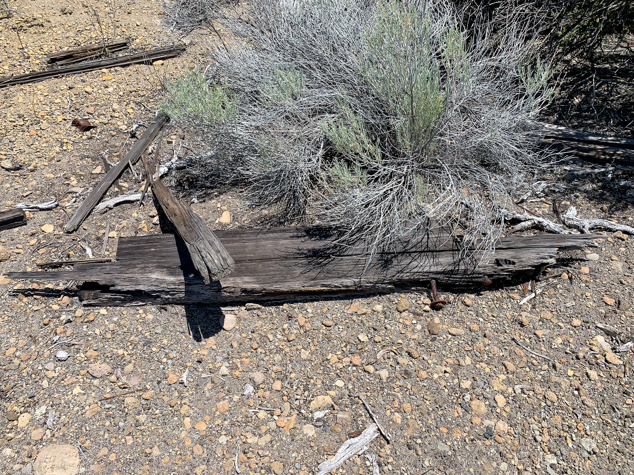
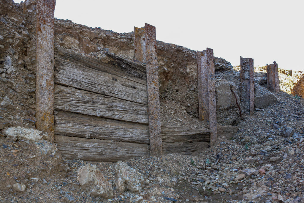
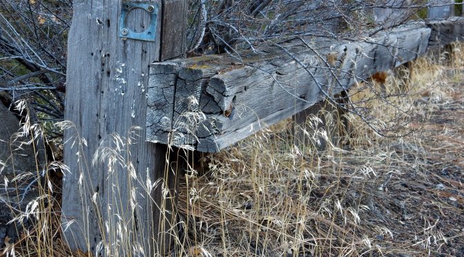
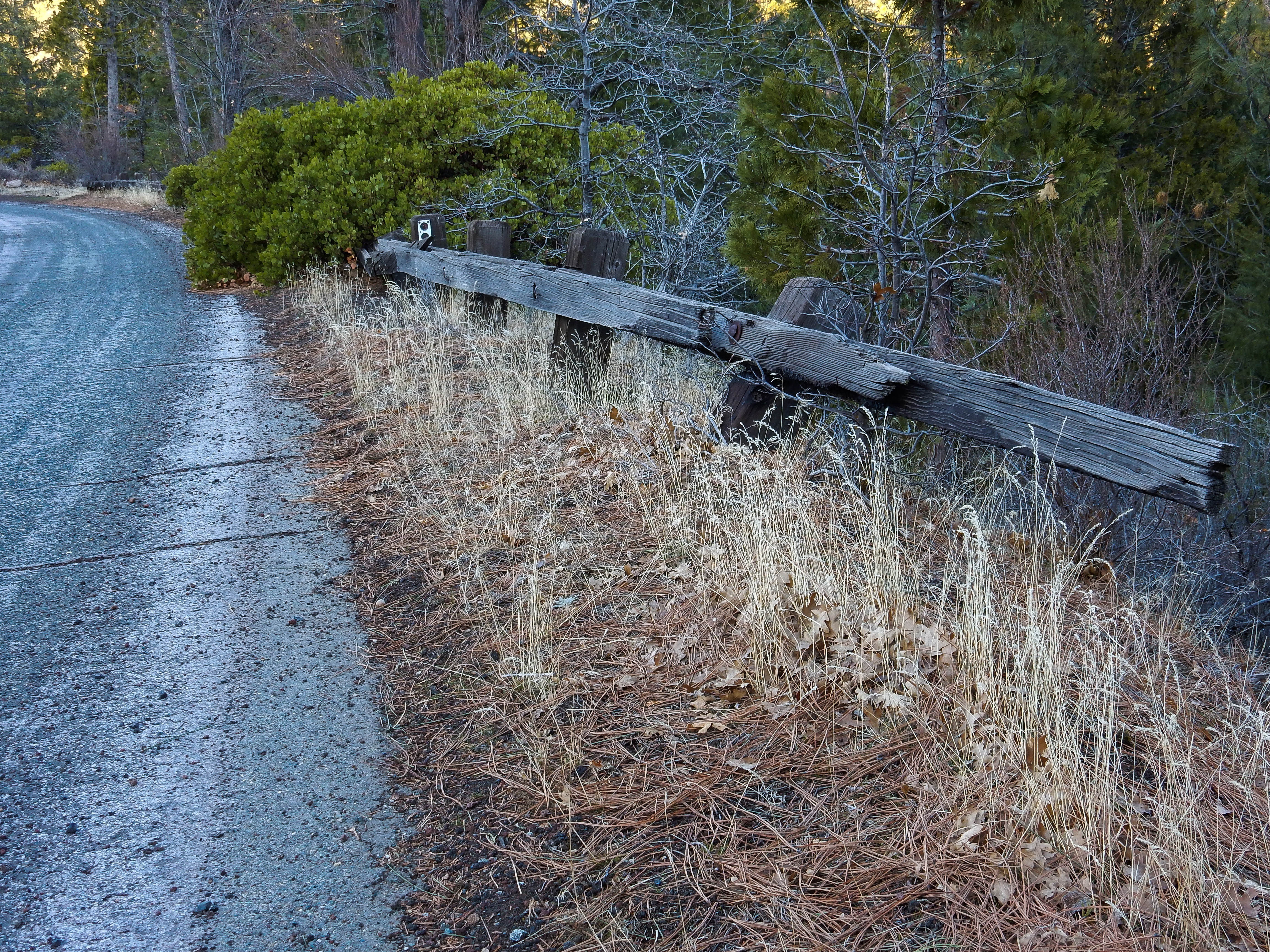
A recent exploration of a segment of the abandoned Weed Lumber Company Railroad yielded clues to the original routing of US 97 northeast of Weed, California. These are remnants of wooden highway guardrails prevalent in the late 1920’s and early 1930’s.
Most of the research involved internet searches for historical maps between the years of 1915 and 1945. While my search started with historical topographic maps at the USGS website, other map sites included the David Rumsey Map Collection, aeronautical charts and airway bulletins at the Library of Congress, as well as posts and articles at Gribblenation and cahighways.org. While my research continues, enough information was accumulated to post a worthy entry about the Yreka Airport on the Siskiyou County Aviation Infrastructure page of this site.
Within the next week, I will also post an entry on the aforementioned page about the original Weed Airport. I had first seen a mention of this airport in the September 1, 1931 Airway Bulletin No. 2. The 1927 (revised 1930) Army Air Corps Air Navigation Map indicates an approximate location of the former airfield, but it was the 1935 California Division of Highways Siskiyou County Highway Map that really helped in nailing down the exact location in a ranch pasture along Old Highway 99/Stewart Springs Road a mile south of the current Weed Airport.
1935 California Division of Highways Siskiyou County Highway Map, with arrow pointing to the rectangle representing the Weed Airport.
The lesson is that it is the journey through the wormhole can be just as rewarding as the destination. Being mindful that seemingly unrelated resources can result in clues to other research projects should always be kept in mind. The only problem is that usually leads one down other, numerous wormholes!
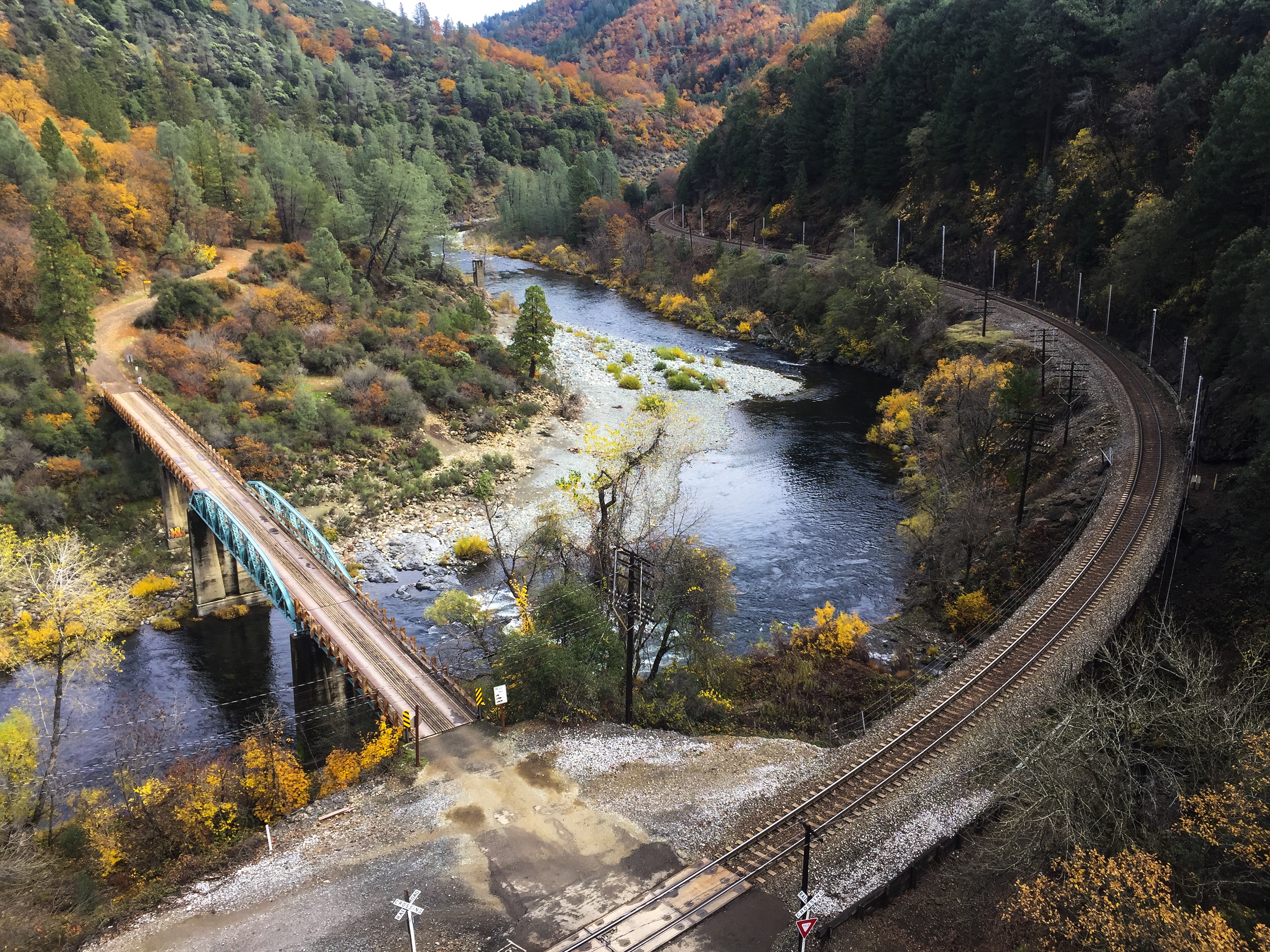
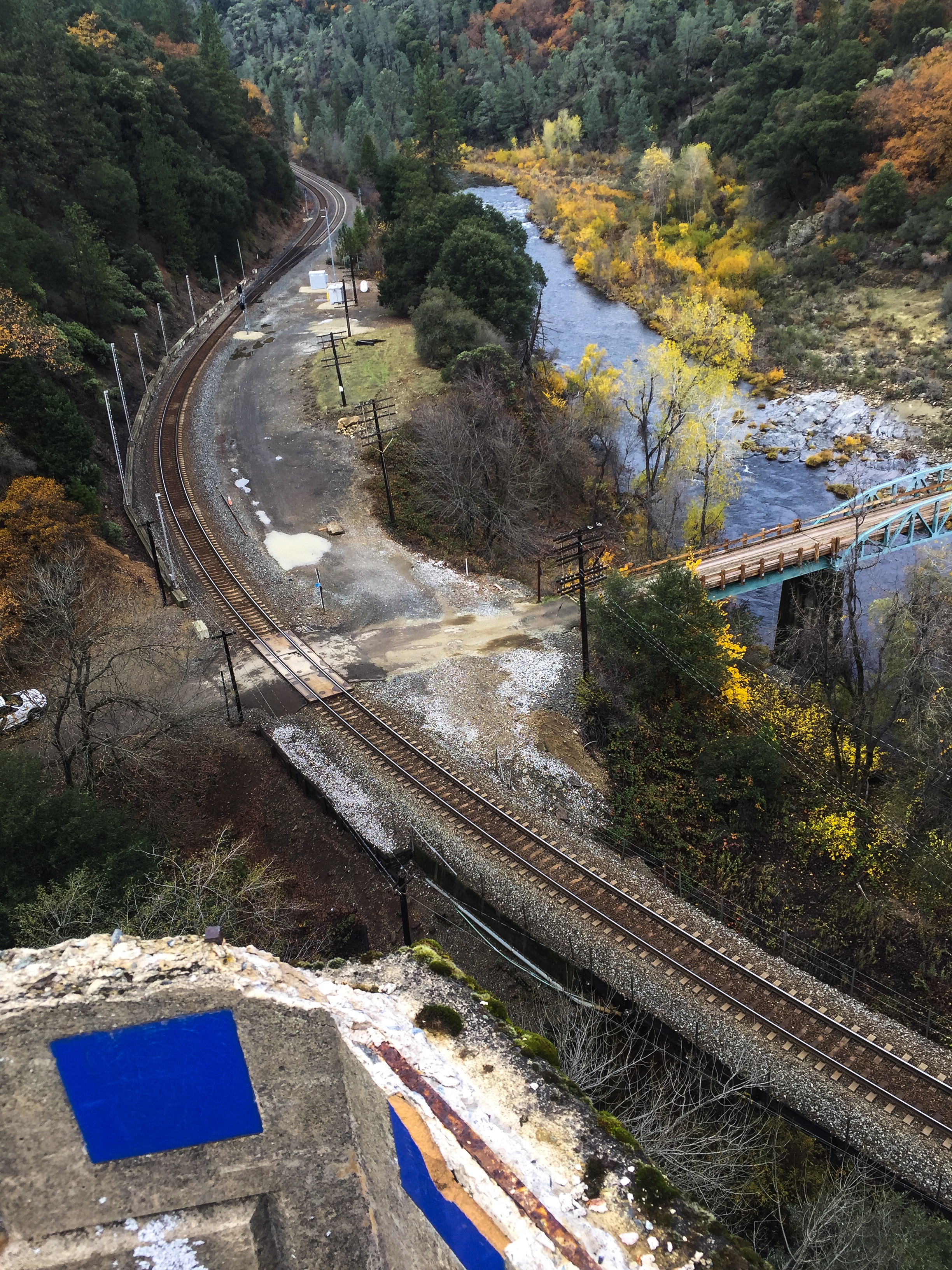
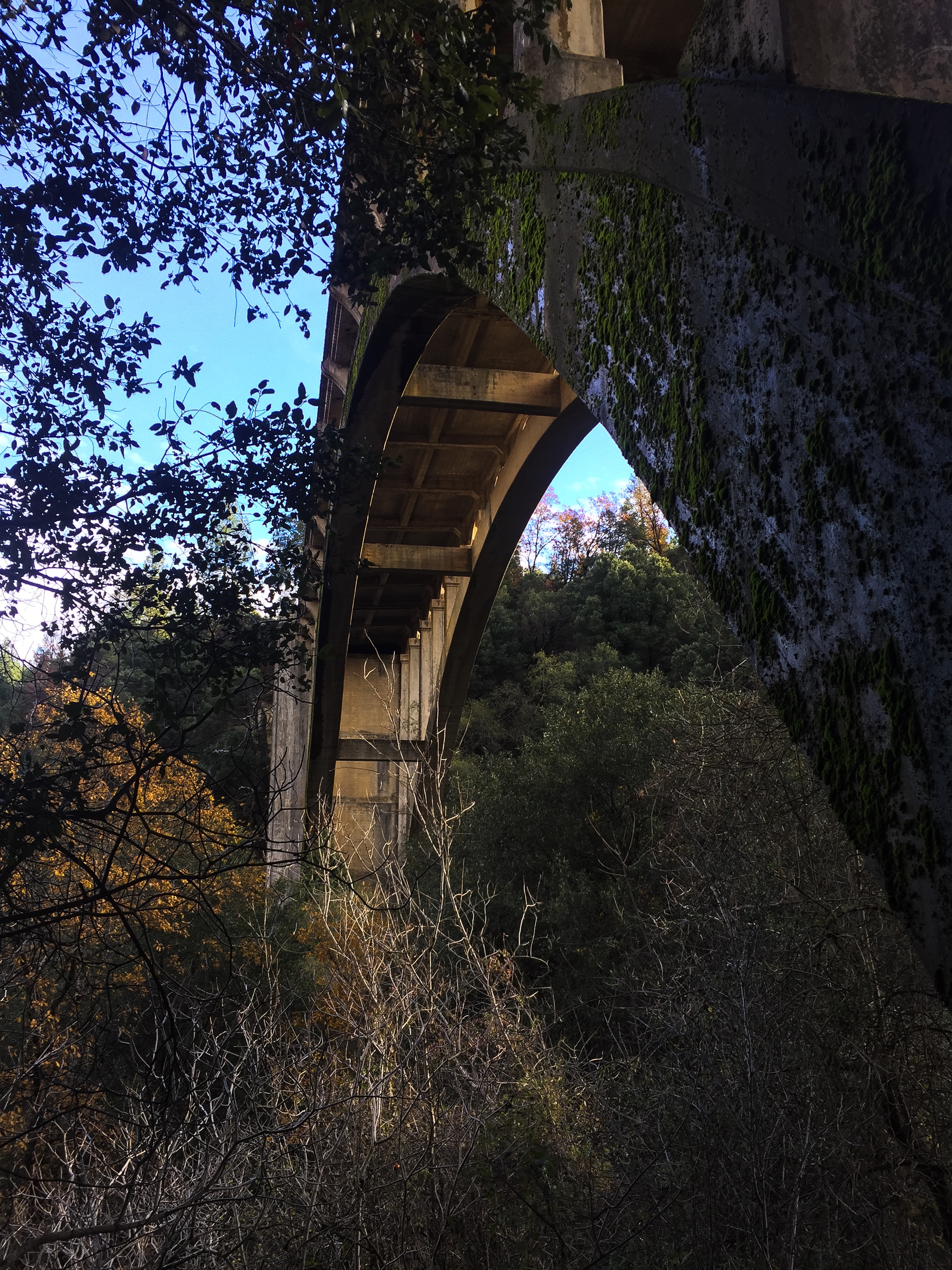
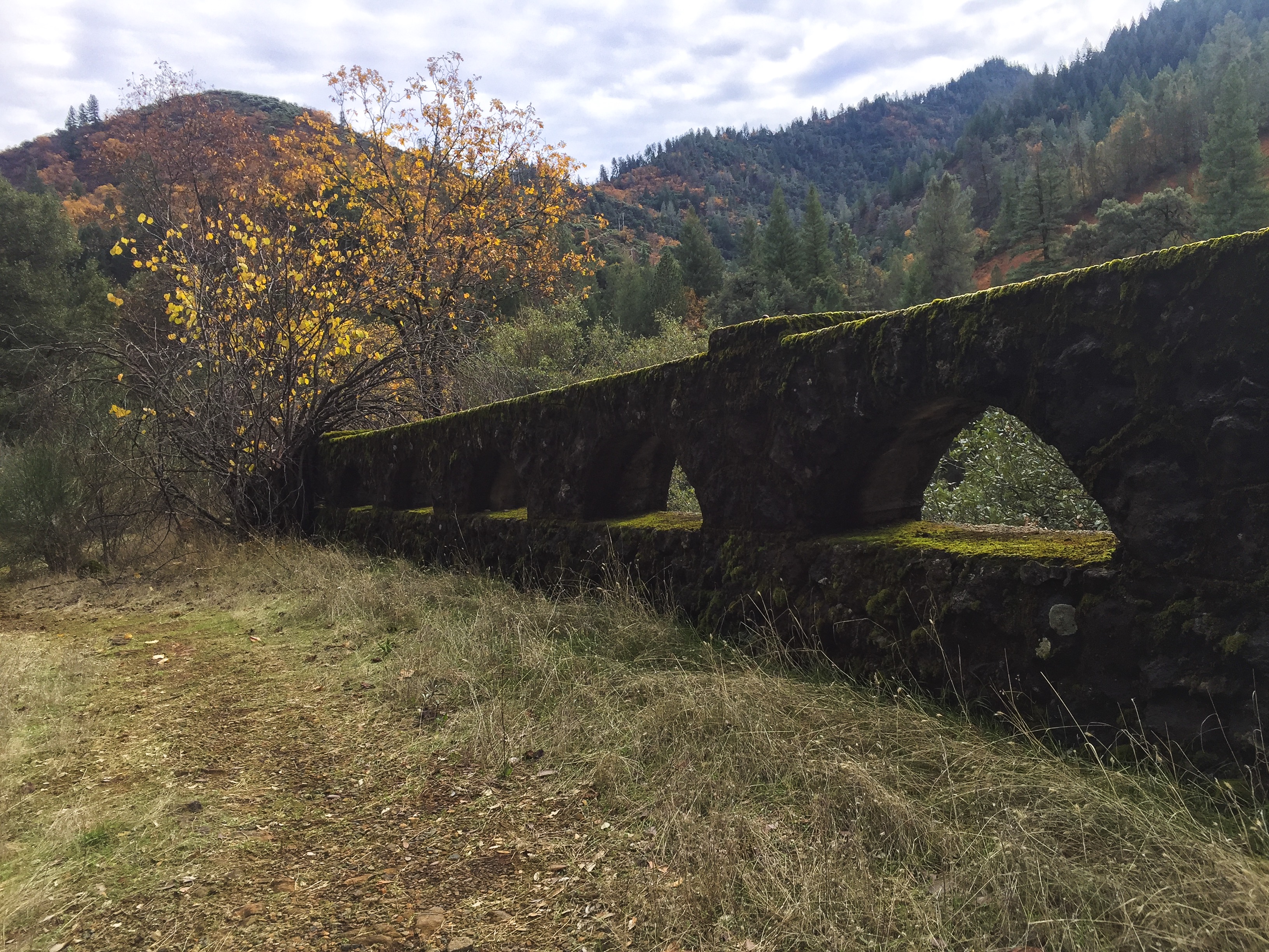
One of the usually submerged historic highway bridges in Shasta Lake
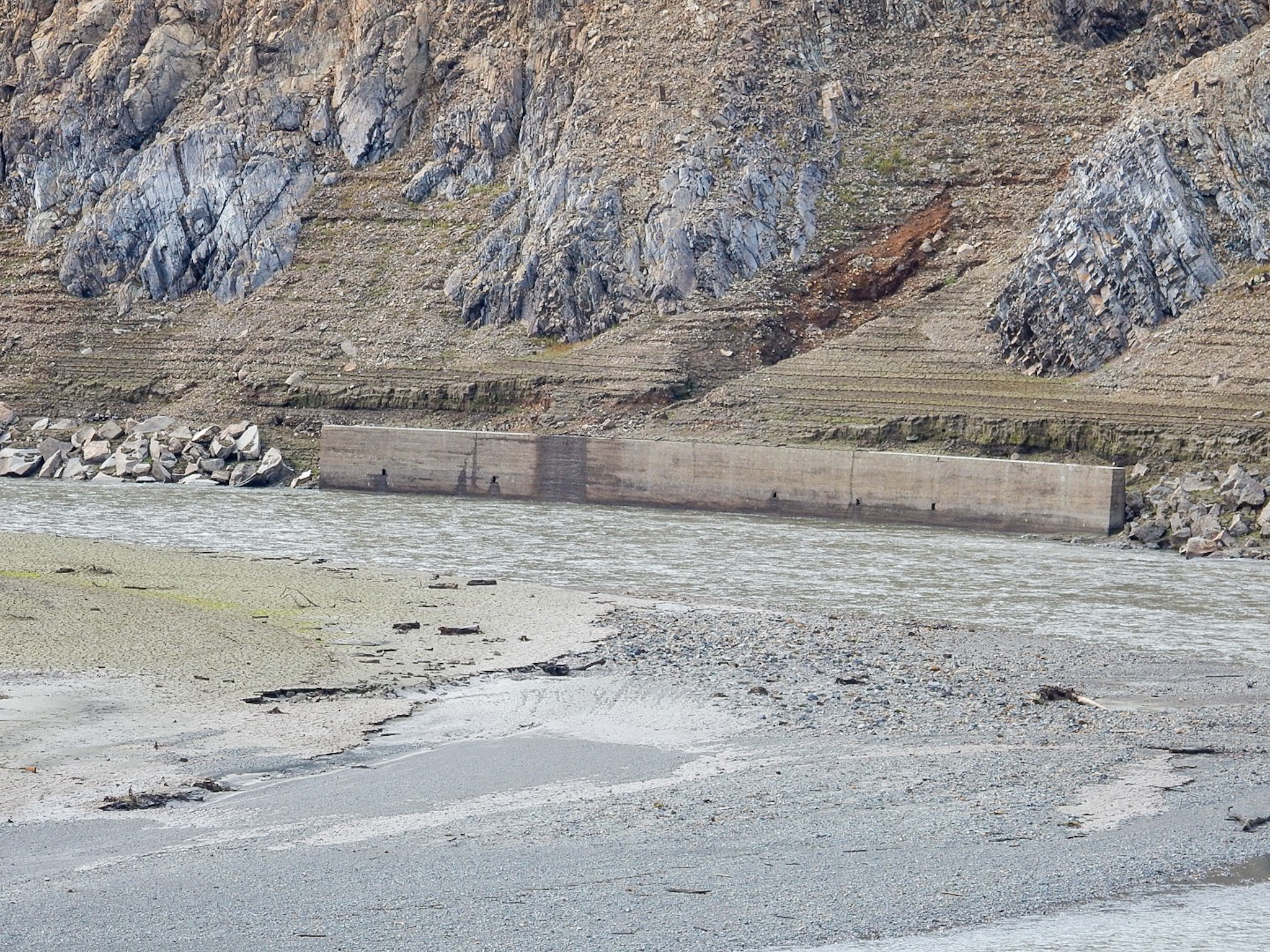
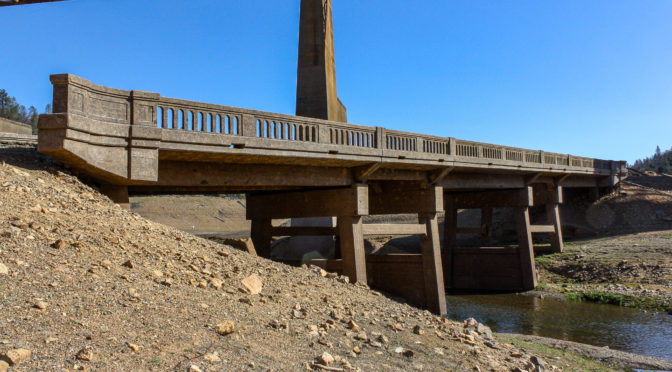
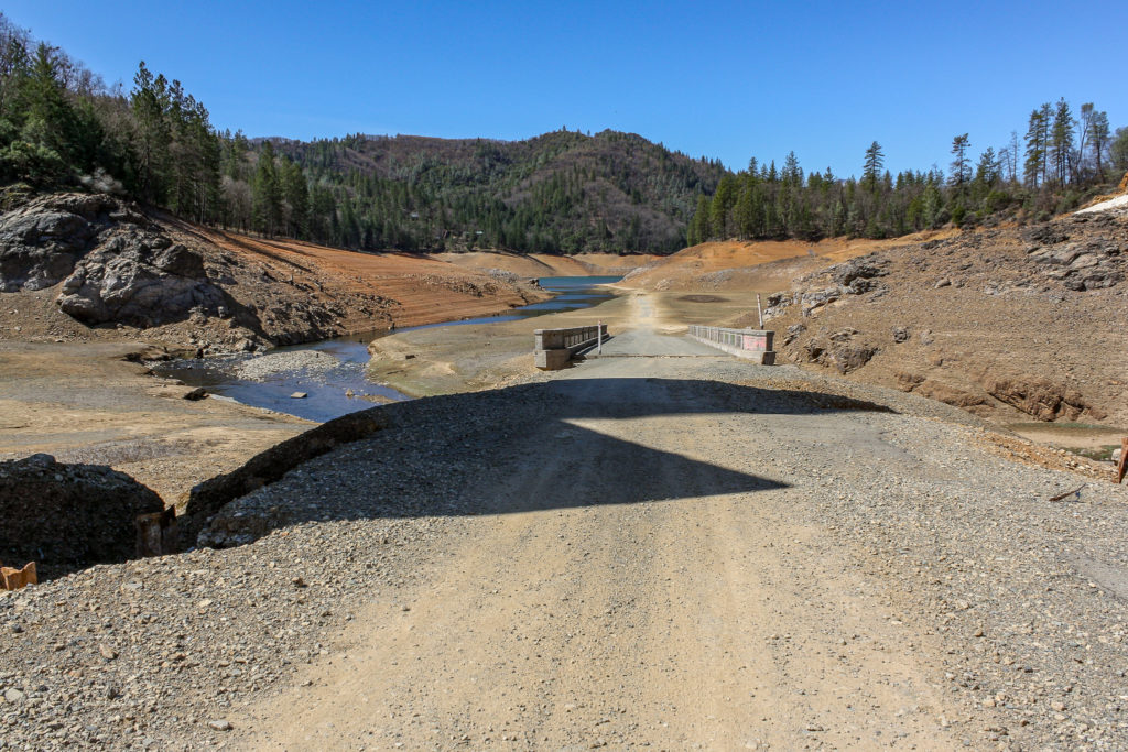
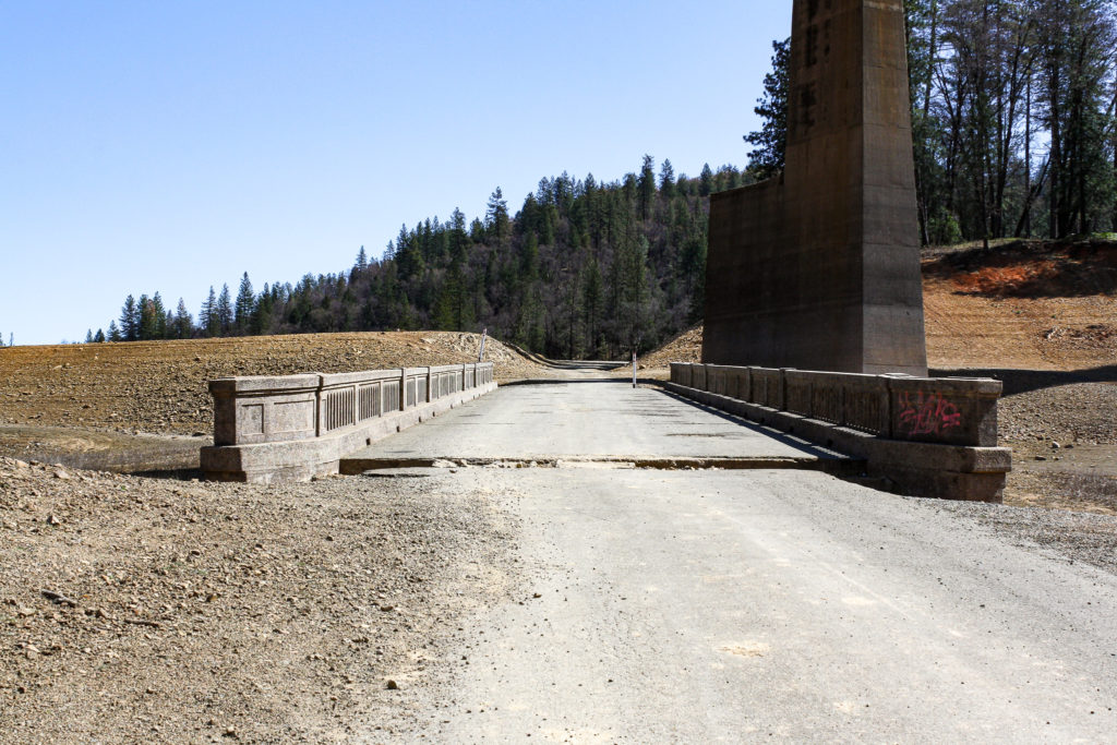
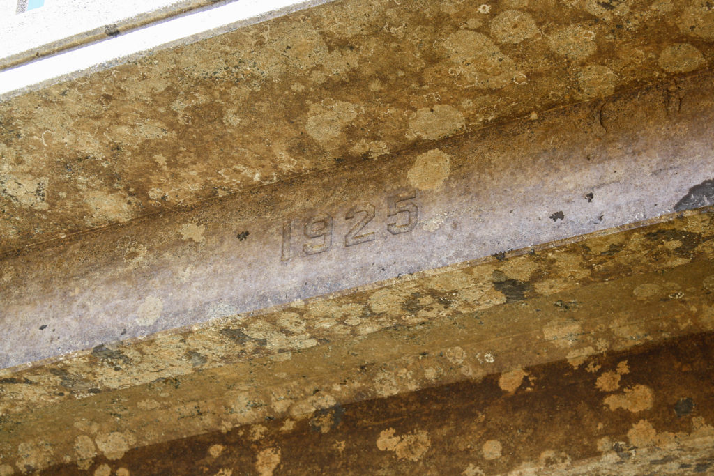
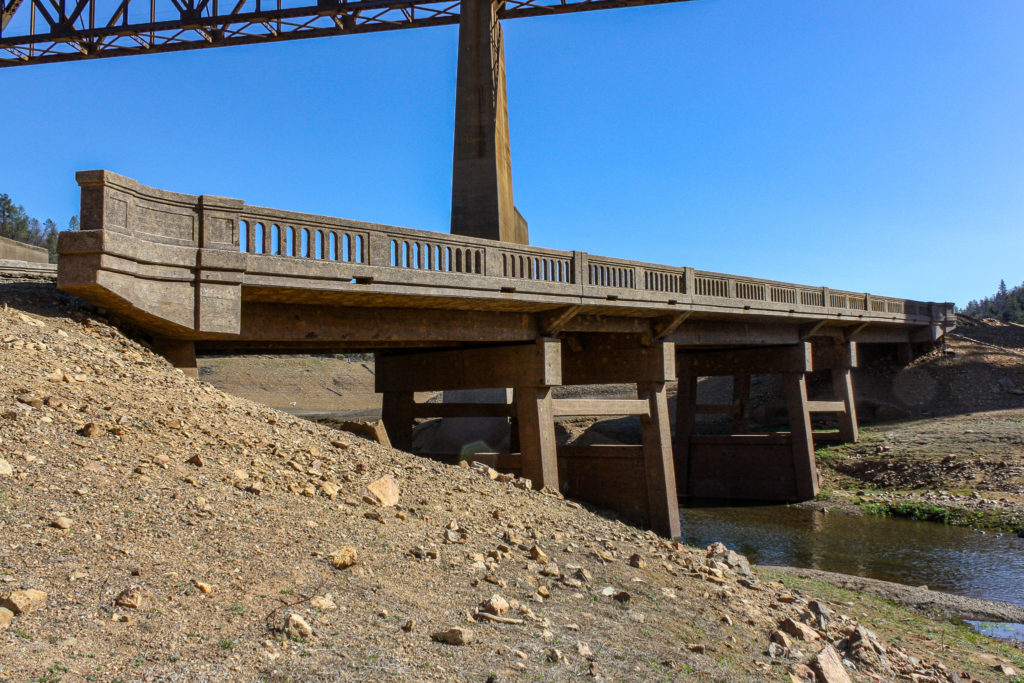
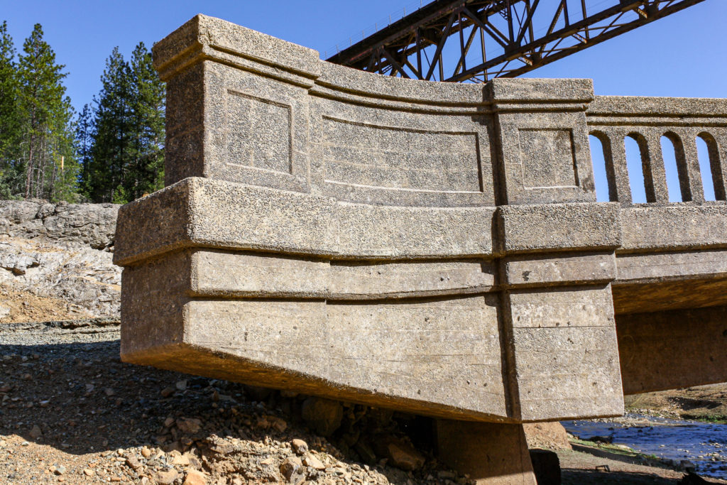
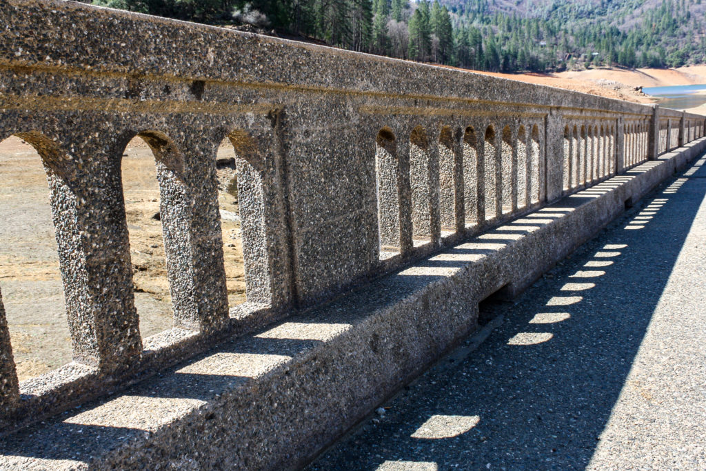
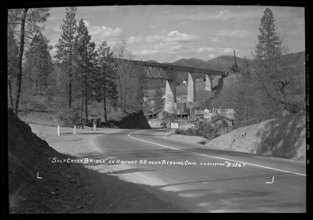
The Salt Creek Bridge was built on the Pacific Highway in 1925 between what is now Lakehead and Redding. This bridge apparently replaced one built some years earlier, as the older abutments are visible underneath the newer structure. It was later abandoned in 1941, as US Route 99 (the former Pacific Highway) was rerouted in anticipation of Shasta Lake inundating the older route (as happened in 1948).
In dryer or drought years, the Salt Creek Bridge is one of the first submerged artifacts to make its appearance as the lake level falls. It is easily accessible from the Salt Creek exit on Interstate 5. Take Lower Salt Creek Road west for about 3 miles at which point you will come to the bridge underneath the towering Union Pacific railroad trestle.
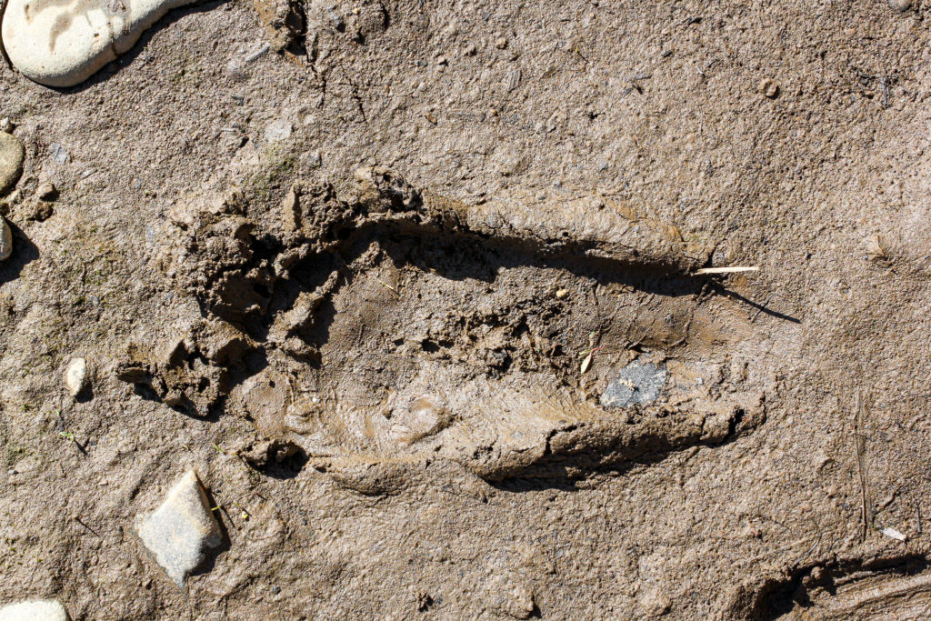
My visit to the site got a little more interesting, as I ran into a gentleman making casts of footprints in the muddy bank of creek upstream of the bridge. He believed them to be evidence of Bigfoot-like creatures. I have to say the footprint and casting of others he had made in the area didn’t look quite human. He proceeded to show me dozens of pictures of like footprints he had found at numerous sites, as well as other weird things that apparently Bigfoot hunters believe are evidence of the mythical creature actually existing. I came away from the conversation thinking I might have to make my forays into the area forests with a new viewpoint.
The Salt Creek Bridge underneath the towering Union Pacific railroad trestle. This is looking south, as the Salt Creek Bridge is oriented east-to-west.The south side of the bridge.Looking west down the old highway grade. The shadow is from the trestle above.Looking east.Another south side view.Date stamp on the Salt Creek Bridge.Another south side view looking east. Notice the flared ends of the railing.Flared railing at the ends.Footing from a previous bridge on this spot, probably built when the US 99 predecessor Pacific Highway was built. The previous bridge would have probably been only 15 feet wide. The underside looking towards the east end. The previous bridge footing can be seen in the center.Since the 1925 bridge was higher than its predecessor, the road approachmentds had to raised. This is the reinforcement of the east approach.Evidence of Bigfoot?
All in all, the bridge is in great condition. This is likely due to being submerged in the cold waters of Shasta Lake most of the year. If you decide to drive across the span, beware of the approaches, as there are gaps between the bridge and the road.
Heading west along US 99 through the settlement of Salt Creek before the site was inundated by Shasta Lake. Some structures were move elsewhere before inundation. Eastman, Jervie Henry. (1941). “Salt Creek Bridge” on Highway 99 near Redding, Calif. Retrieved April 2, 2021, from https://digital.ucdavis.edu/collection/eastman/D-051/B-1/B-1367
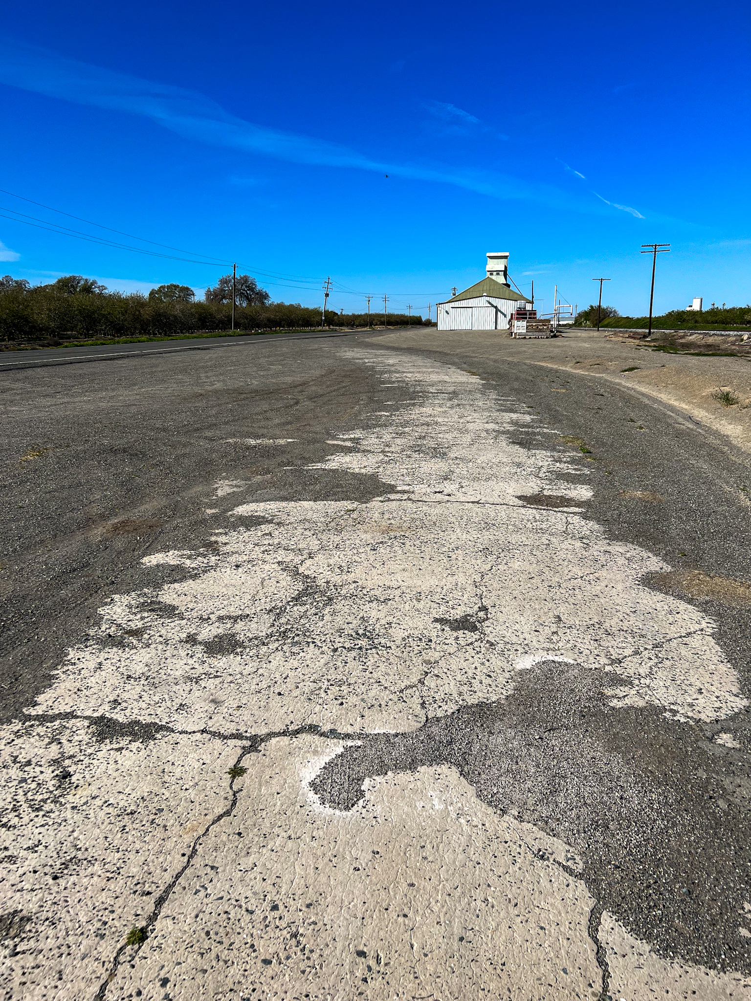
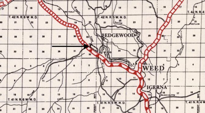
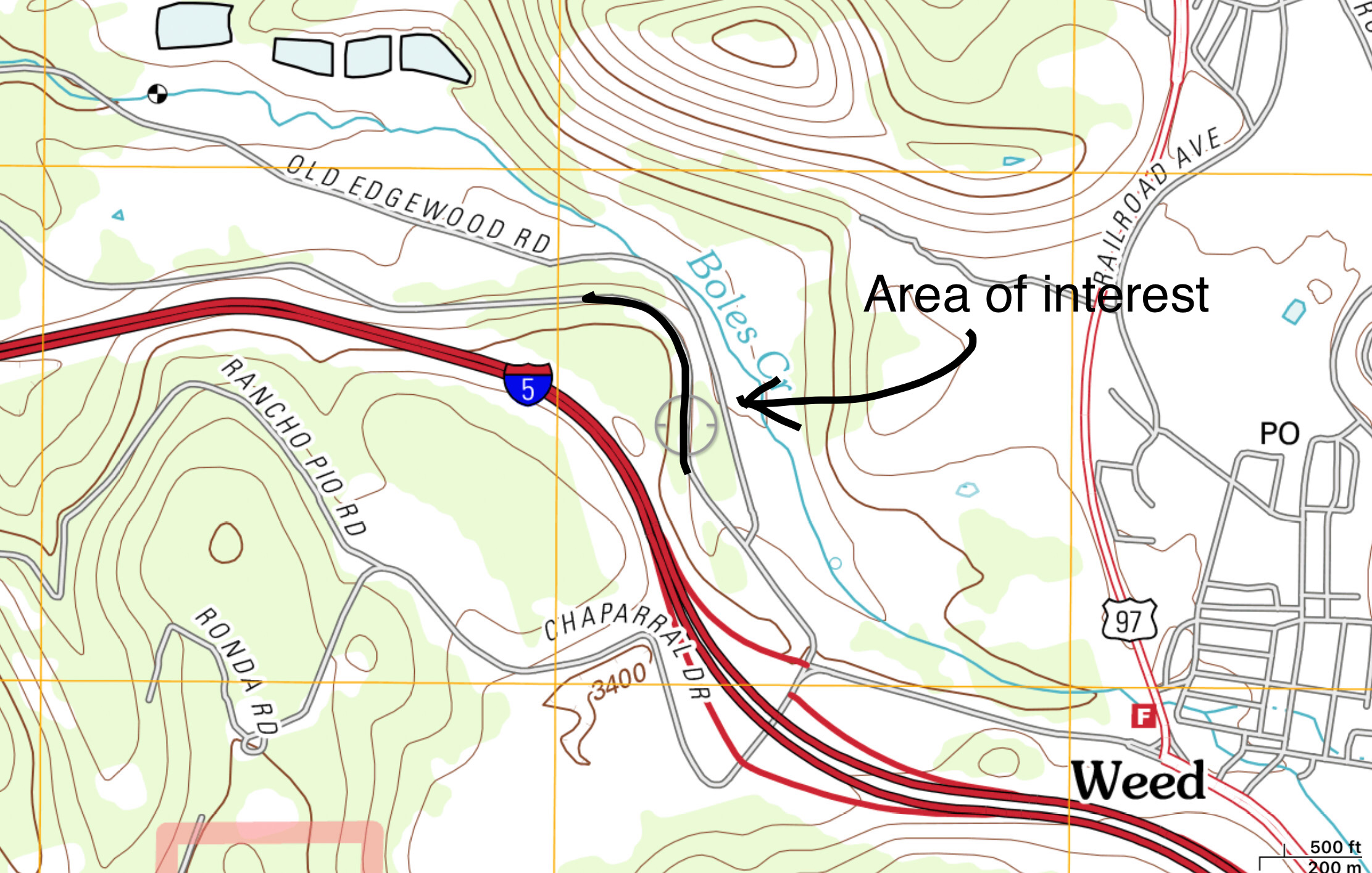
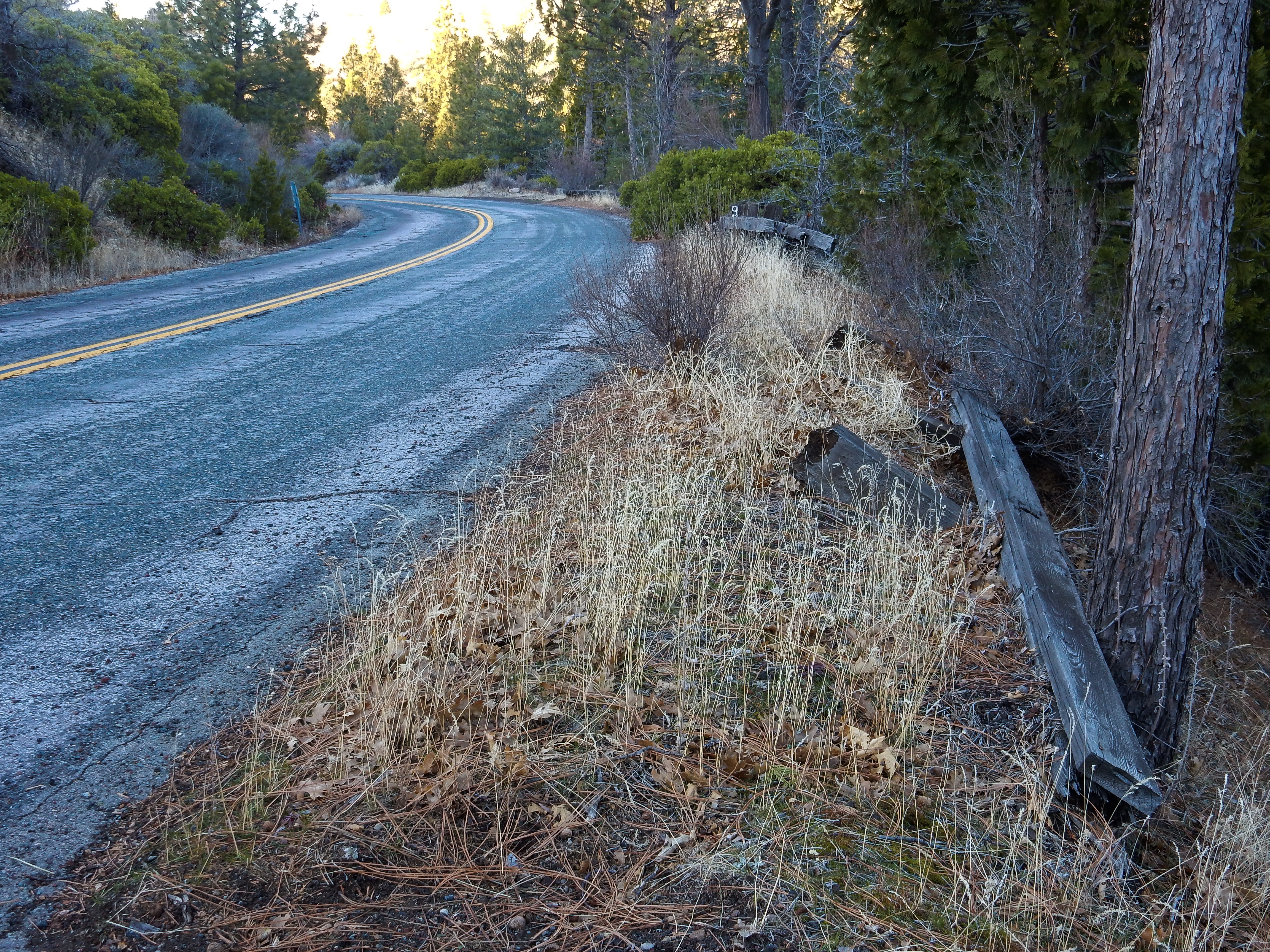
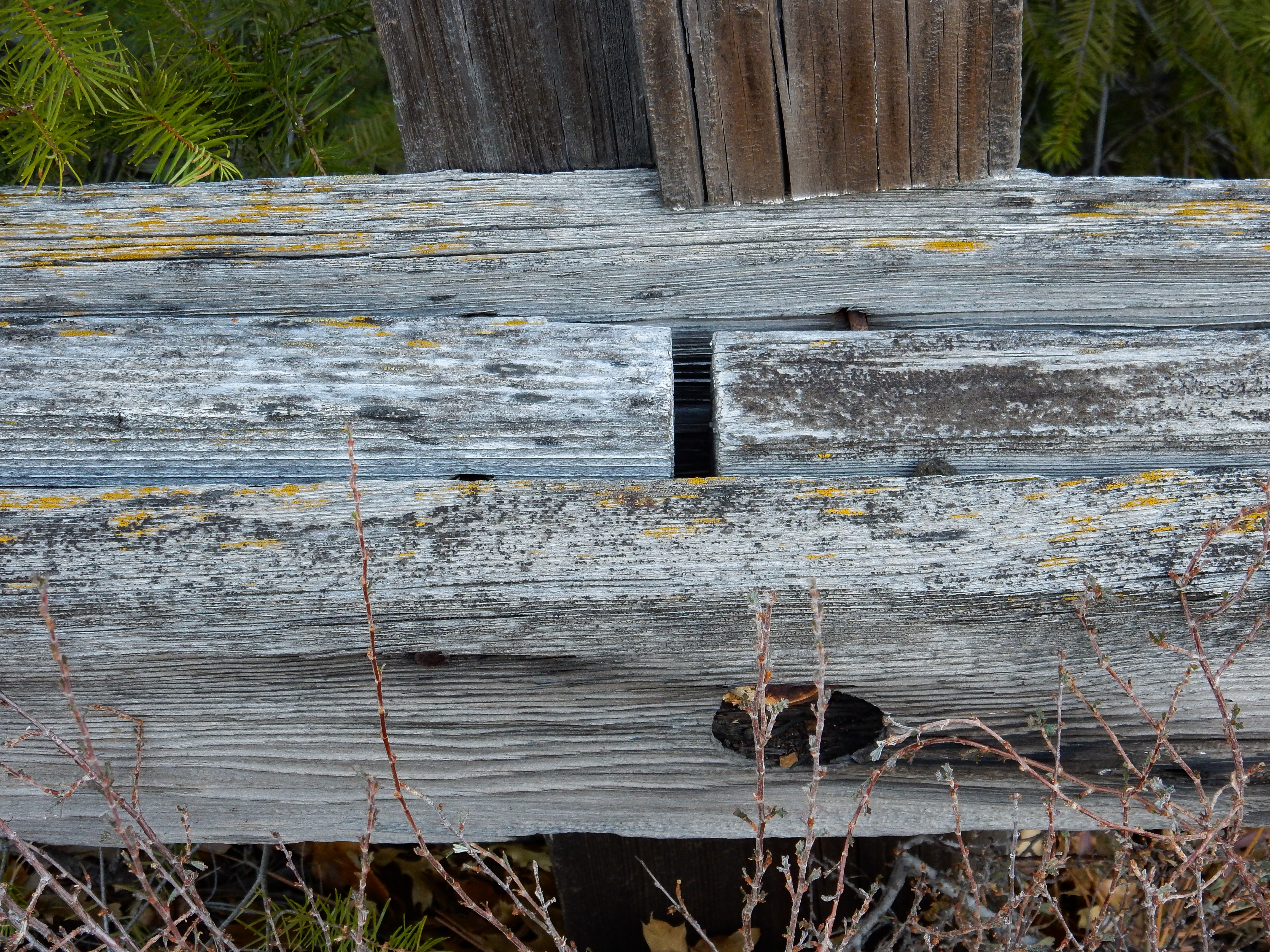
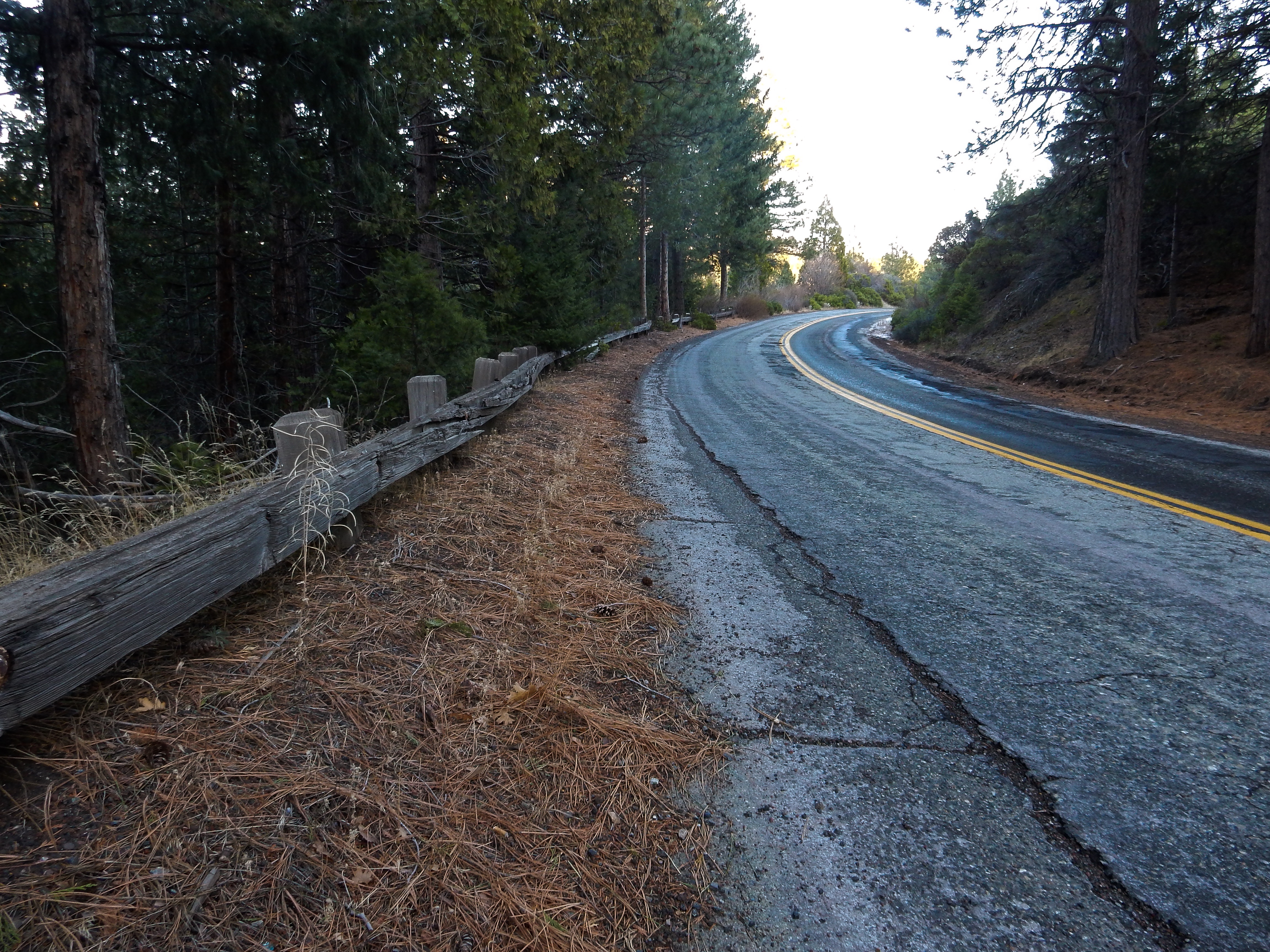
I spent an hour or so this afternoon exploring a small section of Edgewood Road going north out of Weed. This used to be US Route 99, before Interstate 5 was built and replaced Highway 99. I concentrated my efforts on one curved section of the road, examining old wooden guard rails, and looking for “C-blocks”, which are old California Division of Highways survey monuments. I did not find any, but I’ll return and spend a little more time in the brush looking for any that might exist.
The general location of my efforts was 41.43049, -122.39933
1954 USGS 15 minute topographic map showing the US 99 alignment.
2010 USGS 7.5 minute topographic map showing the US 99 alignment next to Interstate 5.
Heading north into the curve. Broken wood guard rail is on the right.
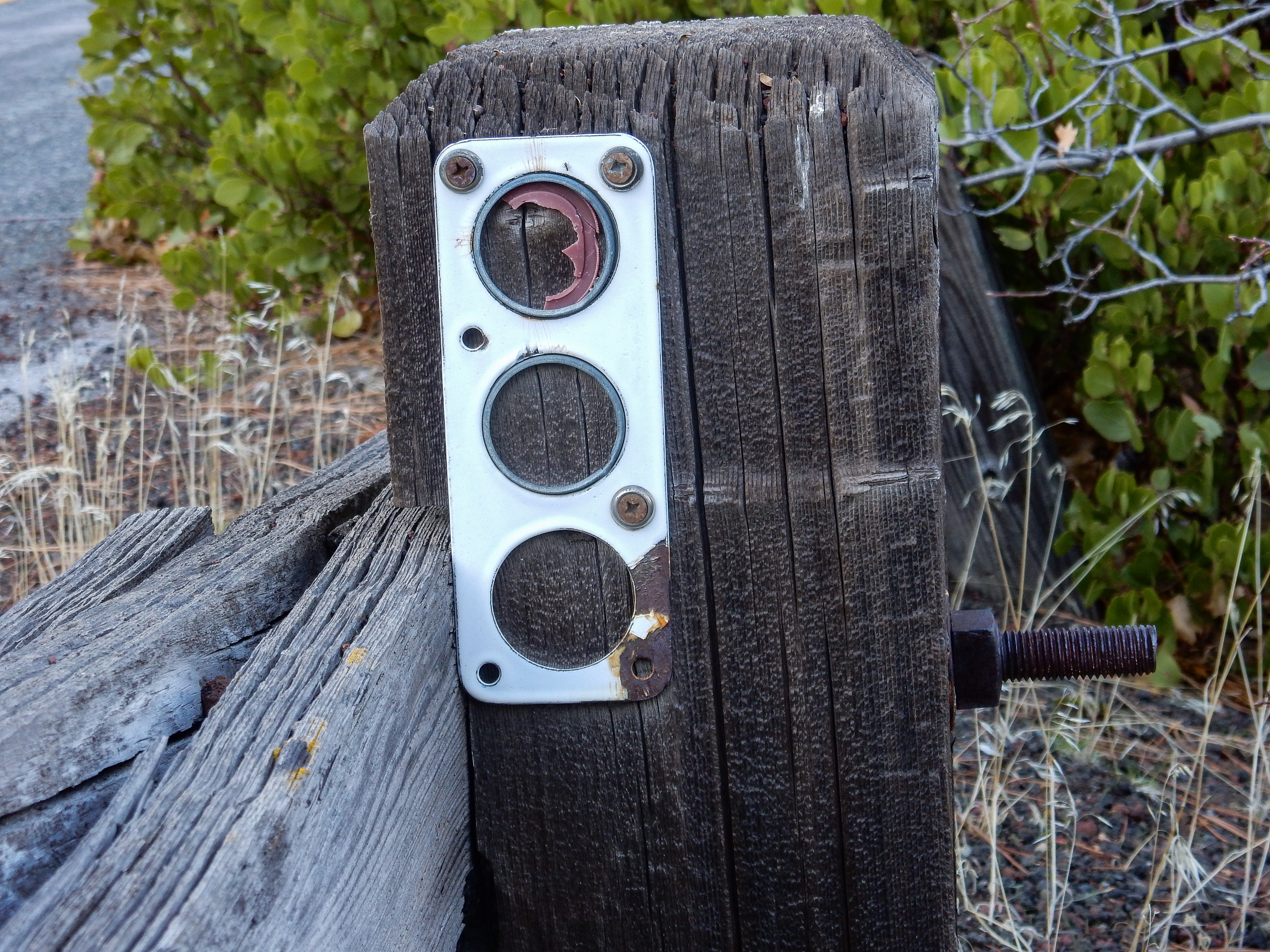
Reflector bracket.
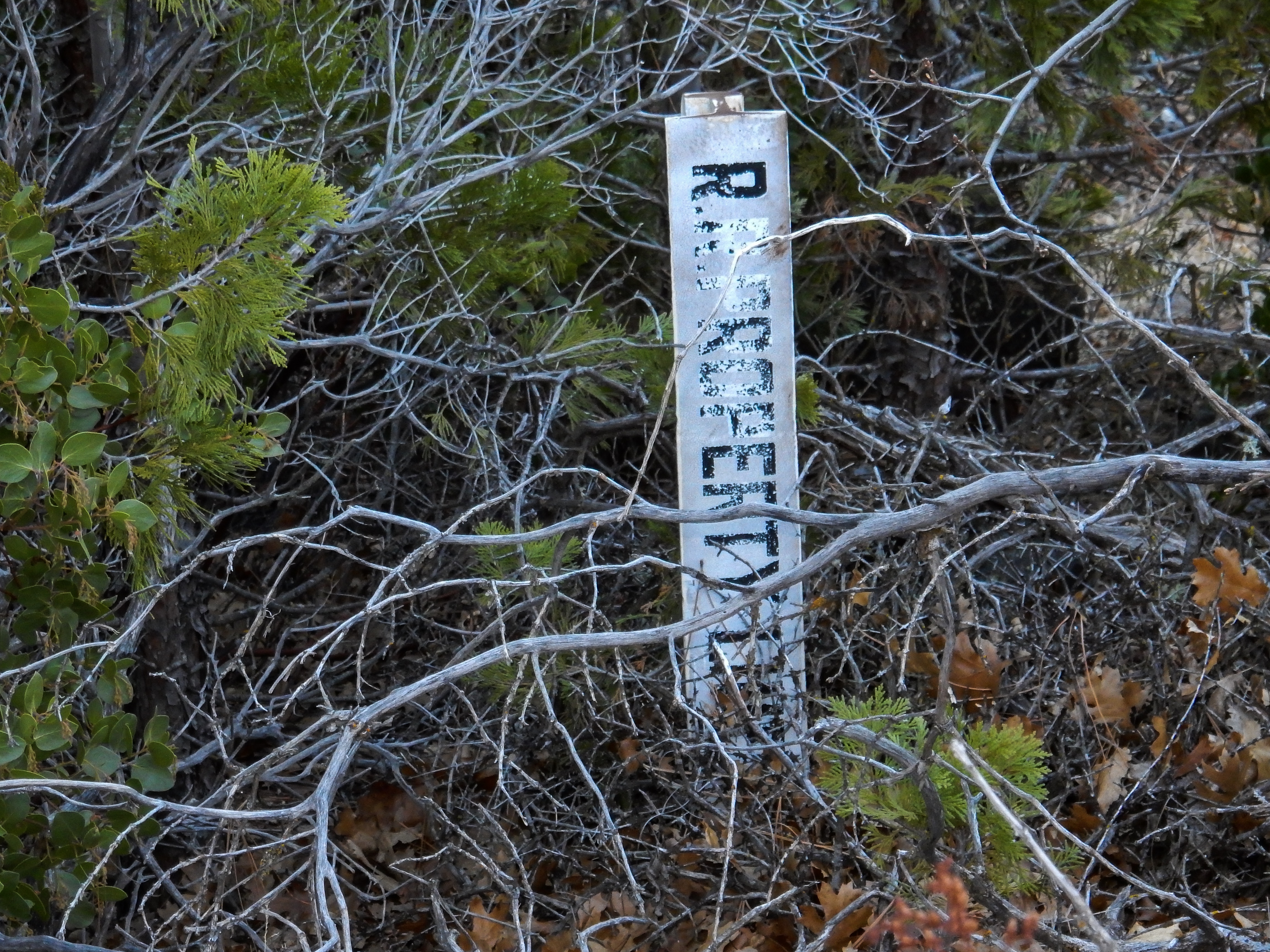
Railroad property line markers delineate the old highway right of way on east side. These should assist in locating any “C-blocks”.
The rail is actually comprised of three pieces of layered lumber.
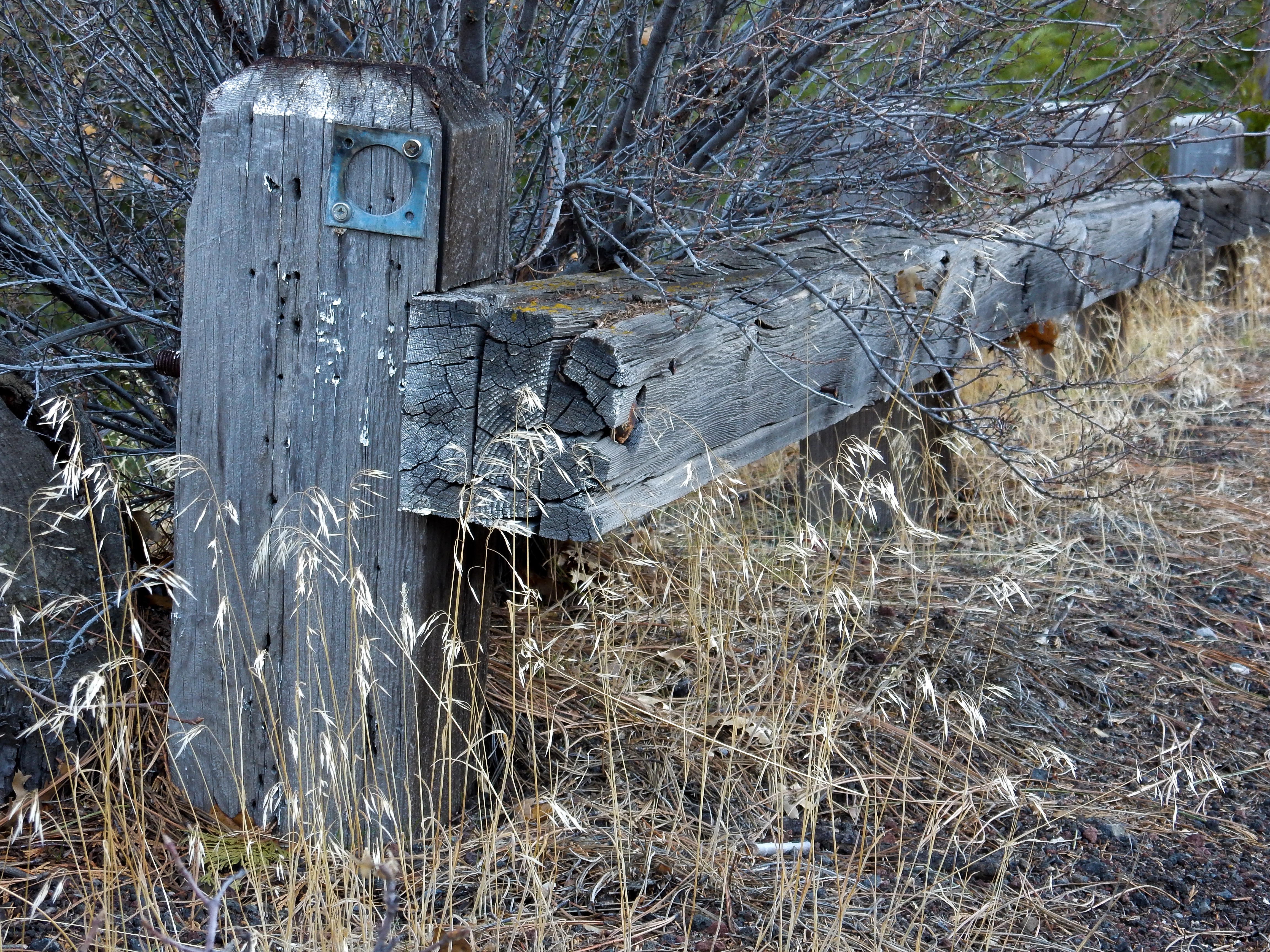
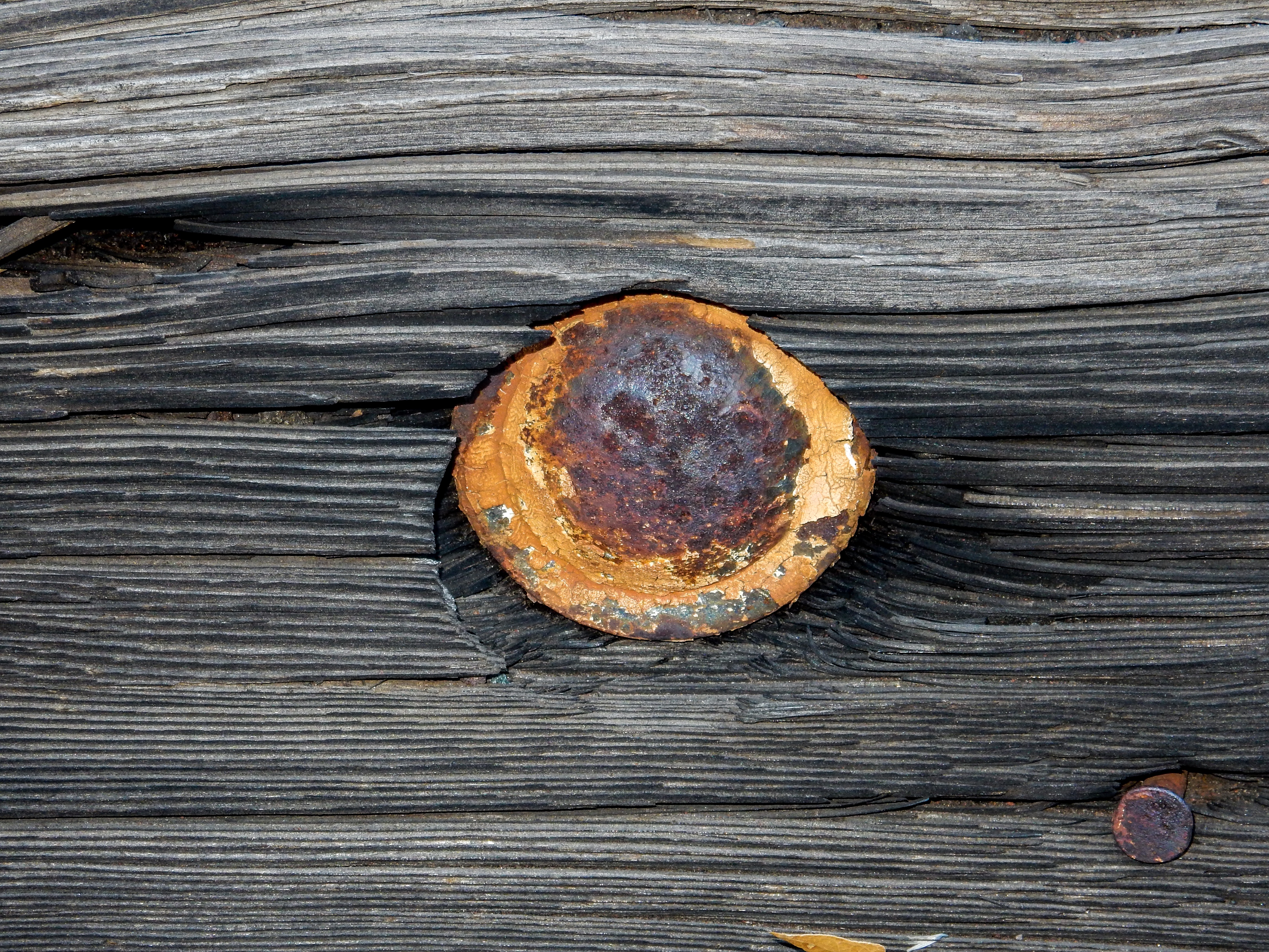
Bolt head.
Retaining nut.
Guard rail at the north end of the curve (looking south).
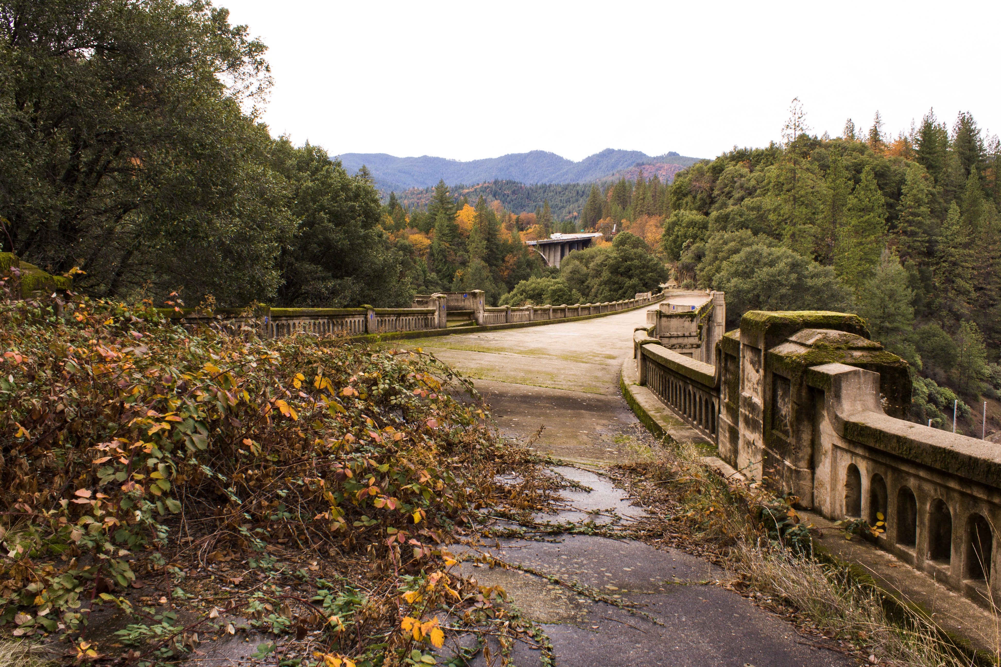
An accessible, historic, and photogenic bridge worth exploring
Trip dates: November 24 & 25, 2017
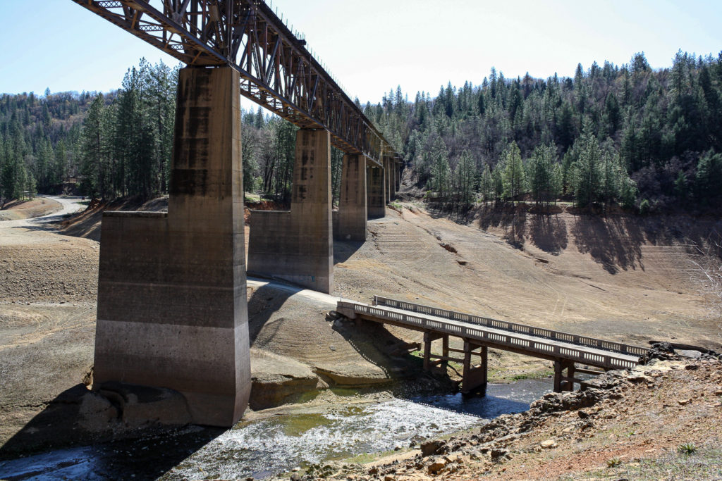
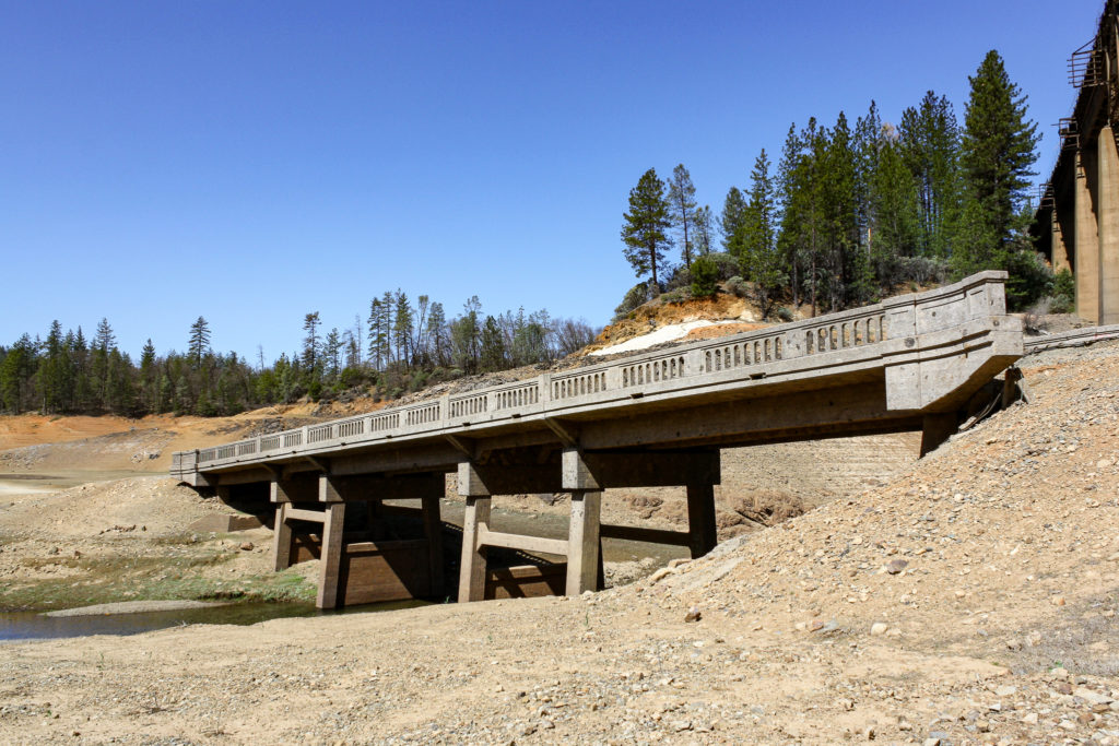
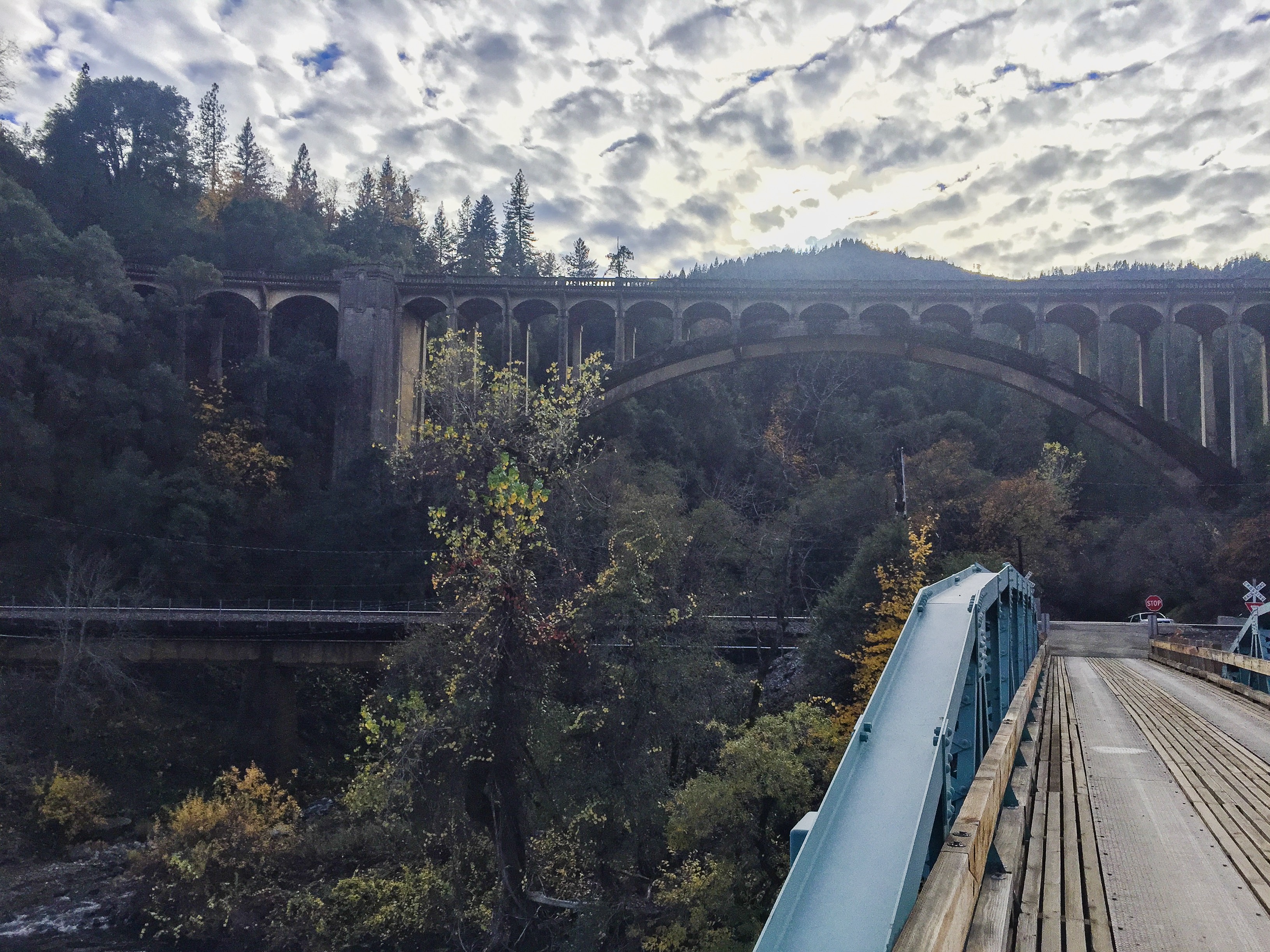
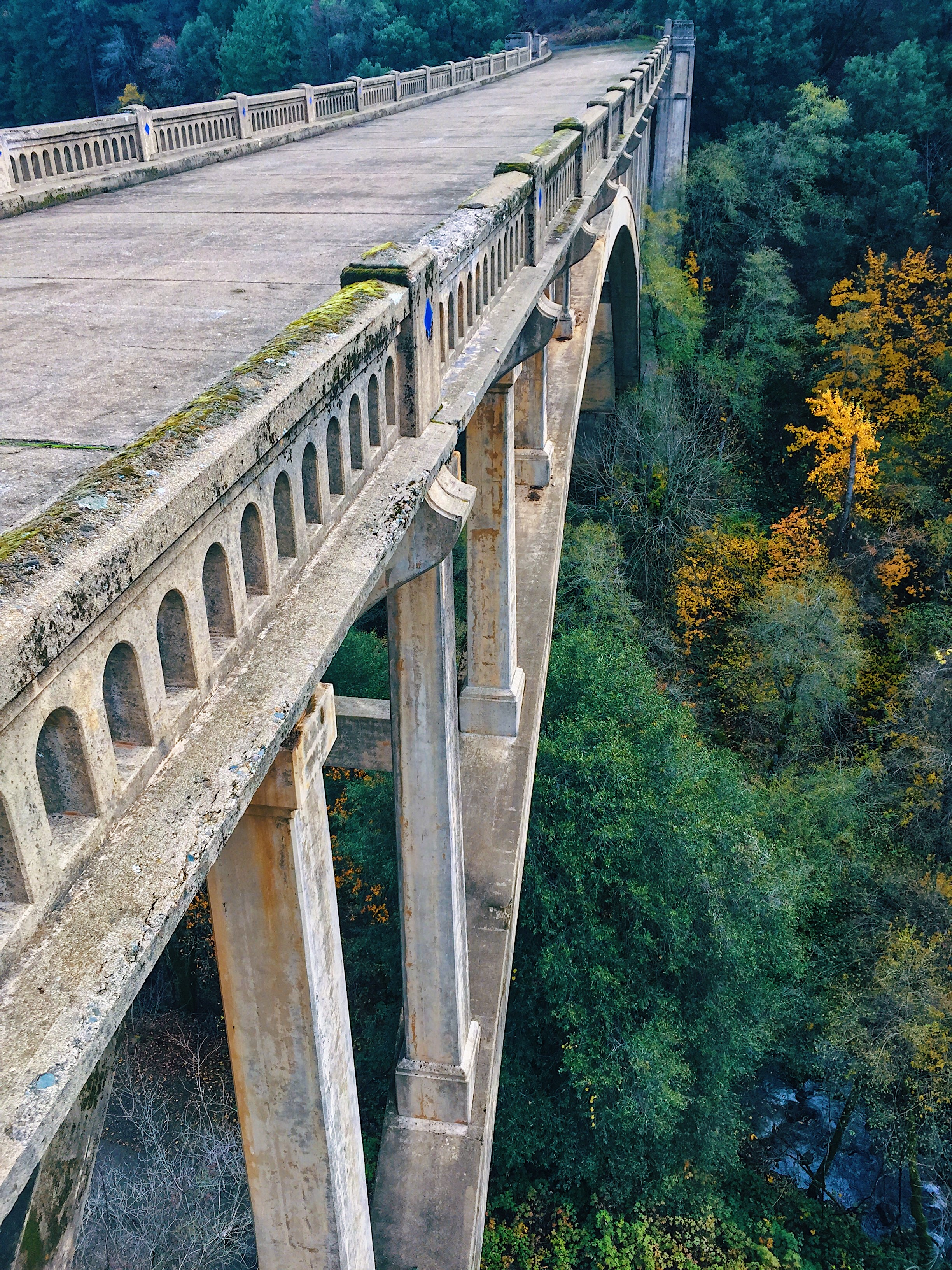
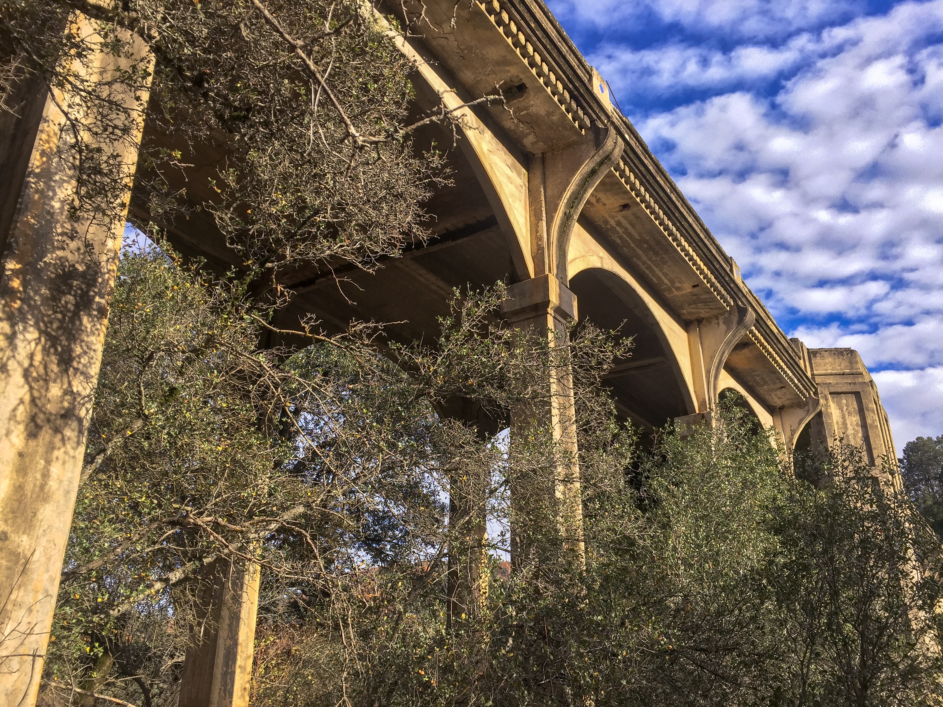
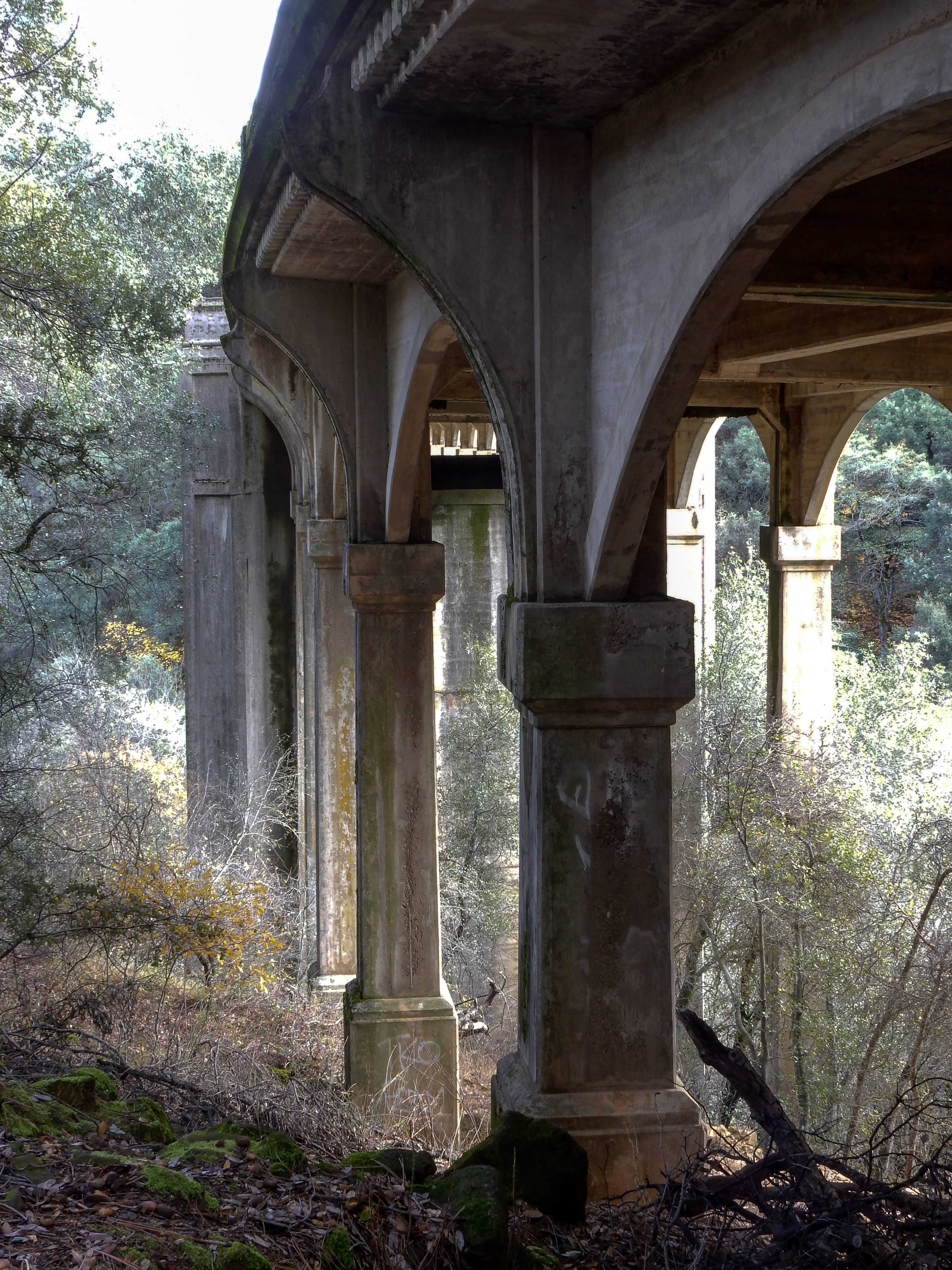
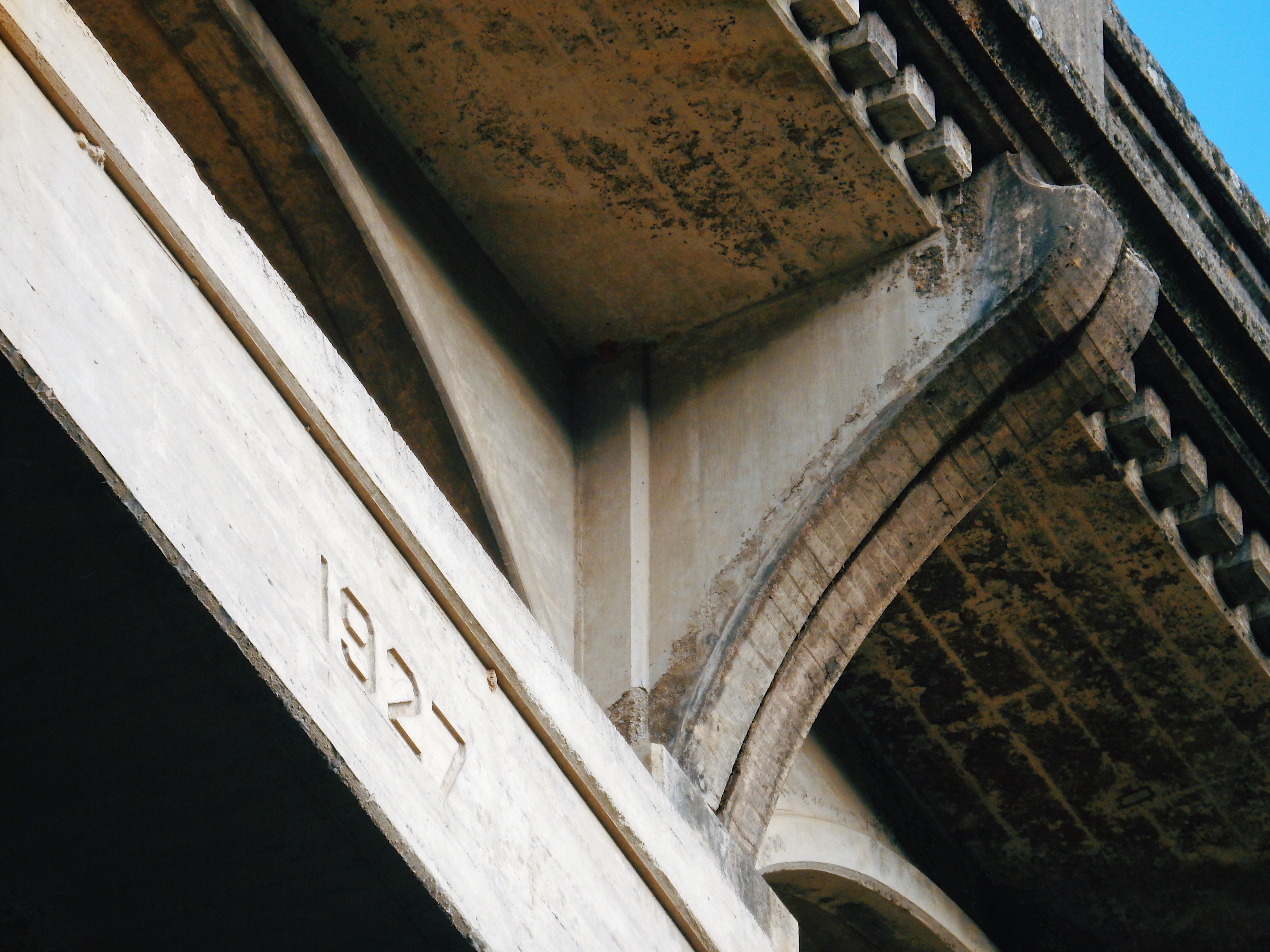
The Harlan D Miller Memorial Bridge, known also as the Dog Creek Bridge, is an abandoned concrete arch bridge completed in 1927 as part of US Route 99 just north of Lakehead, Shasta County, California. After Route 99 was replaced by Interstate 5, it carried traffic as part of Interstate 5 until a bridge to the northwest was expanded to accommodate both directions of traffic in 1974. It was abandoned and slated for demolition, until saved due to efforts of concerned citizens, and is now managed by the US Forest Service.
Harlan D Miller (1880-1926) was the State Bridge Engineer for the California Highway Department from 1923 until his untimely death in 1926. During his short tenure as State Bridge Engineer he made radical changes to the way California designed bridges. These changes included requiring all highway bridges in the state be designed by the state and designing bridges that matched the geometry of the roadway. The latter often complicated design fork but the final result (skewed or curved bridges) justified the efforts in drivability.
Miller’s most visible effect on California bridges was the consideration given to design aesthetics. His designs were recognized in their own periods as possessing beauty and boldness. Many fine details can be seen on Miller designed bridges including rail and end post details, as well as clean lines and details of the superstructure design.
When my family relocated to the Bar Area in 1963, I remember driving across this bridge as we traveled to the Mount Shasta region to visit relatives several times per year. After the bridge was decommissioned, it had always been my desire to explore the now abandoned structure. I finally had a chance to do so this past week.
Looking west at the span. Photo taken from bridge that crosses the Sacramento River. A short railroad bridge is visible to the left which also spans Dog Creek.
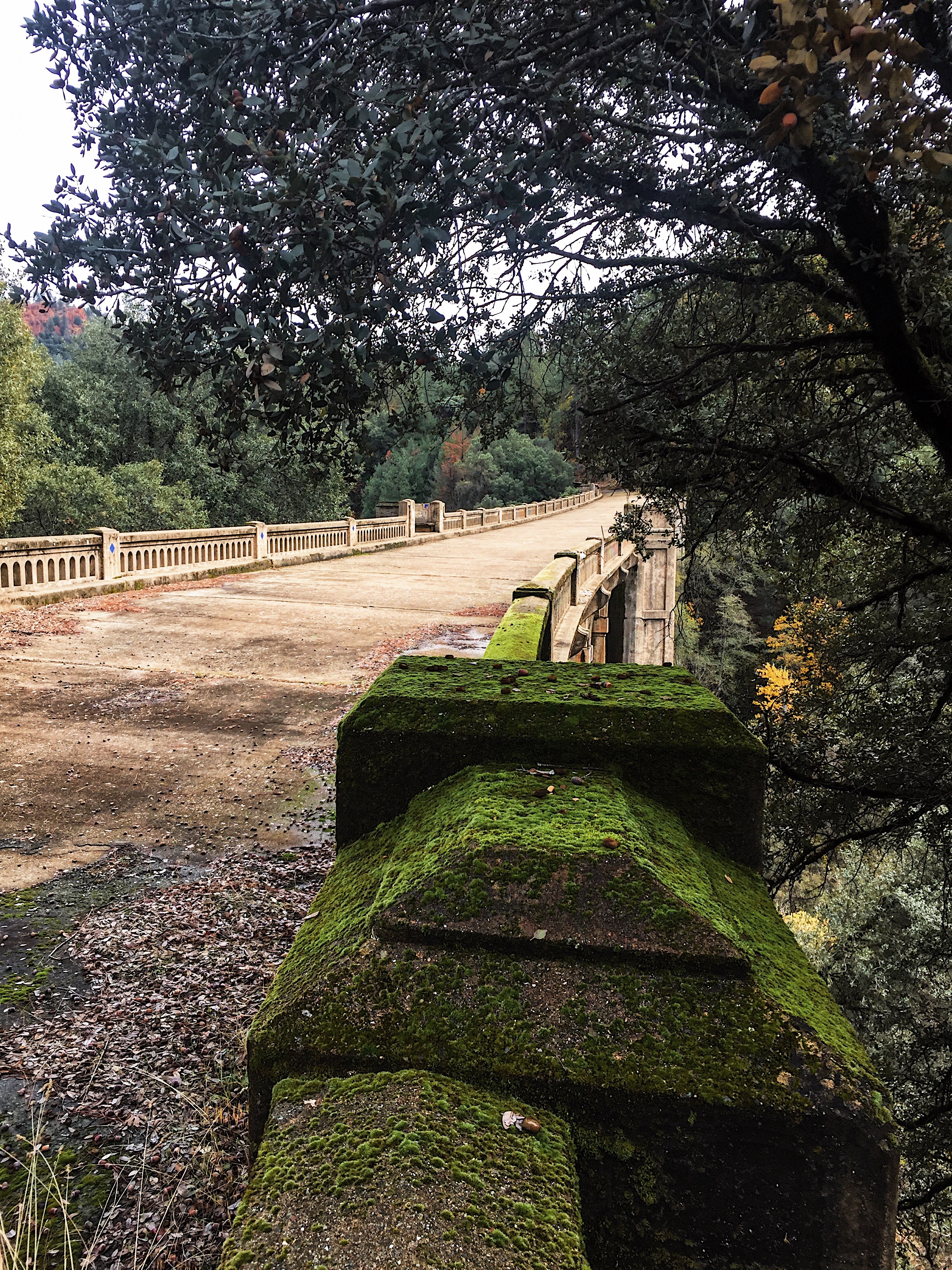
Looking south down the bridge deck.
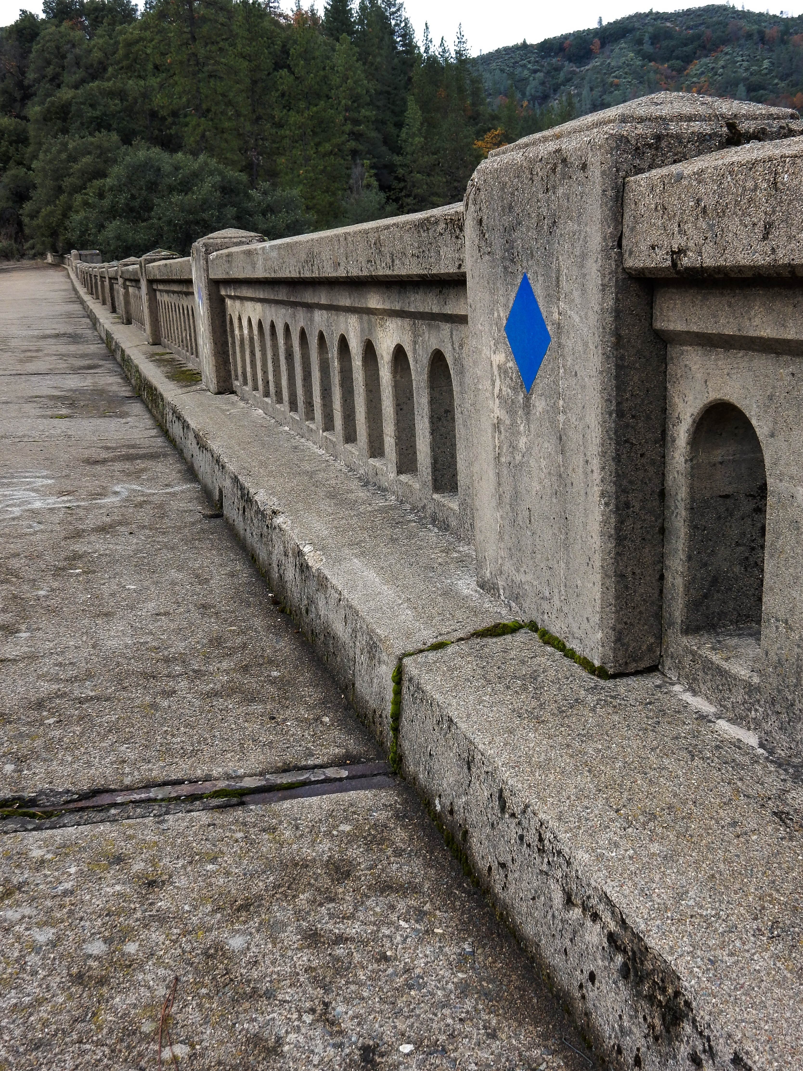
Looking south along the west side of the bridge. Notice the blue tiles in the deck wall pillars.
Curb details.
The view south looking down the Sacramento River.
Looking north up the Sacramento River.
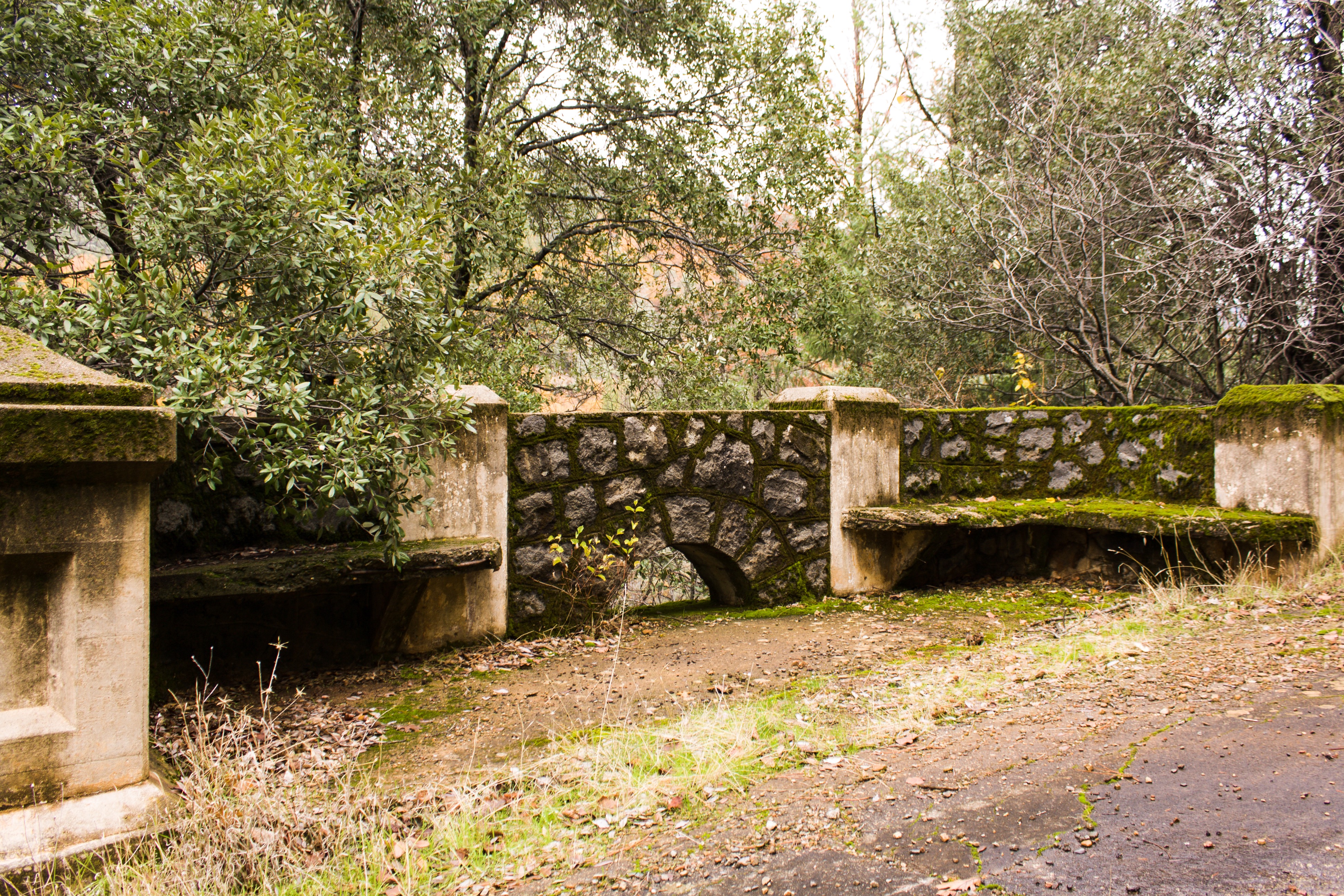
At several places benched areas were provided for travelers to stop, enjoy the views, and rest a bit.
Stone retaining on the northern approach to the span.
Dog Creek.
Looking north. The Interstate 5 span can be seen near the center.
DIRECTIONS & ACCESS
Off Interstate 5, take the Vollmers/Delta exit. Proceed west about a quarter mile and turning left onto Fenders Ferry Road. Drive down along the Dog Creek watershed for about a mile, crossing the creek twice and underneath the I5 span until reaching the historic bridge. Park just before the railroad tracks, and climb up the east side of northern end of the bridge.
According to a couple of other websites, there is supposedly access at the northern end of the bridge from the top, at end of a private road where a Forest Service begins. I checked it out and I’m not comfortable at this time on recommending its use. The adjoining property owners have posted a lot of onerous signage, and have tried to unsuccessfully block the easement. I would be nervous parking my vehicle here. Check this post for updates, as I will attempt to get clarification from the Forest Service regarding use of this easement.
The dichotomy of urbanization and wide open spaces in Southern Arizona has always fascinated me. Within minutes of the hustle and bustle of Tucson, you can find yourself in wide open desert terrain, with an endless view to the horizon; on top of a mountain wilderness, surrounded by towering conifer forests; or in the middle of rural ranchlands and farms, looking more like California’s Central Valley or a Midwest farming state. No more is this apparent than in a drive around the Rincon Mountains east of Tucson.
Our route around the Rincon Mountains. Click on image to enlarge.
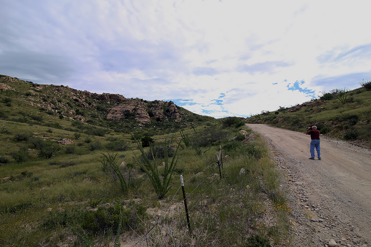
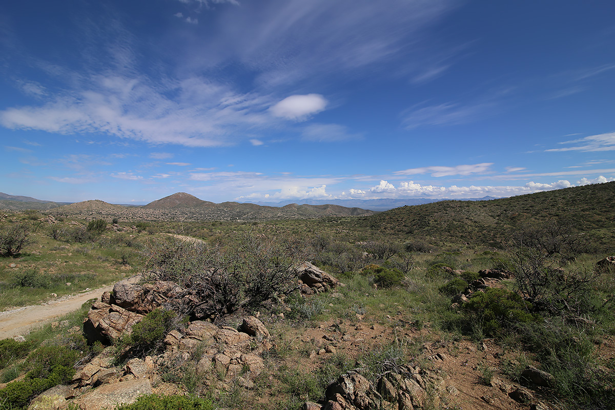
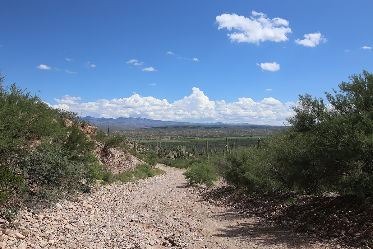
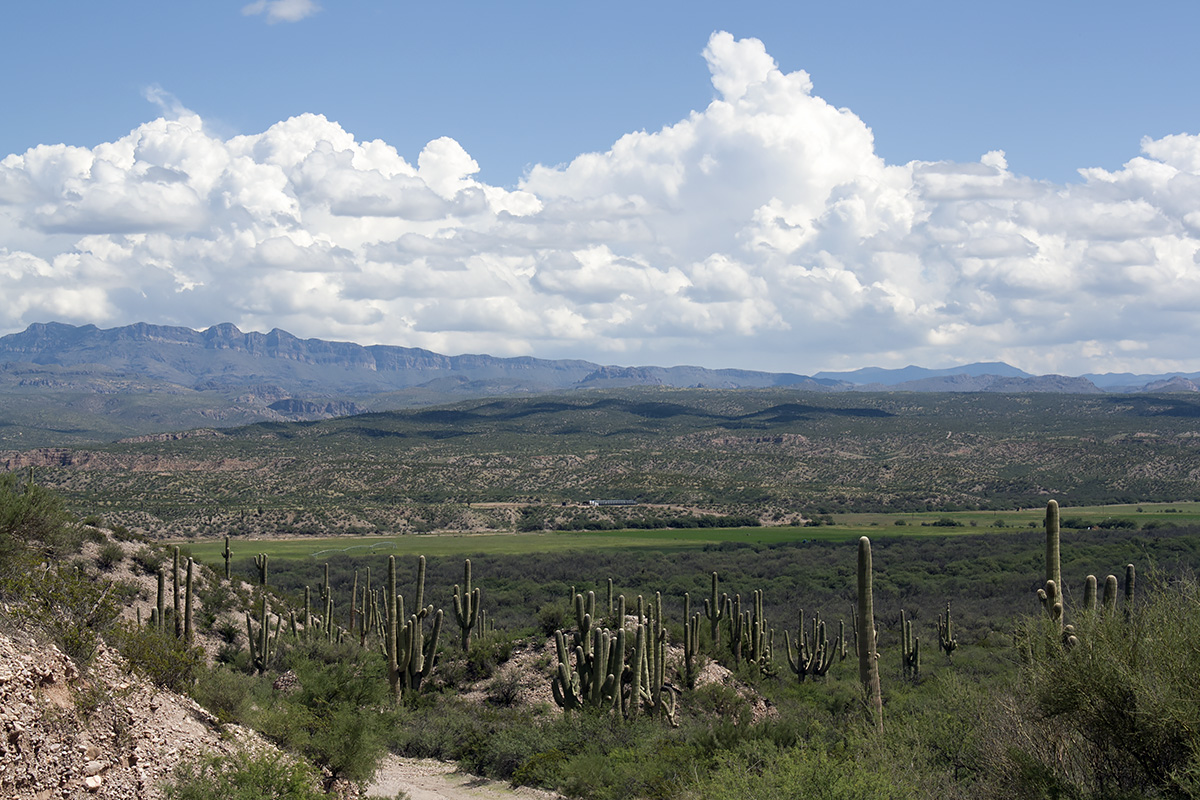
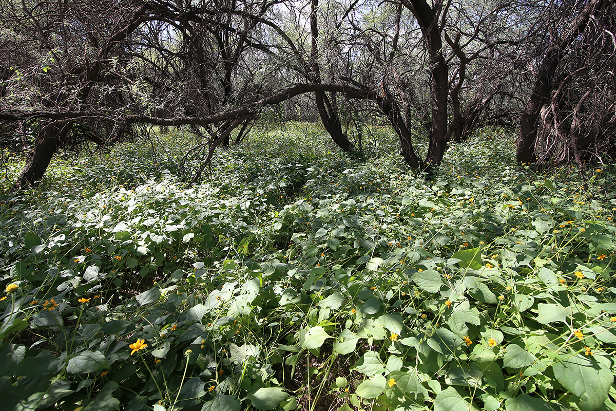
I’ve been in Tucson for 10 years, and have yet to drive from start to finish Redington Road, or circumnavigate either the Catalinas or the Rincons. I had mentioned to my buddy Rob a few weeks ago that I wanted to accomplish these trips, now that I had gotten my Expedition road trip and somewhat off road ready. We decided on this past Saturday to make the trip, with the objective of getting the lay of the land and scouting out stuff for further exploration, as well as taking a few photos along the way. We met at my house on the Eastside and left at 8:20 am. We had a full take of gas, water, ice, donuts, charged batteries for everything, and no deadline to get back. Some clouds floated in the sky ahead, but nothing threatening, so we forged ahead. Since it was a gorgeous morning with relatively low temps, I thought we’d see more people on Redington Road than we did. We ran across a dozen or so souls from a geocaching club who were doing a clean up along the first few miles of the road, a couple of mountain bikers, and a handful of people engaged in target practice. Other than a 4 or five other vehicles, including a Pima County deputy sheriff, we had the entire length of Redington Road to ourselves. The road was in really good shape, save a couple of spots where rain had created small gulleys (maybe 6 inches deep and a foot wide) in the last couple of nights. There were obvious signs that road crews had done some grading and clearing of washes in the last week. The scenery was just stunning. Very green vegetation was abundant, from thick grasses coating the top of the pass to plump saguaro and dark green ocotillo. Wildflowers were everywhere. We made our way along rather slowly, as we stopped along the way to take pictures and check some side roads out. Just below east of Piety Hill we stopped to drink our coffee and devour our donuts. This video is a view to the east with the Galiuro Mountains across the valley
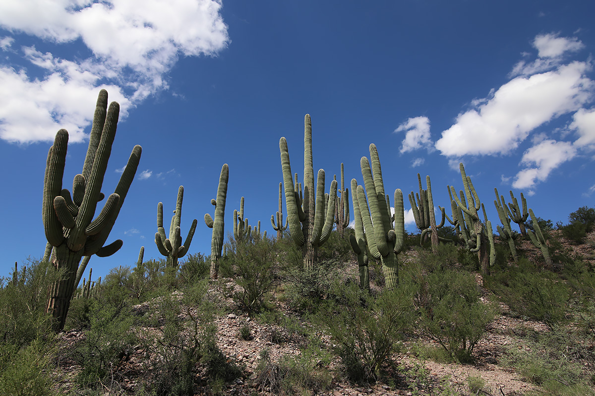
As we finished the descent into the San Pedro River Valley, we came across a magnificent stand of heritage saguaros that cried out to be photographed. Video:
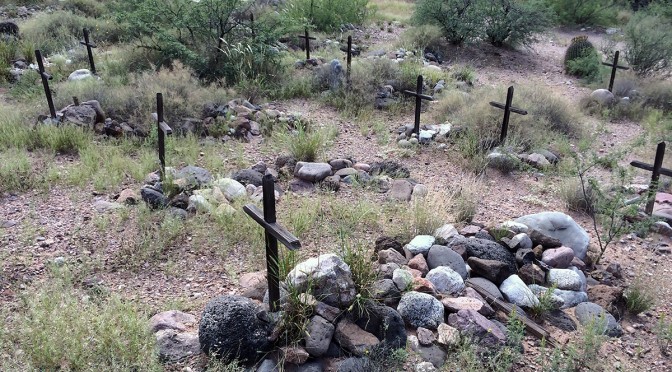
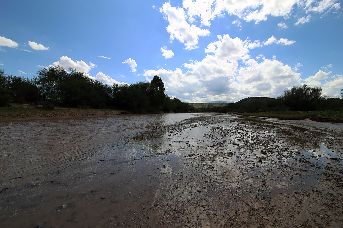
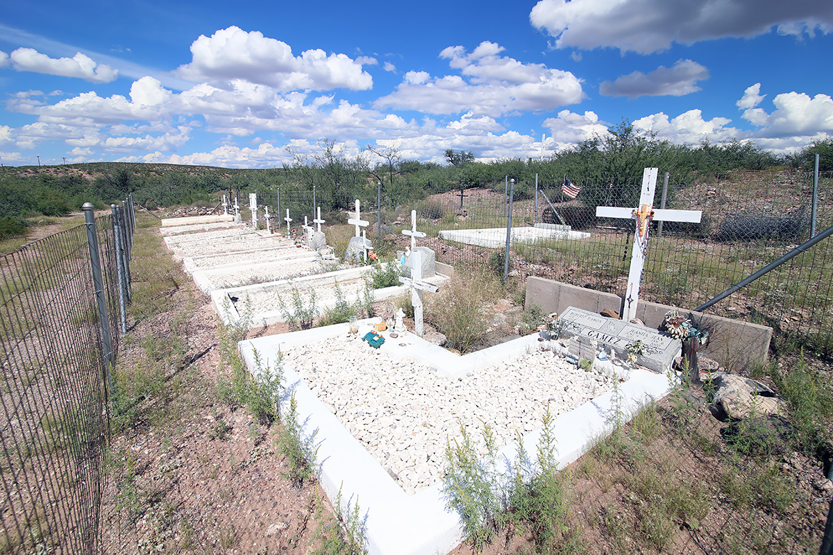
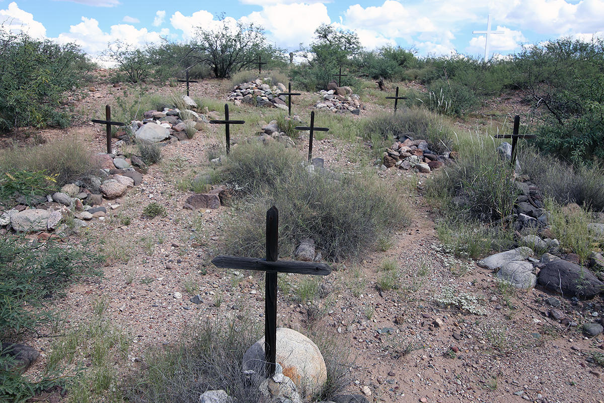
The water was only about 6 inches deep, not swift, and the river bed seemed firm enough, but since we didn’t have a second vehicle to pull us out or any recovery equipment, we crossed further downstream at the bridge. Cascabel Road is in great shape. The valley floor is green and lush. I didn’t expect to see as many residences this far out of Benson as we did. As you would expect, the people we did see reflected the cross section of those you find in rural Arizona – from ranchers to retirees to old hippies to those trying to stay off the grid. Everyone seemed friendly and waved at us, whether from a passing vehicle or from their front gate. Just south of the Spear Ranch I had noted a cemetery on the topo map on the east side of the road. Along this stretch the road was line on both sides by a bosque, which on the east side of the road climbed up a short bluff. I jumped out of the truck and wound my way up the hillside through some brush until I came to a fence about 60 feet off the road. Going through the barbed wire I proceeded another 25 feet until I topped the bluff and wa-lah! there was the graveyard. I had only brought my iPhone up the hill, so I went back to the truck to retrieve my camera and Rob, because he had to see this. As one can see in the photos, besides several modern graves, there are 29 unmarked graves that have to date back to the 1850’s. In a history written by Tess Gamez, of the family that owns the land on which the cemetery sits, it’s not known what year the graveyard was established, or what persons are buried in the 29 unmarked graves.
IMG_2281 webThere was no end to the photographic opportunities, as my buddy Rob will attest to.
IMG_2282 webClouds set up some spectacular shots to photograph.
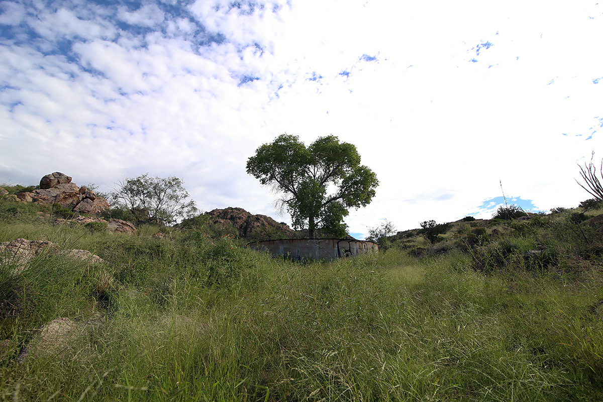
IMG_2286 webA lone cottonwood guards an old water tank near the top of Reddington Pass.
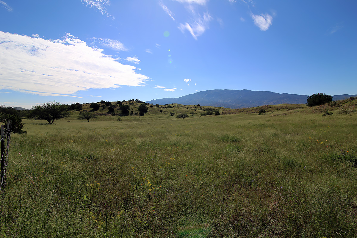
IMG_2293 webThe top of the pass opens into some large grassland areas.
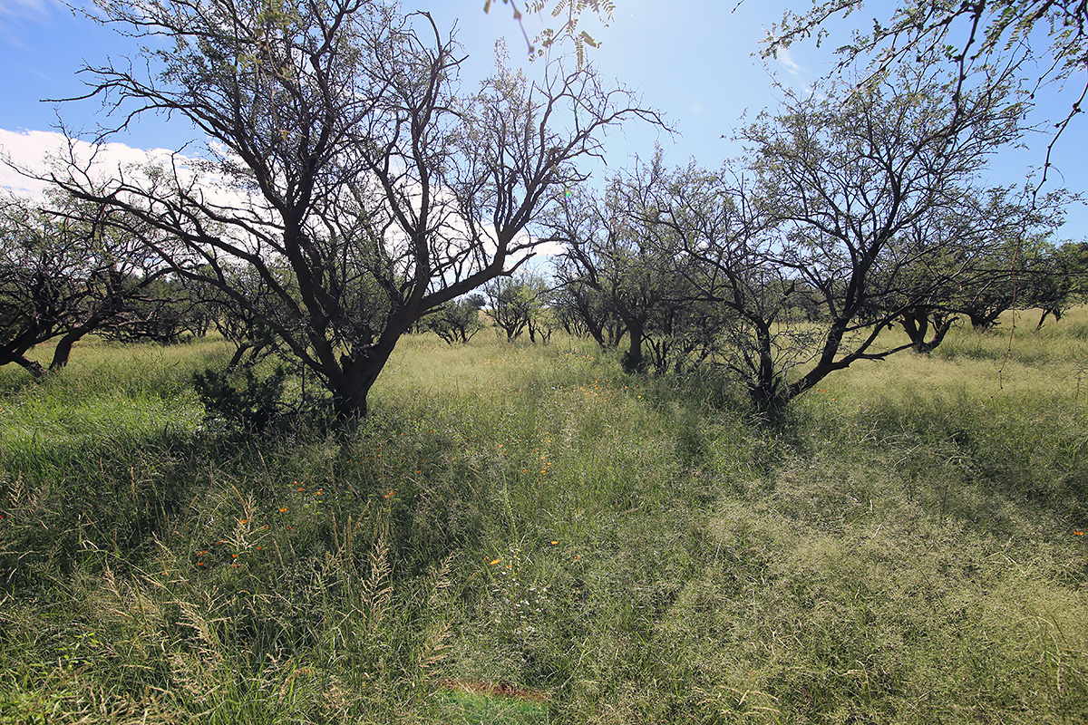
IMG_2298 webMesquite bosques are common throughout Arizona.
IMG_2309 webWe were treated to grand views throughout the trip.
IMG_2310 webThe view as we descended into the San Pedro River Valley.
IMG_1845 webLooking east towards the Galiuro Mountains.
IMG_2314 webA magnificient stand of heritage saguaros.
IMG_2316 webThe San Pedro River.
IMG_2323 webAnother bosque.
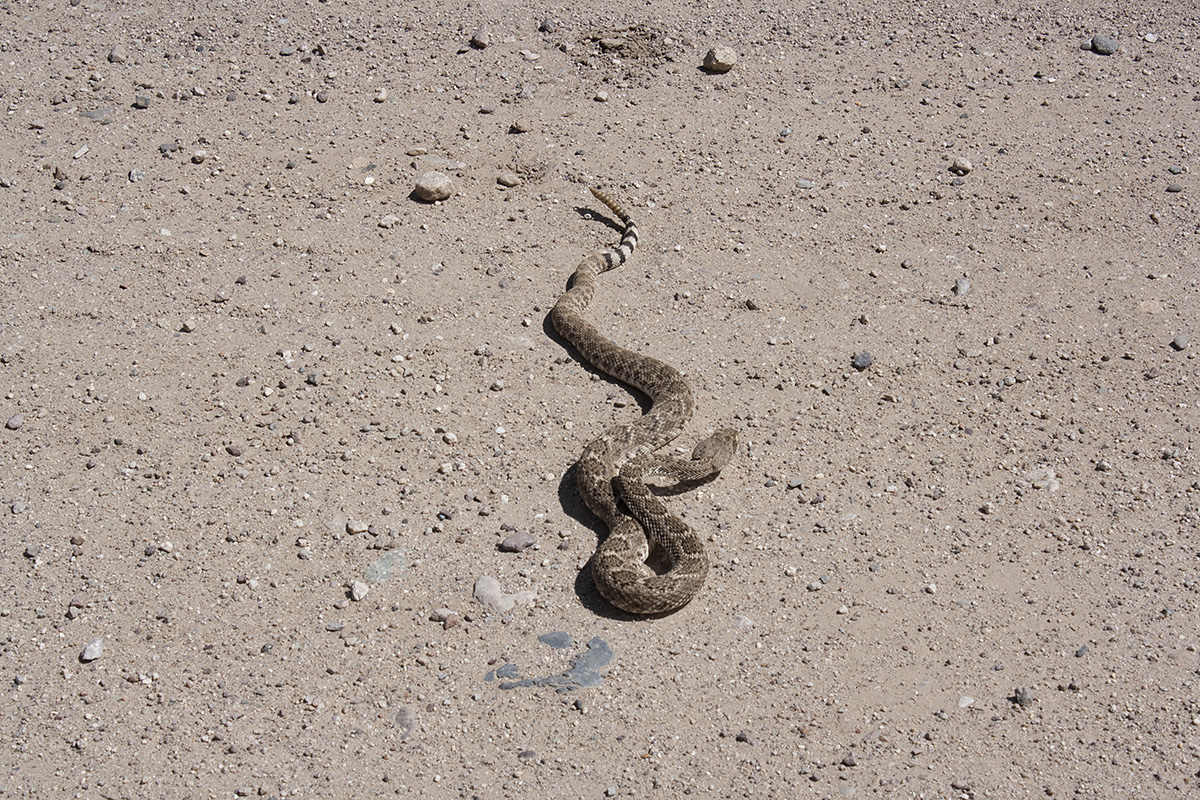
IMG_1846 webNo trip in Arizona is complete without a snake in the road.
IMG_2327 webThe Gamez family cemetery.
IMG_2331 webSome of the 29 pioneer graves, occupants unknown.
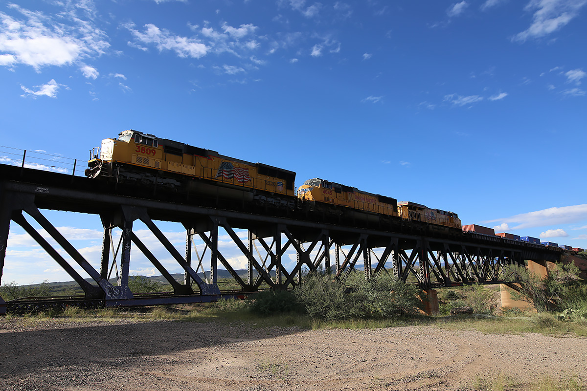
IMG_2339 webRailfanning at the Three Bridges area on Marsh Station Road just east of Vail, Arizona.
We had thought of completing the trip to Benson in about 3 to 4 hours so we could lunch there, but we stopped so often that we found ourselves at the Gamez Cemetery around 1 pm. From there, we left off making any more stops (for the most part), reaching Benson around 3. Rob suggested we eat at the Horseshoe Café. I had never eaten there. Wow, we had quite a meal! While the burgers and sandwiches sounded great, they start serving dinner at 3 on Saturday, so Rob had meatloaf, mashed potatoes, and a salad, while I had liver, bacon, and onions, baked potato, and a salad. The portions were HUGE. Each entrée was only $10. On the way back, we stopped at the Three Bridges area off Marsh Station Road near Vail to photograph a couple of westbound trains we had seen passing through Benson. We finally got back to my house at 5:20 pm, nine hours after we had left.
It was easy to forget within minutes of climbing Reddington Road that a modern city was behind us. Almost immediately we were met with solitude, gorgeous landscapes, and a sense of what Arizona must have looked like when the first European explorers entered the region. For those that live in the region, life is probably pretty much the same as it was 150 years ago – isolated, dependent upon water, neighbors, adaptability, and endurance. Even with Tucson or Benson 40 or 50 miles away, you get a sense that you are a long ways from nowhere.
Random acts of thought, and useless pieces of information – et deinceps per nebula