(Last edit 13 February 2022)
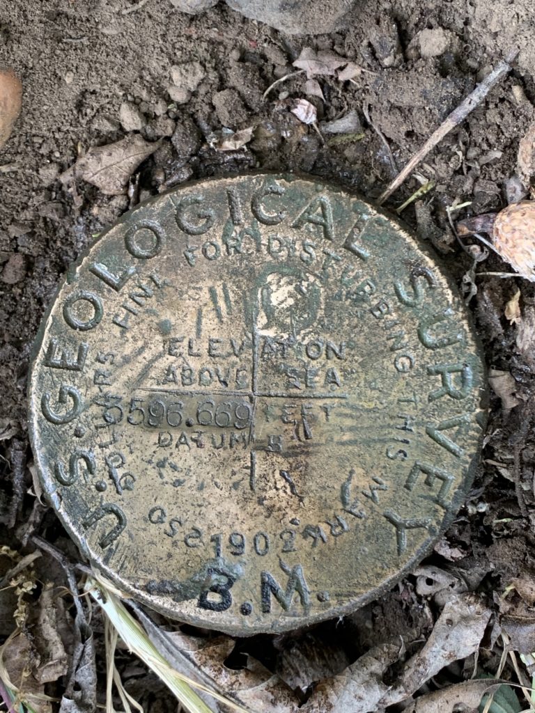
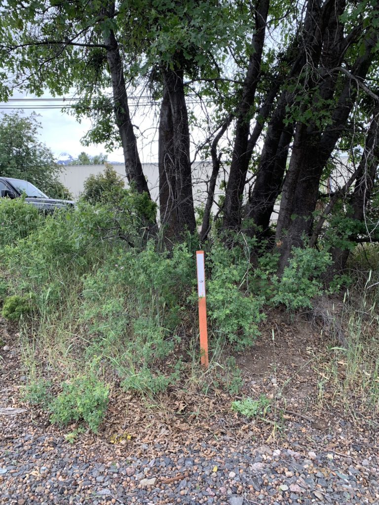
3596 B
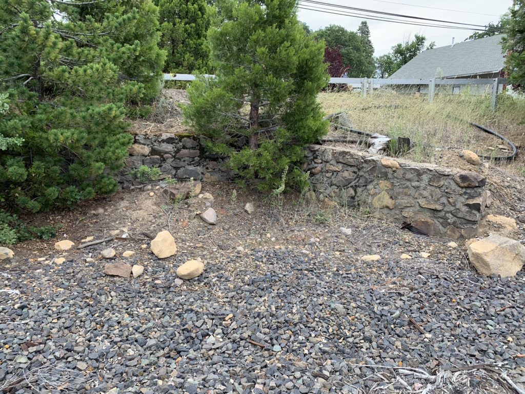
A well preserved benchmark along North Mount Shasta Blvd in Mount Shasta, along the Union Pacific Railroad. Marked by a witness post underneath a small tree. Nearby listed benchmarks F 13 (PID MX0134) and F 13 RESET (PID MX0135) are nowhere to be found. A small retaining wall along the east side of the railroad right-of-way can be found about 200 north of this benchmark (between the two crossings of Nixon Road), that probably dates back to the early 1900″s.
- COORDINATES: 41.323745, -122.321726
- MAP: USGS QUAD “CITY OF MOUNT SHASTA”
- AGENCY: USGS
- TYPE: VERTICAL CONTROL DISK
- SETTING: Set in top of pipe.
- MONUMENTED: 1902
- NGS PID: MX0133
- STATUS: RECOVERED
- CONDITION: EXCELLENT, as of 15 June 2020
D 495 RESET
This benchmark is located just west of Siskiyou County Road A12 (99-97 Cutoff), on the north side of US 97. The National Geodetic Survey Data Explorer wrongly shows a location corrected to the NAVD geodetic datum about 1000 feet to the east, and south of US 97. Nearby can be found a CalTrans benchmark, as well two smaller survey marks, one on each side of the highway. All are marked with witness posts.
- COORDINATES: 41.53399, -122.24987
- MAP: USGS QUAD “JUNIPER FLAT” – Editor’s note: the NGS datasheet lists “The Whaleback” 2018 quad, but I believe it places it in the wrong spot, due to using a computed position in updating the original position to the NAVD 88 geodetic datum.
- AGENCY: NATIONAL GEODETIC SURVEY
- TYPE: VERTICAL CONTROL DISK
- SETTING: Set in top of concrete monument.
- MONUMENTED: 1975
- NGS PID: MX0023
- STATUS: RECOVERED
- CONDITION: GOOD, as of 14 January 2021 visit

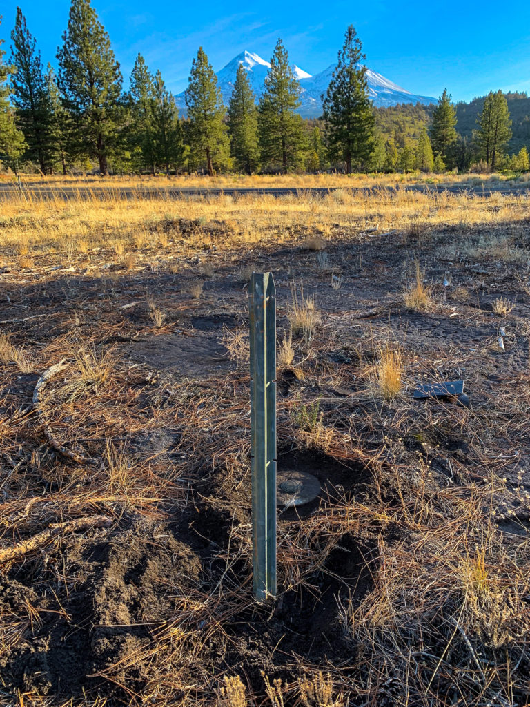
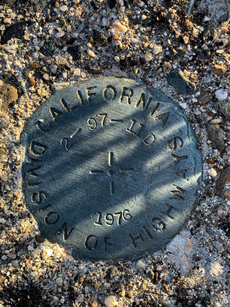
CalTrans benchmark 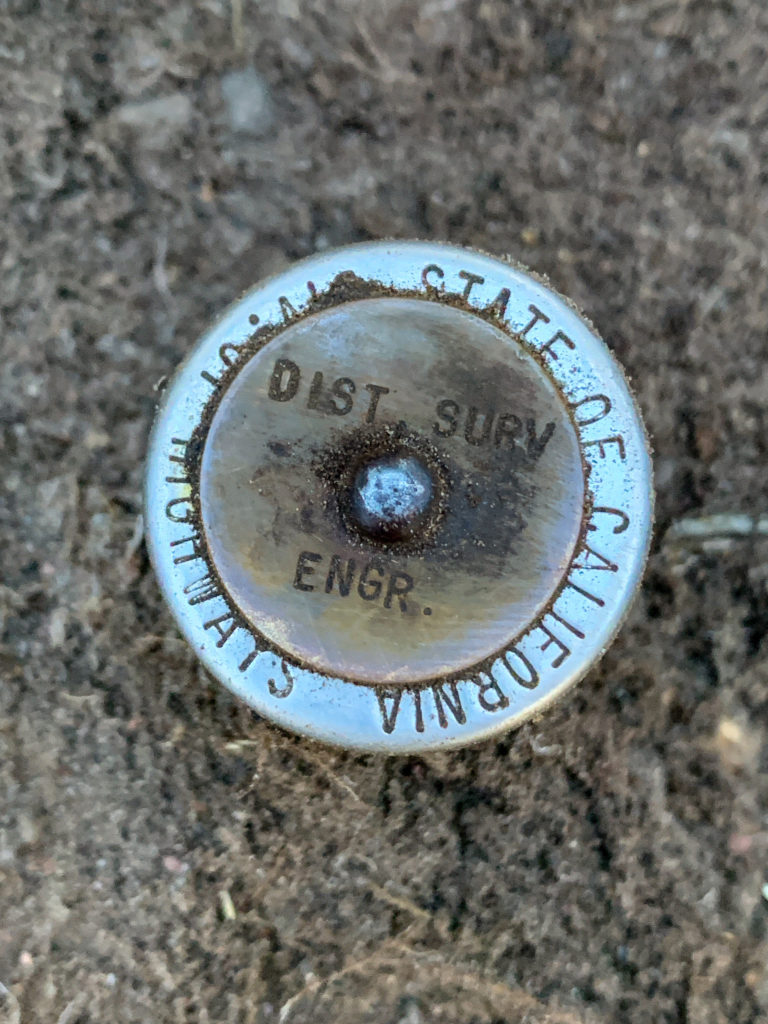
Nearby Caltrans survey mark
F 13
Apparently destroyed, as it was re-monumented as F 13 RESET, which subsequently was destroyed also.
- COORDINATES: 41.325, -122.322222
- MAP: USGS QUAD “CITY OF MOUNT SHASTA”
- AGENCY: COAST & GEODETIC SURVEY
- TYPE: VERTICAL CONTROL DISK
- SETTING: Set in light structure.
- MONUMENTED: 1919
- NGS PID: MX0134
- STATUS: NOT FOUND
- CONDITION: Reset in 1954 as F 13 RESET, probably destroyed during semaphore signal removal in which the benchmark was set, before 1988. All traces of the semaphore signal gone as of my visit of 15 June 2020
F 13 RESET
- COORDINATES: 41.325833, -122.3225
- MAP: USGS QUAD “CITY OF MOUNT SHASTA”
- AGENCY: COAST & GEODETIC SURVEY
- TYPE: VERTICAL CONTROL DISK
- SETTING: Set in light structure.
- MONUMENTED: 1919, but relocated sometime before 1954
- NGS PID: MX0135
- STATUS: NOT FOUND
- CONDITION: PROBABLY DESTROYED before datasheet recovery note of 1988; all traces of the mentioned semaphore signal gone as of my visit of 15 June 2020
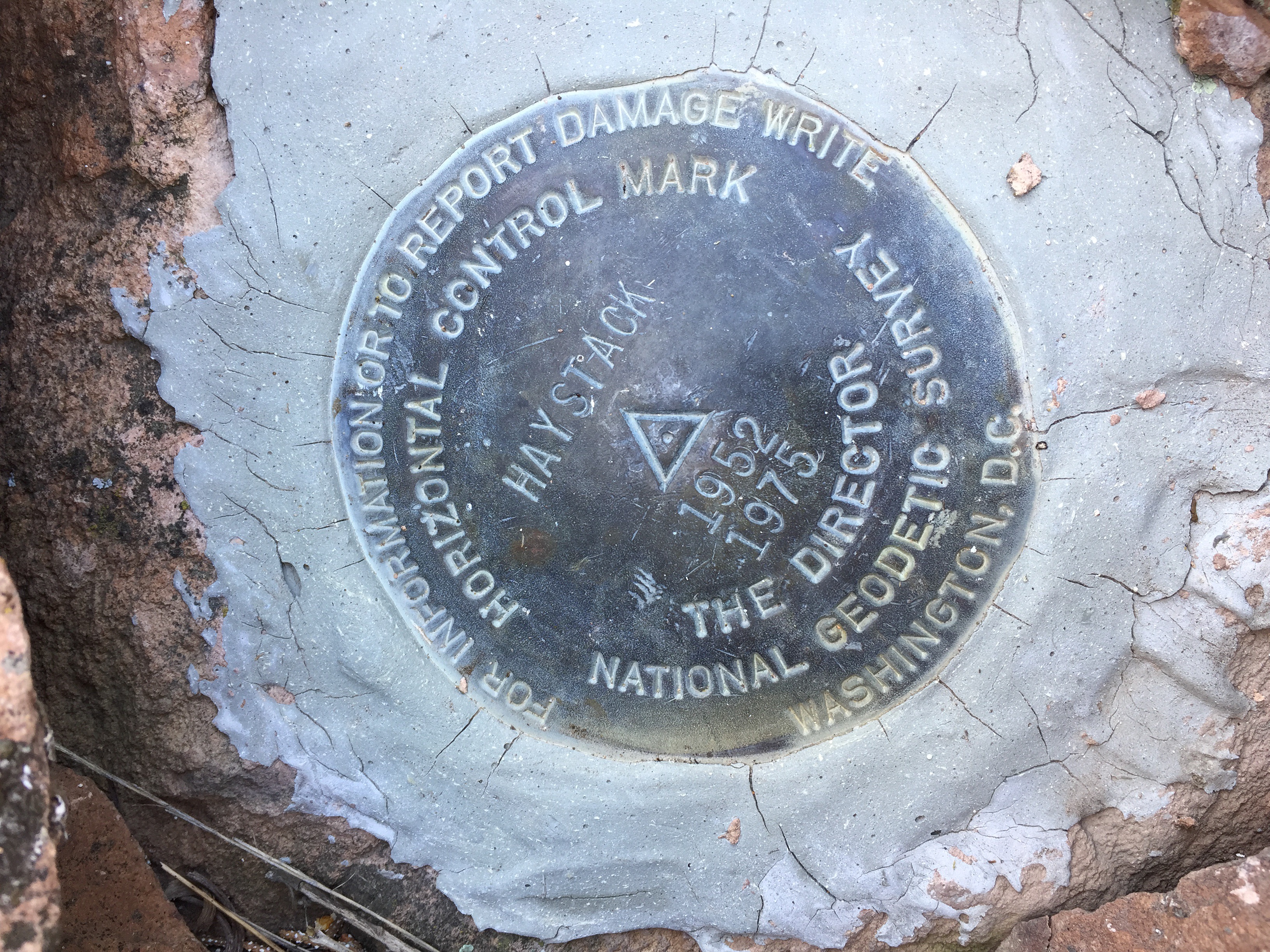
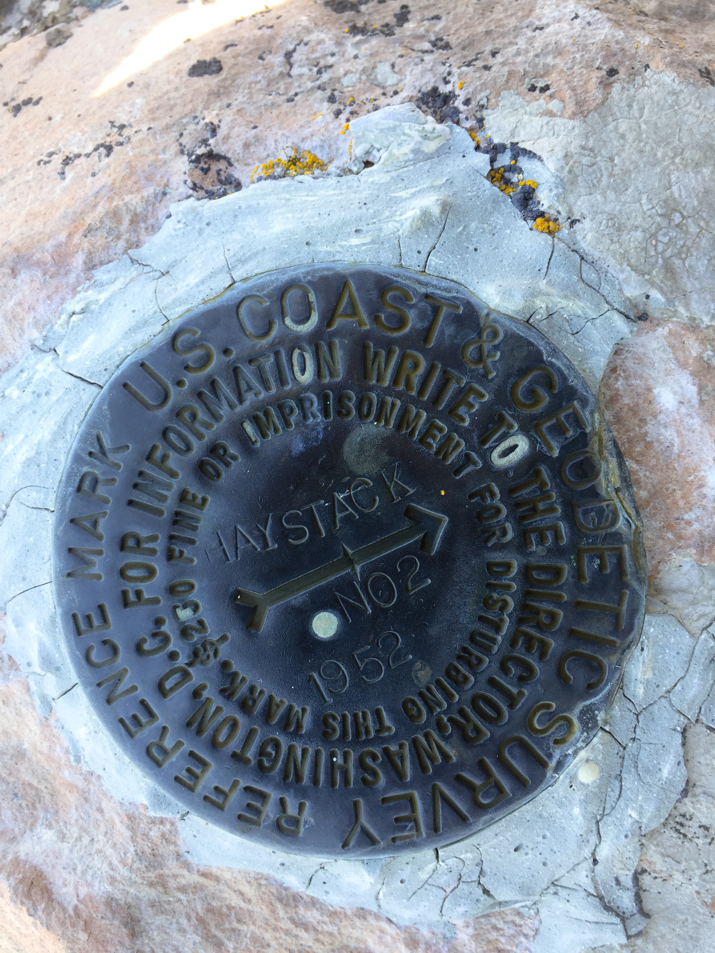
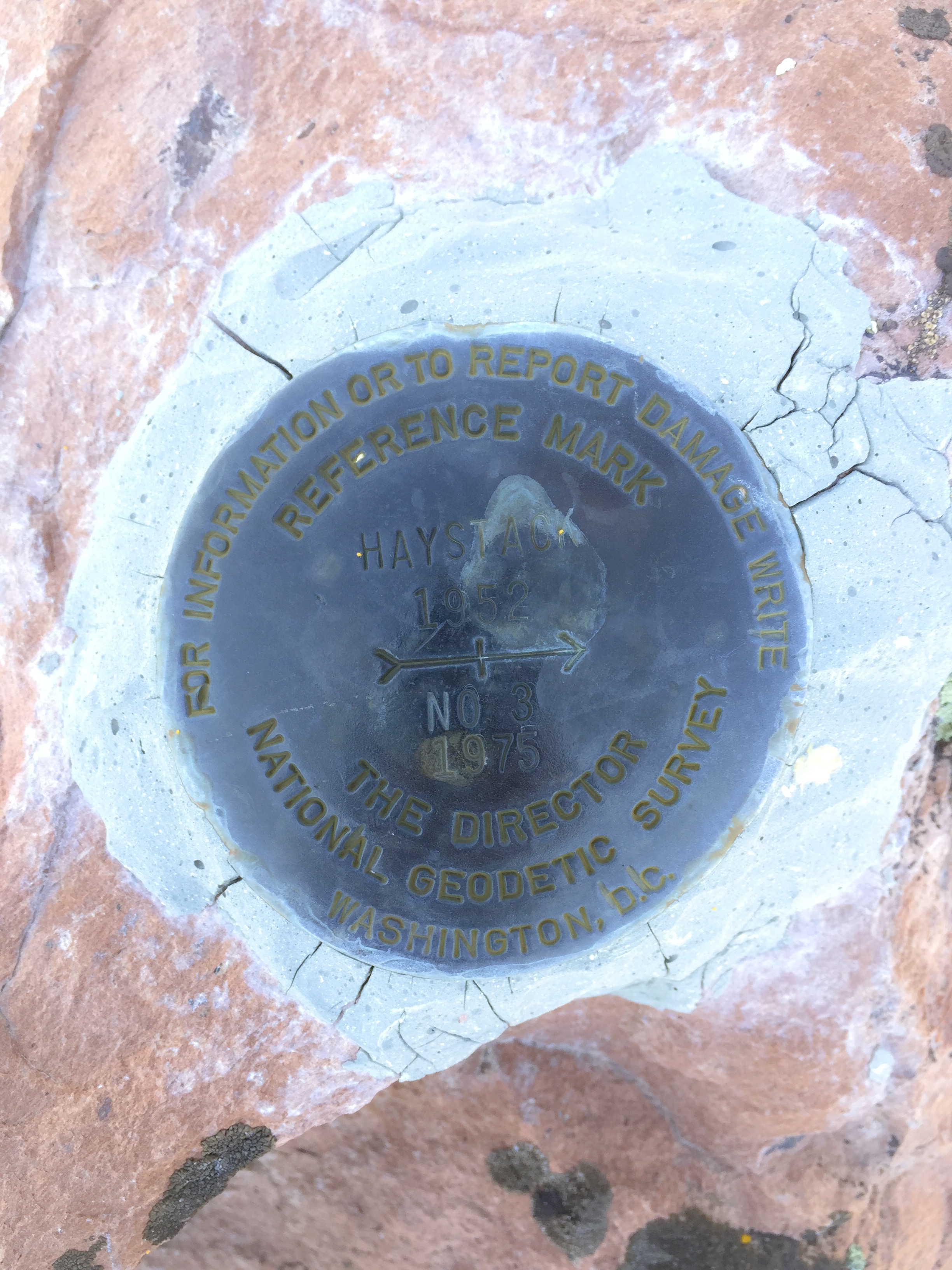
HAYSTACK RESET
Located on Haystack, an andesite dome about 11 mile northeast of Weed, California, along US Highway 97. See Haystack for a brief description of the hike to the top.
- COORDINATES: N 41° 32.046′, W 122° 16.763′
- MAP: USGS QUAD “JUNIPER FLAT”
- AGENCY: NATIONAL GEODETIC SURVEY
- TYPE: HORIZONTAL CONTROL DISK
- SETTING: Set in boulder at highpoint.
- MONUMENTED: 1952 (original), 1975 (reset)
- NGS PID: MX1001
- STATUS: RECOVERED
- CONDITION: GOOD, as of 21 April 2017 visit
NOTES: According to the NGS data sheet for this mark, there were 3 reference marks associated with this station – only reference marks 2 and 3 still exist, with reference mark 1 missing. Haystack is a popular hike, and there is a summit log at the highpoint.
NGS DATASHEET EXCERPT:
RECOVERY NOTE BY NATIONAL GEODETIC SURVEY 1975 (CLN)
 MX1001'THE AZIMUTH MARK (BM Y 12) AND REFERENCE MARK 2 WERE RECOVERED IN GOOD CONDITION. THE STATION MARK DISK AND REFERENCE MARK 1 DISKVWERE FOUND MISSING BUT THE STEM OF THE STATION MARK DISK WASVSTILL IN PLACE SO IT WAS REMOVED, THE DRILL HOLE WAS DEEPENED, AND A NEW STATION MARK DISK WAS SET IN THE SAME EXACT POSITION ON THIS DATE.
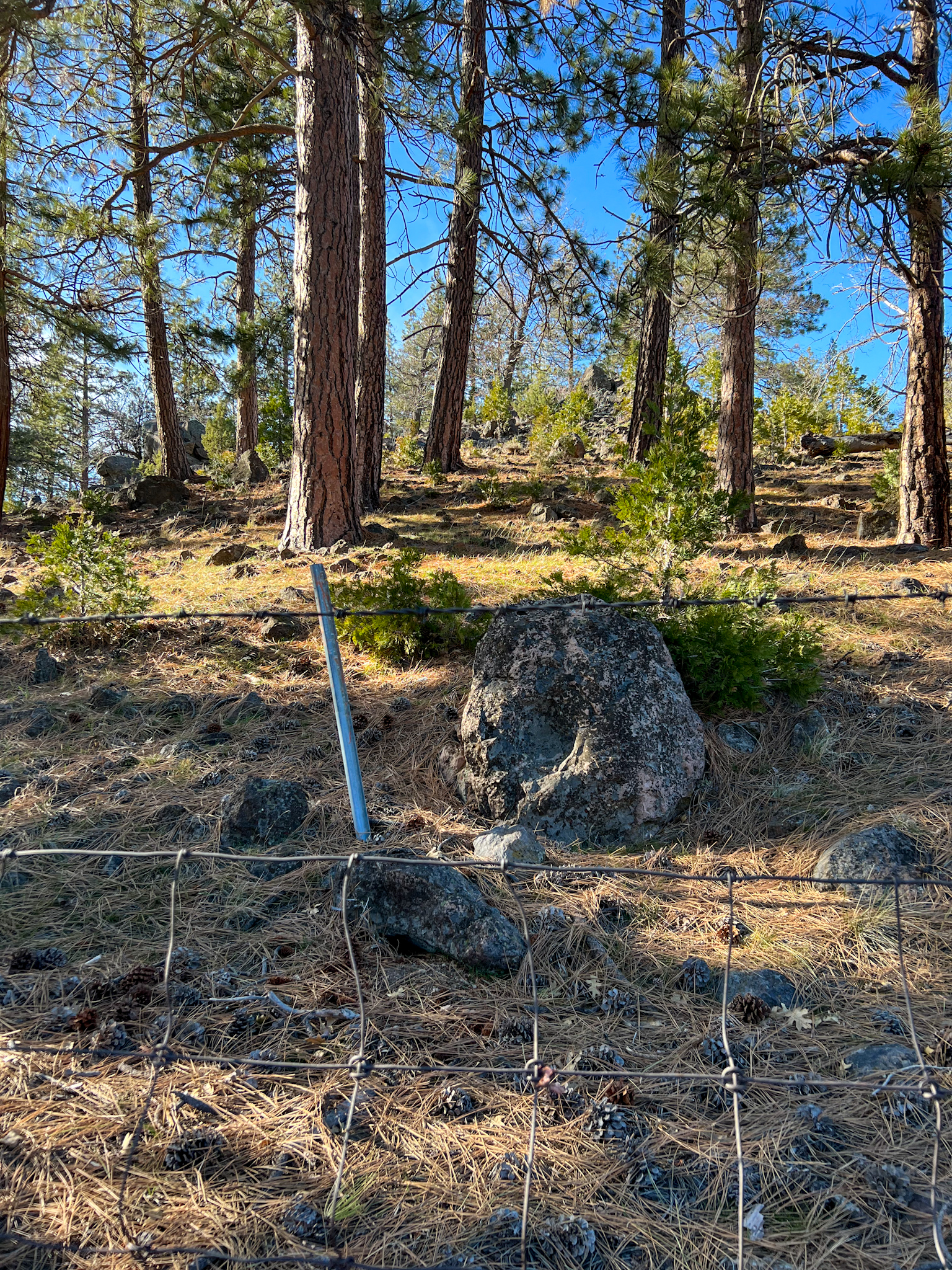
W 12
Missing and most likely destroyed benchmark. See the blog post detailing my search for it.
- COORDINATES: 41.531332, -122.251452
- MAP: USGS QUAD “LAKE SHASTINA (1954)” – Editor’s note: the NGS datasheet lists “The Whaleback” 2018 quad, but I believe it places it in the wrong spot, due to using a computed position in updating the original position to the NAVD 88 geodetic datum.
- AGENCY: COAST & GEODETIC SURVEY
- TYPE: BENCH MARK DISK
- SETTING: Set in rock.
- MONUMENTED: 1919
- NGS PID: MX0021
- STATUS: NOT FOUND
- CONDITION: N/A 14 January 2021
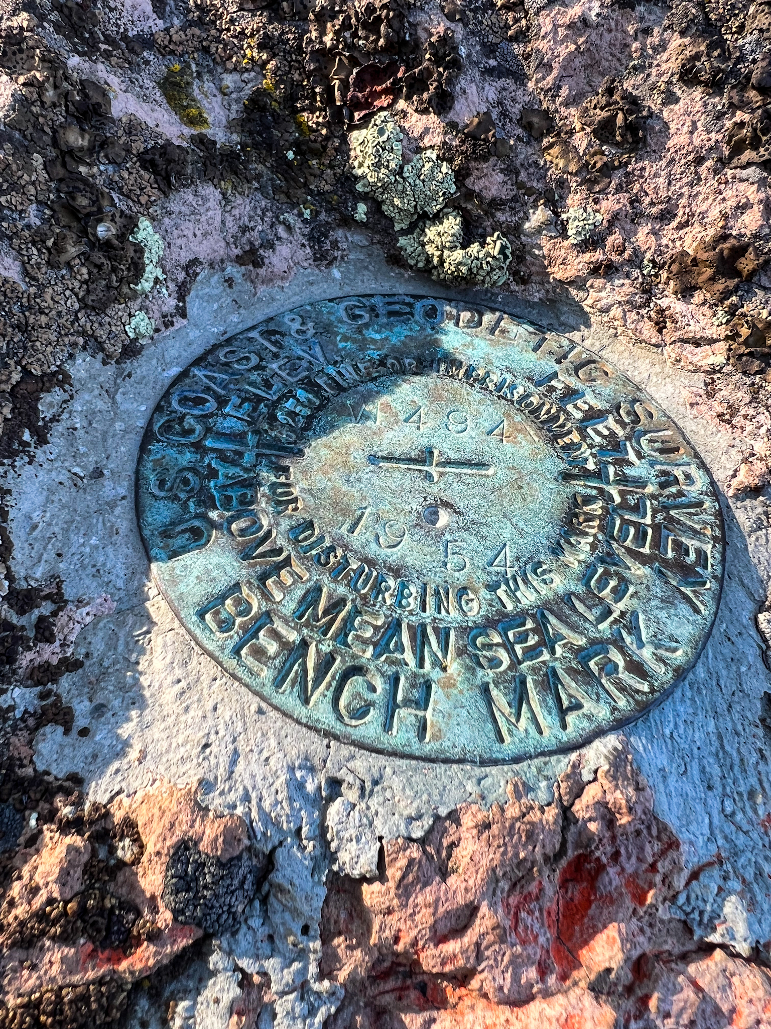
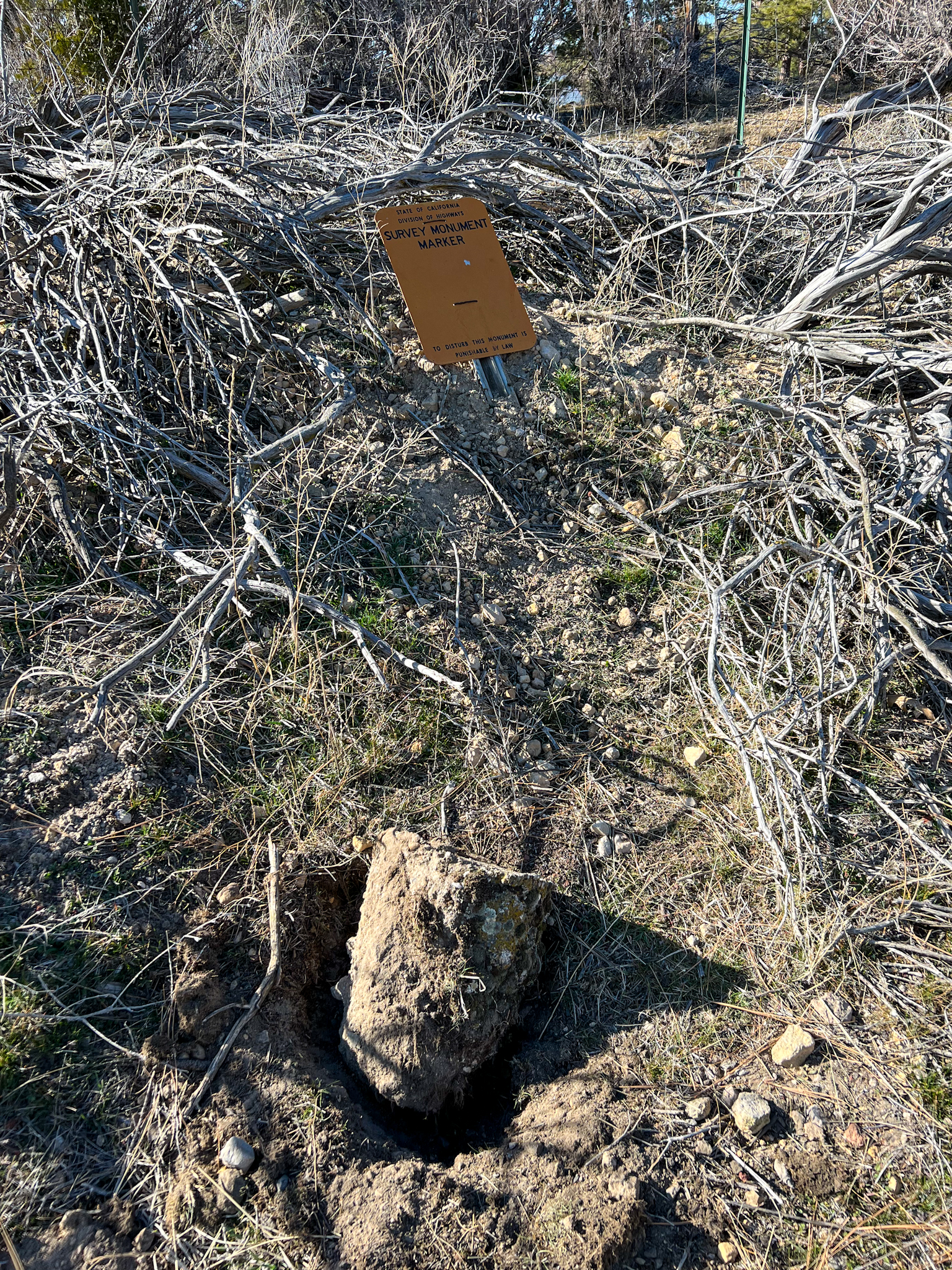
W 494
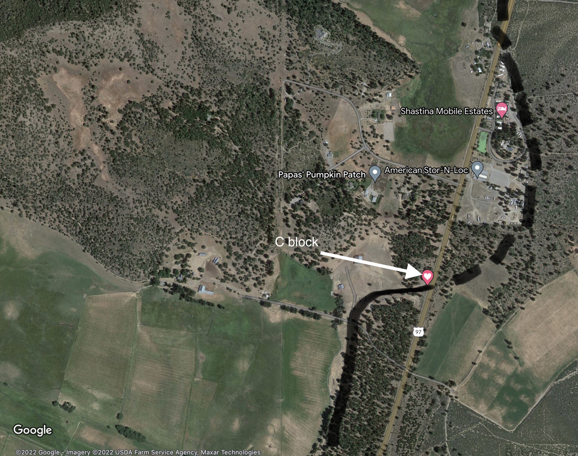
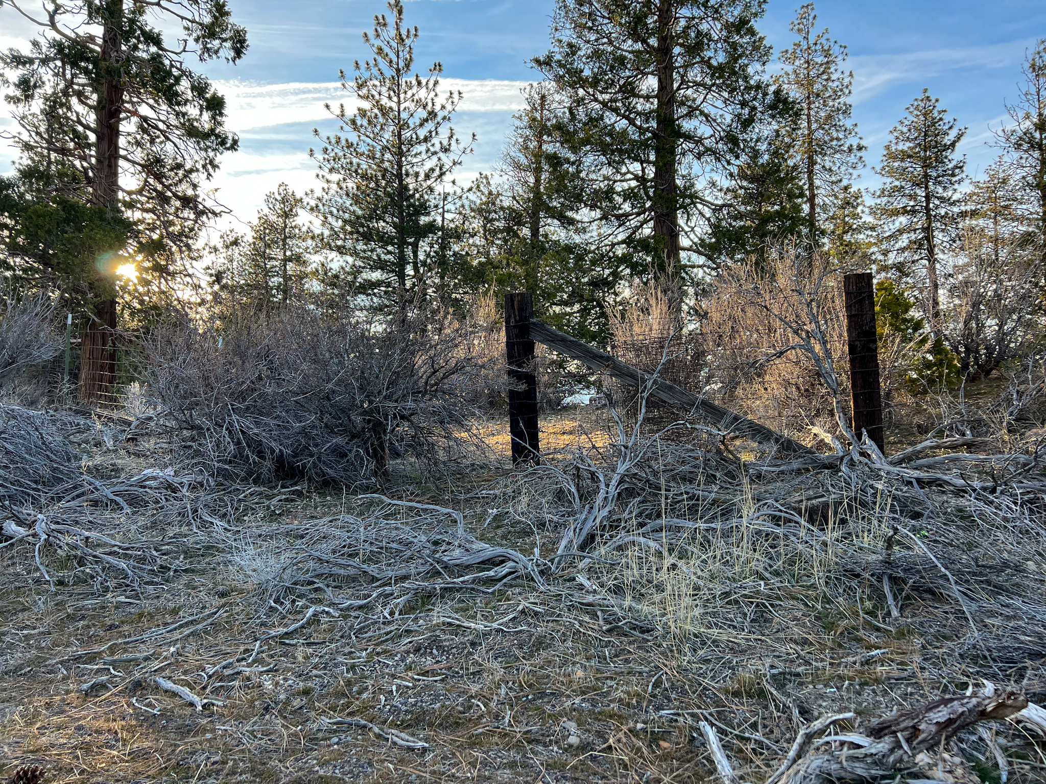
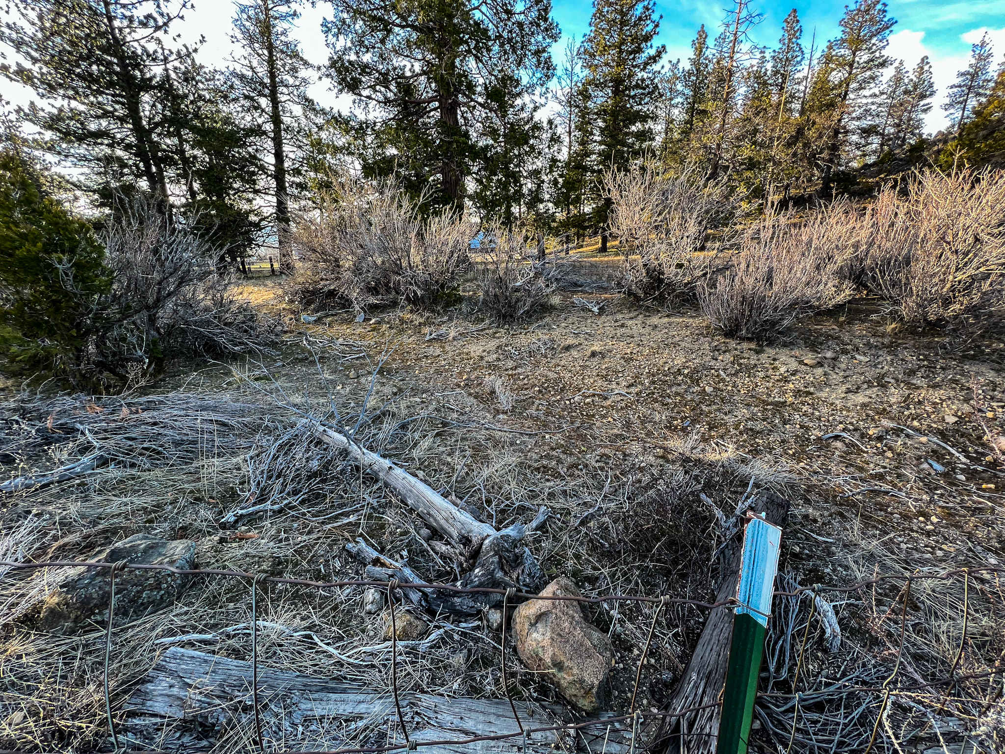
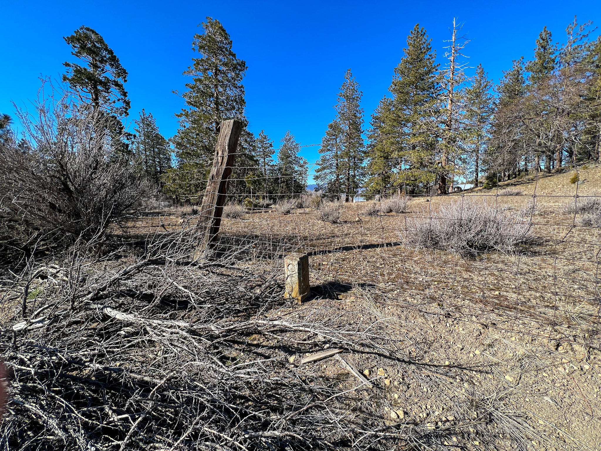
This benchmark is located a little over 4 miles from downtown Weed along the west side of US 97. It’s located on a boulder, sitting above the highway on a hillside, about 15 feet above the highway. It is on private property (barely), and it is evident from the bent fencing that a few have visited this site.
The immediate area is of interest to roadgeeks. When US 97 was first routed in the area, it apparently used existing local roads until new construction could begin. Below is a snippet from the 1935 Dunsmuir 1:125,000 topo which reflects that first routing. About 100 south of this benchmark can be found the narrow roadcut striking out northwest on what is now private property. Between the roadcut and benchmark is an old California Department of Highways “C block”, a concrete artifact marking the state’s right-of-way. Another one can be found across the highway along the fence line. A modern Caltrans survey mark is located to the left of the old roadbed.
- COORDINATES: 41.460833, -122.355833
- MAP: USGS QUAD “HOTLUM”
- AGENCY: COAST & GEODETIC SURVEY
- TYPE: BENCH MARK DISK
- SETTING: Set in a boulder.
- MONUMENTED: 1954 CGS
- PID: MX0152
- STATUS: RECOVERED
- CONDITION: GOOD, as of 11 February 2022 visit


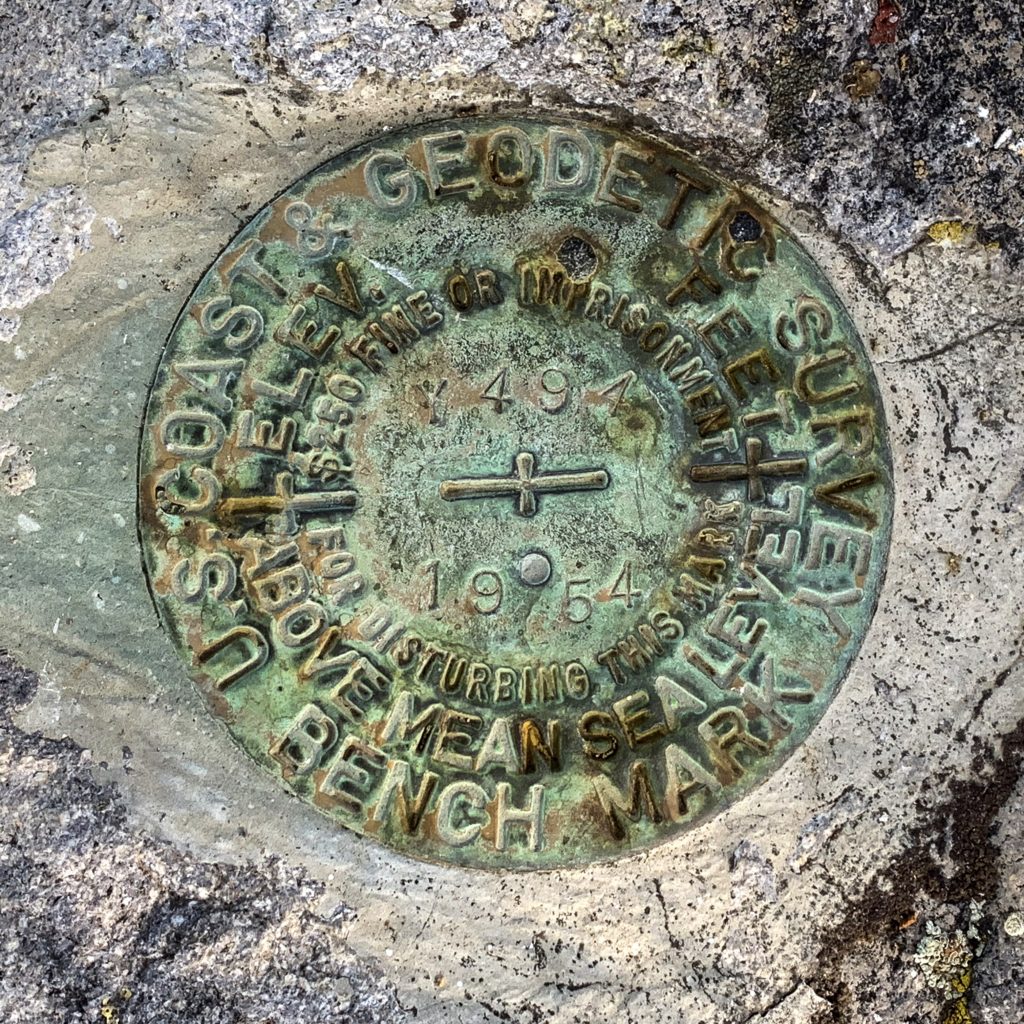
Y 494
This benchmark is an easy find about miles northeast of Weed along US 97. It is located under a tree, set in a boulder, on the south side of the highway.
- COORDINATES: 41.486088, -122.338418
- MAP: USGS QUAD “HOTLUM”
- AGENCY: COAST & GEODETIC SURVEY
- TYPE: BENCH MARK DISK
- SETTING: Set in rock.
- MONUMENTED: 1954
- NGS PID: MX0181
- STATUS: RECOVERED
- CONDITION: GOOD, as of 6 August 2019 visit