New blog post: Lake Shasta Artifacts, 9 December 2021. A visit to a segment of historical US 99 left high and dry by the receding waters of Lake Shasta, as well as a railroad tunnel that is also accessible.
Update to the Union Pacific Railroad: Black Butte Subdivision page in the Abandoned Railroad Infrastructure section. I’ve identified a number of straightened curves between Dunsmuir and the Black Butte siding that I’m checking out.
All photographs by Denis Fabbrini unless otherwise indicated.
At the beginning of November, I made a trip down to Lake Shasta to explore some of the old infrastructure uncovered by the drought conditions much of the West has been suffering from in the past couple of years. Lake Shasta has been a levels only really seen in the past decades – 2014, I believe, and the great drought of 1976-77. Stuff that has emerged from the waters include old highways, bridges, and railroad beds and tunnels. Unfortunately, much of the area surrounding the lake was engulfed in wildfires throughout this past summer, with national forest closures making access to much of the lake and these historic sites pretty tough.
At the beginning of November, I was finally able to make it down to the lake and spend a few hours exploring a couple of sites of interest with a fellow roadgeeker, Eric Hall, from Redding.
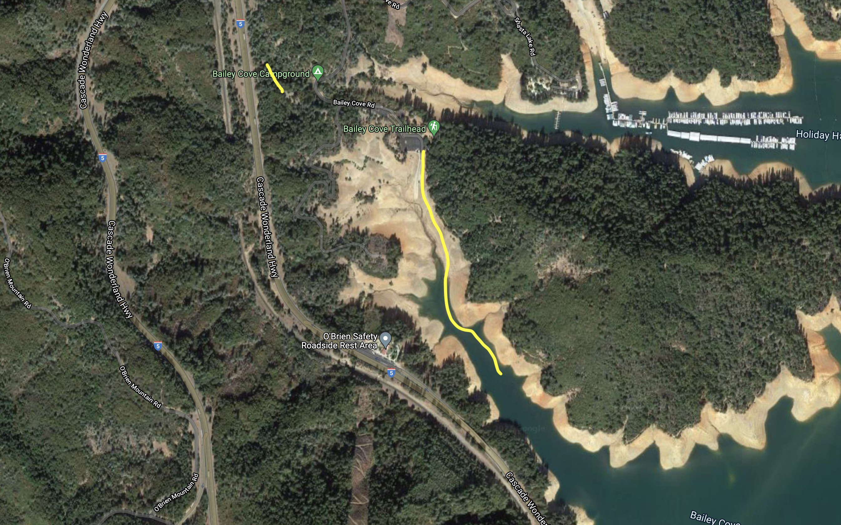
Bailey Cove
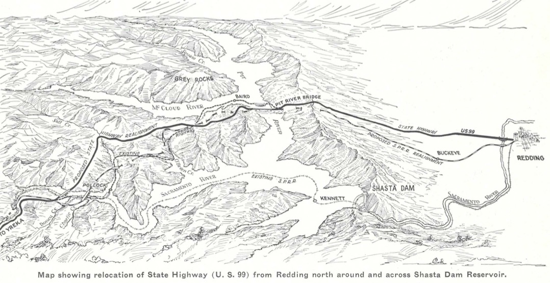
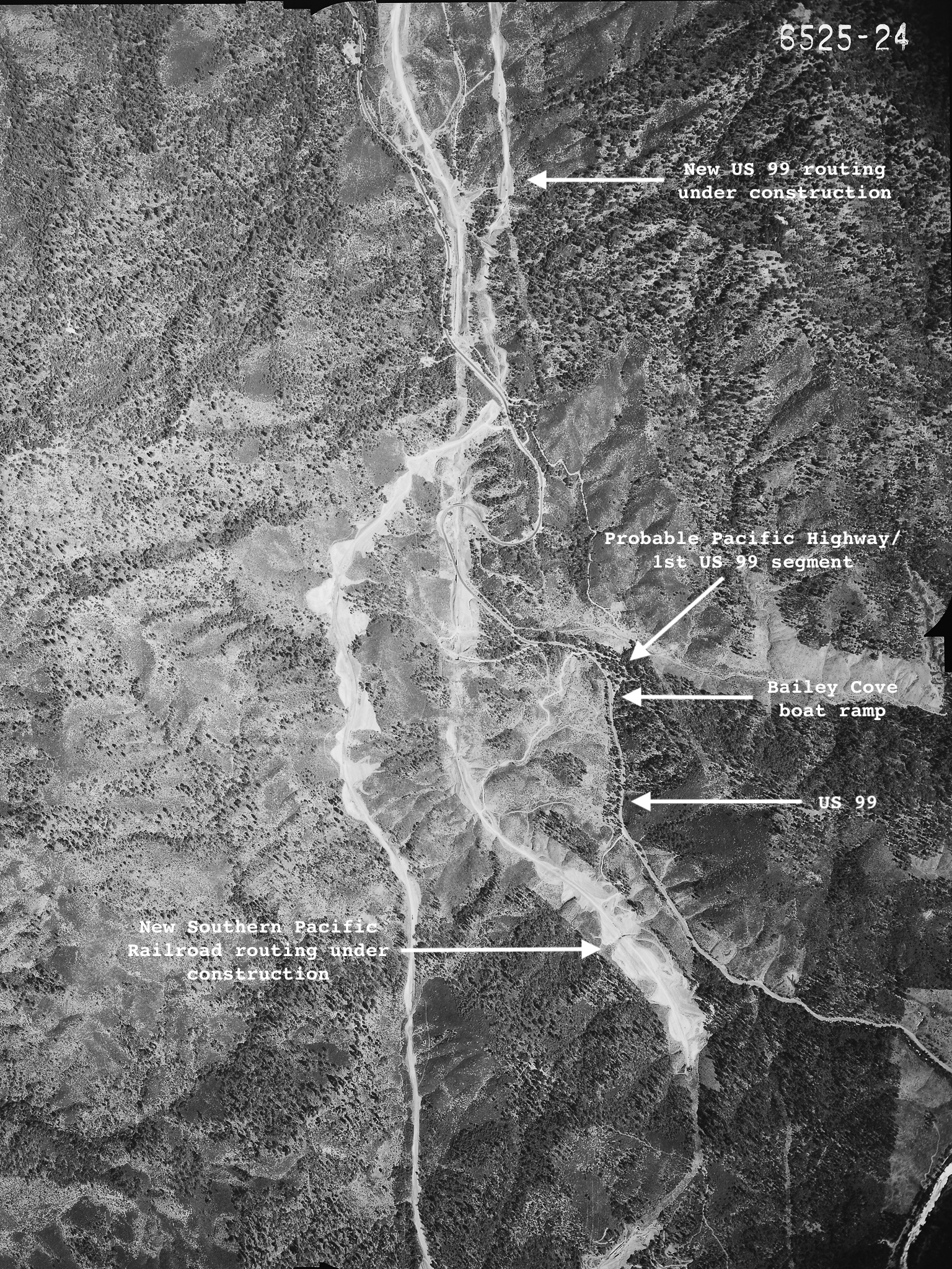
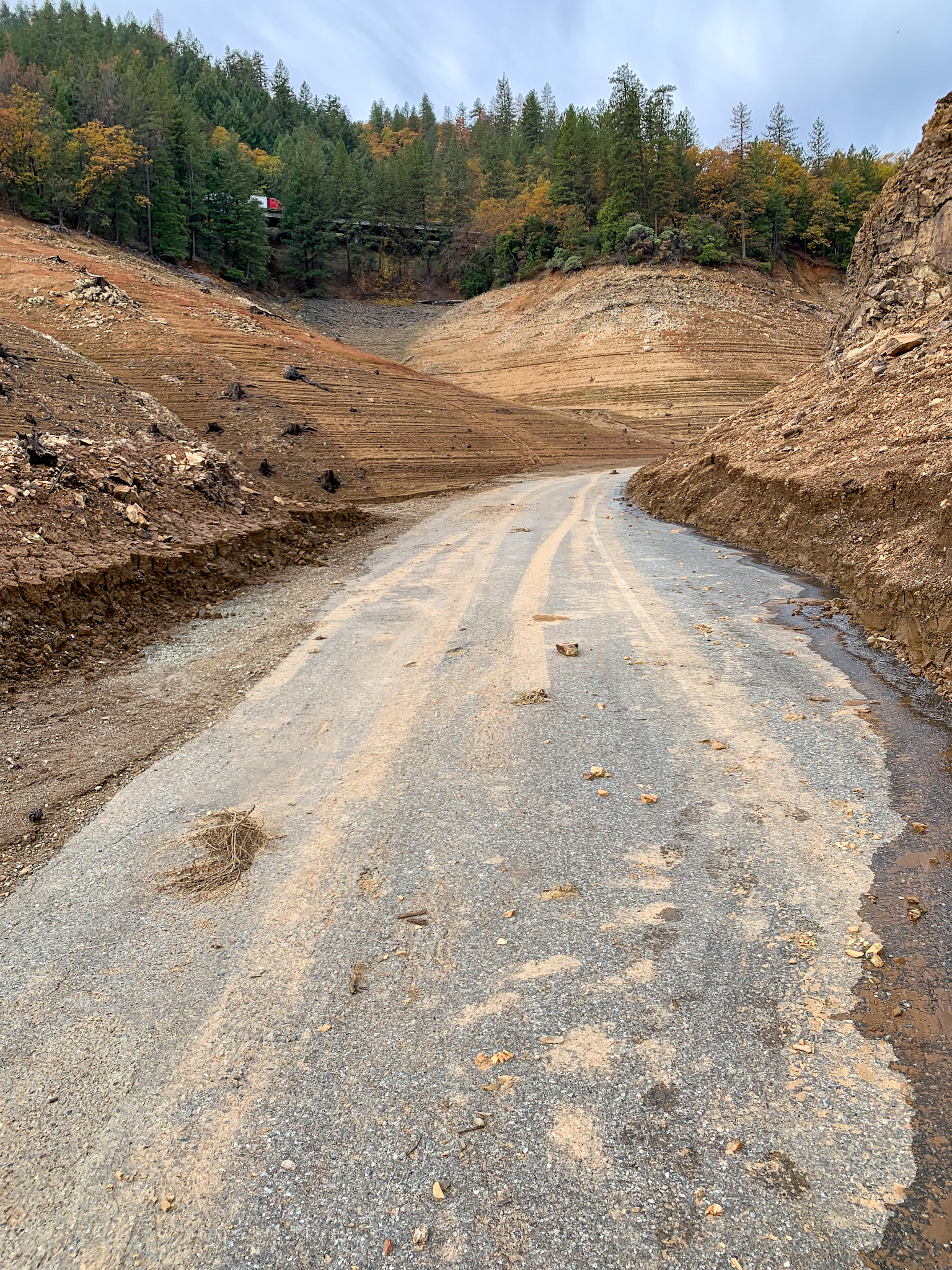
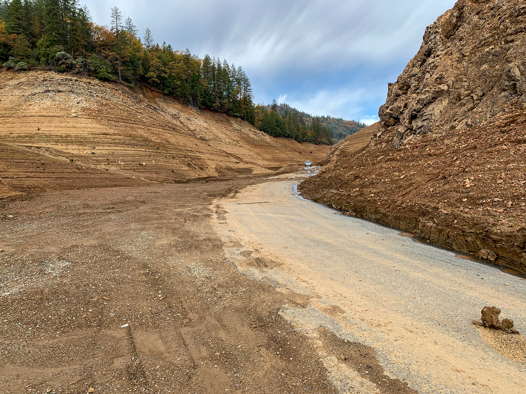
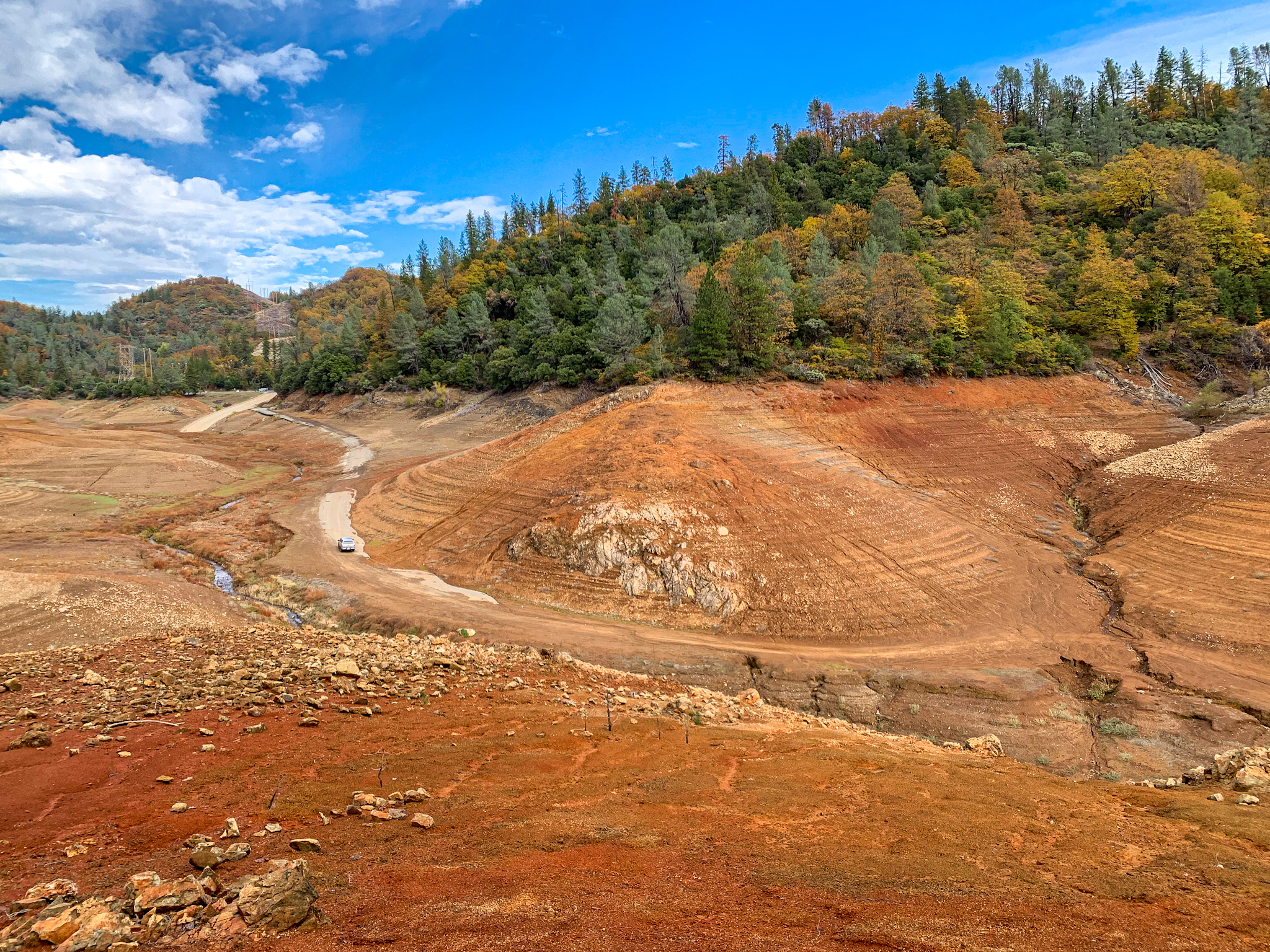
This spot is located in a drainage off the west side of the McCloud River Arm of Lake Shasta. The 1915 Pacific Highway and the 1926 US 99 routing drops off a ridge heading south down to the McCloud River, then along the north side of the Pit River, until it crossed the Pit near what is now Bridge Bay, under the shadow of the present I-5 Pit River Bridge. This routing was replaced when Shasta Dam was built and required that US 99 be moved to higher ground, along with 26 miles of Southern Pacific trackage. The new routing opened in January 1943.
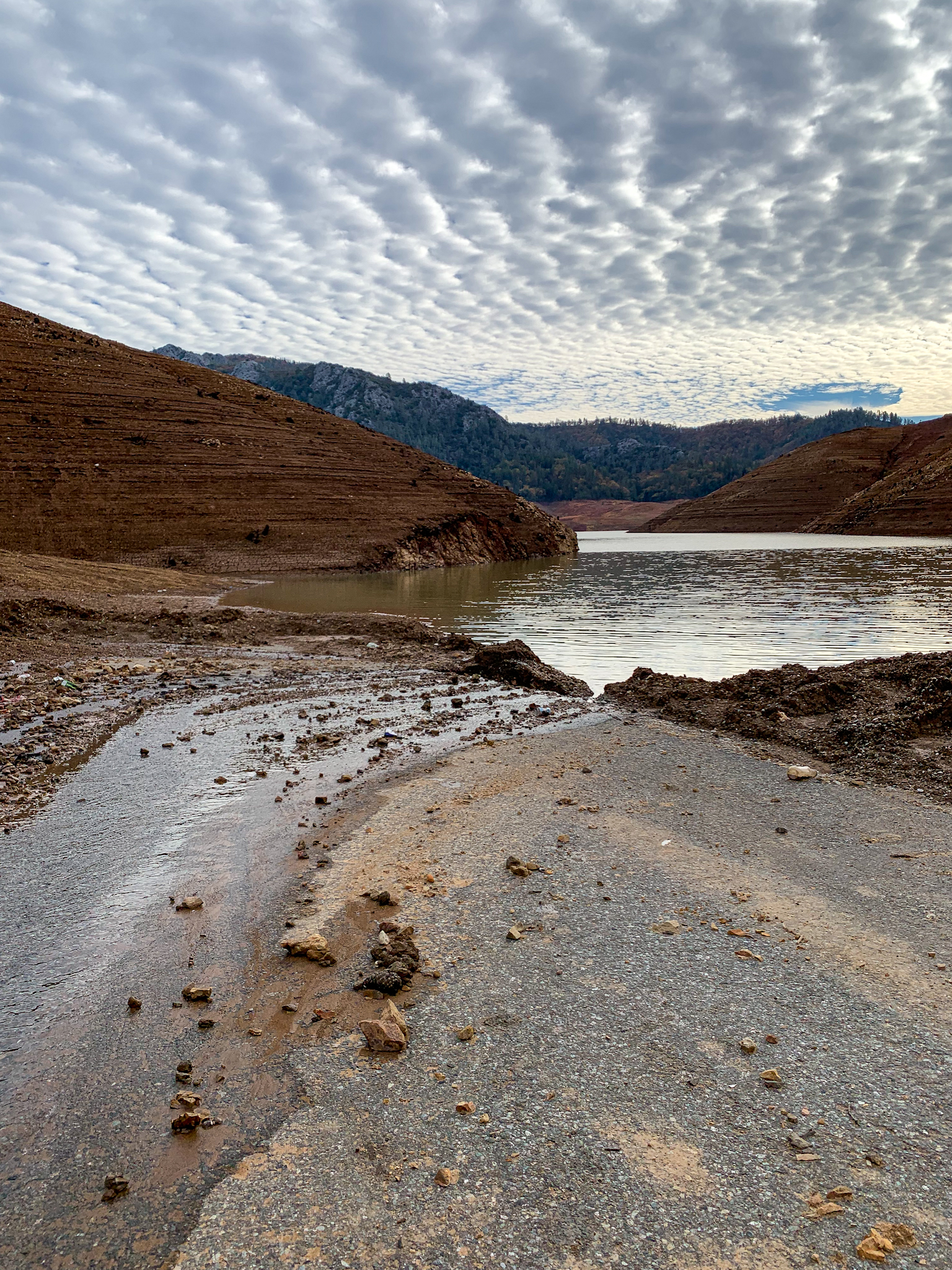
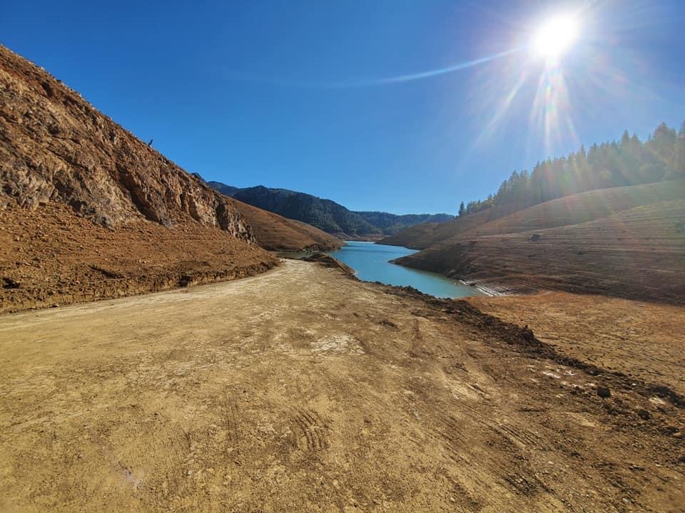
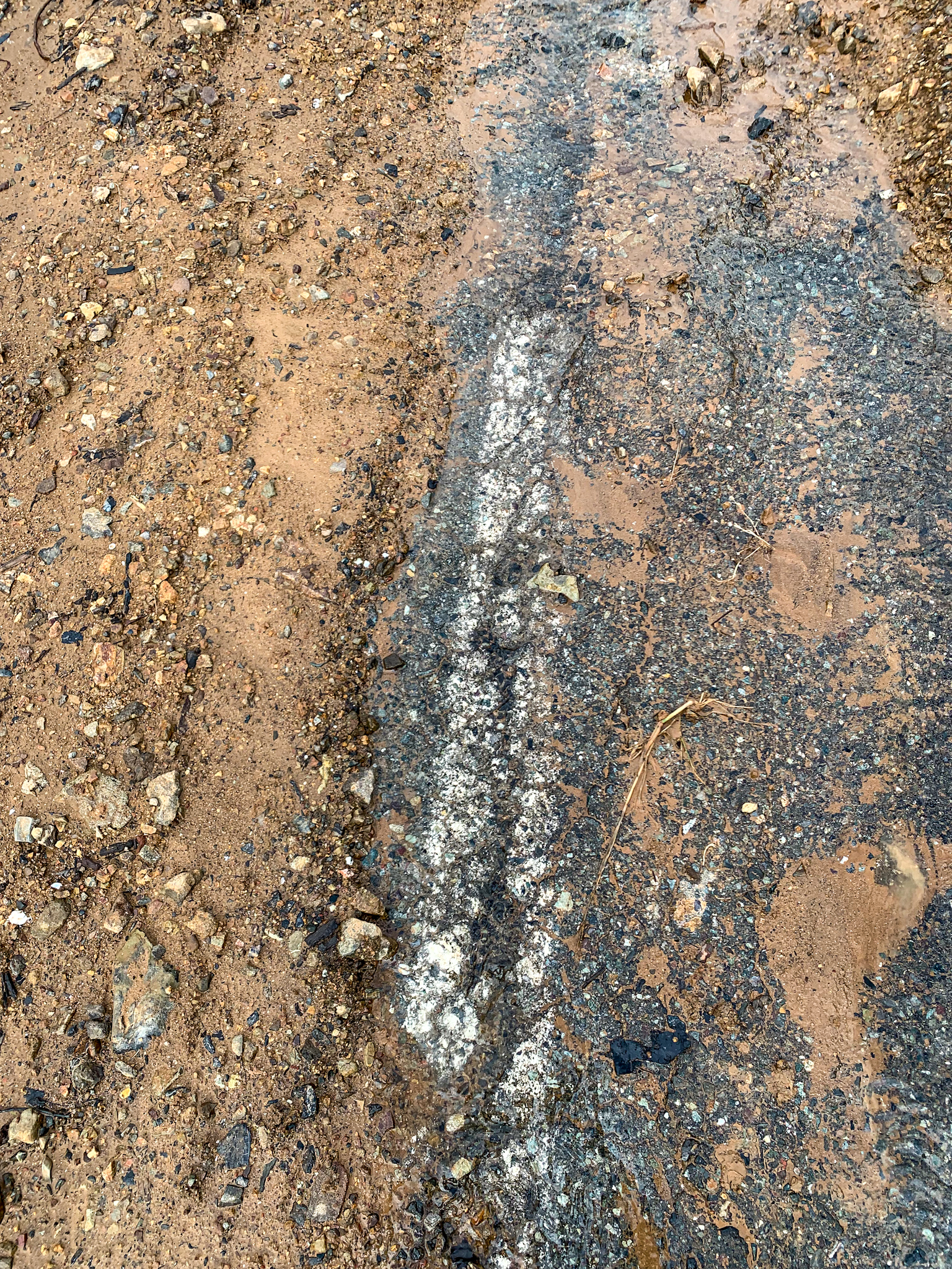
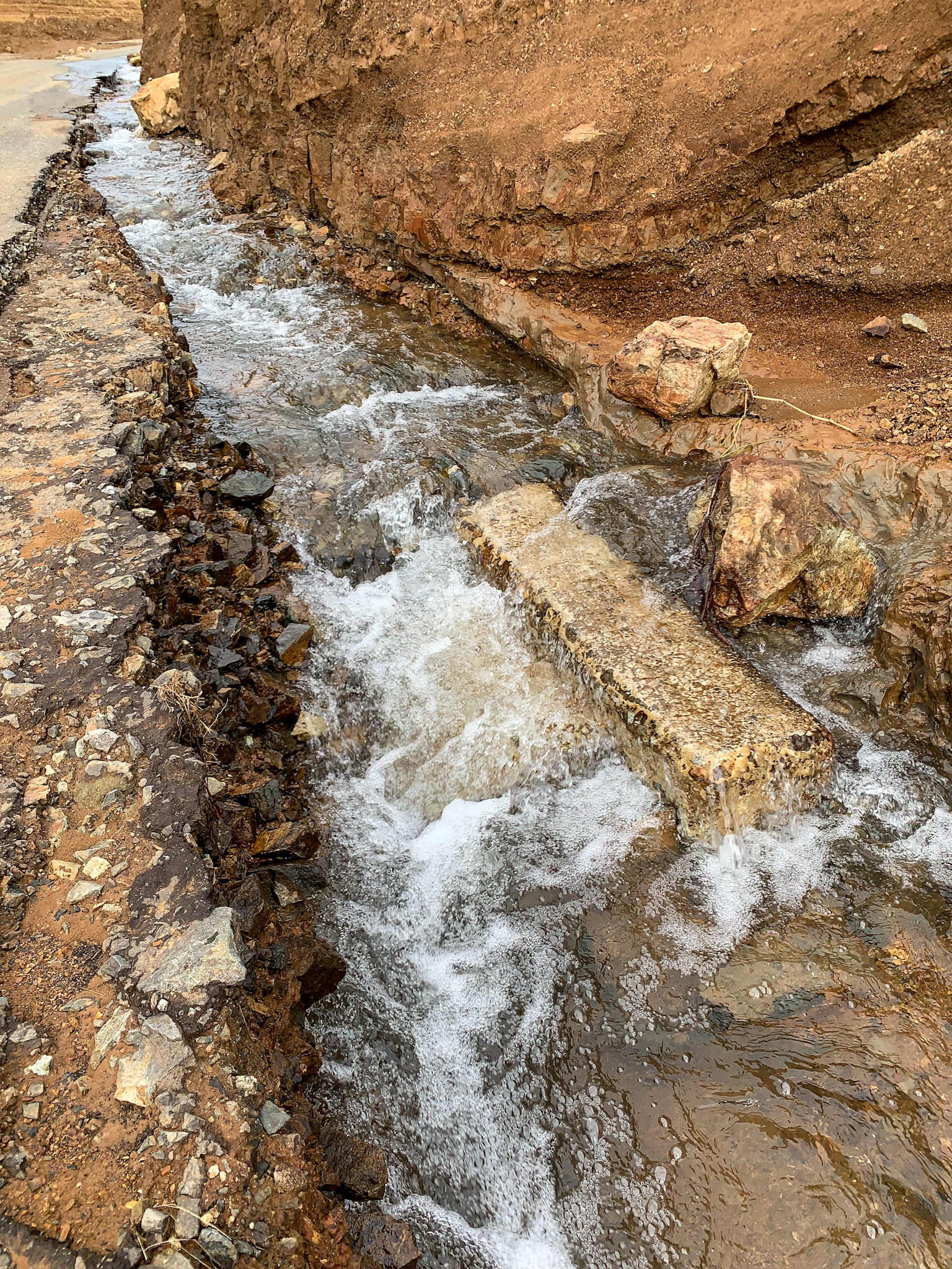
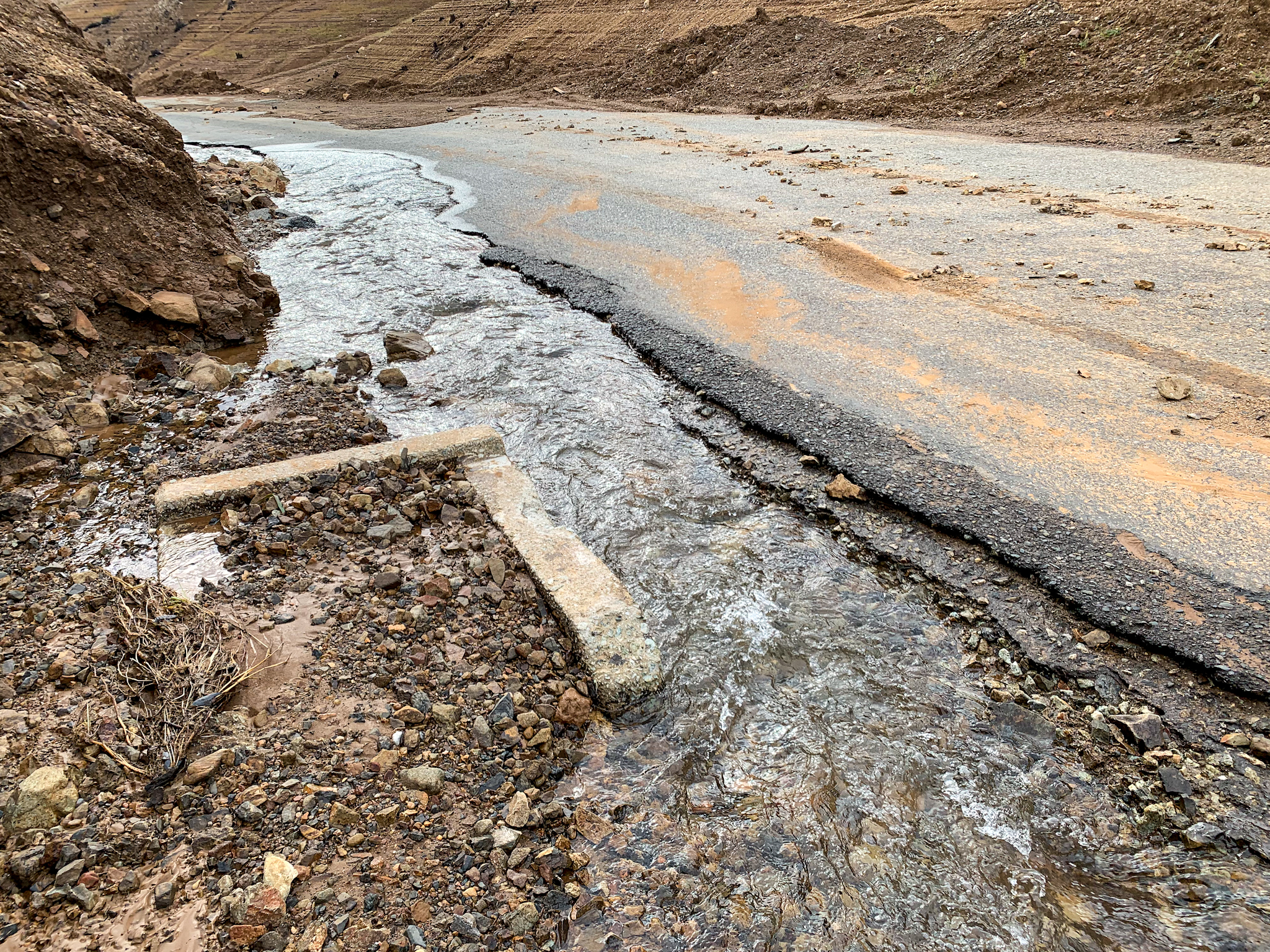
We found this segment from the Bailey Cove boat ramp down to the water level of that day to be in remarkable condition. Some stretches were nearly intact, while other pieces were partially washed away or still covered in 10 to 12 feet of silt deposits. Eric and I believe that part of the road had been uncovered by grading over the summer to allow boaters to reach the receding waters.
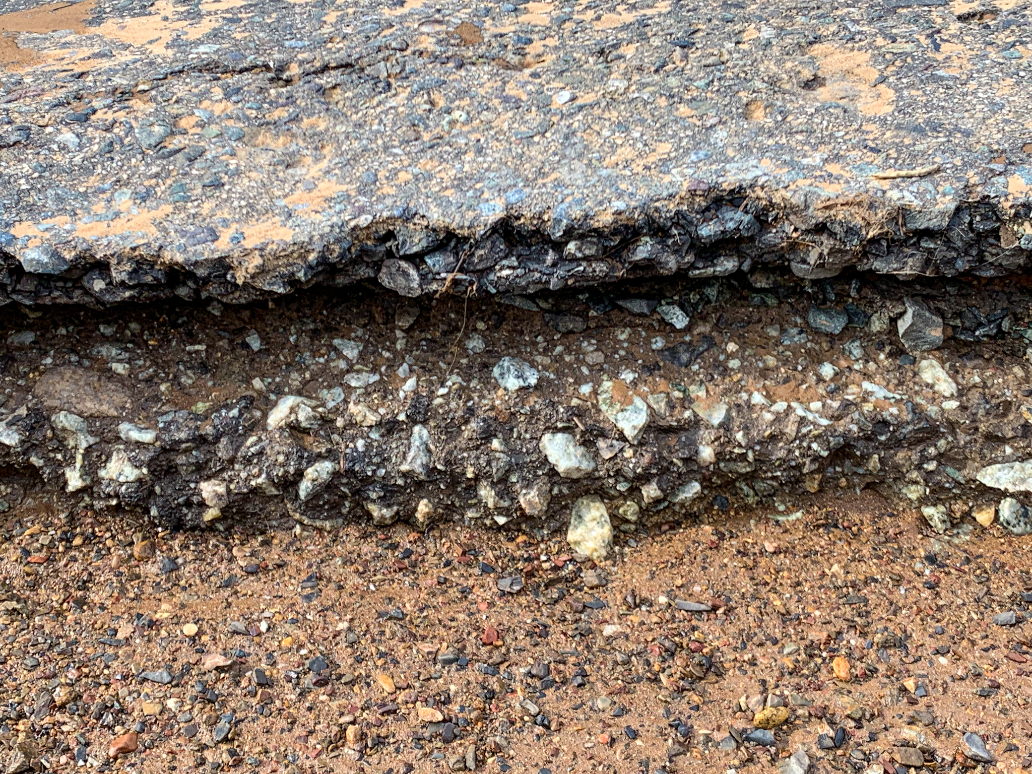
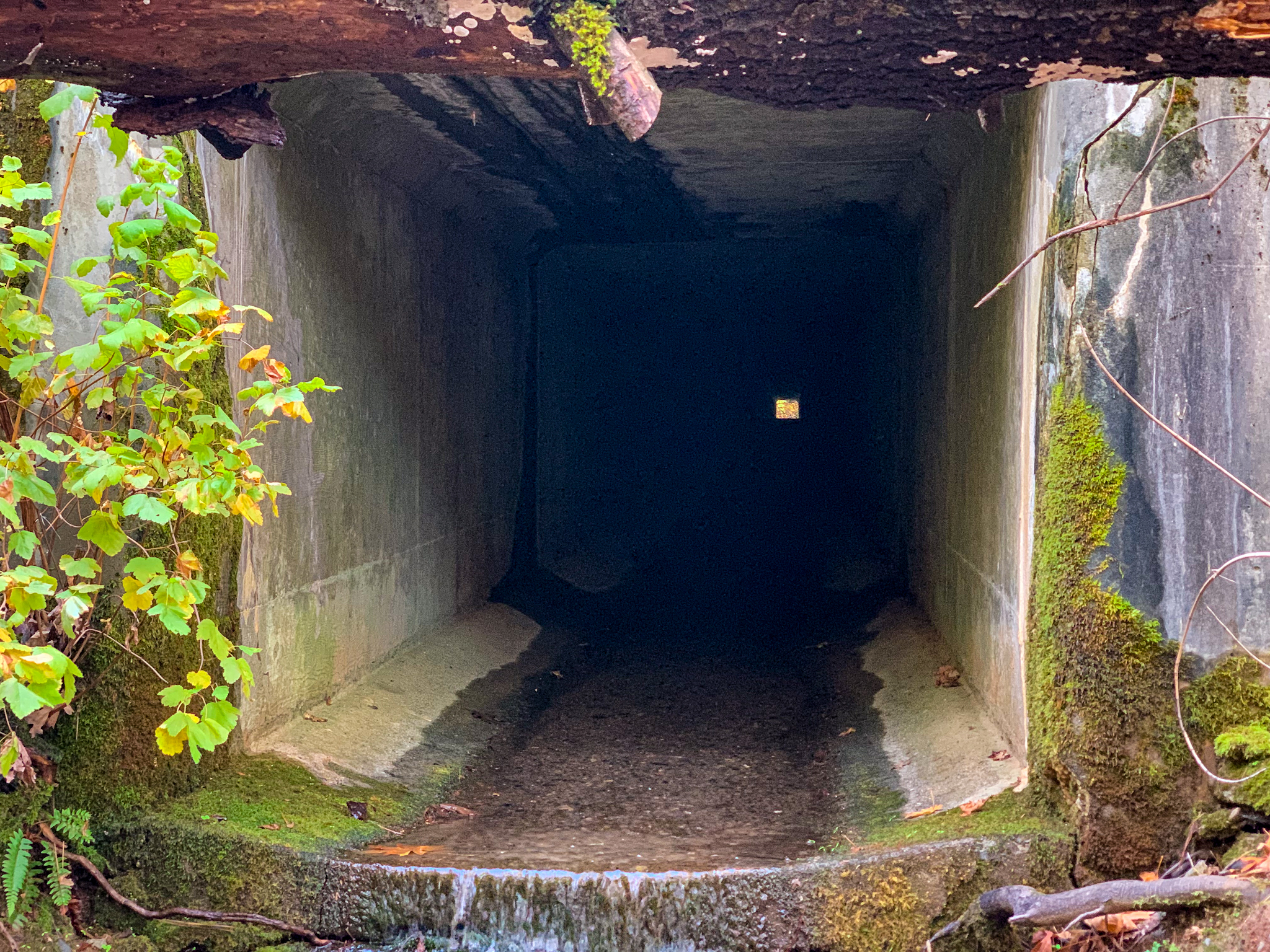
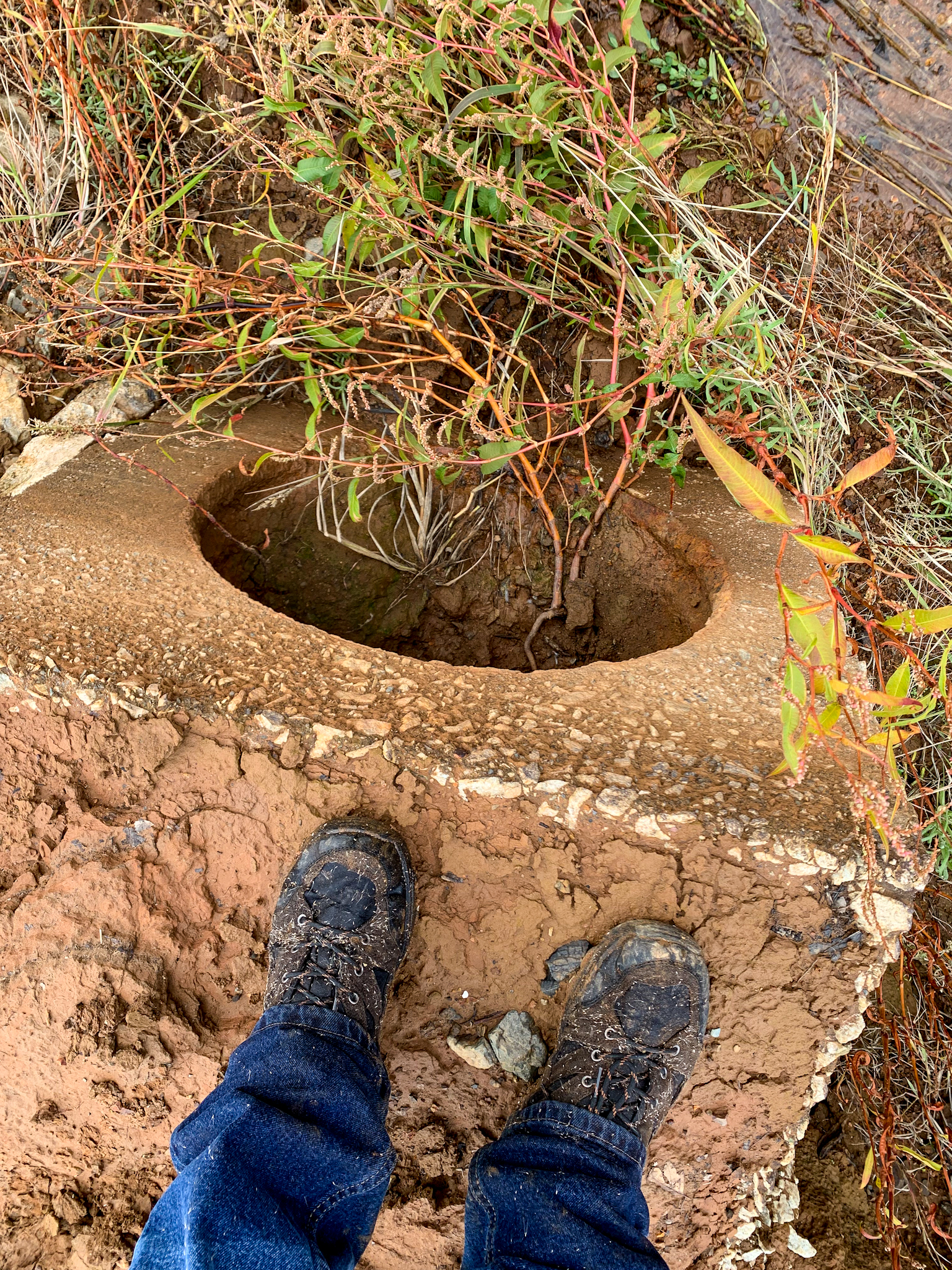
Google Maps. Google Satellite screenshot of the Bailey Cove area. The longer yellow line is the location of the normally submerged section of the Pacific HIghway/1926 US 99 that we explored. The shorter line by the campground area is a blackberry and poison oak covered segment that we also checked out.Map from the November 1939 issue of California Highways and Public Works magazine, showing the current US 99 at the time, and the proposed rerouting of US 99 and the Southern Pacific Railroad, due to the construction of the Shasta Dam. This view is looking east.Aerial photograph from 1940 showing the replacement route under construction, as well as the construction of new routing for the Southern Pacific Railroad. Photo: Flight C-6525, frame 24, July 12, 1940, Courtesy of UCSB Library Geospatial CollectionLooking south towards the McCloud River Arm. Photograph by Eric Hall, from a trip he made to this area on October 12. The lake level was about 20 feet higher on this date.Highway stripe still evident after nearly 80 years.Looking north. Interstate 5 is in the upper lefthand corner.Continuing north. A major storm a few days before our trip washed out part of the road where my truck is parked.Looking north from where I had parked. Photograph by Eric Hall.One of 3 culverts we found. I suspect that dates to around 1926, when the route was designated US 99 and improved and paved.Pavement layers. My hunch is the bottom layer dates to the mid-20’s, while the top layer is probably early 1930’s.Remnants of a utility pole just below the full lake level on the east side of the highway. A string of these cut off poles could be seen along the canyon. The second culvert.We climbed the west side of this small canyon because we thought we saw some old stonework, but we found this box culvert a buried a couple of hundred feet below northbound Interstate 5.Looking through to the other side of the cut and fill that makes up northbound Interstate 5.Looking south down Bailey Cove from a point just below the culvert in previous photo.Looking north towards the boat ramp from the same spot.The third culvert we found as Eric and I were making our way back down to the road.Back up at the picnic grounds above the boat ramp, this area in the right of the photo was probably the 1915 Pacific Highway routing. The curve was straightened a bit an moved a couple of hundred yards to the west, now under the marina parking lot.Eric walking in the road cut adjacent to the campground. This segment is indicated by the shorter yellow line in the Google Sat image at the beginning of this post.
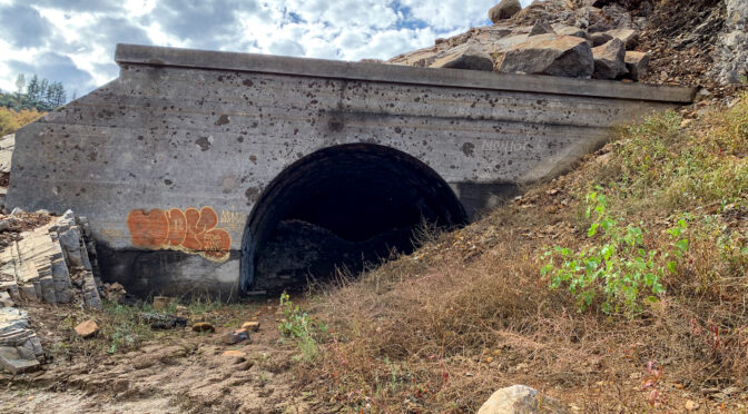
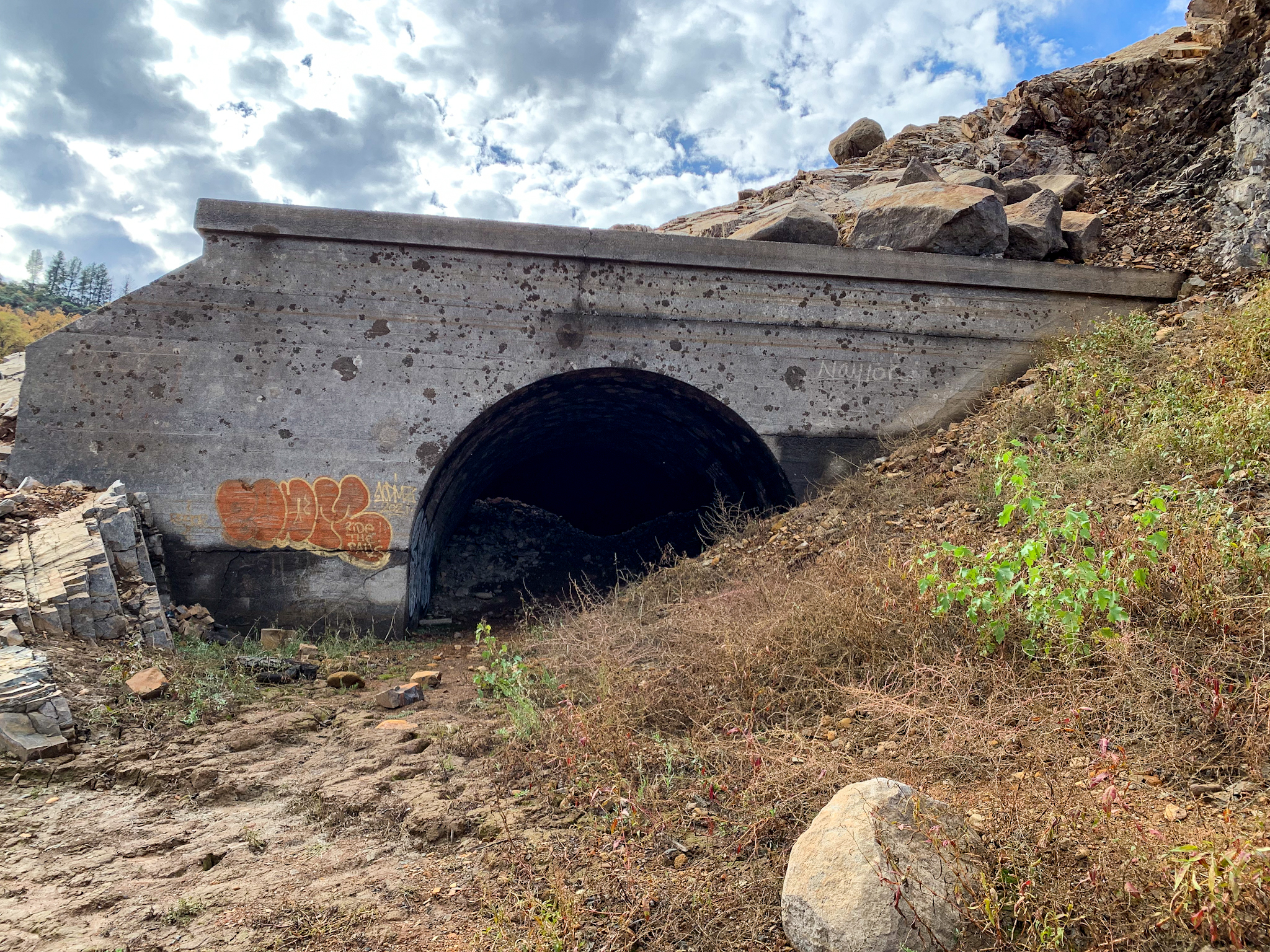
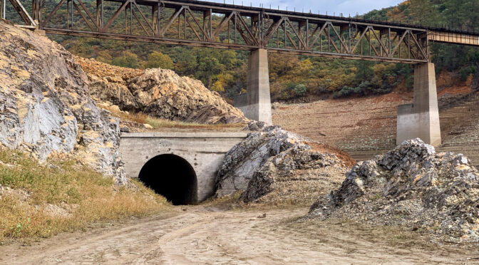
Southern Pacific Railroad Tunnel 6
After concluding our exploration of the Bailey Cove area, we drove up Interstate 5 to Antlers to check out one of the old railroad tunnels exposed by the receding waters. Tunnel 6 is located just north of what was the confluence of the Sacramento River and Charlie Creek. Today, the tunnel can be reached by driving south on Lakeshore Drive south of Antlers about 1 mile. After passing the US Forest Service Lakeshore Station, make a hard left just before crossing the Charlie Creek Bridge. A high clearance vehicle is recommended to travel down the river canyon slope to reach the tunnel.
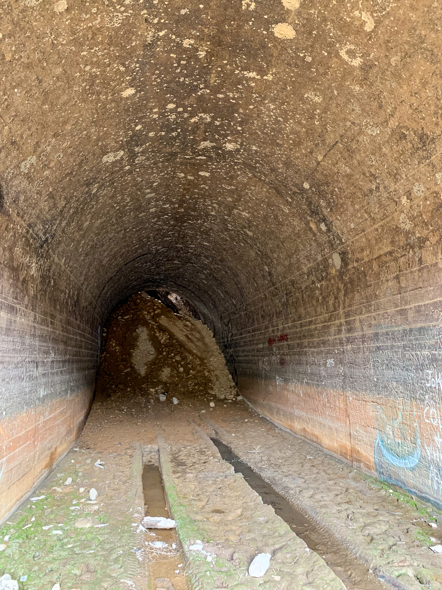
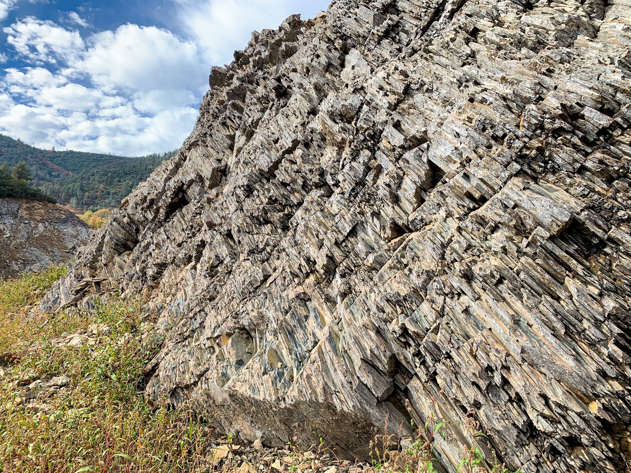
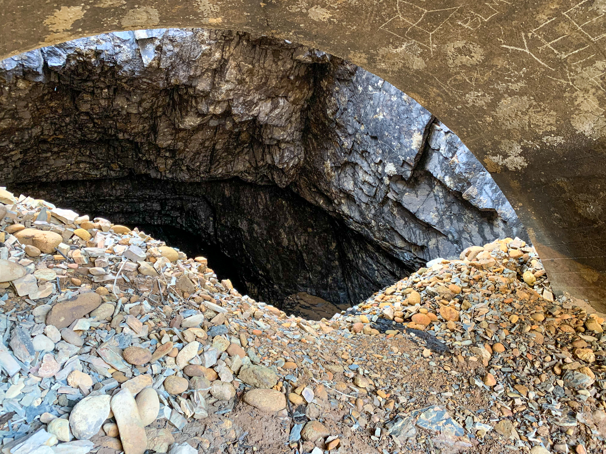
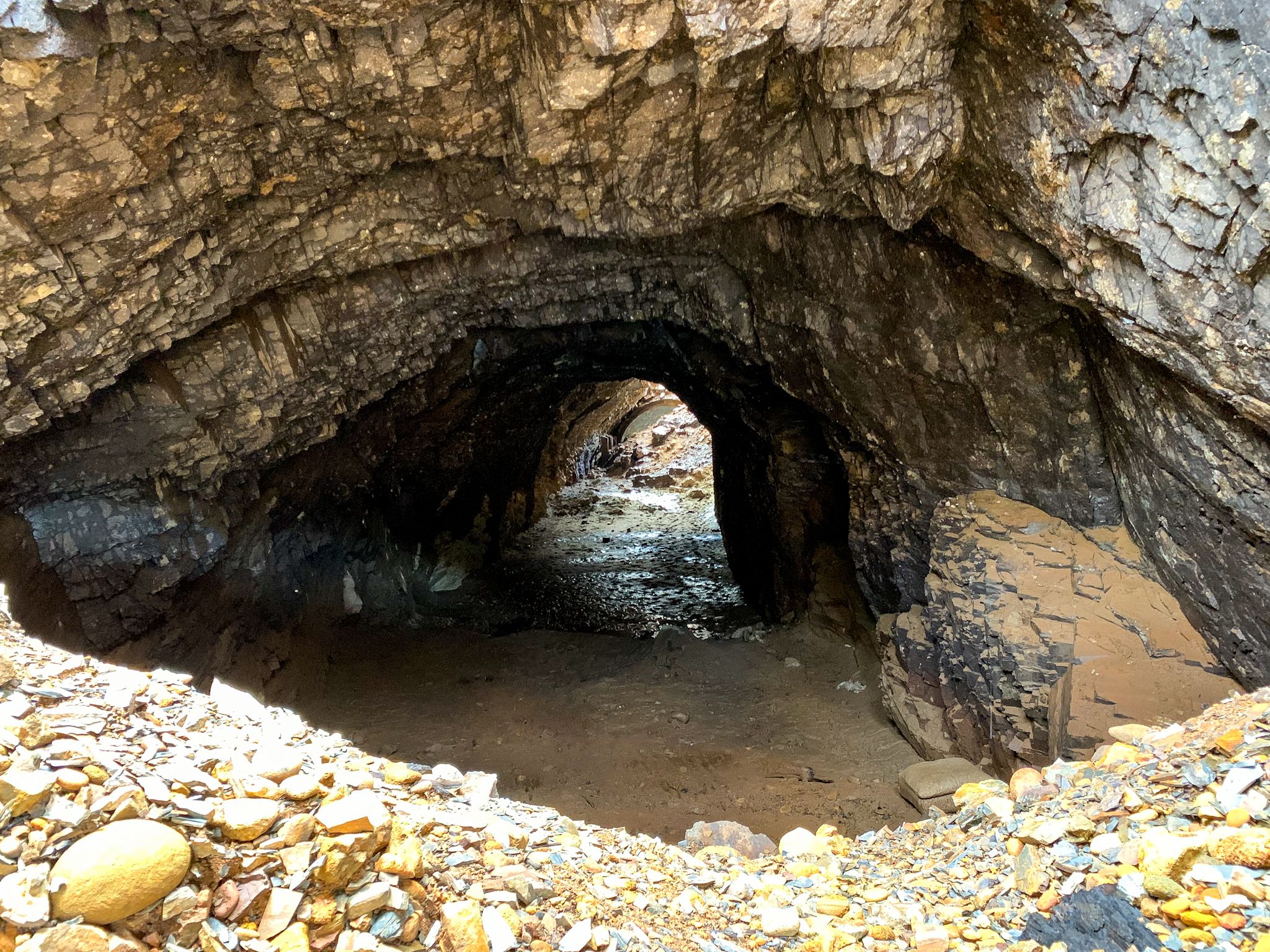
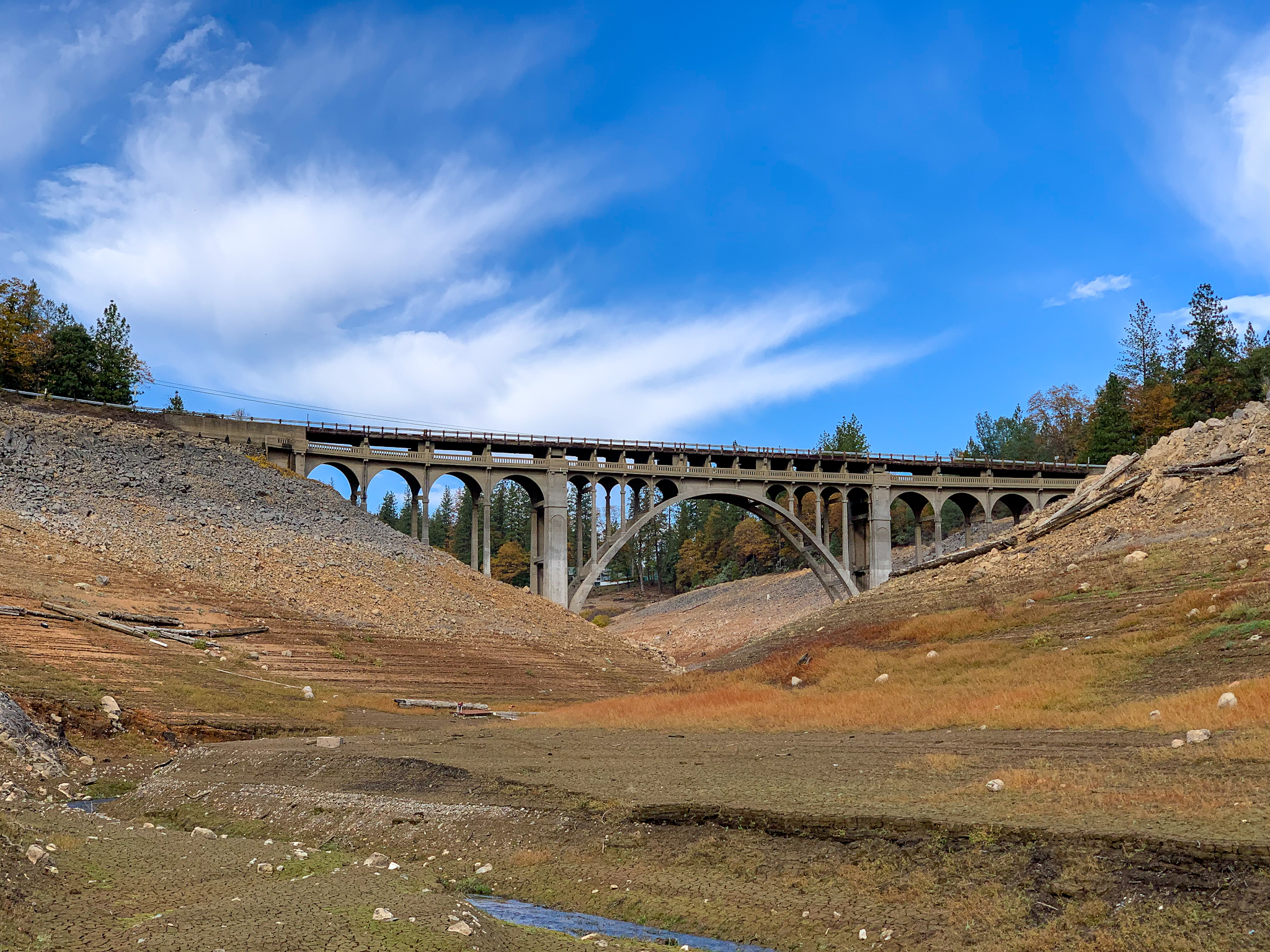
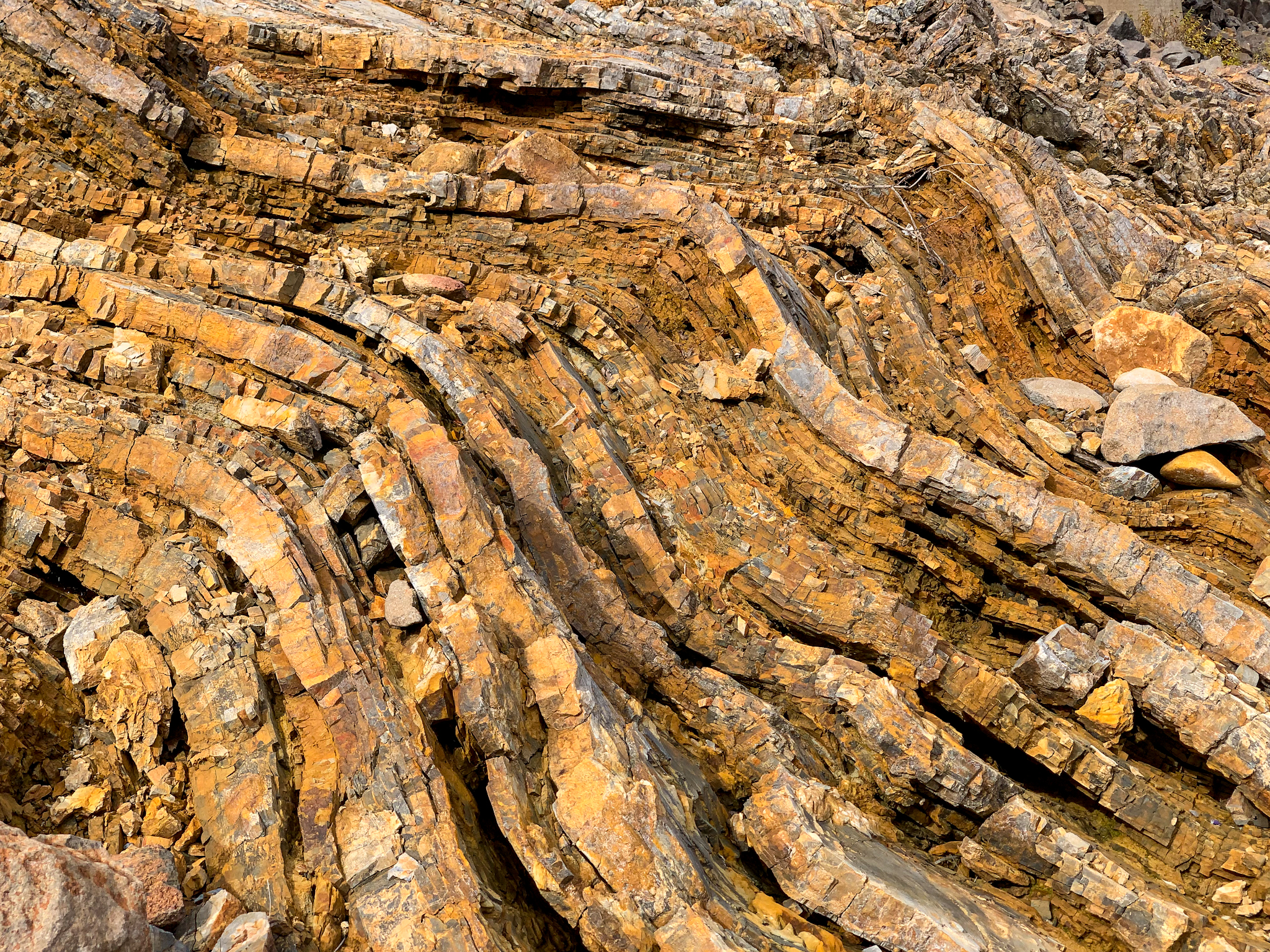
When built by Southern Pacific predecessor Central Pacific in 1884, it was a just basically a hole dug through rock until sometime in the 1920s when concrete headwalls were added. The south end of the tunnel is lined for about 50 feet, whereas the north portal is not. Since being first inundated in 1948, the tunnel has partly filled with silt, raising the floor probably about 10 feet or more. The tunnel is situated in highly metamorphosed shale and slate, more than likely from some old island arc slammed up against the North American plate many millions of years ago. Also impressive is the the trestle high above the canyon that replaced the tunnel necessitated by the flooding the Sacramento River by the Shasta Dam.
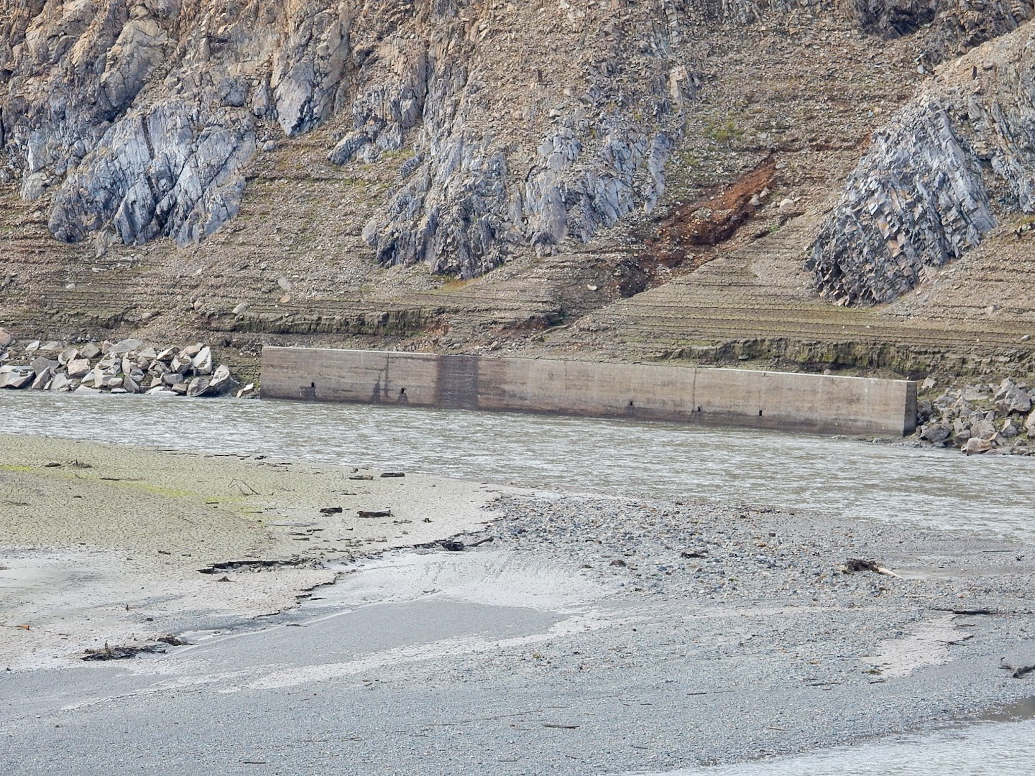
South entrance of Tunnel 6. Current Union Pacific (ex-Southern Pacific) trestle looms high above. The Sacramento River arm is to the right.The south entrance was lined for about 75 feet somewhere around the late 1920s, along with the addition of concrete headwalls at the entrances. The rest of the tunnel is exposed rock.The river-facing side of the tunnel. The shelf-like area I’m standing on alongside the tunnel was graded to allow for construction of the overhead trestle.The north entrance. The amount of silt that has been deposited for the decades is evident, as the current clearance at this end is only abut 12 feet.This is just as you enter the north portal. As you can see, the tunnel was not lined at this end.Just north of the tunnel are apparently the buried remains of 3 railroad cars that spilled into the Sacramento River in 1903. This is a wheel set visible from one of the overturned cars.The historic 1925 Charlie Creek Bridge just south of the tunnel, and on the west side of the Sacramento River. The current bridge deck was added about 1940 in anticipation of rising waters from filling Lake Shasta. Just further upstream is the 1917 Charlie Creek bridge, which carried the Pacific Highway.A few hundred yards south of the Charlie Creek and Sacramento River Confluence is a concrete retaining wall built to protect the railroad bed. Some of the great geology through which Tunnel 6 was built.