Some months back blog posts by Tom Fearer at Gribblenation.org regarding local roads in my area ended up leading me down the proverbial wormhole for more information. I have to say the trip was rewarding. While not answering all my questions about the original subjects – Siskiyou County Road A12 and the first routing of US Route 99 through Weed, California – the search for information resulted in answering a few questions about previous railroads in the area (the Weed Lumber Railroad/Southern Pacific Railroad) and the locations of the first Weed Airport and the long-gone Yreka Airport.
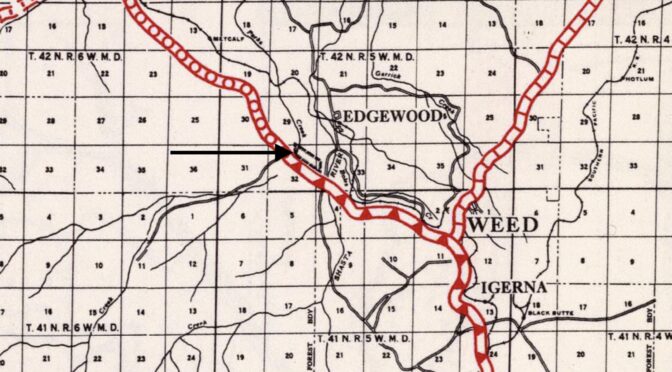
A recent exploration of a segment of the abandoned Weed Lumber Company Railroad yielded clues to the original routing of US 97 northeast of Weed, California. These are remnants of wooden highway guardrails prevalent in the late 1920’s and early 1930’s.
Most of the research involved internet searches for historical maps between the years of 1915 and 1945. While my search started with historical topographic maps at the USGS website, other map sites included the David Rumsey Map Collection, aeronautical charts and airway bulletins at the Library of Congress, as well as posts and articles at Gribblenation and cahighways.org. While my research continues, enough information was accumulated to post a worthy entry about the Yreka Airport on the Siskiyou County Aviation Infrastructure page of this site.
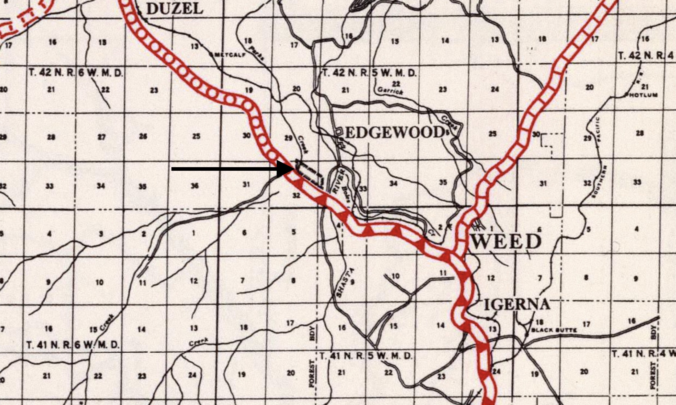
Within the next week, I will also post an entry on the aforementioned page about the original Weed Airport. I had first seen a mention of this airport in the September 1, 1931 Airway Bulletin No. 2. The 1927 (revised 1930) Army Air Corps Air Navigation Map indicates an approximate location of the former airfield, but it was the 1935 California Division of Highways Siskiyou County Highway Map that really helped in nailing down the exact location in a ranch pasture along Old Highway 99/Stewart Springs Road a mile south of the current Weed Airport.
1935 California Division of Highways Siskiyou County Highway Map, with arrow pointing to the rectangle representing the Weed Airport.
The lesson is that it is the journey through the wormhole can be just as rewarding as the destination. Being mindful that seemingly unrelated resources can result in clues to other research projects should always be kept in mind. The only problem is that usually leads one down other, numerous wormholes!
An abandoned railroad bed, a lost benchmark, & things found
Shortly after moving back to the Mount Shasta area (after leaving as a child in 1963), I began exploring the remains of the Weed Lumber Railroad. The railroad was built in the early 1900’s by lumber baron Abner Weed, to exploit the abundant forests east of the town he founded, with the segment from Weed to Grass Lake being sold to Southern Pacific shortly thereafter. When Southern Pacific opened the new Black Butte Subdivision (from Black Butte, just south of Weed, to Klamath Falls) bypassing the Weed-Grass Lake segment in 1926, the original ex-Weed Lumber Railroad portion was abandoned.
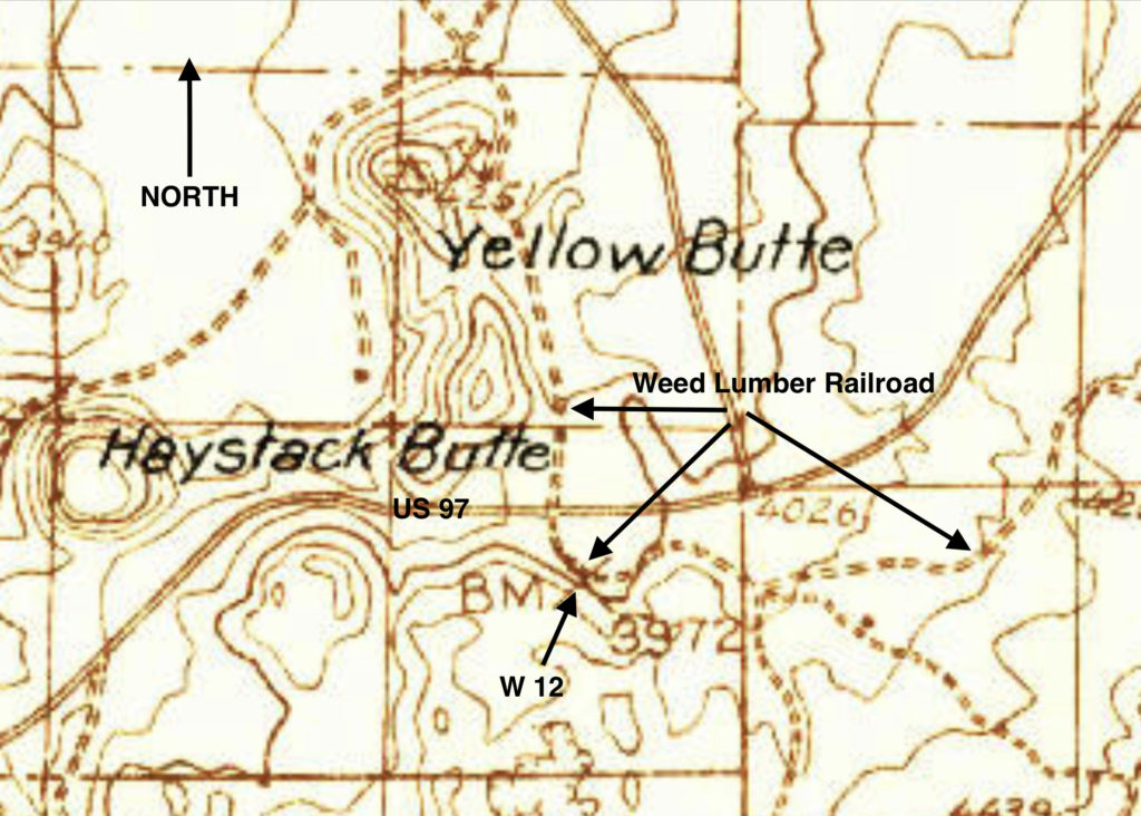
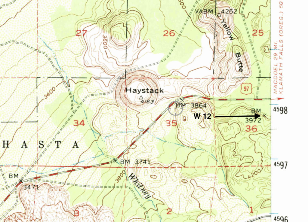
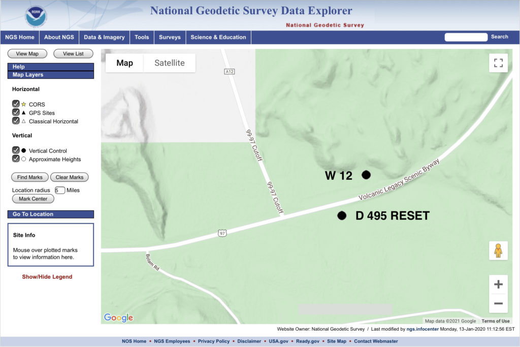
One piece of old right-of-way of interest winds its way along a tongue of lava south of US 97 to Bolam Road, a road which heads south from 97 to the Union Pacific control point of Bolam. I initially walked this segment one day after noticing the raised manzanita and creosote choked railbed heading south off of 97. Later, after checking topographic maps of the area, I noticed that older maps indicated the presence of a benchmark along the railbed. Searching the National Geodetic Survey benchmark database, I found that this one was still listed as Siskiyou County W 12 (PID MX0021).
The datasheet station description of the benchmark is one of the more confusing that l’ve read.
First, it lists the benchmark as being monumented in 1919, but the description seems to have been written in 1954, during a recovery visit to the site by a Coast and Geodetic Survey team. However, it also says that the benchmark was not found.
Second, it describes the mark as “on the abandoned Southern Pacific Co. roadbed, 9-1/2 poles (156.75 feet) southeast along the roadbed from the crossing of the Weed-Dorris highway” which matches placements on the 1934 Macdoel and 1954 Lake Shastina topographic maps. However, then the description reads “about 300 feet west of the highway, about 300 west of milepost 12“, which doesn’t make sense as the indicated position of the benchmark on the 1934 and 1954 maps puts it south, not west, of US 97. Of further note, the description notes the old highway – I can find no record of any highway other than 97 at this spot predating 97 before its construction. The only thing I can think this refers to is perhaps that US 97 was straightened between its original construction around 1936 and 1954, when the above mentioned topo map shows its present roadbed. An aerial photo on historicalaerials.com seems to show an older highway trace crossing Yellow Butte Road (which itself is the old Weed Lumber Railroad bed heading north from the segment being discussed here) about 75 feet north of the modern US 97.
Third, the description says that the mark is “near the middle of a side hill rock cut, 12 feet east of the centerline of the roadbed, in bedrock, 1 foot higher than than the roadbed”. Okay, so the 1934 Macdoel map seems to indicate that the mark is on the west side of the roadbed (or, railbed), as the roadbed travels north-to-south along the east side of the lava flow. The railbed climbs up in elevation from US 97 along the lava flow, on a constructed berm, with no rock existing on the east side of the railbed. Additionally, the aforementioned “9-1/2 poles” or 156.75 feet placement from the intersection of the railbed and the Weed-Dorris highway, either from the modern intersection placement, or the suspected original intersection, lands nowhere near any “bedrock”.
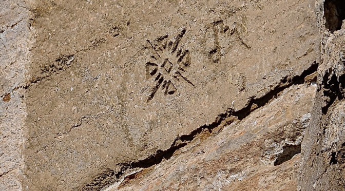
The datasheet states that two recovery efforts were made in 1981 to locate the benchmark, both unsuccessful.
My search efforts
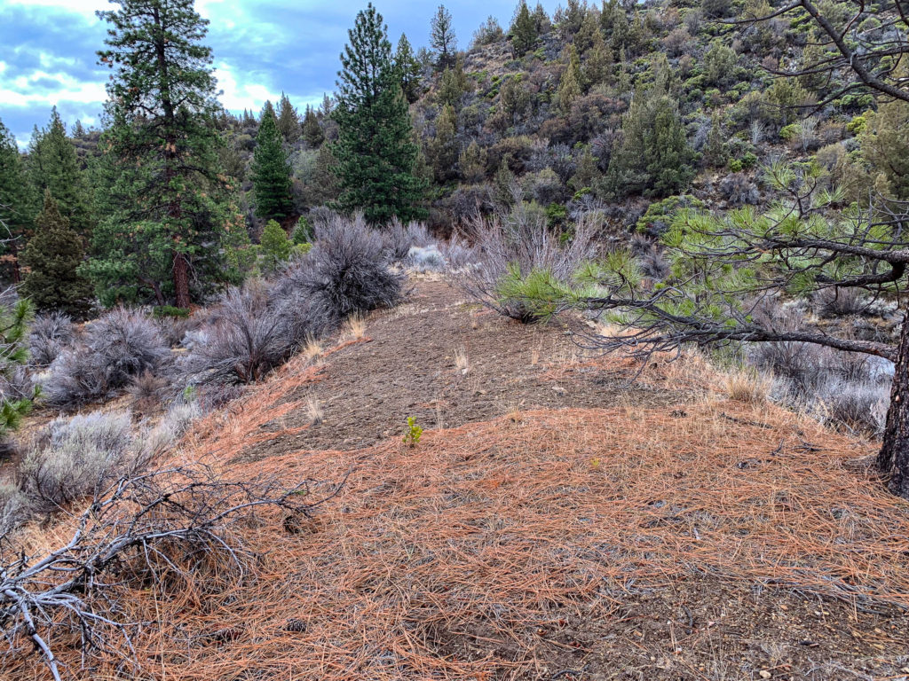
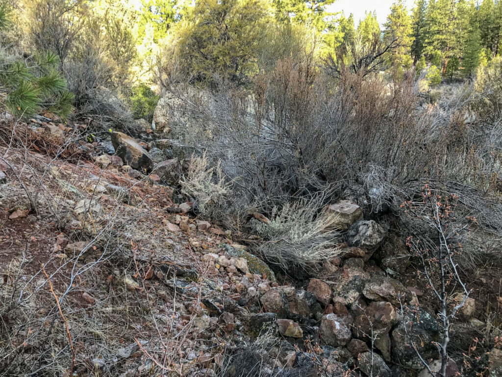
I’ve made three visits to the area to search for the benchmark. I examined both sides of the railbed, including the east side which does not travel next to any bedrock formations. On the west side of the railbed, I searched further than the 12 feet from the centerline where I could, and up to 10 feet or so up the side of the lava flow. Significant erosion of the andesite bedrock along the east side of the railbed has occurred, with several small landslides along the alignment present, and in other places the hillside rock has broken in large chunks, falling onto the roadbed. I spent a lot of time scraping dirt off of the hillside bedrock, hoping to find the brass disk underneath, but it wasn’t to be. My efforts extended from the railbed crossing at US 97 south for 2000 feet, well beyond the distance stated in the datasheet.
Looking south down the abandoned railbed from US 97. At the center of the photo, the railbed starts to curve to the left (east).Example to the eroded hillside along the west side of the railbed.
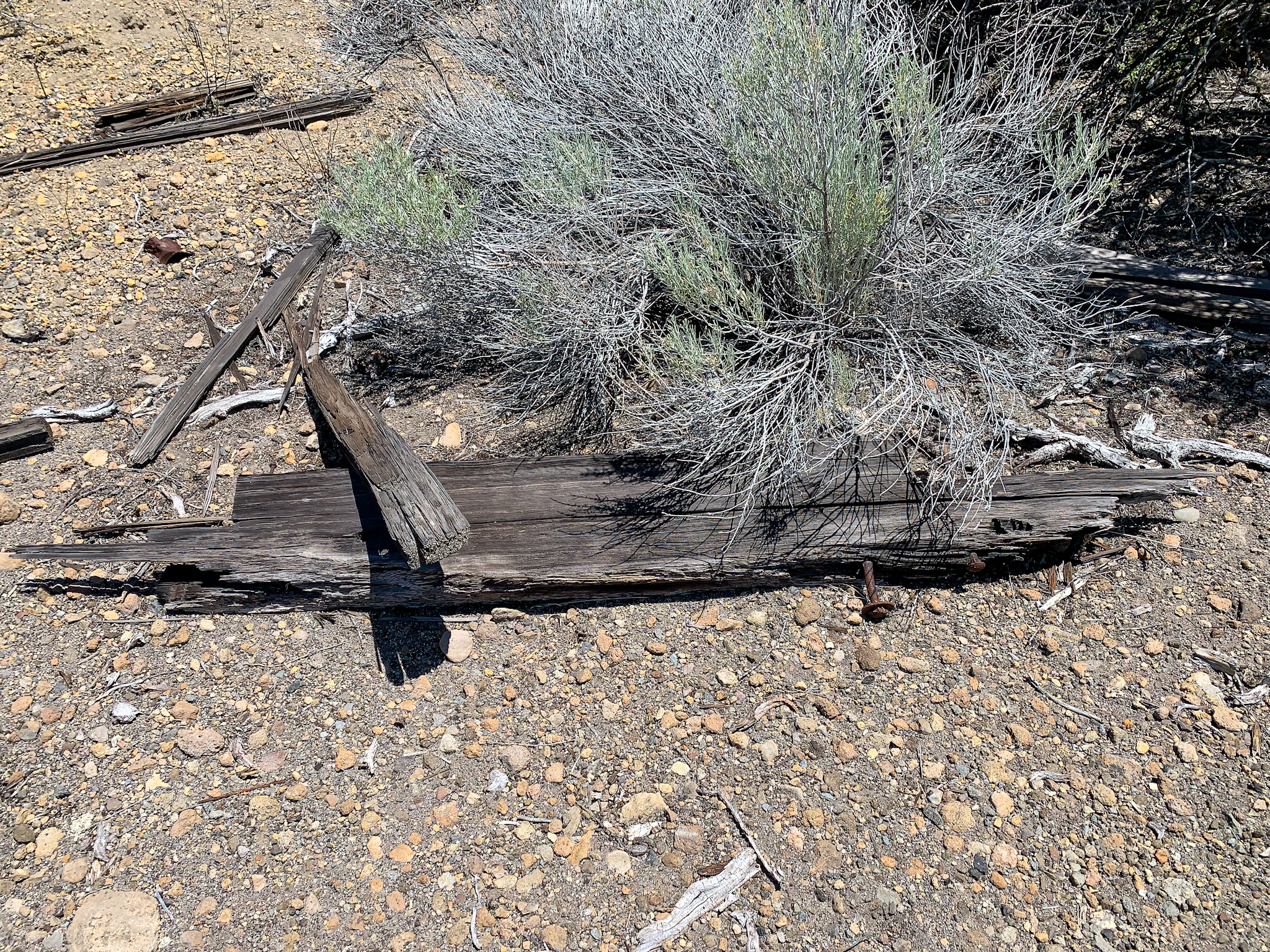
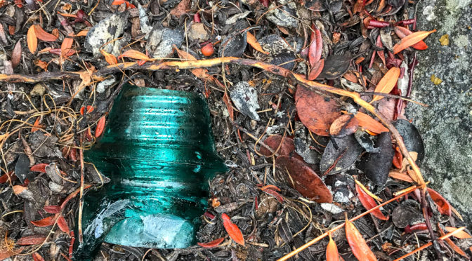
I did find numerous railroad ties, remnants of signal poles, a piece of a glass insulator, and a railroad spike, as well as numerous tin cans, probably left by railroad or salvage crews.
My conclusions
The NGS benchmark locator shows both benchmarks in the wrong locations. D 495 RESET is on the north side of the highway, and W 12 was located 2000 feet to the southwest.
What happened to the benchmark disk? I suspect one of several things could have occurred: 1) a worker took the disk as a souvenir during rail salvage and demolition; 2) someone else took it while exploring the area after railroad operation ceased, looking for collectibles such as bottles, glass insulators, or tools (my grandparents did this for years, searching out old railroad, lumber, and fire camps); or 3) the disk is still attached to a piece of rock that is now buried amongst the erosion.
My efforts were not without accomplishment. On my last visit, I did recover a nearby benchmark,D 495 RESET (PID MX0023), as well as 3 Caltrans survey markers, and found a geocache as well.
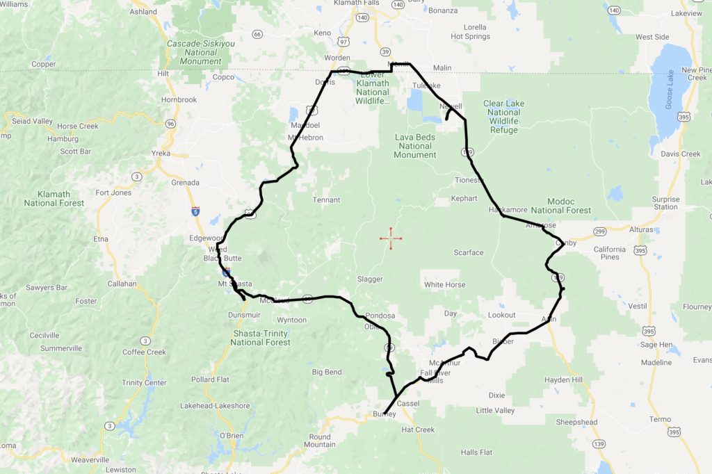
After a few weeks of self isolation, and the onset of great spring weather, my wife and I headed out for a day trip through eastern Siskiyou County, as well as parts of Shasta, Lassen, and Modoc counties, California, and Klamath County, Oregon.
This is sparsely inhabited country, consisting of national forest lands, large ranching and farming operations, small towns, and stunning volcanic, forested, and high desert vistas. This was mostly a scouting trip to plan future explorations. Some parts of this country I had never been to, and others it had been decades since I visited.
We drove this loop counterclockwise, starting in Mount Shasta.
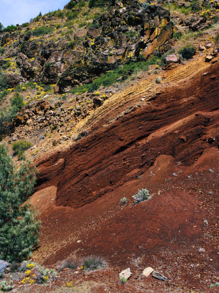
Inside the 300 mile round loop is found Mount Shasta; the Medicine Lake Highlands, including the massive Medicine Lake Volcano; the McCloud, Pit, and Fall rivers, which flow into the Sacramento and then the Pacific Ocean through the Golden Gate some 300+ miles south; Lava Beds National Monument; the Tule Lake and Lower Klamath National Wildlife Refuges; the remains of historic lumber, agricultural, and railroad operations; large cattle ranches; numerous alfalfa, hay, potato, garlic, onion, and horseradish farms; and Native American reservations and historic sites. The trip also skirts the Klamath River along the Oregon border.
This region on the eastern side of the Cascades is classic Basin and Range landscape, combined with the spectacular results of Cascade volcanism.
We loaded on provisions for the day to minimize our contact with others. We drove counterclockwise from Mount Shasta on this loop. State Route 89 (Volcanic Legacy Scenic Byway) going east takes you through the former lumber town of McCloud, then through federal and privately held forest lands for about an hour until reaching the junction of 89 and State Route 299 (Lassen State Highway). This portion of the drive treats one to an impressive view of Mount Shasta’s east side, as well as titillating turnoffs to a multitude of destinations (McCloud River and its falls; Pondosa ghost town; stretches of the abandoned McCloud Lumber Railroad (now a multi use trail); and Burney Falls and the nearby railroad bridge used in “Stand By Me”).
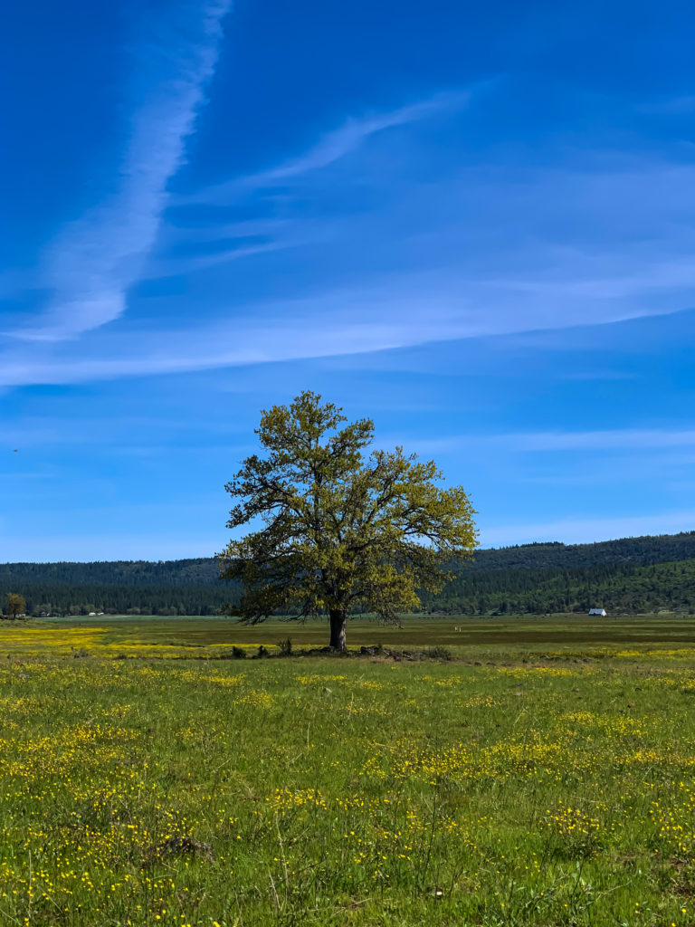
As you approach the 89/299 junction, the forest gives way to views of grass covered valleys, flood basalts, and other volcanic structures, such as cinder cones and impressive secondary volcanic peaks in this eastern side of the Cascades, such as Burney Mountain (7864 feet). As you head east on 299 to the town of Fall River Mills, the highway climbs a volcanic ridge, with a spectacular canyon carved by the Pit River to the south. Here, one gets a view of Lassen Peak, as well as other prominent secondary volcanic peaks between Lassen and Mount Shasta.
Forests give way to grass covered valleys as you near Burney, driving from McCloud.
It’s amazing how much water there is in these parts. Just north of Fall River Mills lays Ahjumawi Lava Springs State Park, which is only accessible by boat. According to Wikipedia, “The park sits on “one of the nation’s largest systems of underwater springs.” They produce some 1.2 billion US gallons (4.5×10⁹ l) of fresh water per day into the aboveground waterways. Water in the springs originate as snowmelt from the Medicine Lake Volcano highlands.”
A readout just outside of Fall River Mills reveals the volcanic structure of the area. Layered cinder cone deposits are covered by a newer lava flow.
The towns along this trip are for the most part shells of their former selves. With the mechanization of logging and farming operations, the closing of smaller milling operations, railroad mergers, and the shift towards more sustainable industries (i.e. tourism), these are settlements still looking for a purpose and relevance in today’s world. Fall River Mills has done better than most, with a golf resort, nearby hot springs, and retirement development. Other towns are struggling to repurpose themselves.
We stopped to inspect a forest service campground and have lunch. Just a few miles north of Adin is the Lower Rush Creek forest service campground, only 3/4 of a mile off of combined State Route 299/139. It was a nice little campground with the creek running through it, but you drive past several manufactured home hovels to get to it. In fact, the campground is situated within 200 yards of one of these shacks. I’m not quite sure what a night would be like at this site, as it seems that several of the nearby properties house cannabis grow operations. There is another campground (Upper Rush Creek) farther up the road, but the road was not yet open for the season beyond this campground.
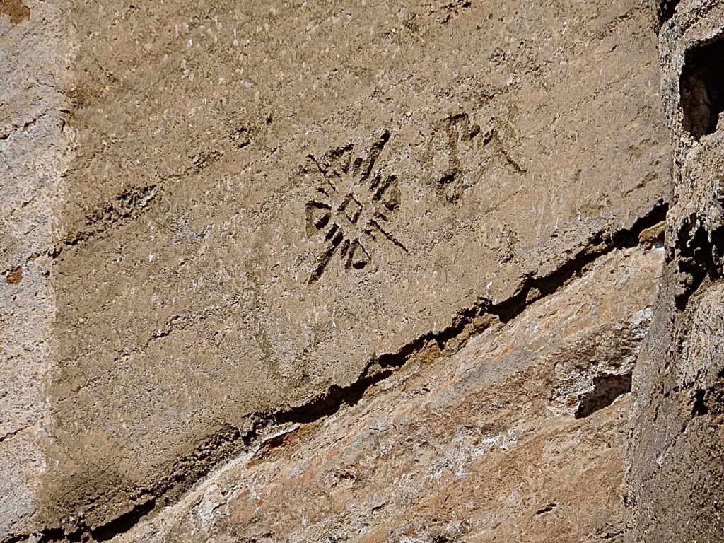
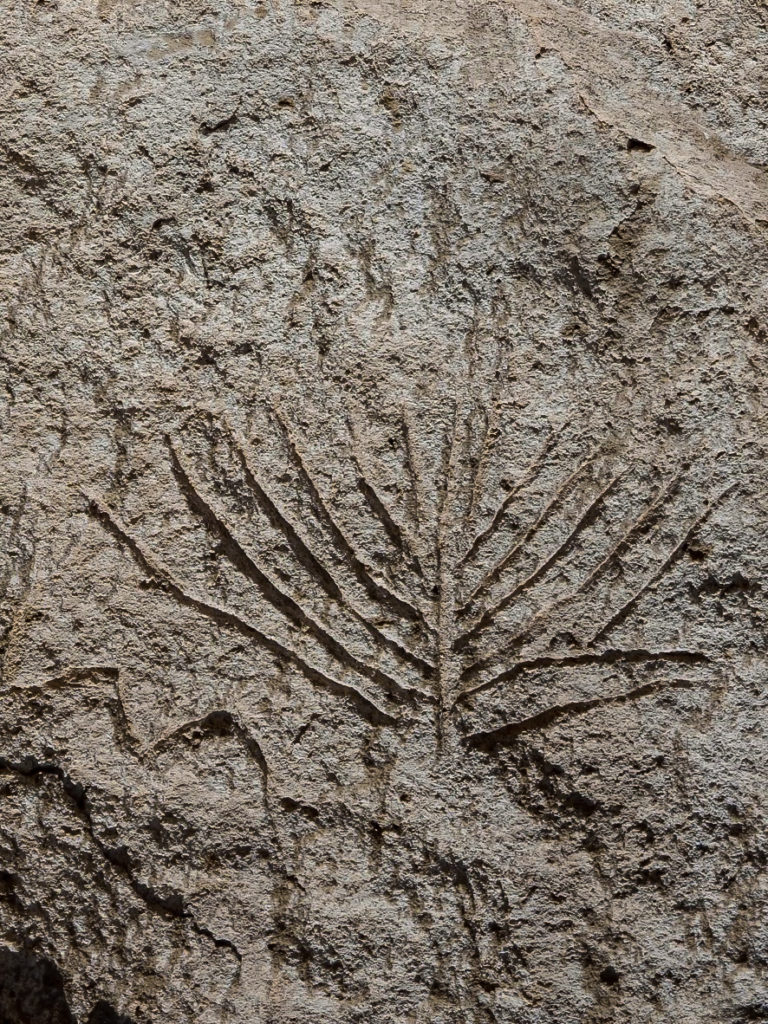
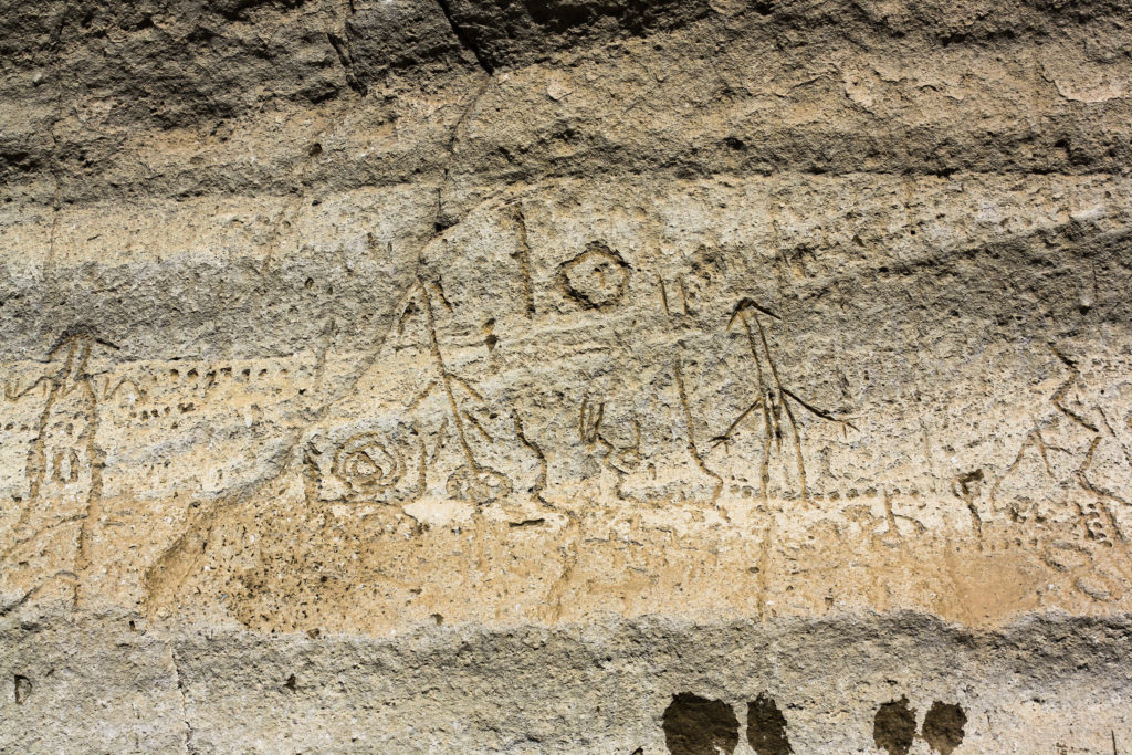
At Canby, we turned north on 139 towards Oregon, we finally popped into the southern end of the Klamath Lake Basin. We made our way into the Lava Beds at Petroglyph Point, containing one of the largest panels of Native American rock art in the United States. It was pretty awesome, but sad at the same time, as one also sees the the results of vandalism thrust upon such a significant cultural treasure.
From here, Mount Shasta again dominates the landscape, with Mount McLoughlin in Oregon also visible to the north. By this time, it was getting late in the afternoon. We headed briefly to Merrill, Oregon, where we used the bathrooms at the local Dollar General, then headed west on California State Route 161. We stopped for a few moments to enjoy the golden hour at Lower Klamath Wildlife Refuge, watching the birds at a gorgeous viewing platform. With hunger pains not too far from manifesting themselves, we headed home to Mount Shasta to grab some takeout before finally arriving home.
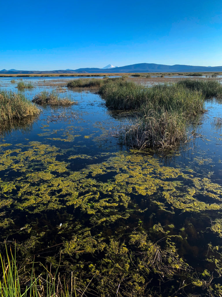
The Lower Klamath Wildlife Refuge, with Mount Shasta in the distance.
Random acts of thought, and useless pieces of information – et deinceps per nebula