Speedway Airport
(last edit: 8/2/15)
Location: Indianapolis
Coordinates: 39°48’00.0″, – 86°21’36.0″
Status: Closed
Opened: mid-1950’s (source: Abandoned & Little-Known Airfields)
Closed: 31 December 2001 (source: Abandoned & Little-Known Airfields)
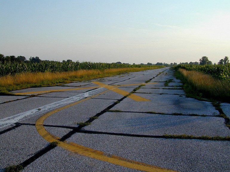
Last surface: Asphalt
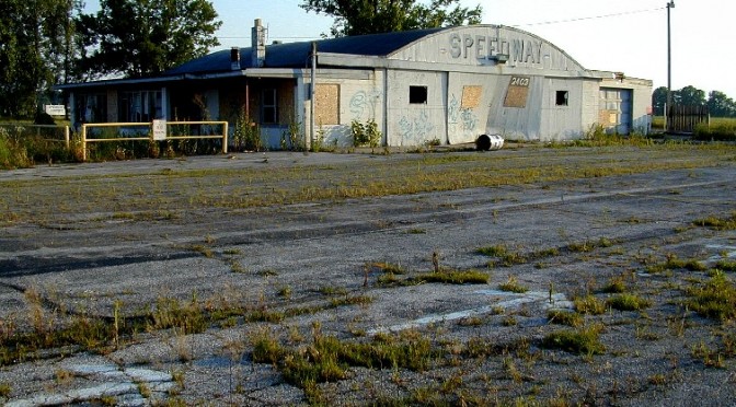
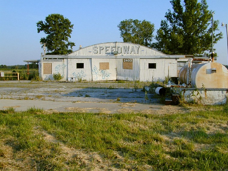
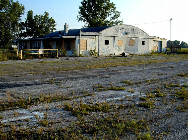
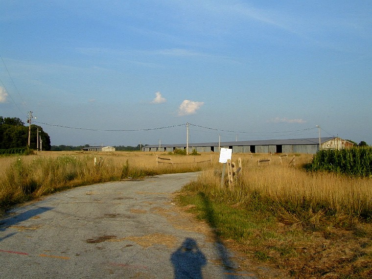
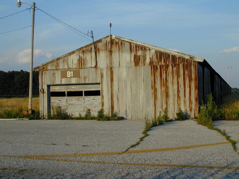
While on a business trip to Indianapolis in 2003, I noticed an X’ed off airstrip while looking out the window on the approach to Indianapolis International, just northwest of the airport. I jumped in my rental car and made my way out to the site, which turned out to be Speedway Airport. I was able to freely roam about the abandoned site in my vehicle in the late afternoon. Being out in the middle of farm country, it was quiet, with the runways lined with rows of very tall corn. I was able to drive up and down the abandoned strip and around the rest of the facility, taking the pictures in the following gallery.
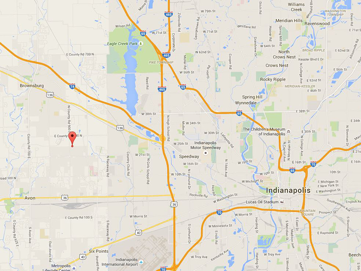
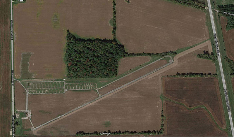
Below is a Google Satellite image of the airfield (8/2/15). None of the buildings remain.