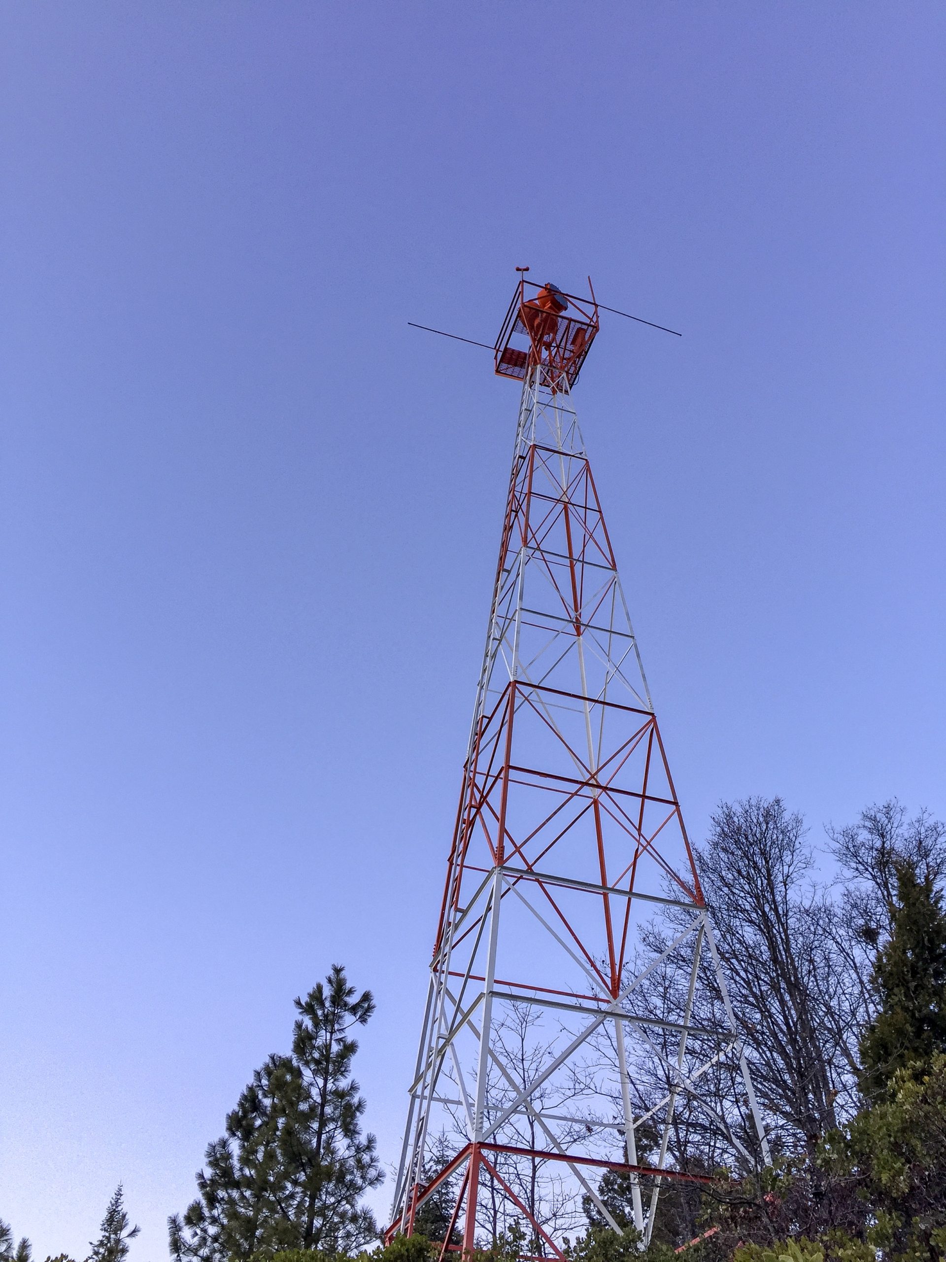
Top image: Decommissioned airport beacon at Mott-Dunsmuir Airport. Flight operations are now restricted to daytime only at the airport.
(LAST EDIT: 14 December 2021)
OVERVIEW
Siskiyou County, the middle of three counties that border neighboring Oregon, is the 5th largest county in California (by land size), and the 37th largest in the 48 contiguous states. By population, it is ranked number 45 in California, with about 44,000 residents. The landscape is diverse, consisting of forests, mountains (most notably Mount Shasta), rivers (the Sacramento, Klamath, McCloud, and Shasta, to name a few), and high desert in the eastern county. Settlement was first driven by trapping, then gold and silver mining, farming, ranching, and lumber. Today, recreation is a significant economic driver, as the county is positioned almost dead center between Portland and the San Francisco Bay Area.
Siskiyou County has always been part of the north-south transportation corridor. First explored by Hudson Bay trappers as route between Fort Vancouver and San Francisco, the county quickly became a focal point of emigrant, stage, and railroad routes. Being pretty much on a direct line between Seattle and San Francisco, it was only natural that the county saw its fair share of aviation infrastructure development as flight paths took commercial airmail flights directly overhead. In the 1920’s and 30’s. airfields, beacons, and other infrastructure were built to accommodate airmail and passenger traffic and to enhance safety.
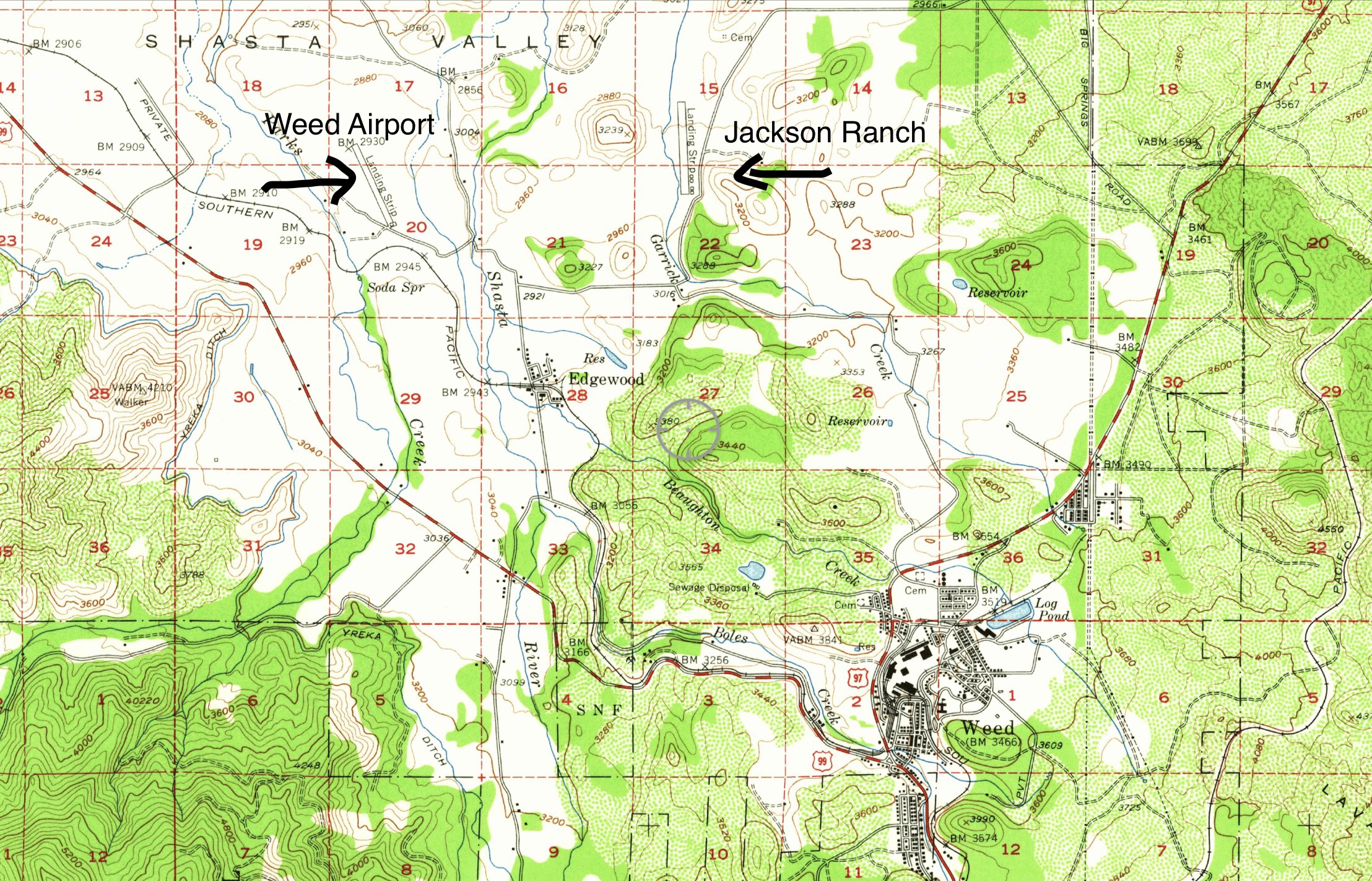
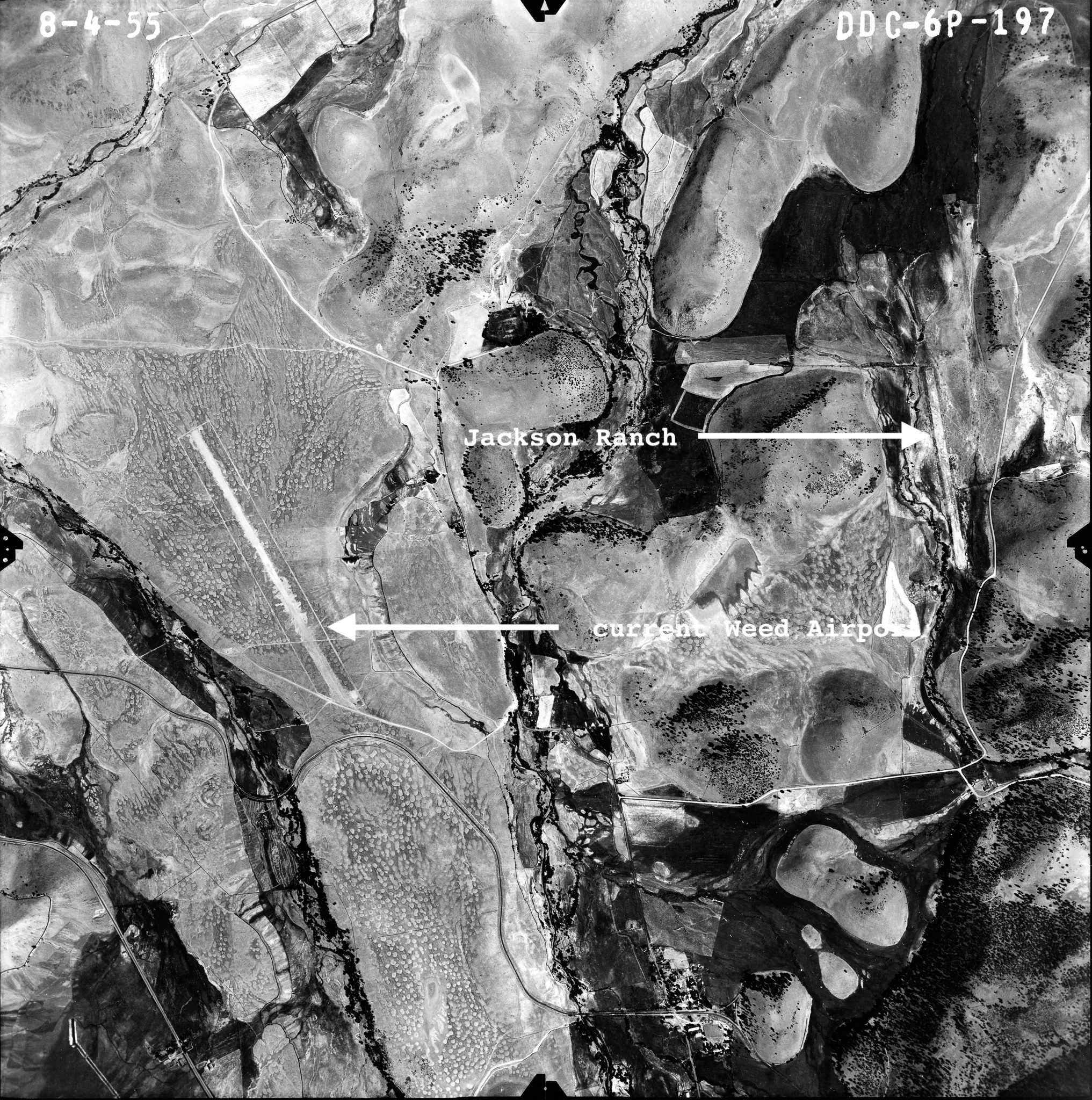
JACKSON RANCH
(last edit 14 December 2021)
- Location: Edgewood
- Coordinates: 41.48113, -122.41231
- Status: Closed, location shows no sign of aviation use in decades
- Operational details: Opened sometime before 1948, the first topographic map I’ve seen the airstrip indicated on. Apparently it predates the nearby Weed Airport, which shows up on a 1954 topographic map.

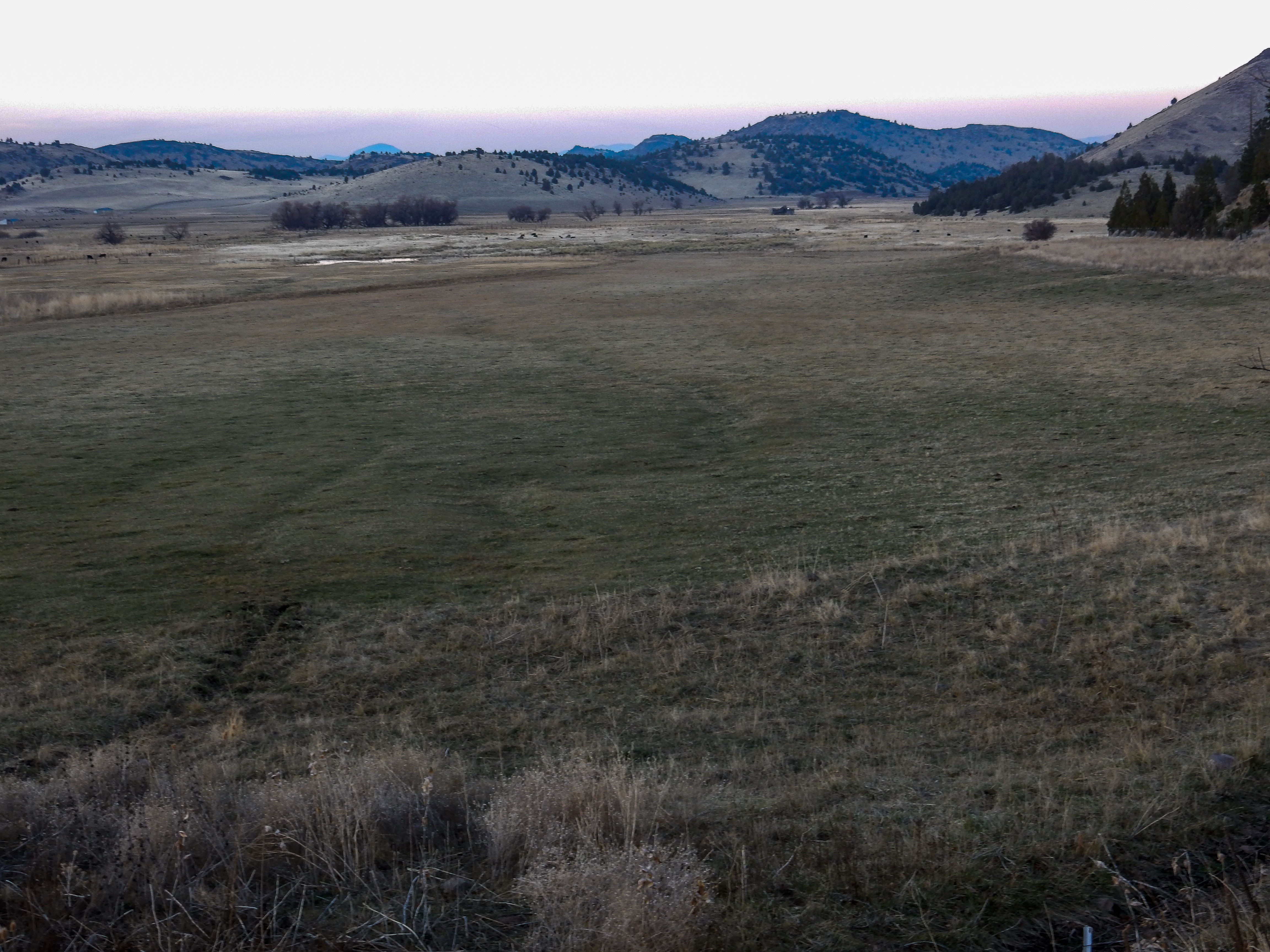
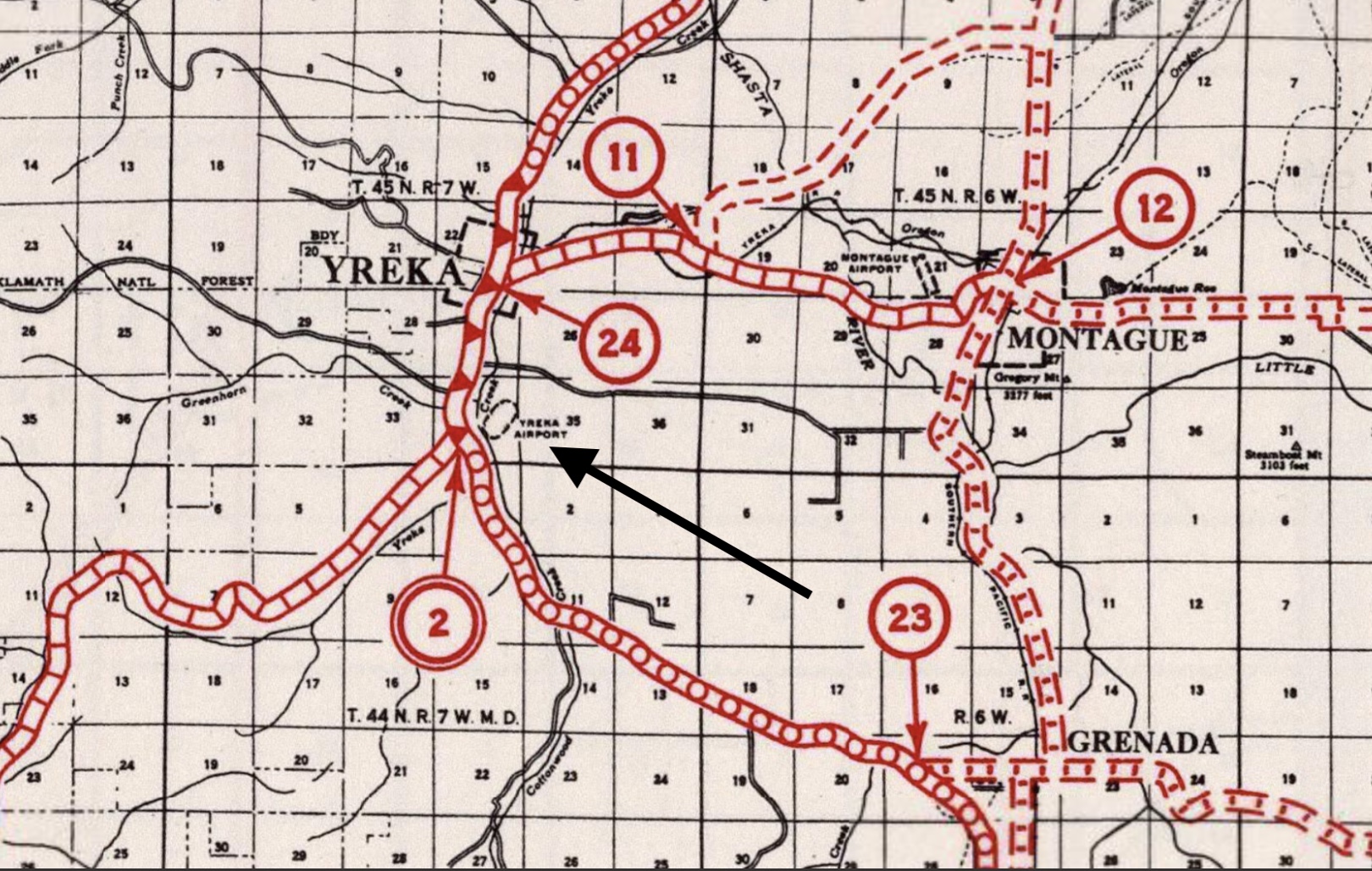
YREKA AIRPORT
(LAST EDIT: 16 August 2021)
- Location: Yreka
- Coordinates: 41.7044727,-122.6379286
- Status: Closed, no traces remain of the airfield
- Operational details: opened sometime after late 1927 within the eastern half of an older racetrack. Decommission date unknown
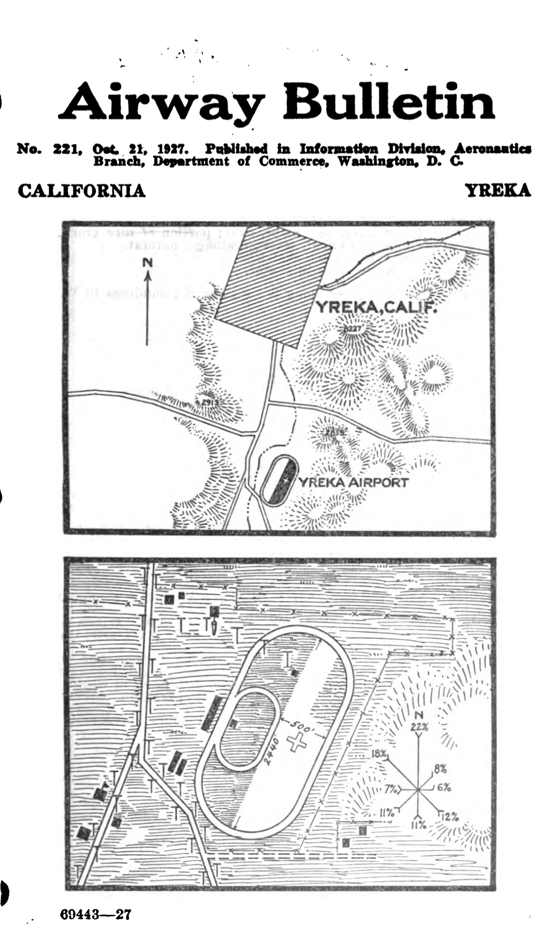
An early airfield contained within a racetrack at the county fairgrounds, now known as the Siskiyou Golden Fair. The California 10th District Agricultural Association opened the fairgrounds in late 1927. The first mention of the airport that I can find is in the October 21, 1927 Airway Bulletin (shown below).
Below are pages from the 1927 Airway Bulletin describing the airport.

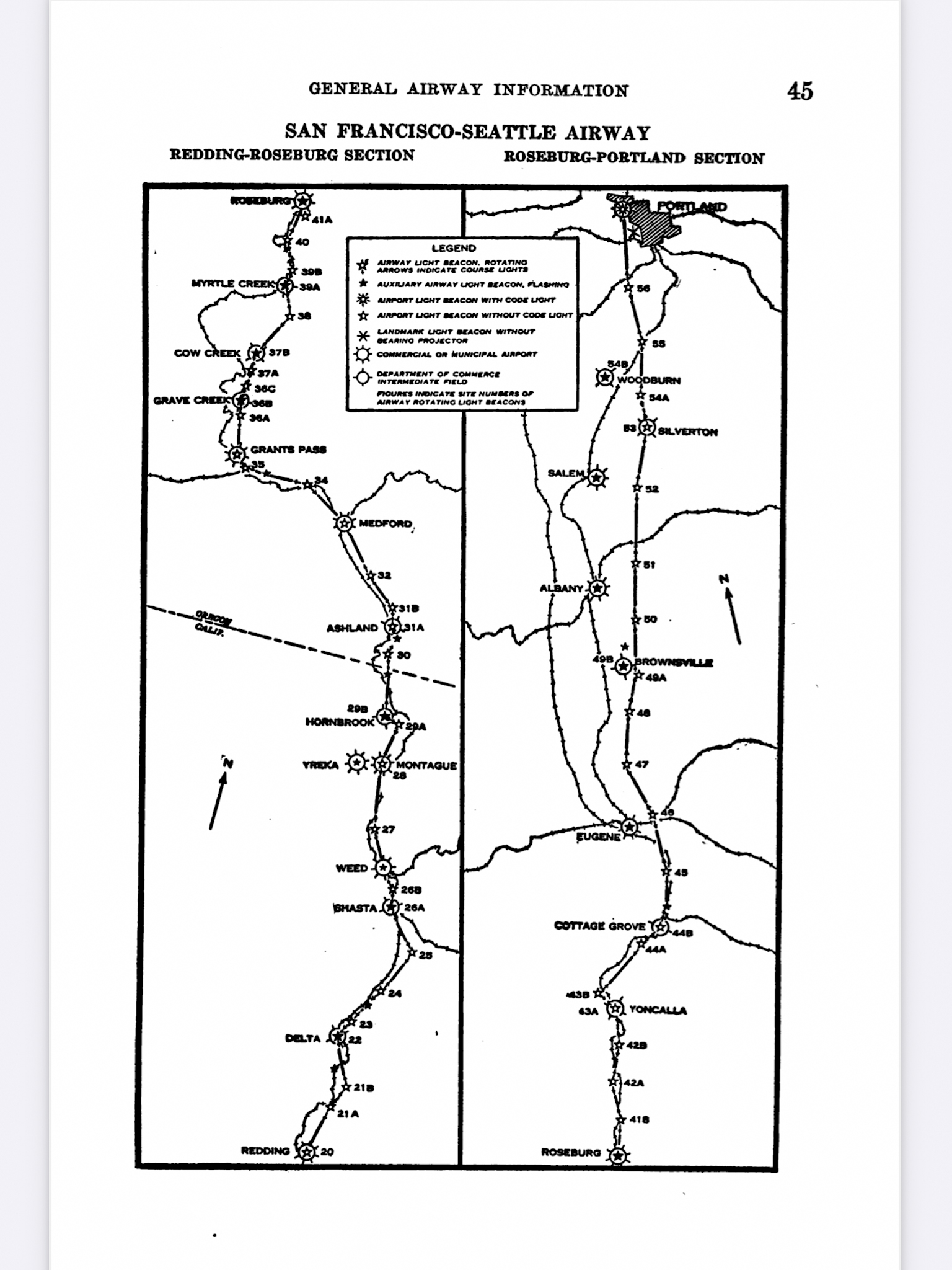
U.S. Army Air Corps 1927 (revised 1930) Air Navigation Map No. 41
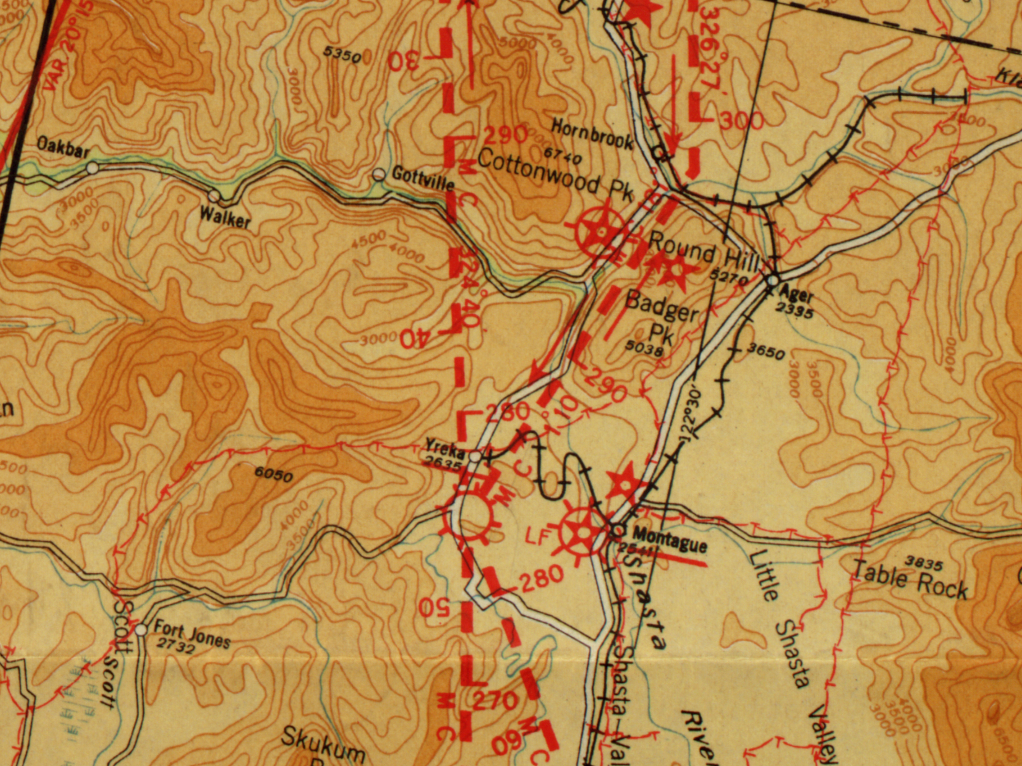
U.S. Department of Commerce September 1, 1931 Airway Bulletin No. 1 airway map.
September 1, 1931 Airway Bulletin No. 2 airfield description.
The airport is shown on the 1935 California Division of Highways Siskiyou County map.
Interestingly, none of the Department of Commerce aeronautical sectional charts available in the Library of Congress collection show the airport as such, though the racetrack appears on the October 1936 chart and on subsequent charts for a number of years.
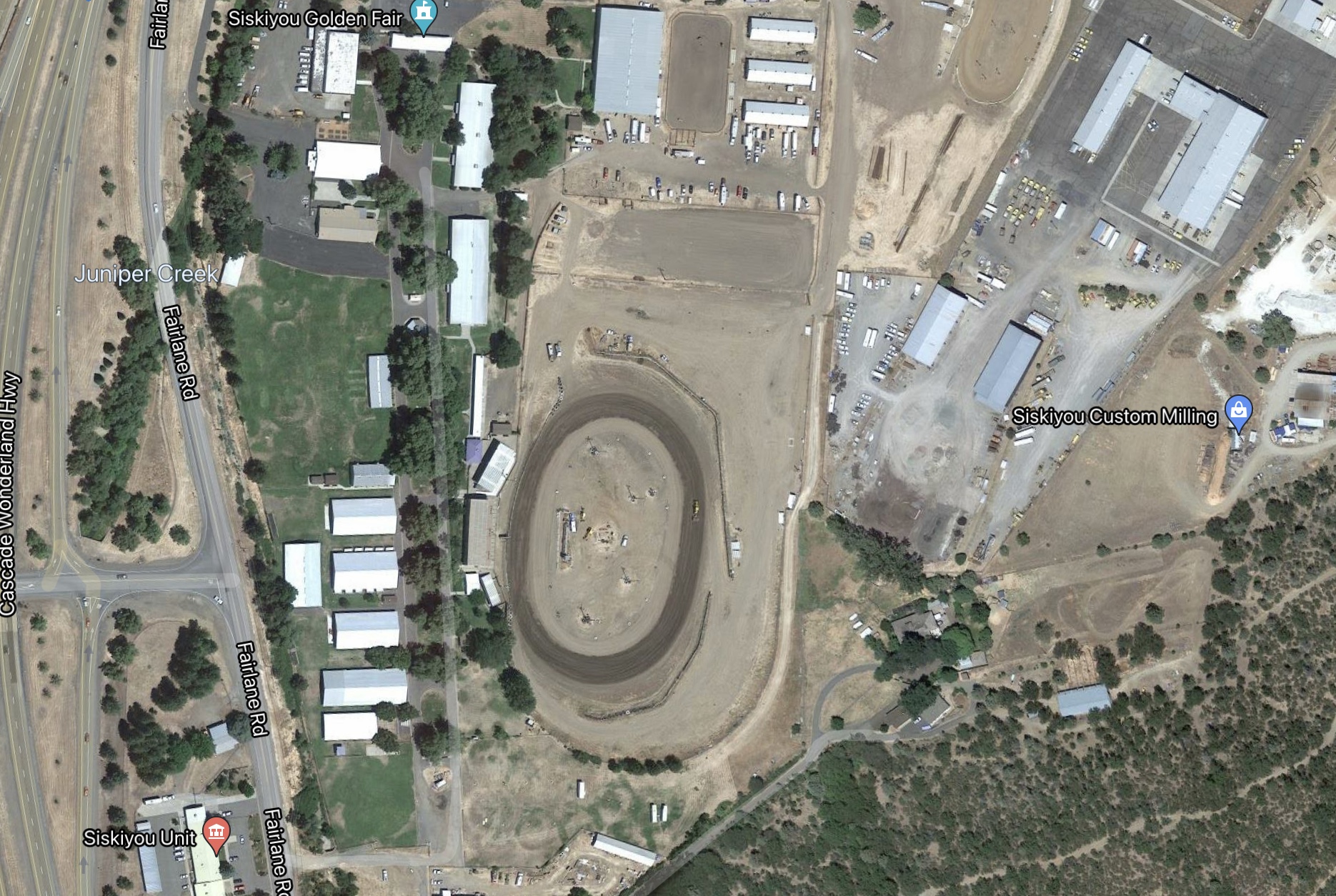
Today, no trace of the Yreka Airport remains. The Google Maps screenshot of the fairgrounds shows a racetrack, which I believe lays a few hundred feet south of the center of the original racetrack.