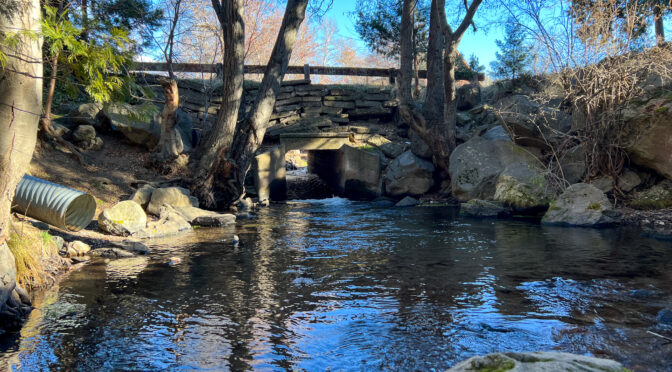
Above photo: Boles Creek flows under Grove Street in Weed. Grove Street carried the first routing of US 97 into Weed.
A little bit of this, a little bit of that
During the past couple of months, I have spent what little bit of free time I’ve had chasing down some benchmarks, determining the early routing of US 97 through Weed, California, and doing a little exploration of former US 99W and US 99E. I still have some research to do on the aforementioned section of US 97, as well as some pictures to take, but I hope to have a post up in the next month or so on that subject. If you are a member of the Facebook group “California Historic Highways” you’ve seen some results of my research already posted to that group in the past few weeks.
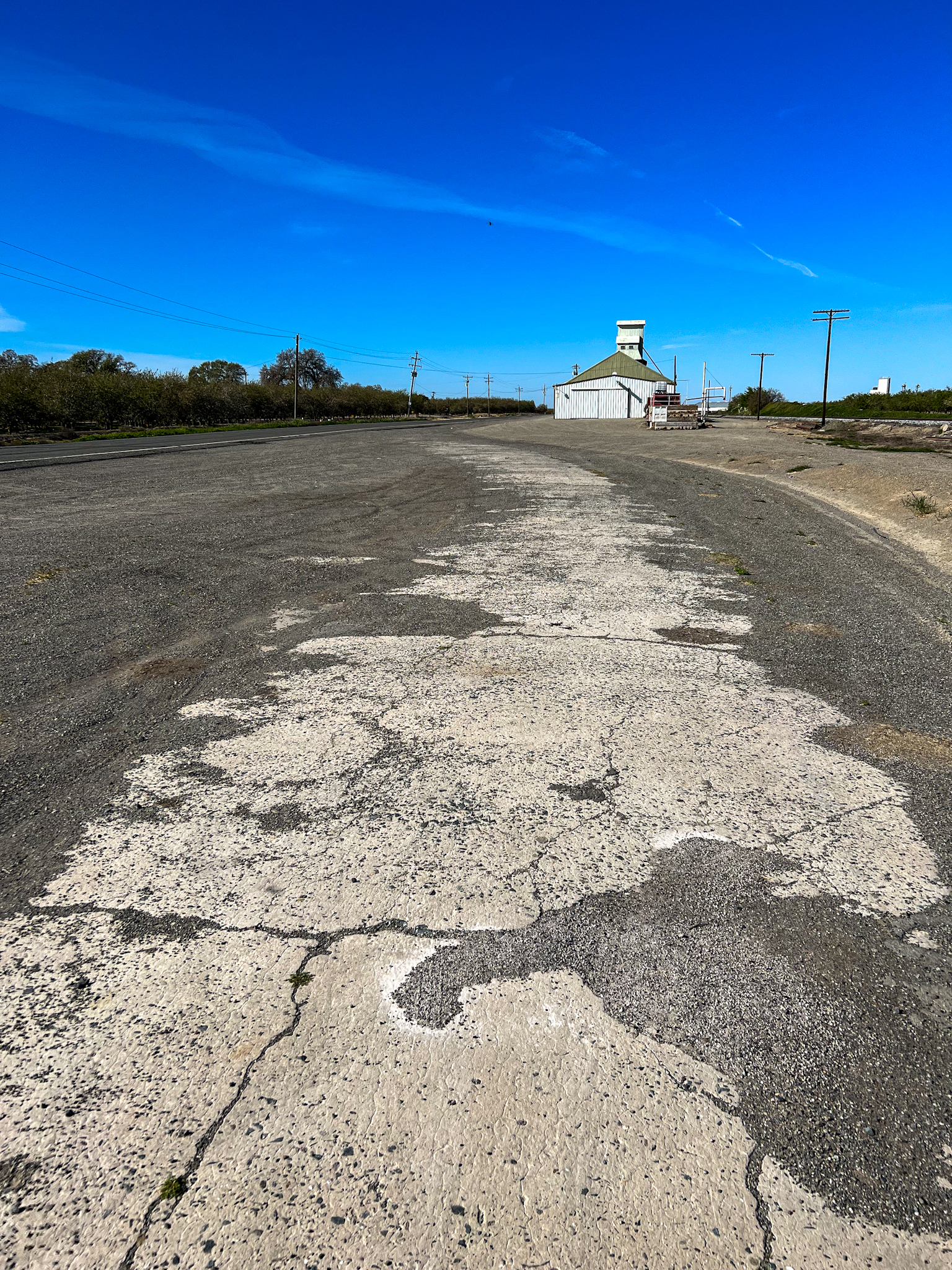
Segment of first routing of the Pacific Highway, then US 99, then US 99W, just south of Yolo County Line Road, just east of Interstate 5. This pavement probably dates from 1925. I haven’t yet researched when the more modern and straighter alignment was built to the left, but I suspect sometime around the late 1930s. Photo taken 24 February 2022.
Benchmarks: I added benchmark W 494 to the Siskiyou County, California Survey Marks page. This benchmark is near the first routing of US 97 outside of Weed, after the southern terminus of 97 was moved from Ashland, Oregon, to Weed in 1934.
I also added new pages for Butte and Tehama counties in California. The first benchmark listed in the Butte County page is near the crossing of an abandoned branch of the Sacramento Northern Railway over CA State Route 99 (ex-US 99E).
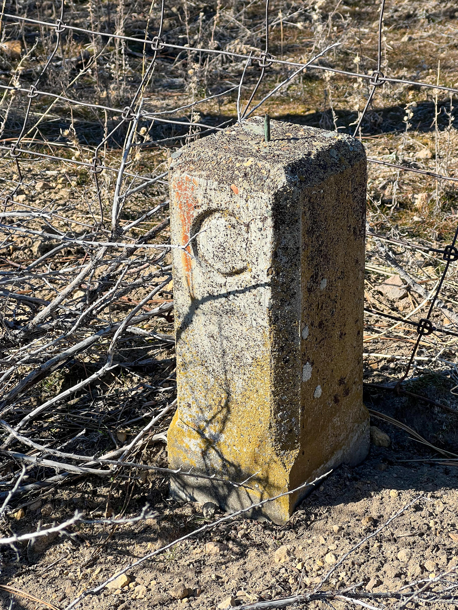
“C post” right-of-way marker used by the California Department of Highways from the mid-1910s to the late 1930s. This one is found near benchmark W 494 along US 97 north of Weed.
An abandoned railroad bed, a lost benchmark, & things found
Shortly after moving back to the Mount Shasta area (after leaving as a child in 1963), I began exploring the remains of the Weed Lumber Railroad. The railroad was built in the early 1900’s by lumber baron Abner Weed, to exploit the abundant forests east of the town he founded, with the segment from Weed to Grass Lake being sold to Southern Pacific shortly thereafter. When Southern Pacific opened the new Black Butte Subdivision (from Black Butte, just south of Weed, to Klamath Falls) bypassing the Weed-Grass Lake segment in 1926, the original ex-Weed Lumber Railroad portion was abandoned.
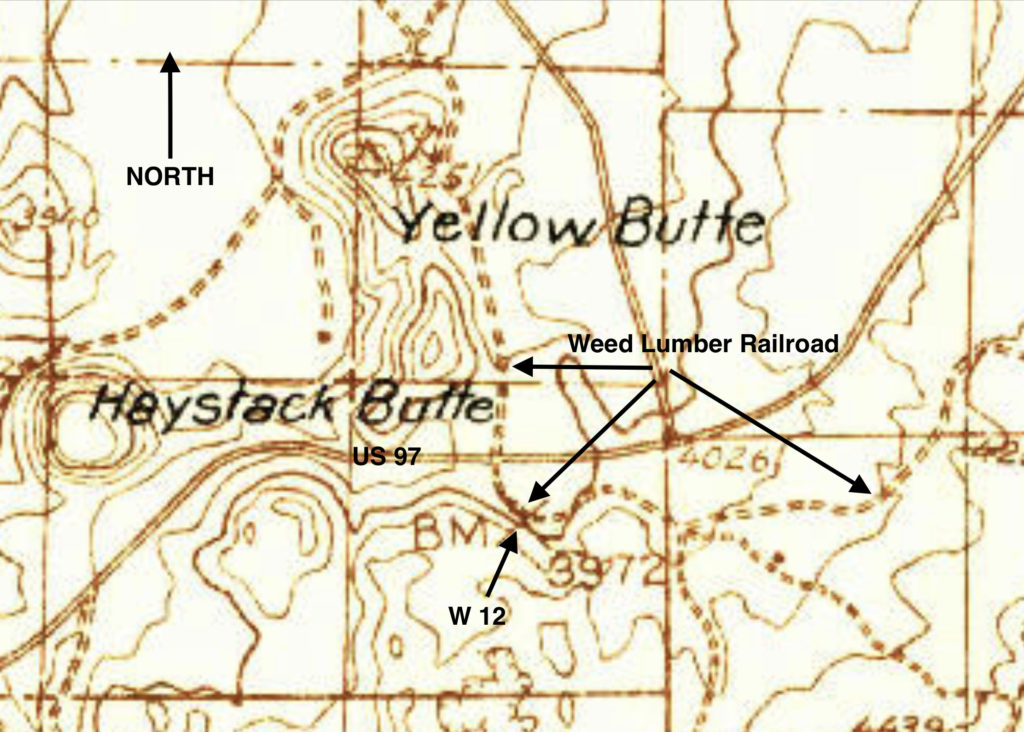
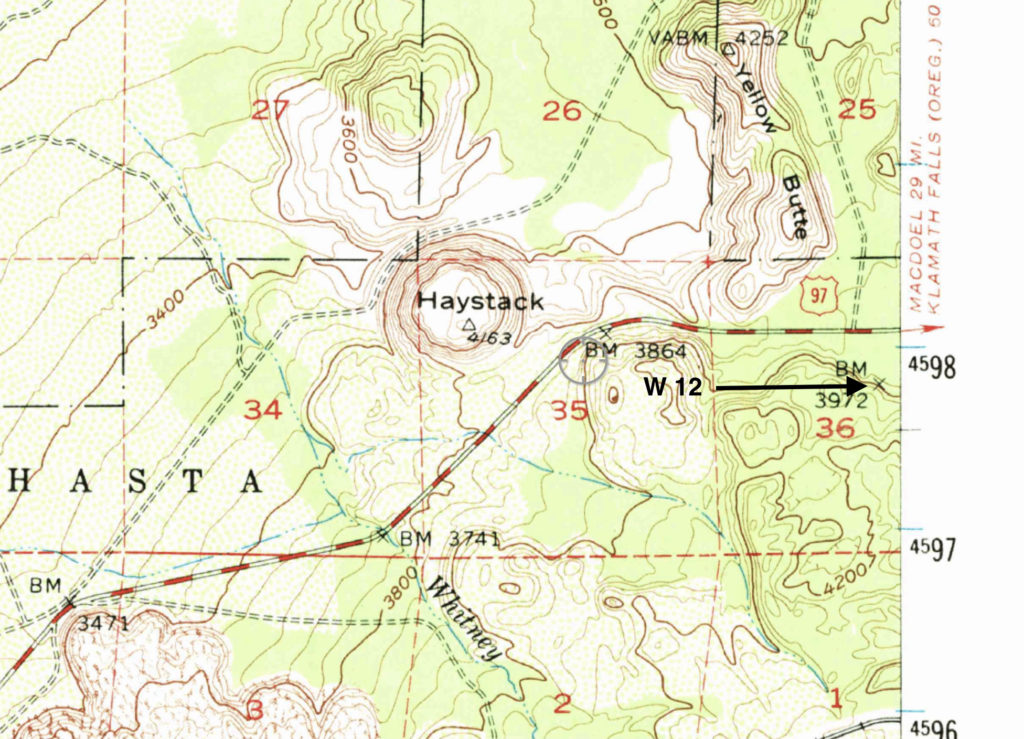
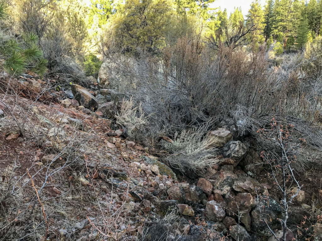
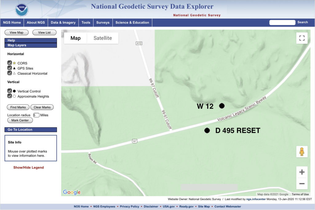
One piece of old right-of-way of interest winds its way along a tongue of lava south of US 97 to Bolam Road, a road which heads south from 97 to the Union Pacific control point of Bolam. I initially walked this segment one day after noticing the raised manzanita and creosote choked railbed heading south off of 97. Later, after checking topographic maps of the area, I noticed that older maps indicated the presence of a benchmark along the railbed. Searching the National Geodetic Survey benchmark database, I found that this one was still listed as Siskiyou County W 12 (PID MX0021).
The datasheet station description of the benchmark is one of the more confusing that l’ve read.
First, it lists the benchmark as being monumented in 1919, but the description seems to have been written in 1954, during a recovery visit to the site by a Coast and Geodetic Survey team. However, it also says that the benchmark was not found.
Second, it describes the mark as “on the abandoned Southern Pacific Co. roadbed, 9-1/2 poles (156.75 feet) southeast along the roadbed from the crossing of the Weed-Dorris highway” which matches placements on the 1934 Macdoel and 1954 Lake Shastina topographic maps. However, then the description reads “about 300 feet west of the highway, about 300 west of milepost 12“, which doesn’t make sense as the indicated position of the benchmark on the 1934 and 1954 maps puts it south, not west, of US 97. Of further note, the description notes the old highway – I can find no record of any highway other than 97 at this spot predating 97 before its construction. The only thing I can think this refers to is perhaps that US 97 was straightened between its original construction around 1936 and 1954, when the above mentioned topo map shows its present roadbed. An aerial photo on historicalaerials.com seems to show an older highway trace crossing Yellow Butte Road (which itself is the old Weed Lumber Railroad bed heading north from the segment being discussed here) about 75 feet north of the modern US 97.
Third, the description says that the mark is “near the middle of a side hill rock cut, 12 feet east of the centerline of the roadbed, in bedrock, 1 foot higher than than the roadbed”. Okay, so the 1934 Macdoel map seems to indicate that the mark is on the west side of the roadbed (or, railbed), as the roadbed travels north-to-south along the east side of the lava flow. The railbed climbs up in elevation from US 97 along the lava flow, on a constructed berm, with no rock existing on the east side of the railbed. Additionally, the aforementioned “9-1/2 poles” or 156.75 feet placement from the intersection of the railbed and the Weed-Dorris highway, either from the modern intersection placement, or the suspected original intersection, lands nowhere near any “bedrock”.
The datasheet states that two recovery efforts were made in 1981 to locate the benchmark, both unsuccessful.
My search efforts
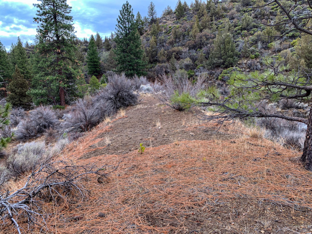
I’ve made three visits to the area to search for the benchmark. I examined both sides of the railbed, including the east side which does not travel next to any bedrock formations. On the west side of the railbed, I searched further than the 12 feet from the centerline where I could, and up to 10 feet or so up the side of the lava flow. Significant erosion of the andesite bedrock along the east side of the railbed has occurred, with several small landslides along the alignment present, and in other places the hillside rock has broken in large chunks, falling onto the roadbed. I spent a lot of time scraping dirt off of the hillside bedrock, hoping to find the brass disk underneath, but it wasn’t to be. My efforts extended from the railbed crossing at US 97 south for 2000 feet, well beyond the distance stated in the datasheet.
Looking south down the abandoned railbed from US 97. At the center of the photo, the railbed starts to curve to the left (east).Example to the eroded hillside along the west side of the railbed.
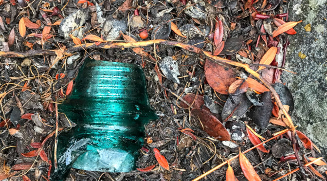
I did find numerous railroad ties, remnants of signal poles, a piece of a glass insulator, and a railroad spike, as well as numerous tin cans, probably left by railroad or salvage crews.
My conclusions
The NGS benchmark locator shows both benchmarks in the wrong locations. D 495 RESET is on the north side of the highway, and W 12 was located 2000 feet to the southwest.
What happened to the benchmark disk? I suspect one of several things could have occurred: 1) a worker took the disk as a souvenir during rail salvage and demolition; 2) someone else took it while exploring the area after railroad operation ceased, looking for collectibles such as bottles, glass insulators, or tools (my grandparents did this for years, searching out old railroad, lumber, and fire camps); or 3) the disk is still attached to a piece of rock that is now buried amongst the erosion.
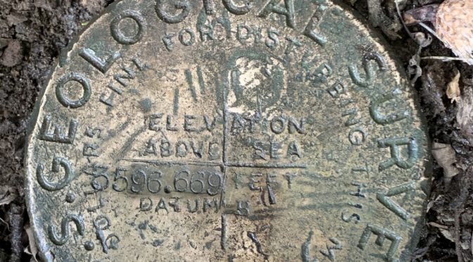
My efforts were not without accomplishment. On my last visit, I did recover a nearby benchmark,D 495 RESET (PID MX0023), as well as 3 Caltrans survey markers, and found a geocache as well.