(last edit 28 February 2022)
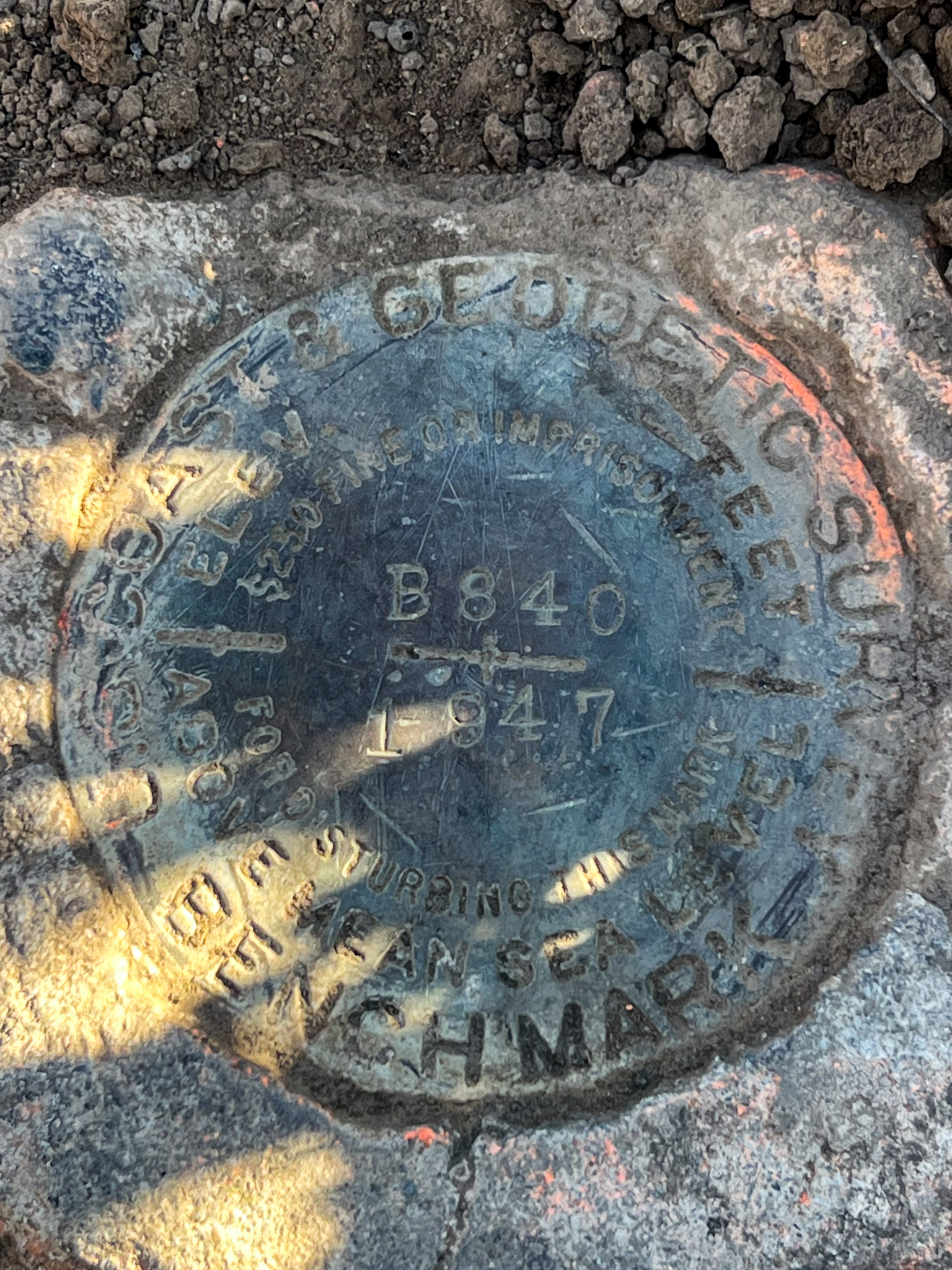
B 840
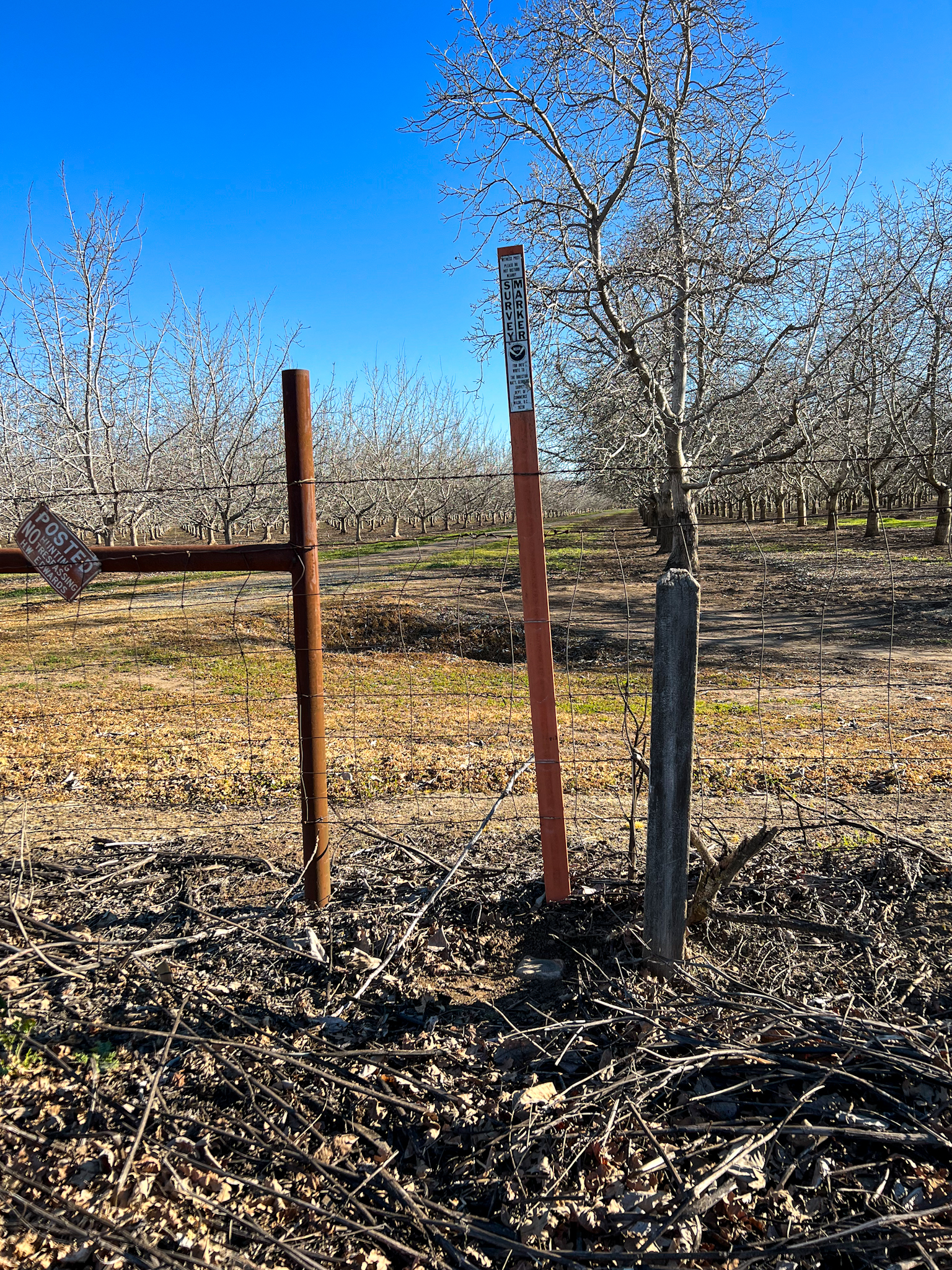
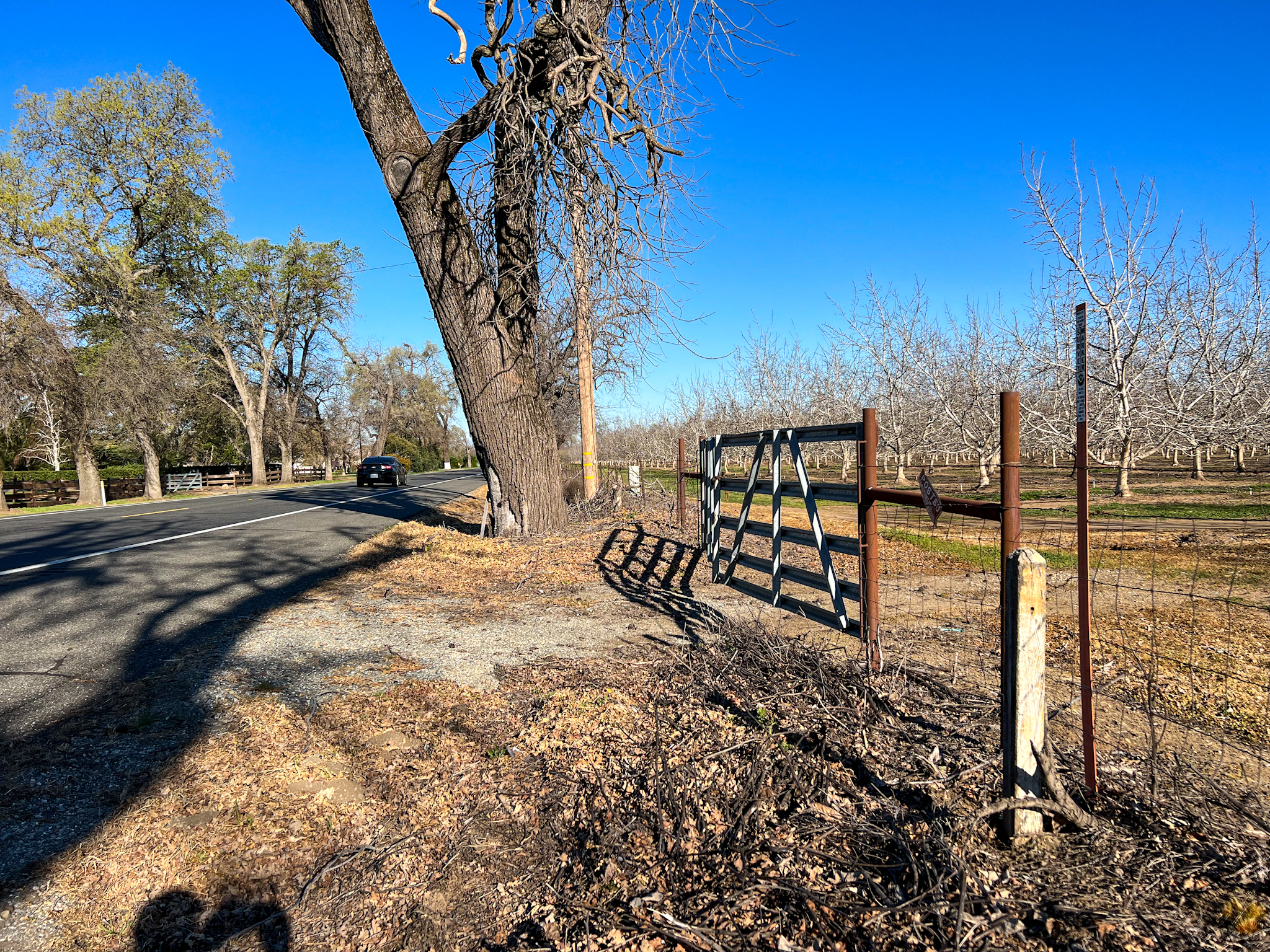
This benchmark is found on the east side of of California State Route 99 (ex-US 99E) along a fence line of an agricultural property, about 4 miles south of Red Bluff. Monumented in 1947, it has survived highway maintenance activities and escaped vandalism. It is marked by an old wooden post, as well as a more modern plastic marking stake. The mark is in great shape, and an easy find if you find yourself along Route 99.
- COORDINATES: 40.176944, -122.168611
- MAP: USGS QUAD “RED BLUFF EAST 2018″
- AGENCY: CGS
- TYPE: BENCH MARK DISK
- SETTING: Set in top of concrete monument
- MONUMENTED: 1947
- NGS PID: LU0339
- STATUS: RECOVERED
- CONDITION: EXCELLENT, as of 23 February 2002