Tag Archives: Rincon Mountains

Spud Rock Spring Via Turkey Creek Trail

A challenging but spectacular scenic hike

Trip dates: November 13-15, 2015

This was my first backpacking trip in over 10 years. I went with my buddy Joe, who’s about the same age as I, and we took the 15 year old son of a friend who couldn’t go due to back problems. Ryan is a good kid, in great shape, and has a great attitude.  And who has a fondness for aluminum foil.

Sign at the primary trailhead at Miller Flat.

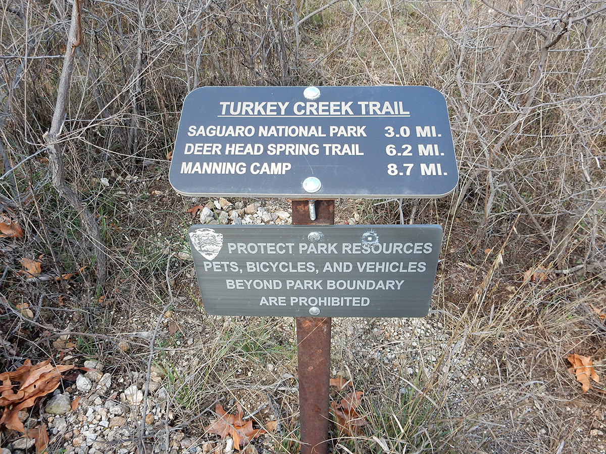
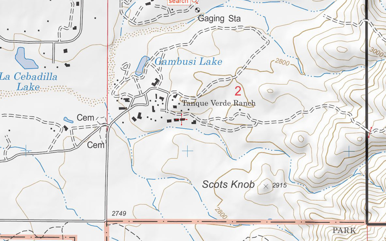
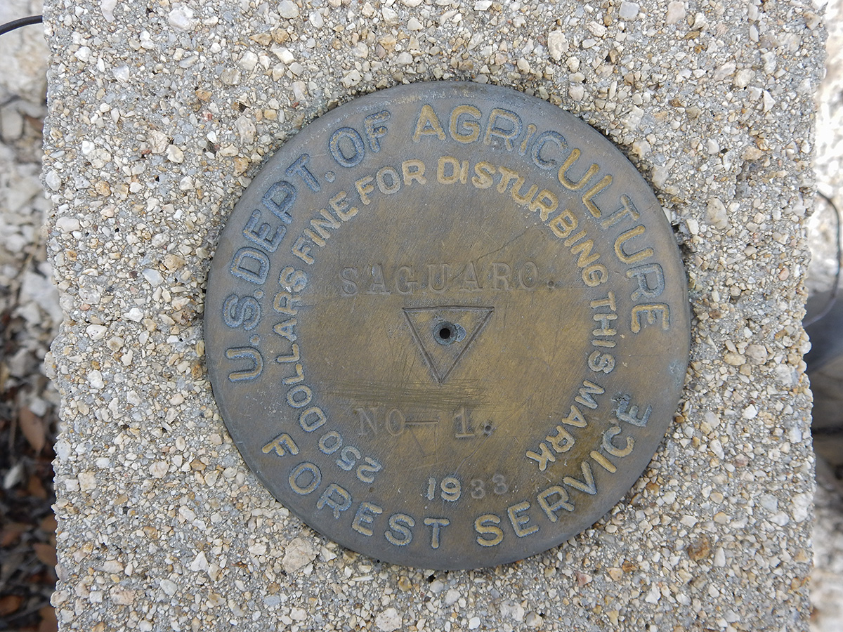
Our destination was the Spud Rock Spring campsite by way of the Turkey Creek Trail, located in the eastern side of the Rincon Mountains, in the Saguaro Wilderness Area of Saguaro National Park.  From the eastside of Tucson, it’s about a 2 hour drive east towards Benson, getting off Interstate 10 at Mescal. From there, you head north into the Coronado National Forest to the Happy Valley area on Forest Service road 35. If you don’t have a high clearance four wheel drive, you have to park at Miller Flat and walk an extra 1.5 miles or so up FS 4408; otherwise, you can proceed through a gate and park at the end of FS 4408 to start the hike.

A great place to car camp at Miller Flat in Happy Valley.
DSCN0329
Heading up Forest Service road 4408 to the secondary trailhead. This road is suitable for high clearance 4WD vehicles only.

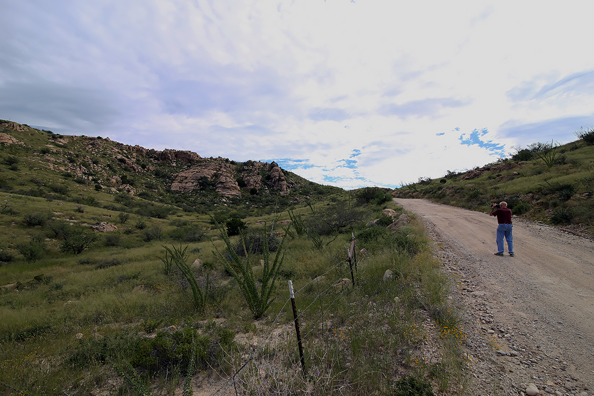
We left Tucson at 6:30 on Friday morning and arrived at the trail head in Happy Valley around 8:20 AM. Joe has a Jeep Liberty, so we were able to get the end of Forest Service  road 4408 to start our journey, rather than having to park down the ridge and hike another 1.5 miles in. The weather was great, though still chilly at this time of morning – 36 degrees and clear. We hit the trail at 8:45, quickly shedding a couple of layers as we warmed up from the sun and exertion.

Joe and Ryan amid tall grass on the Turkey Creek Trail about 1.5 miles from the secondary trailhead.

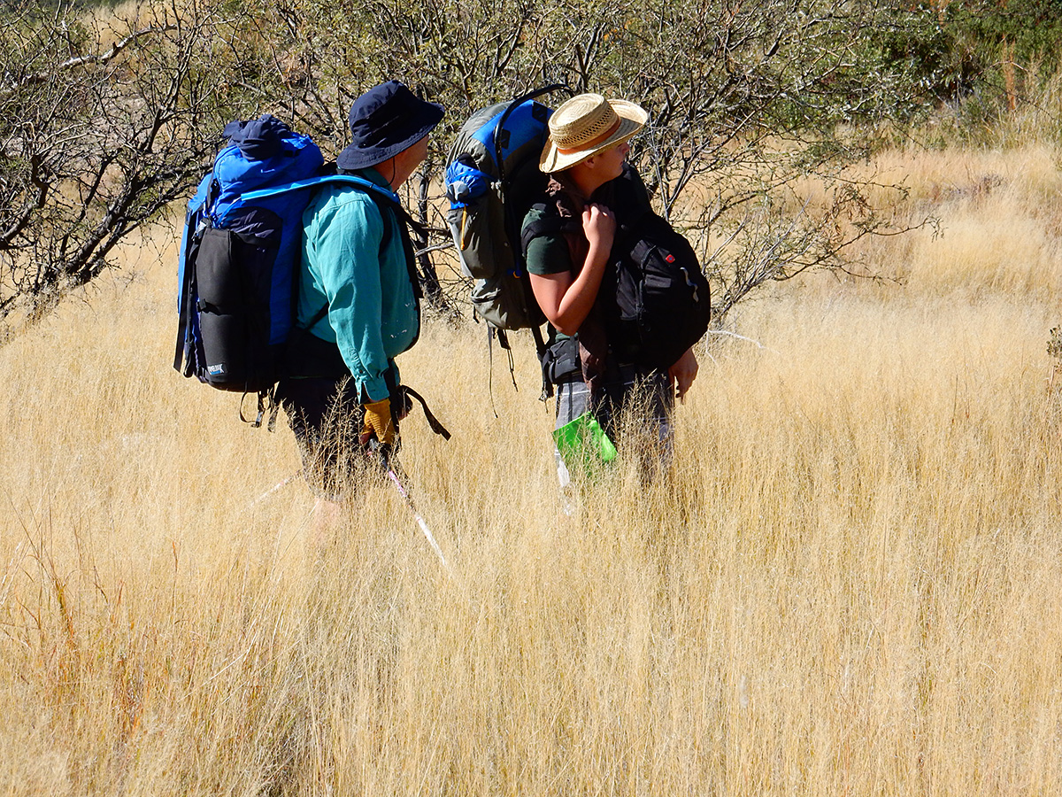
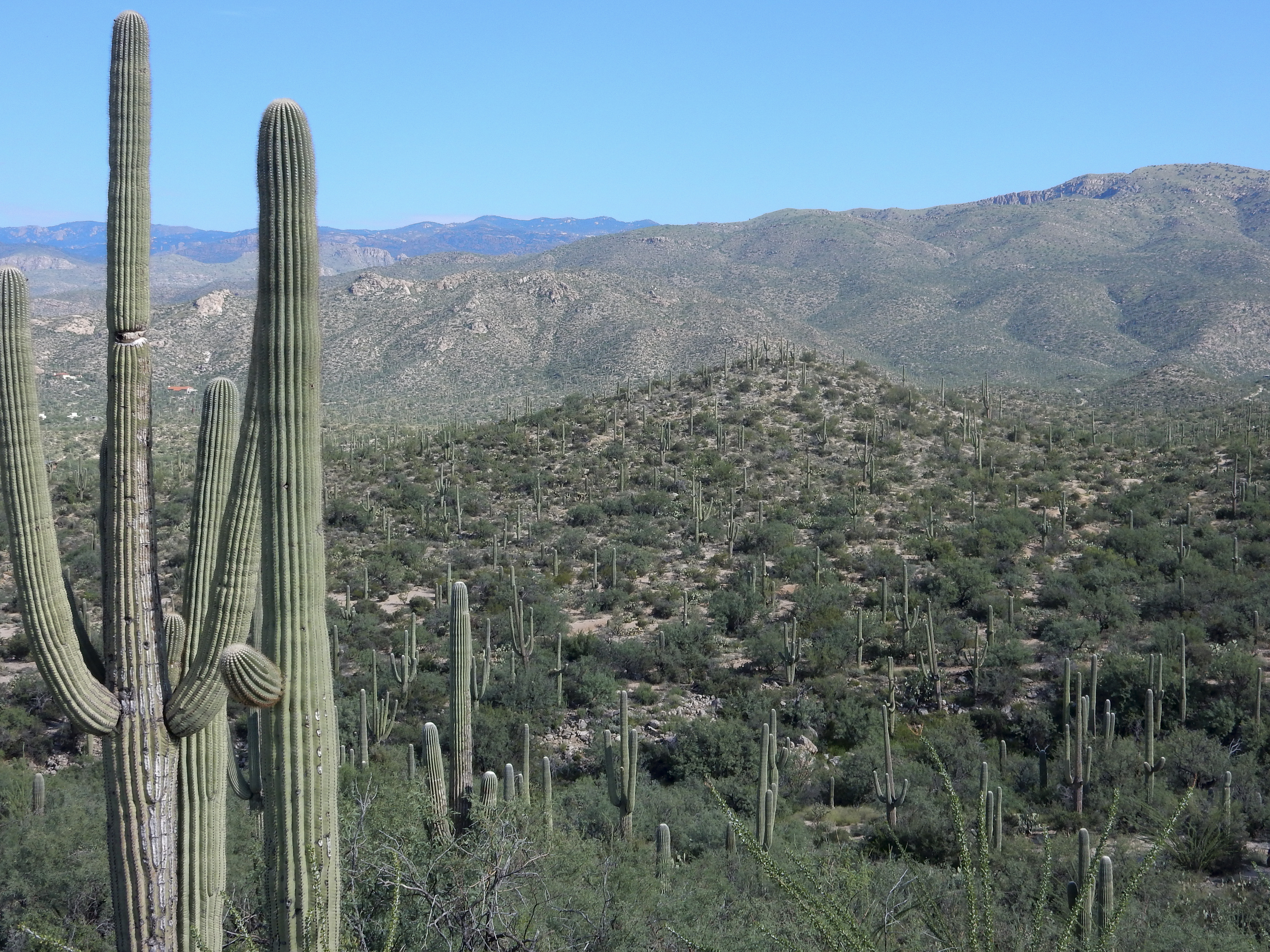
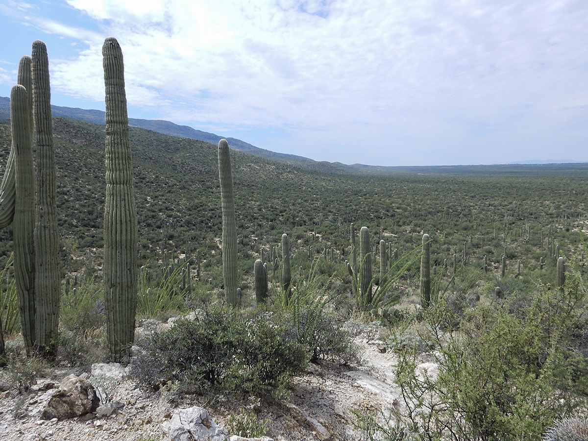
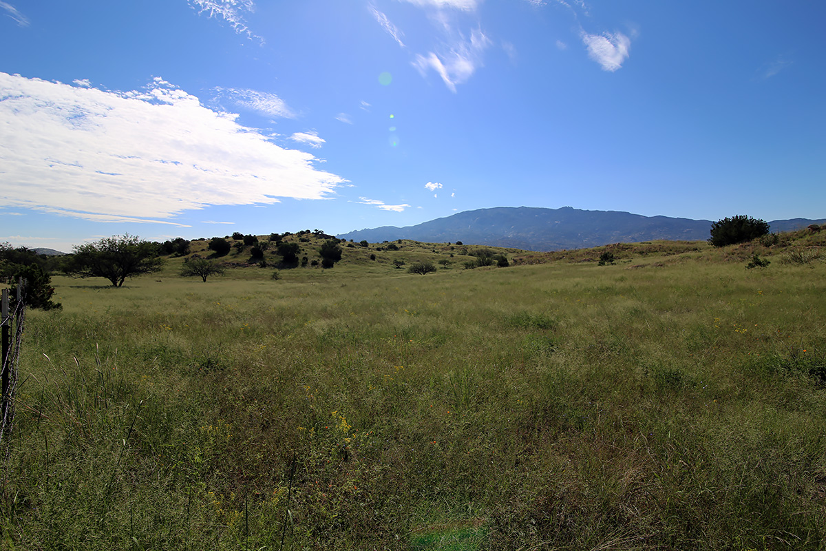
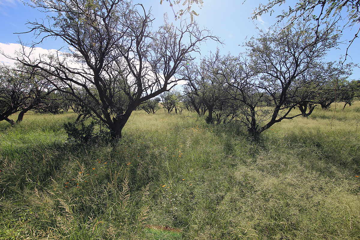
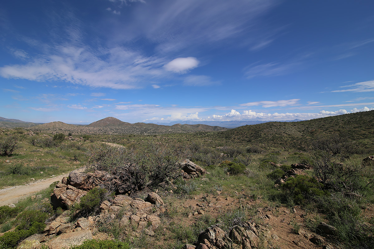
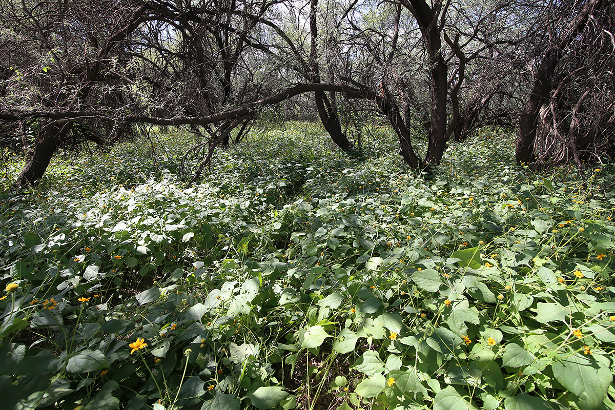
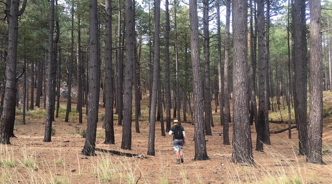
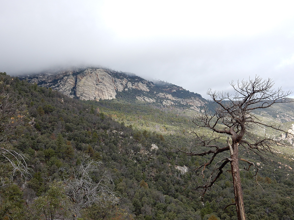
For the first couple of miles, the trail climbs slowly through savanna grasslands and oaks. After that, it was a slog for pretty much the next 3 miles. It was like doing Blackett’s Ridge in Sabino Canyon twice. We stopped frequently to catch our breath, as well as to enjoy the view and take photos. At Mud Hole Spring, we ate lunch and took a half hour nap.

Mud Hole Spring.
Mud Hole Spring.

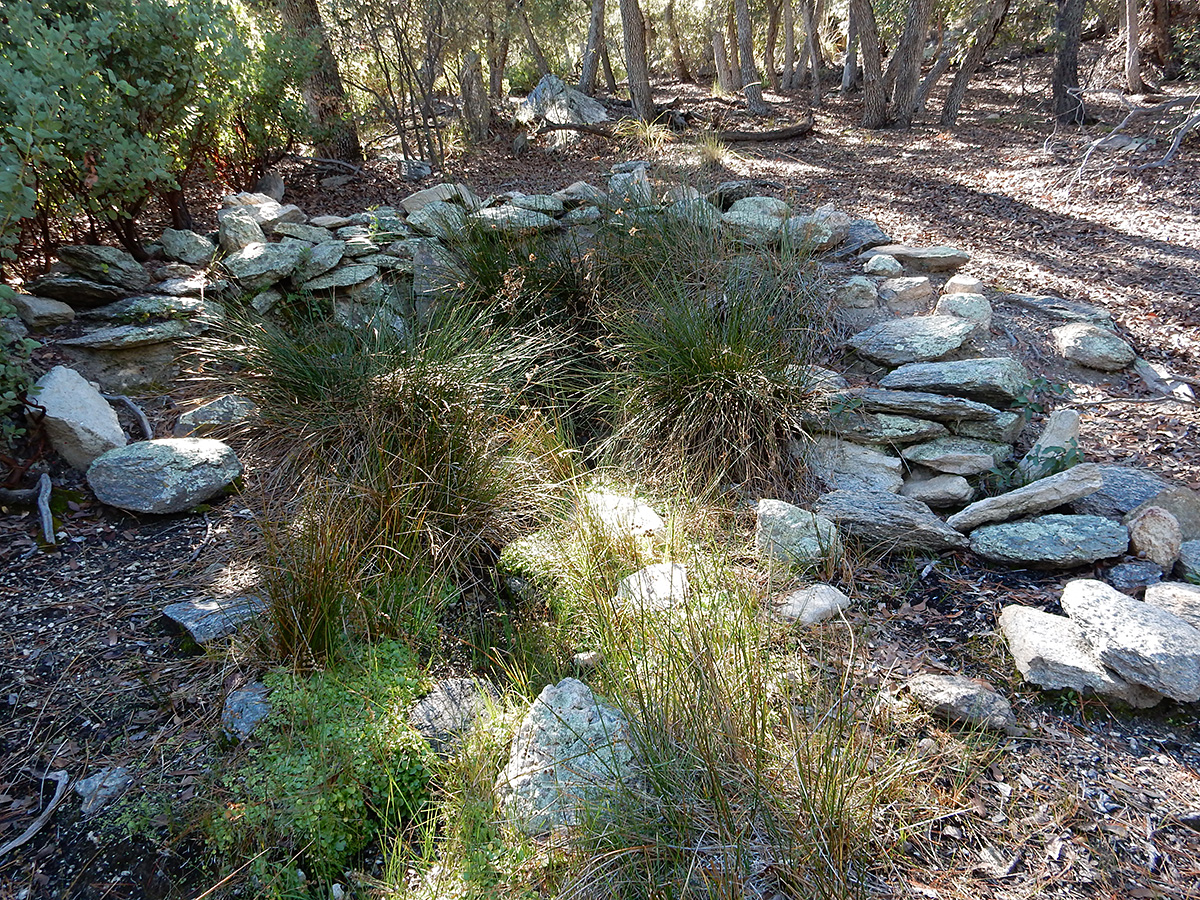
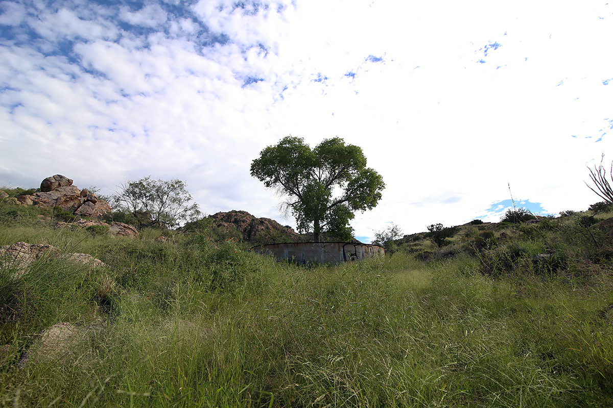
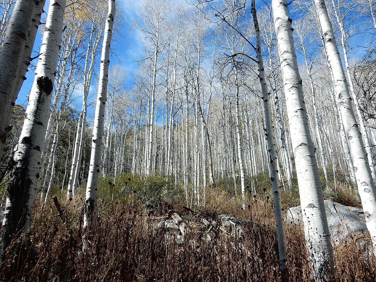
It was evident that this trail doesn’t get much use. It was overgrown almost all the way up, and in many spots, felled trees crossed our path. Near the end, about 3/8 mile from Spud Rock Spring, we spent about 20 minutes trying to follow the trail, due to overgrowth and debris on the trail. We finally arrived at the campsite at 5 PM. Of the three sites available, we made ours nearest the pit toilet and the bear box, which served double duty as a camp table. There was ample firewood about, but the no water at the spring, just a wet bog, surrounded by a large grove of aspen trees. Even if there had been a flow, the ranger had told Joe it was not good for drinking.

The ranger had also told Joe that we would be by ourselves on Friday night, but that the other two sites would be occupied on Saturday. We thought this odd, given it was November, it was the far side of the Rincons, and the threat of inclement weather loomed.

Ryan contemplate uses for aluminum foil by the camp fire.
Ryan contemplates uses for aluminum foil by the camp fire.

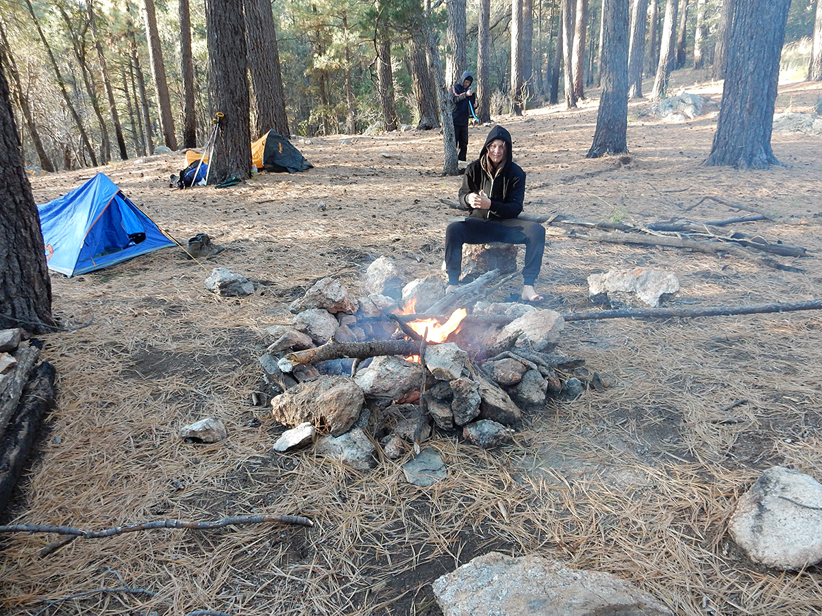
All of us had frozen meat with us (2 steaks and 2 chicken breasts) that had thawed out nicely during the day. We cooked these on small wire we had brought along, and supplemented these with baby carrots, dinner rolls, potatoes, and nuts.  Ryan had not brought any plateware. Rather, he had a roll of aluminum foil. He took a flat piece of rock, and covered it with foil, using this as his plate. After dinner we made hot chocolate while a roaring fire danced before us. Ryan did not have a cup. Using mine as a mold, he fashioned one out of foil. We called it a night around 7:30. The night time temperature was quite pleasant, with almost no wind during the night.

Aspen grove at Spud Rock Spring.

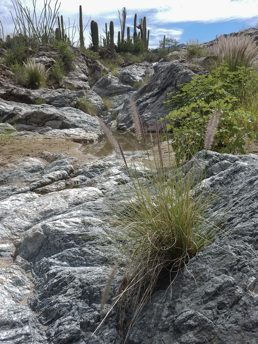
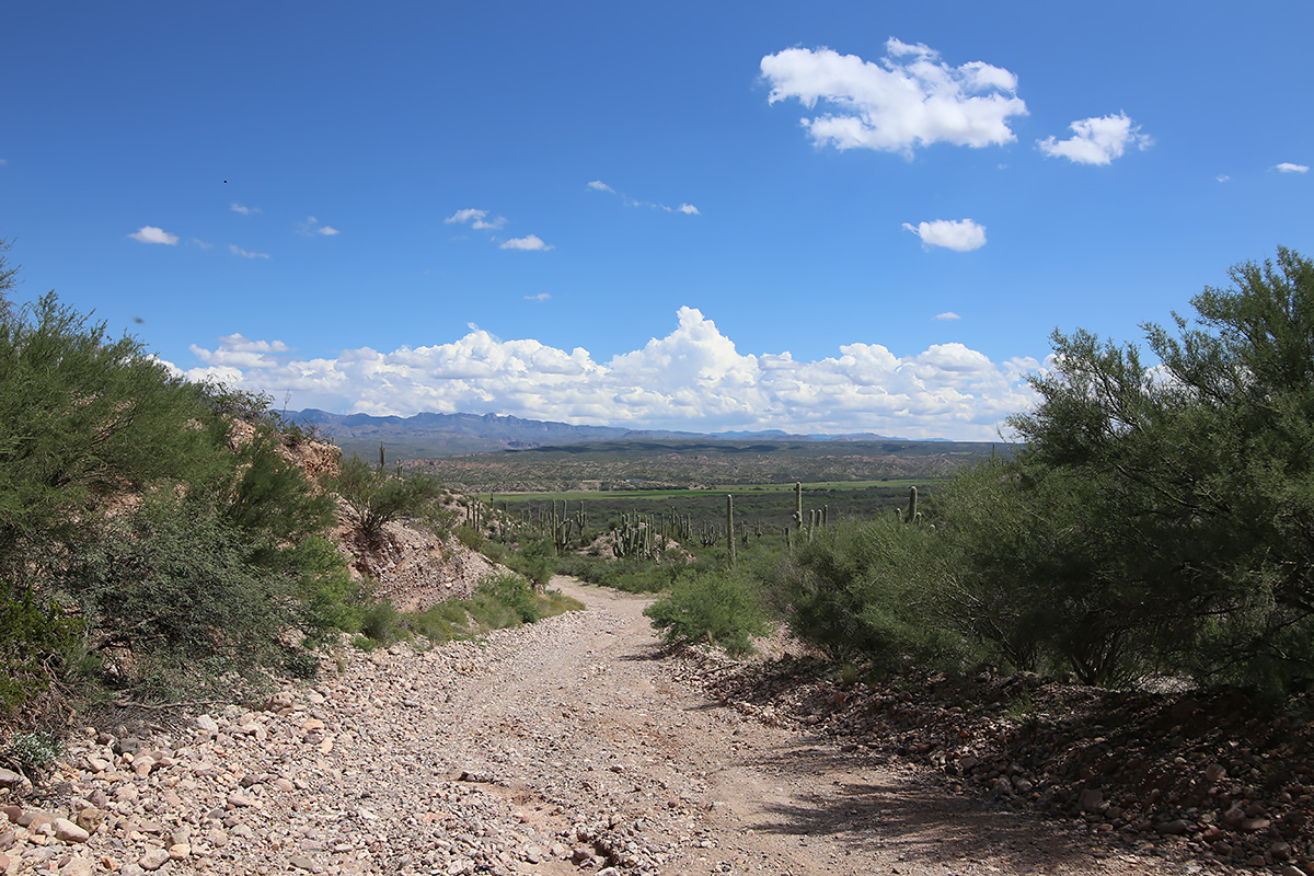
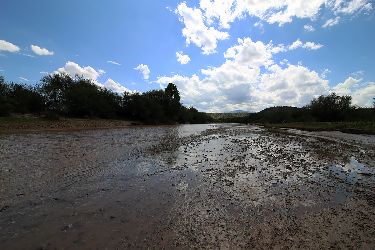
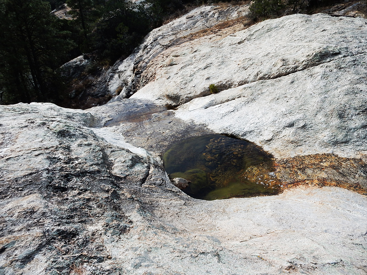
Saturday morning found us getting up around 7 AM. Quickly Ryan made a fire (he being 15, the fire was much larger than it needed to be, but boys will be boys) and we went about making coffee and breakfast. We spent most of the morning sitting around the fire, taking a nap mid morning, before getting our act together and heading over to Devil’s Bathtub to procure water. We missed the trail for the most direct route, taking a route that led us to a farther south meeting with the Heartbreak Ridge Trail, causing us to have to climb back up 500 feet, rather than staying fairly level.

At Devil’s Bathtub, we filled our bottles and bladders, ate lunch, and napped again in the warm rays of the sun on the gently sloping granite at the top of the falls. We didn’t go to the bottom of the falls, as we just didn’t want to do any more climbing than we had. After about an hour and a half, we made our back on the correct route to Spud Rock Spring.

Cool, clear water at Devil's Bathtub.
Cool, clear water at Devil’s Bathtub.

As evening approached, we prepared dinner and built another roaring fire. The temperature dropped, but it was still comfortable. Ryan threatened to make a jacket out of, you guessed it, aluminum foil. Joe and I convinced him that he would be better served by just climbing into his sleeping bag. The skies overhead were clear, with no wind whatsoever. We began to doubt any arrival of rain during the night. Too, no other campers appeared either, though around 8 PM both Joe and myself thought we heard voices in the distance, but we never saw any lights or smelled smoke from other fires. About that time, we called it a night.

The rain came at 1:45 AM on Sunday.

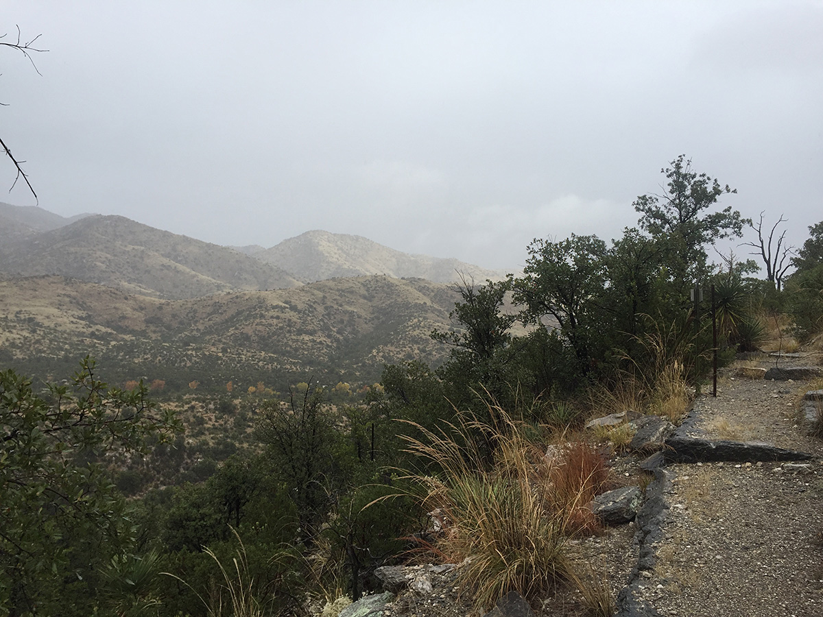
It drizzled most of the night. Joe and I stayed dry, but neither of us noticed that Ryan had not put a rain fly on his tent, so he got a bit wet. By the time we got up at 7, the rain had abated, allowing us to eat some breakfast bars and break camp without too much fuss. We made our way out at 8:25 AM.

To make your way in or out of Spud Rock Spring, you climb a small ridge. As we went over and down that ridge, we came across 5 women in 3 tents in the area of the poor trail marking/overgrowth/felled trees. These were the hikers that held the permits for the other 2 sites, and the ones we had heard the night before. They had fought their way up the Turkey Creek Trail the day before, only to be stymied by the poor trail conditions and impending nightfall. The apparent leader walked over to us, inquiring about our campsite and water, as they had run out and were in the process of collecting what they could off their tent rainflies. Then, as panic set manifest itself in her eyes, she said “Perhaps this wasn’t the best trail or time to bring a couple of newbies on.” I think some friendships were damaged that day.

Looking back up at the Spud Rock Spring area as we made our way down the trail.

We made our way down through almost constant drizzle in four hours, without slipping and breaking anything. It was actually a pleasant experience. Sunlight shone upon us for the last mile, allowing us to dry somewhat before getting into the Jeep.

Rain drizzles as we descend the trail into the lower foothills of the eastern Rincon Mountains near Miller Flat.

We enjoyed a late and large lunch at Reb’s Café in Benson before heading back to Tucson.

QUESTION: Why is Spud Rock Spring not even close to to Spud Rock? They are not even on the same ridge.

GEAR NOTES: I had checked out my old Coleman Peak 1 gas stove (dating back to 1982) last May, and it worked fine. When I tested it out before this trip, it was evident that it had developed bad seals, because the flames were burning yellow, and I couldn’t get new parts in time to rebuild it for use on this trip. So I bought an Optimus Crux Lite canister stove and the Optimus Terra Solo Cook Set. A small canister sits inside the cook set, along with the stove, and the cook set comes with a mesh stuff bag that doubles as a scrub cloth. The stove worked perfectly, and the cook set was just right for what I needed (making hot drinks and boiling water for instant oatmeal, a pouch dinner, and clean-up).

My humble $39.99 tent.

I also needed to get some shelter at the last minute. An offer of a borrowed bivy did not come through, and I didn’t want to pack my Mountain Hardware Optic 3.5 up the mountain, so I ended up getting a $39.99 1 person tent at Big Five at 8:55 PM on Thursday night. It worked great. It’s actually pretty well made for the price, with a generously sized mesh side panel to get in and out of, mesh panels on the other sides, a rainfly, and a fitted footprint. It was vented well, and I didn’t get any condensation. Both the tent and rainfly have good zippers, reinforced tie-down points, and the weight is 3 pounds. The factory sealed seams did not leak in the rain. Not a bad deal for back up or light duty bivy. Branded “Golden Bear”, one of the Rec-Out brands (Rugged Exposure, Columbus).

Exploring Scotts Knob

Scotts Knob is little hill (marked elevation of 2915 feet) on the eastern side of Tucson, about 1 mile east of the end of Speedway Boulevard, just north of the Saguaro National Park boundary, apparently on the property of the Tanque Verde Ranch (a local guest ranch). Unlike a couple of other hills in the area, this one is named on topographical maps, with an indicated elevation. (NOTE: On the Forest Service topo map below, “Scots Knob” with one “t” is used, but on all other maps it is spelled with two t’s)

Capture

My buddy Rob and I checked it out this Labor Day morning.  Access is through a gate to the left of the TV Ranch sign; stay on any trail that goes right and hugs the boundary fence of the national park. You will eventually pass through a fence line that goes north/south – you will see the hill on your left. Proceed another 100 yards or so and another trail going north towards Scotts Knob will become apparent. Within a few minutes you will be on top of the summit. From the top you have nice views towards the Santa Catalina Mountains and Agua Caliente Hill to the north, and a great southwest sightline of the northwest face of Tanque Verde Ridge component of the Rincon Mountains.

Below are a few pictures from our exploration of Scotts Knob.

DSCN0251-1 web
Scotts Knob is the small hill in the foreground. Agua Caliente Hill is behind it with it’s summit to the right. In the far distance are the Santa Catalina Mountains. This view is from the Douglas Springs Trail in Saguaro National Park.
DSCN0256-1 web
One of the small washes we crossed on our way to Scotts Knob.
DSCN0257-1 web
My best guess is that this is a male Filigree Skimmer dragonfly.
DSCN0267 web
Benchmark on the summit of Scotts Knob.
DSCN0269 web
Looking southwest from Scotts Knob. The Rincon Mountains are to the left.

DSCN0263-1 web

A Drive Around The Rincon Mountains

Trip date: 9/27/14

The dichotomy of urbanization and wide open spaces in Southern Arizona has always fascinated me. Within minutes of the hustle and bustle of Tucson, you can find yourself in wide open desert terrain, with an endless view to the horizon; on top of a mountain wilderness, surrounded by towering conifer forests; or in the middle of rural ranchlands and farms, looking more like California’s Central Valley or a Midwest farming state. No more is this apparent than in a drive around the Rincon Mountains east of Tucson.

Around The Rincons map
Our route around the Rincon Mountains. Click on image to enlarge.

I’ve been in Tucson for 10 years, and have yet to drive from start to finish Redington Road, or circumnavigate either the Catalinas or the Rincons. I had mentioned to my buddy Rob a few weeks ago that I wanted to accomplish these trips, now that I had gotten my Expedition road trip and somewhat off road ready. We decided on this past Saturday to make the trip, with the objective of getting the lay of the land and scouting out stuff for further exploration, as well as taking a few photos along the way. We met at my house on the Eastside and left at 8:20 am. We had a full take of gas, water, ice, donuts, charged batteries for everything, and no deadline to get back. Some clouds floated in the sky ahead, but nothing threatening, so we forged ahead. Since it was a gorgeous morning with relatively low temps, I thought we’d see more people on Redington Road than we did. We ran across a dozen or so souls from a geocaching club who were doing a clean up along the first few miles of the road, a couple of mountain bikers, and a handful of people engaged in target practice. Other than a 4 or five other vehicles, including a Pima County deputy sheriff, we had the entire length of Redington Road to ourselves. The road was in really good shape, save a couple of spots where rain had created small gulleys (maybe 6 inches deep and a foot wide) in the last couple of nights. There were obvious signs that road crews had done some grading and clearing of washes in the last week. The scenery was just stunning. Very green vegetation was abundant, from thick grasses coating the top of the pass to plump saguaro and dark green ocotillo. Wildflowers were everywhere. We made our way along rather slowly, as we stopped along the way to take pictures and check some side roads out. Just below east of Piety Hill we stopped to drink our coffee and devour our donuts. This video is a view to the east with the Galiuro Mountains across the valley

http://youtu.be/oqvQtZobY8A

As we finished the descent into the San Pedro River Valley, we came across a magnificent stand of heritage saguaros that cried out to be photographed. Video:

http://youtu.be/66aUNO9xquc

We wanted to cross the San Pedro at the Redfield Canyon Road.

http://youtu.be/NyO6i6I8L6A

The water was only about 6 inches deep, not swift, and the river bed seemed firm enough, but since we didn’t have a second vehicle to pull us out or any recovery equipment, we crossed further downstream at the bridge. Cascabel Road is in great shape. The valley floor is green and lush. I didn’t expect to see as many residences this far out of Benson as we did. As you would expect, the people we did see reflected the cross section of those you find in rural Arizona – from ranchers to retirees to old hippies to those trying to stay off the grid. Everyone seemed friendly and waved at us, whether from a passing vehicle or from their front gate. Just south of the Spear Ranch I had noted a cemetery on the topo map on the east side of the road. Along this stretch the road was line on both sides by a bosque, which on the east side of the road climbed up a short bluff. I jumped out of the truck and wound my way up the hillside through some brush until I came to a fence about 60 feet off the road. Going through the barbed wire I proceeded another 25 feet until I topped the bluff and wa-lah! there was the graveyard. I had only brought my iPhone up the hill, so I went back to the truck to retrieve my camera and Rob, because he had to see this. As one can see in the photos, besides several modern graves, there are 29 unmarked graves that have to date back to the 1850’s. In a history written by Tess Gamez, of the family that owns the land on which the cemetery sits, it’s not known what year the graveyard was established, or what persons are buried in the 29 unmarked graves.

  • IMG_2281 web IMG_2281 web There was no end to the photographic opportunities, as my buddy Rob will attest to.
  • IMG_2282 web IMG_2282 web Clouds set up some spectacular shots to photograph.
  • IMG_2286 web IMG_2286 web A lone cottonwood guards an old water tank near the top of Reddington Pass.
  • IMG_2293 web IMG_2293 web The top of the pass opens into some large grassland areas.
  • IMG_2298 web IMG_2298 web Mesquite bosques are common throughout Arizona.
  • IMG_2309 web IMG_2309 web We were treated to grand views throughout the trip.
  • IMG_2310 web IMG_2310 web The view as we descended into the San Pedro River Valley.
  • IMG_1845 web IMG_1845 web Looking east towards the Galiuro Mountains.
  • IMG_2314 web IMG_2314 web A magnificient stand of heritage saguaros.
  • IMG_2316 web IMG_2316 web The San Pedro River.
  • IMG_2323 web IMG_2323 web Another bosque.
  • IMG_1846 web IMG_1846 web No trip in Arizona is complete without a snake in the road.
  • IMG_2327 web IMG_2327 web The Gamez family cemetery.
  • IMG_2331 web IMG_2331 web Some of the 29 pioneer graves, occupants unknown.
  • IMG_2339 web IMG_2339 web Railfanning at the Three Bridges area on Marsh Station Road just east of Vail, Arizona.


We had thought of completing the trip to Benson in about 3 to 4 hours so we could lunch there, but we stopped so often that we found ourselves at the Gamez Cemetery around 1 pm. From there, we left off making any more stops (for the most part), reaching Benson around 3. Rob suggested we eat at the Horseshoe Café. I had never eaten there. Wow, we had quite a meal! While the burgers and sandwiches sounded great, they start serving dinner at 3 on Saturday, so Rob had meatloaf, mashed potatoes, and a salad, while I had liver, bacon, and onions, baked potato, and a salad. The portions were HUGE. Each entrée was only $10. On the way back, we stopped at the Three Bridges area off Marsh Station Road near Vail to photograph a couple of westbound trains we had seen passing through Benson. We finally got back to my house at 5:20 pm, nine hours after we had left.

It was easy to forget within minutes of climbing Reddington Road that a modern city was behind us. Almost immediately we were met with solitude, gorgeous landscapes, and a sense of what Arizona must have looked like when the first European explorers entered the region. For those that live in the region, life is probably pretty much the same as it was 150 years ago – isolated, dependent upon water, neighbors, adaptability, and endurance. Even with Tucson or Benson 40 or 50 miles away, you get a sense that you are a long ways from nowhere.