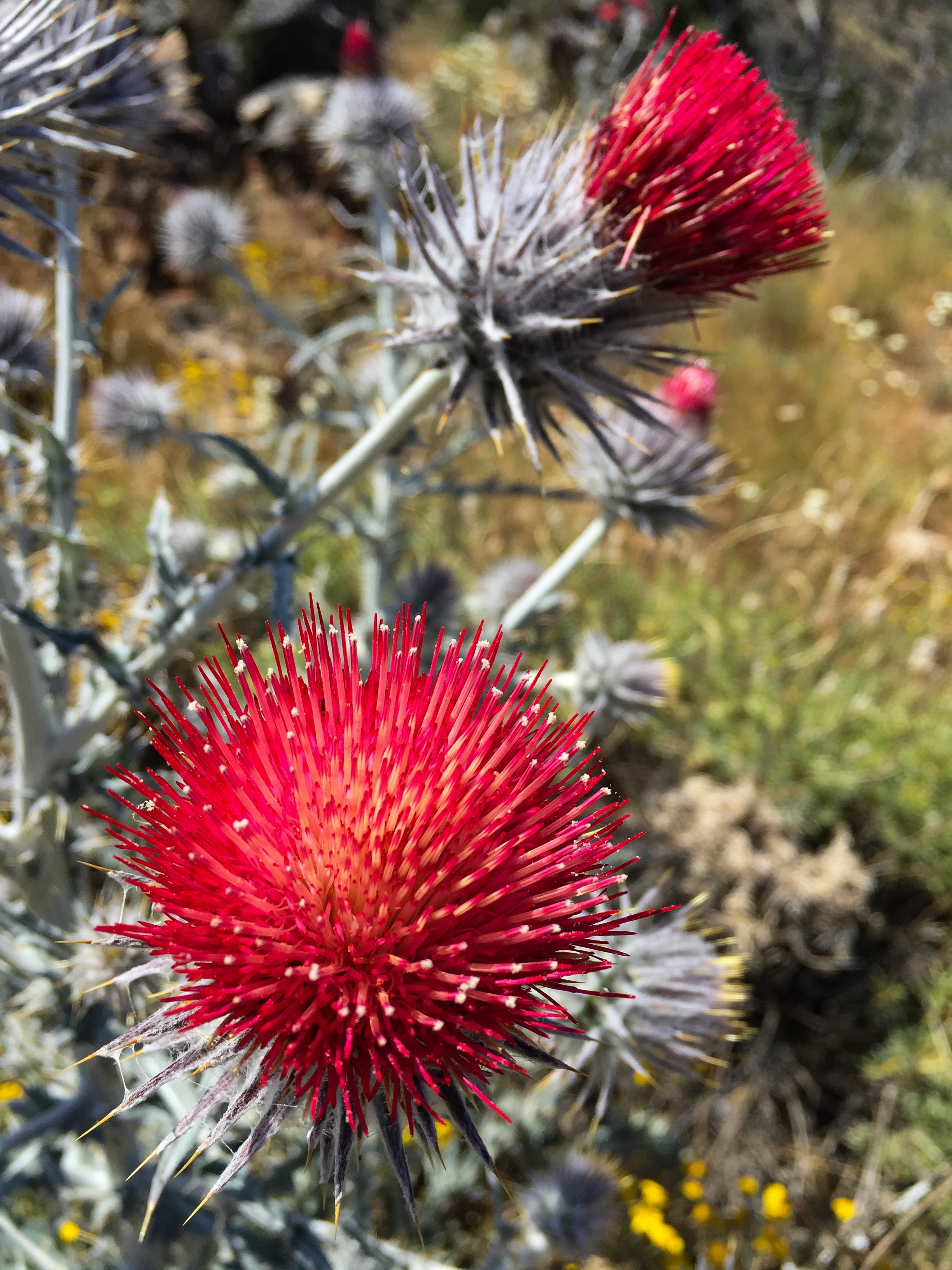
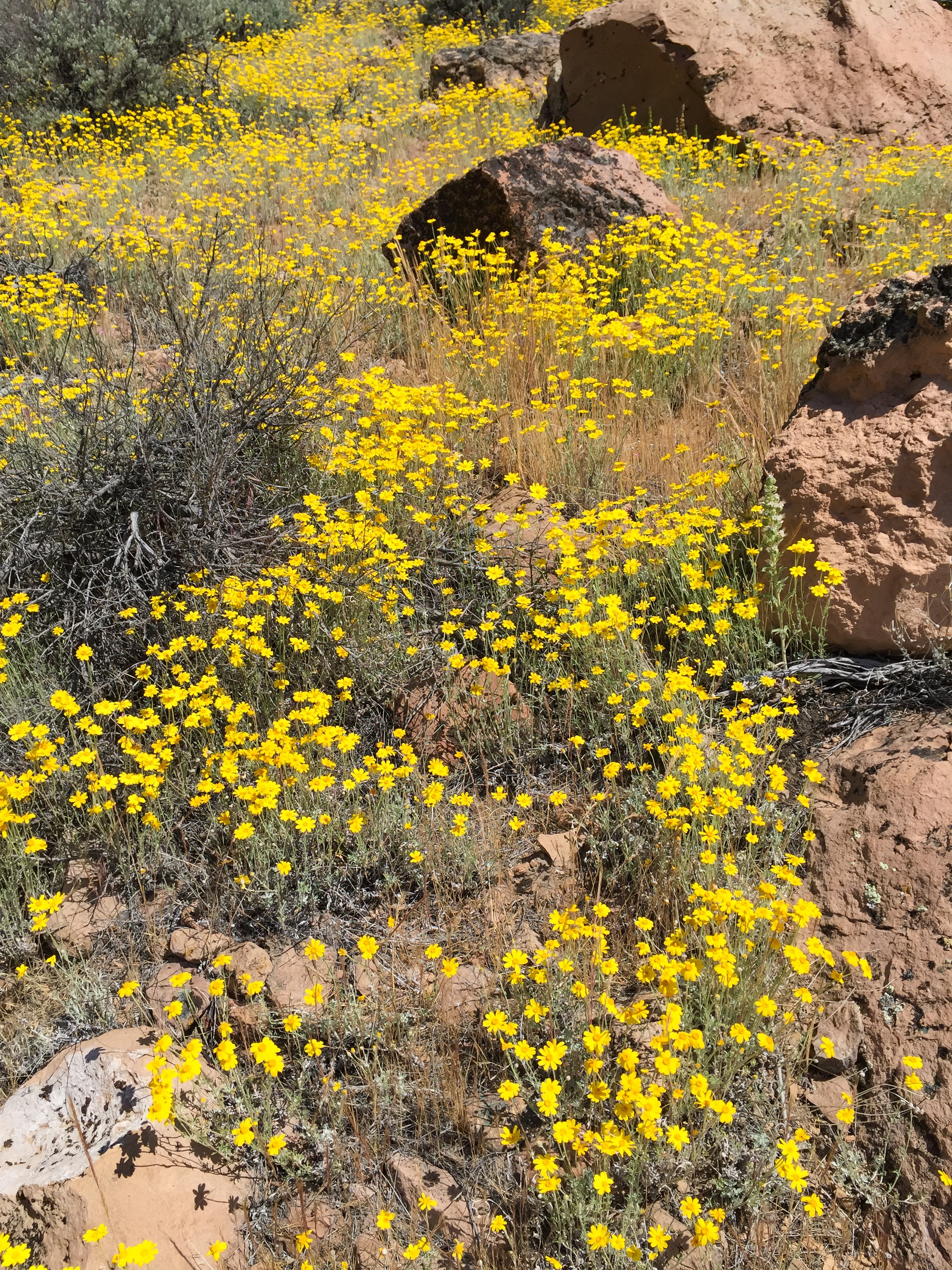
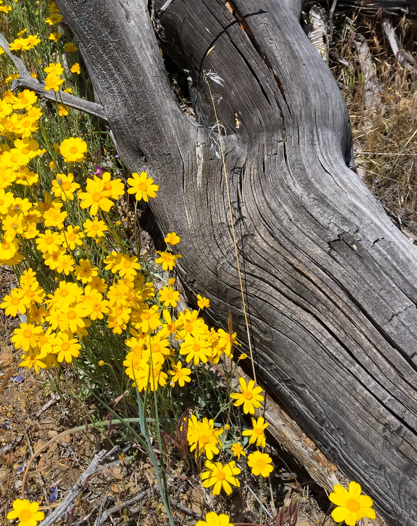
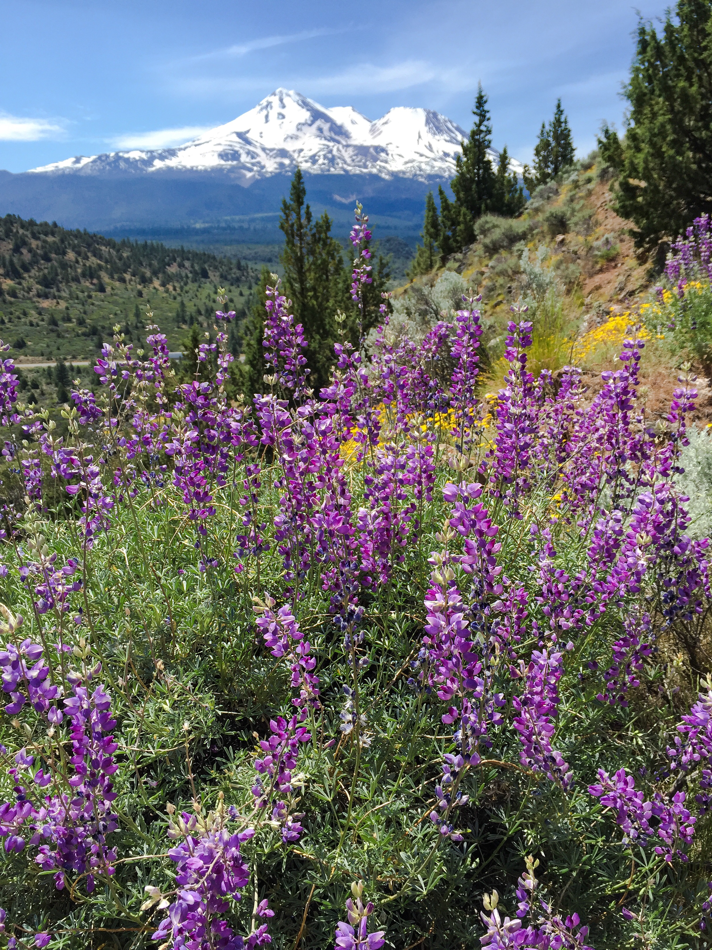
PHOTO OF THE DAY
My wife and I had to go to Portland, Oregon, earlier this week for two days to address some medical issues. Here are a few notes from that trip.
Hotel: we stayed at the Park Lane Suites & Inn, located in the Goose Hollow neighborhood at the west side of the downtown area. It’s a hotel with outside entrances to the rooms; however, you can only access the rooms by first going through a lobby entrance. The room was clean and bright – we had a suite with a kitchen area and dining table. WiFi is provided. Numerous restaurants, as well as a Starbucks, Walgreens, and Fred Meyers are within 5 minutes walking distance. We booked our room on Priceline for $90 per night – a deal considering most hotels in the downtown area are double that.
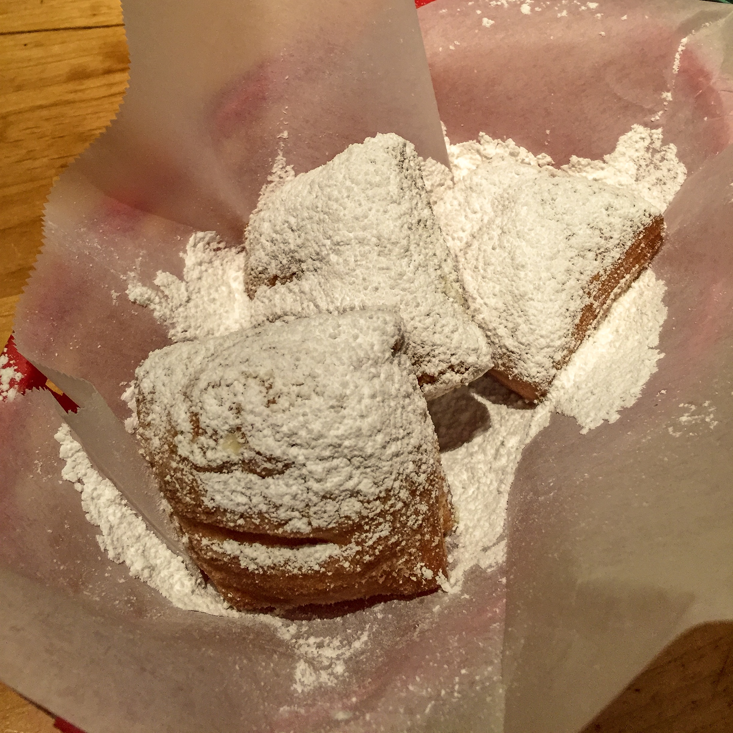
Good Eats: dinner our first night was at Tapalaya, a Creole/Cajun tapas eatery with a Vietnamese twist in the east side Laurelhurst neighborhood. My wife and I split popcorn shrimp ($12), followed by seafood gumbo ($14) for her, and a crab cake for me ($14). But I really went for the beignets ($6). Served with a bourbon dipping sauce, they are guaranteed to induce a culinary orgasm. They are as good or even better than Cafe Du Monde’s.
The second night we ate at Oven and Shaker in the Pearl District. After a long day spent at Oregon Health Sciences Center, a simple pizza dinner was all we were looking for. Disappointed we were not, as we had a wonderful Neopolitan style Margherita (tomato, basil, mozzarella) pizza ($13), preceded by lamb sugo served over a crispy polenta, and followed by layered budino, a parfait of chocolate ganache, whipped cream, cajeta caramel, and cookie crumble ($7). I could have easily oredered a second of everything.

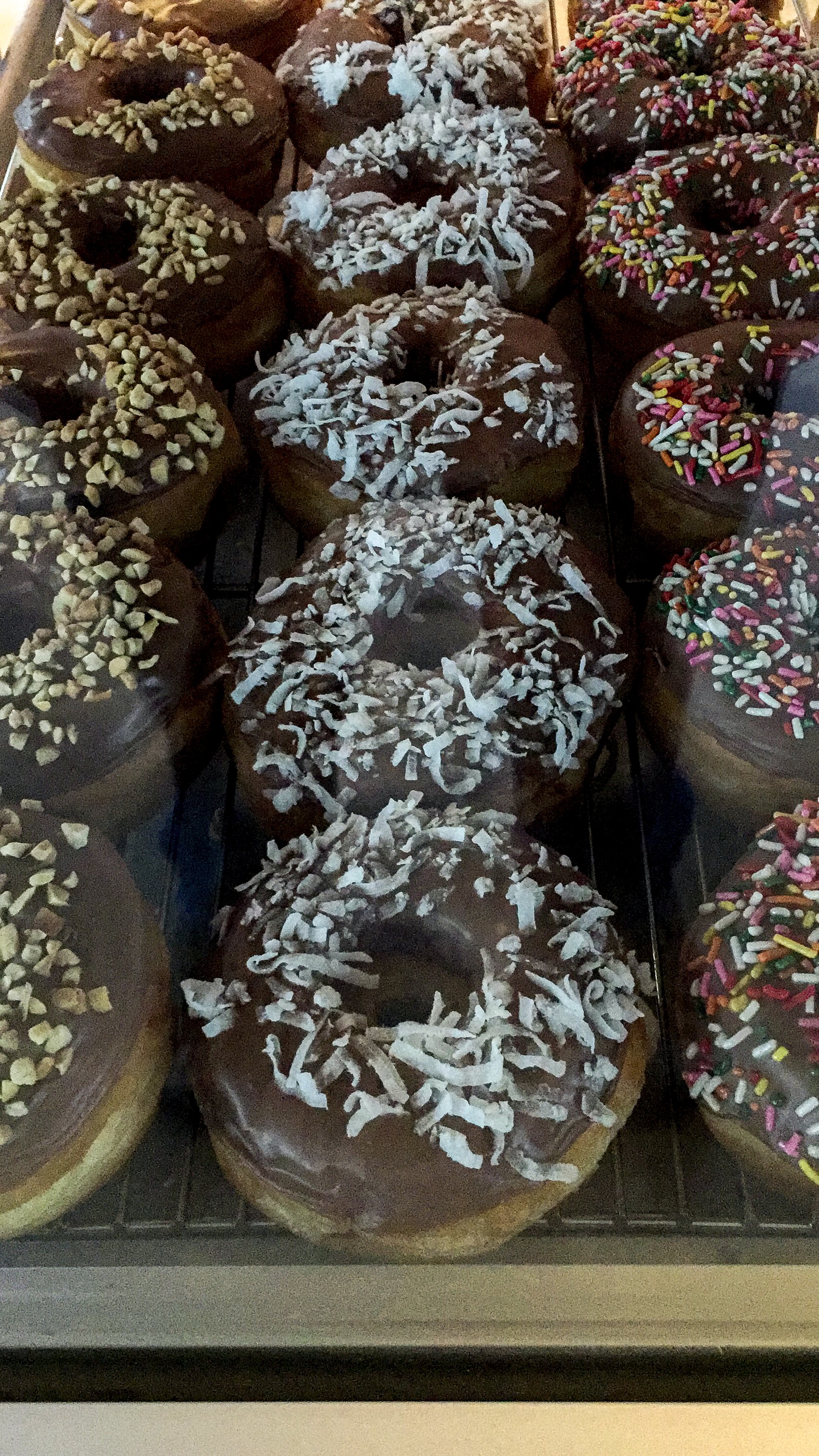
And one must not forget donuts. One of Coco Donuts’ three locations is a five minute walk from the Park Lane, at 709 SW 17th. Classic donuts and great coffee.

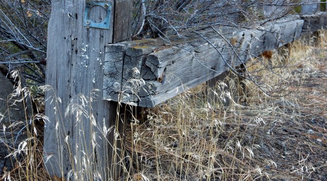
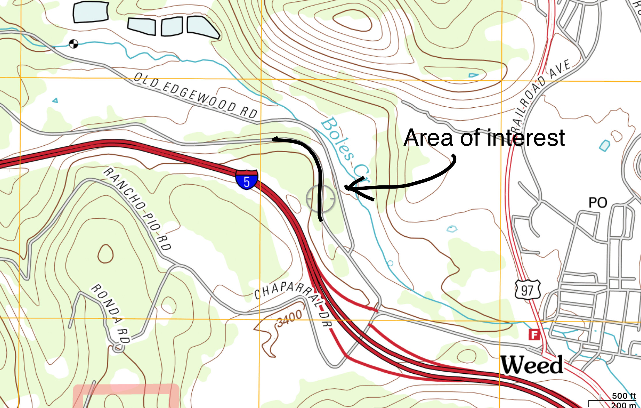
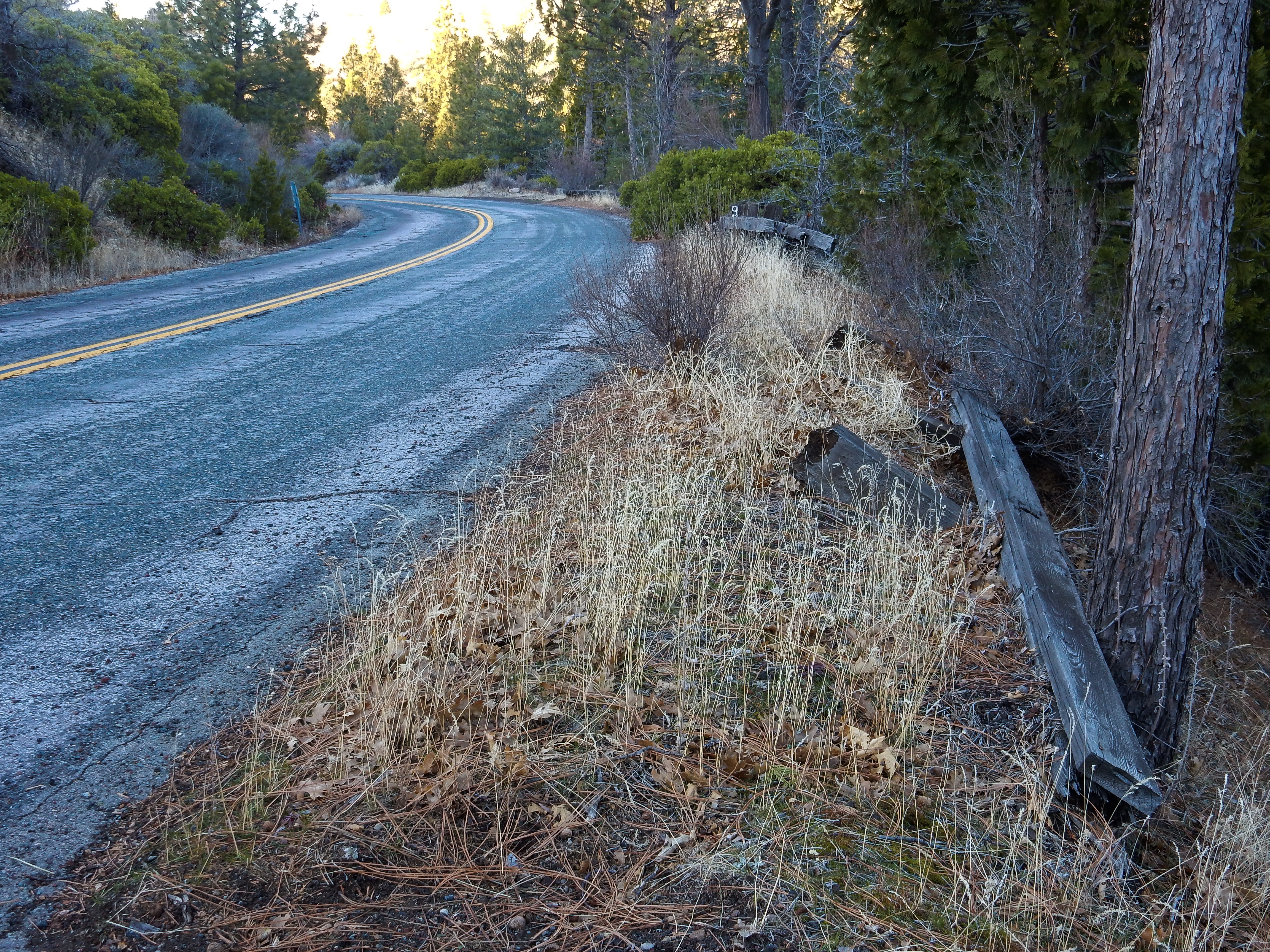
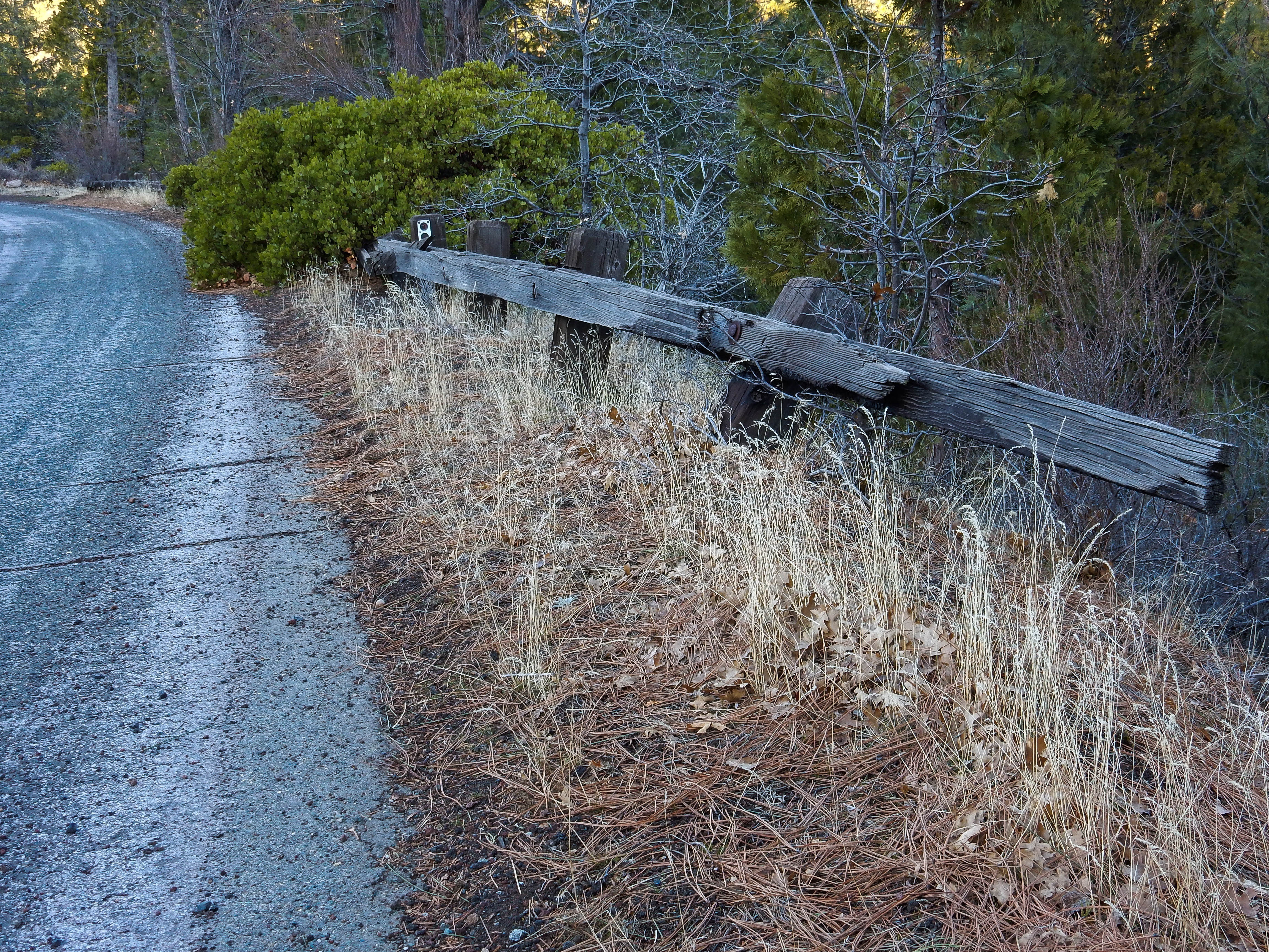
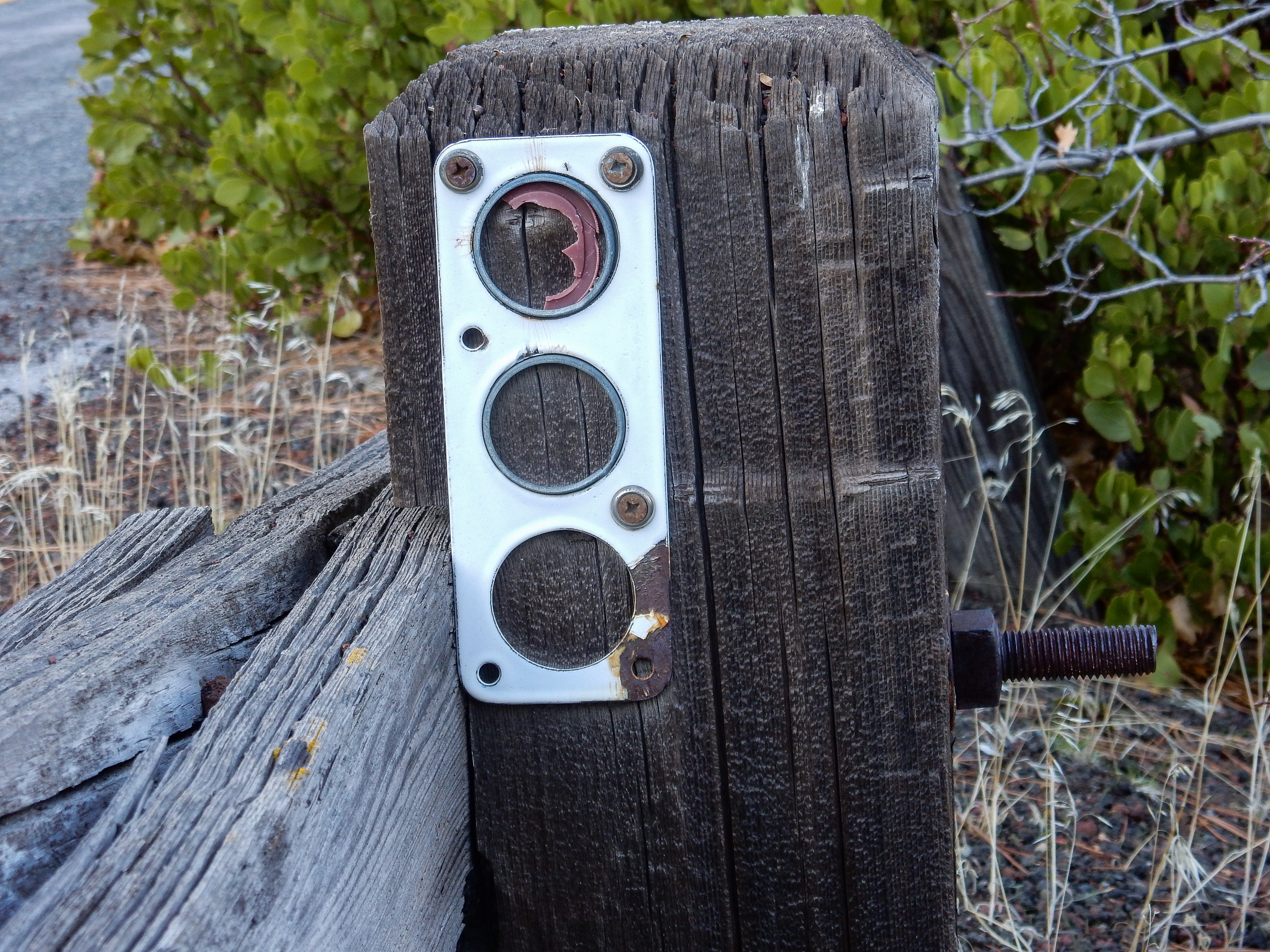
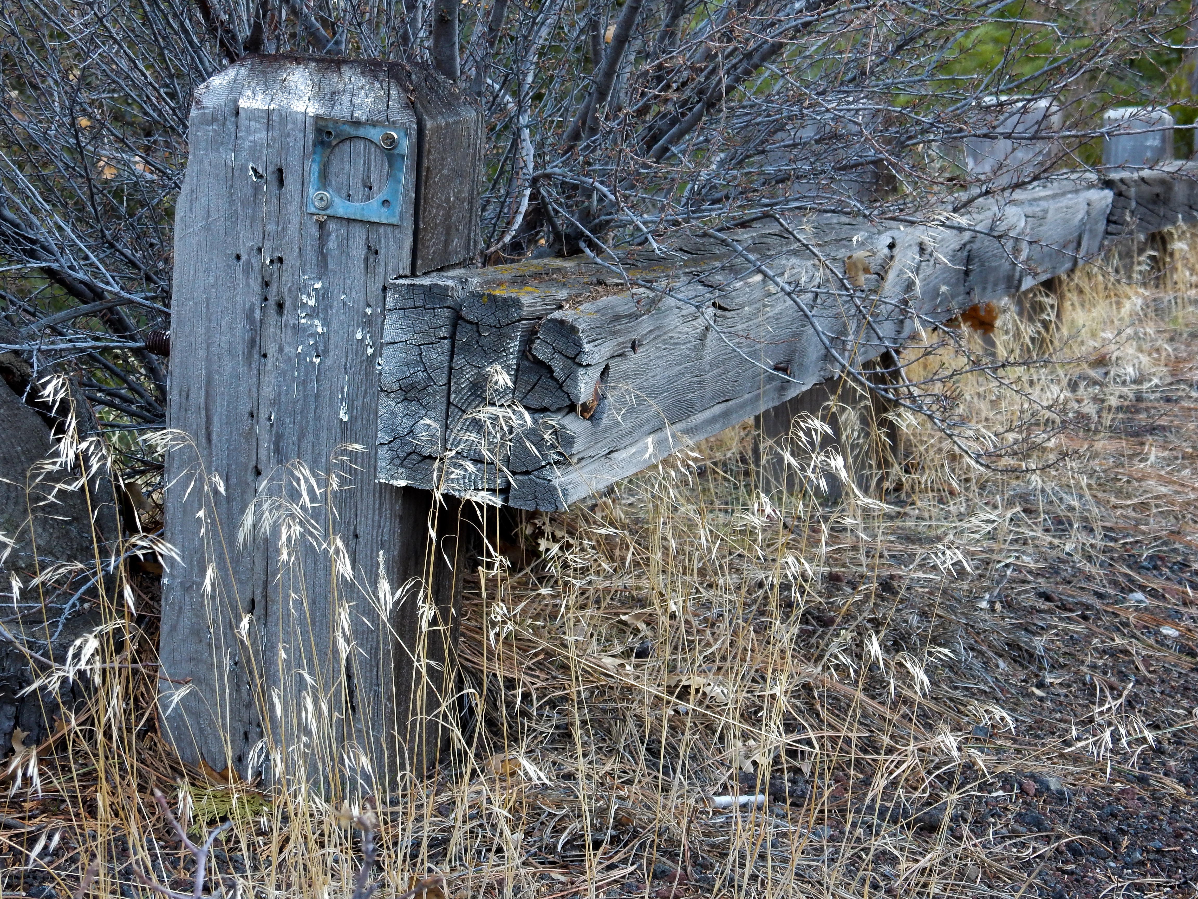
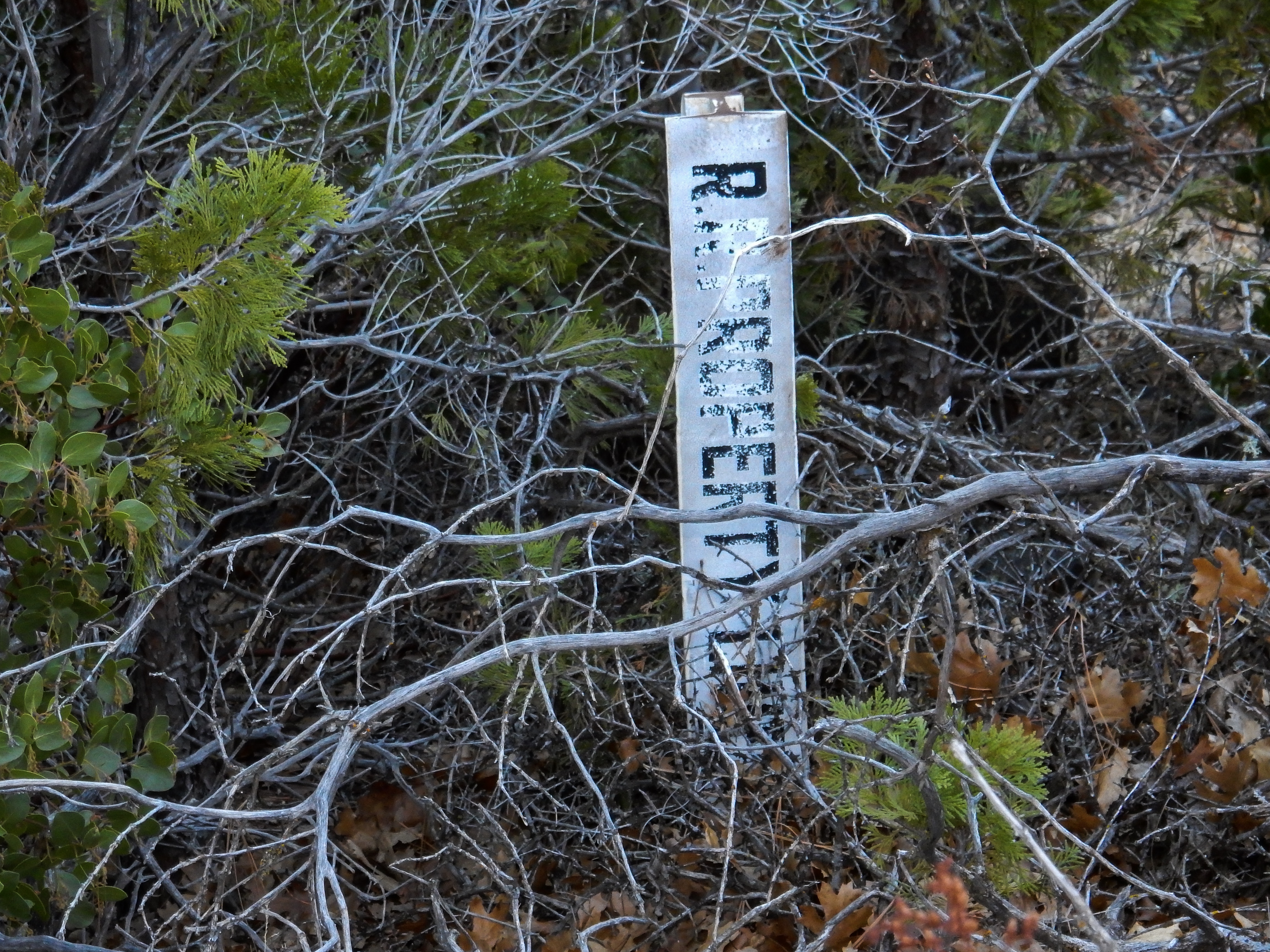
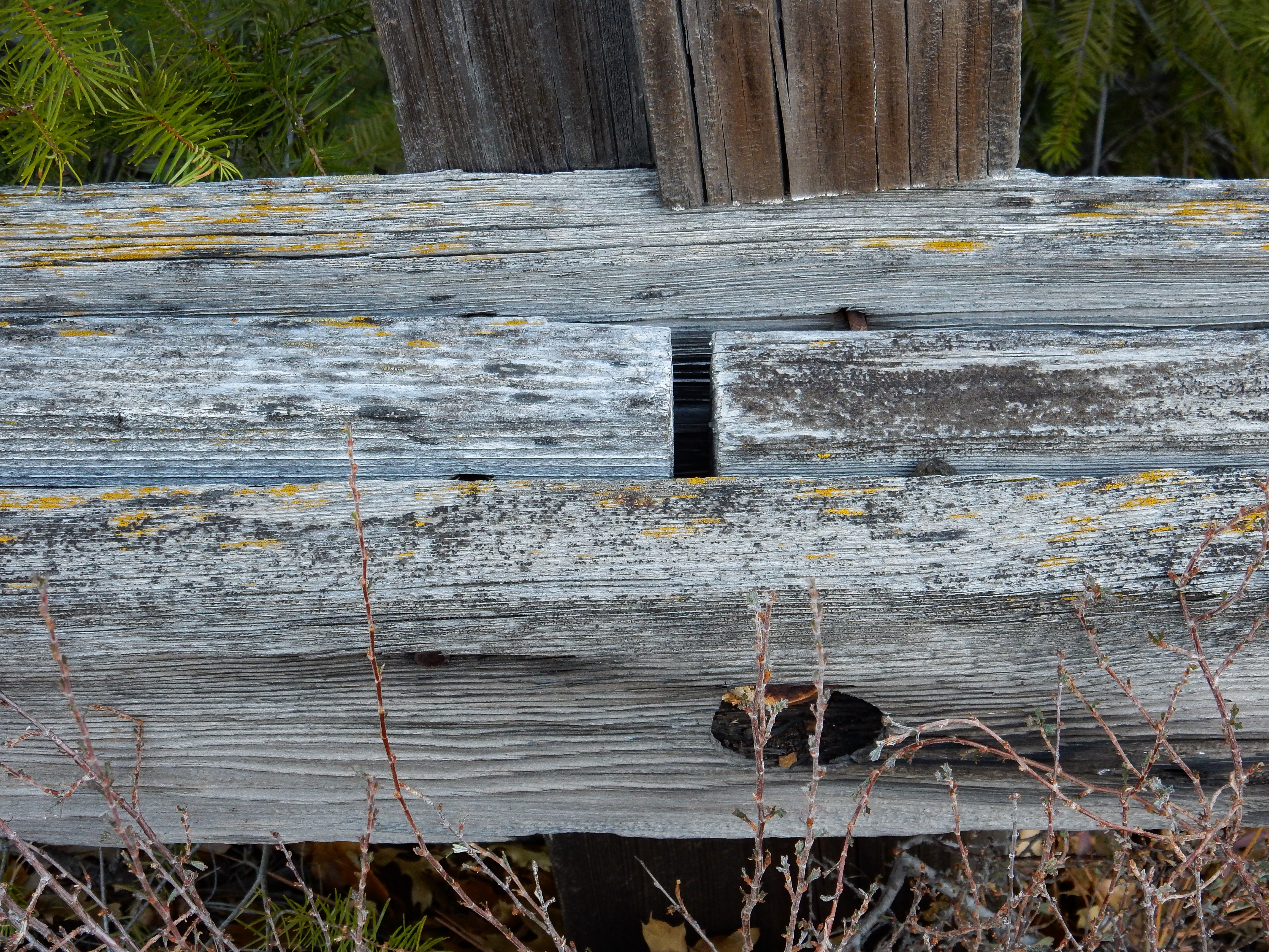
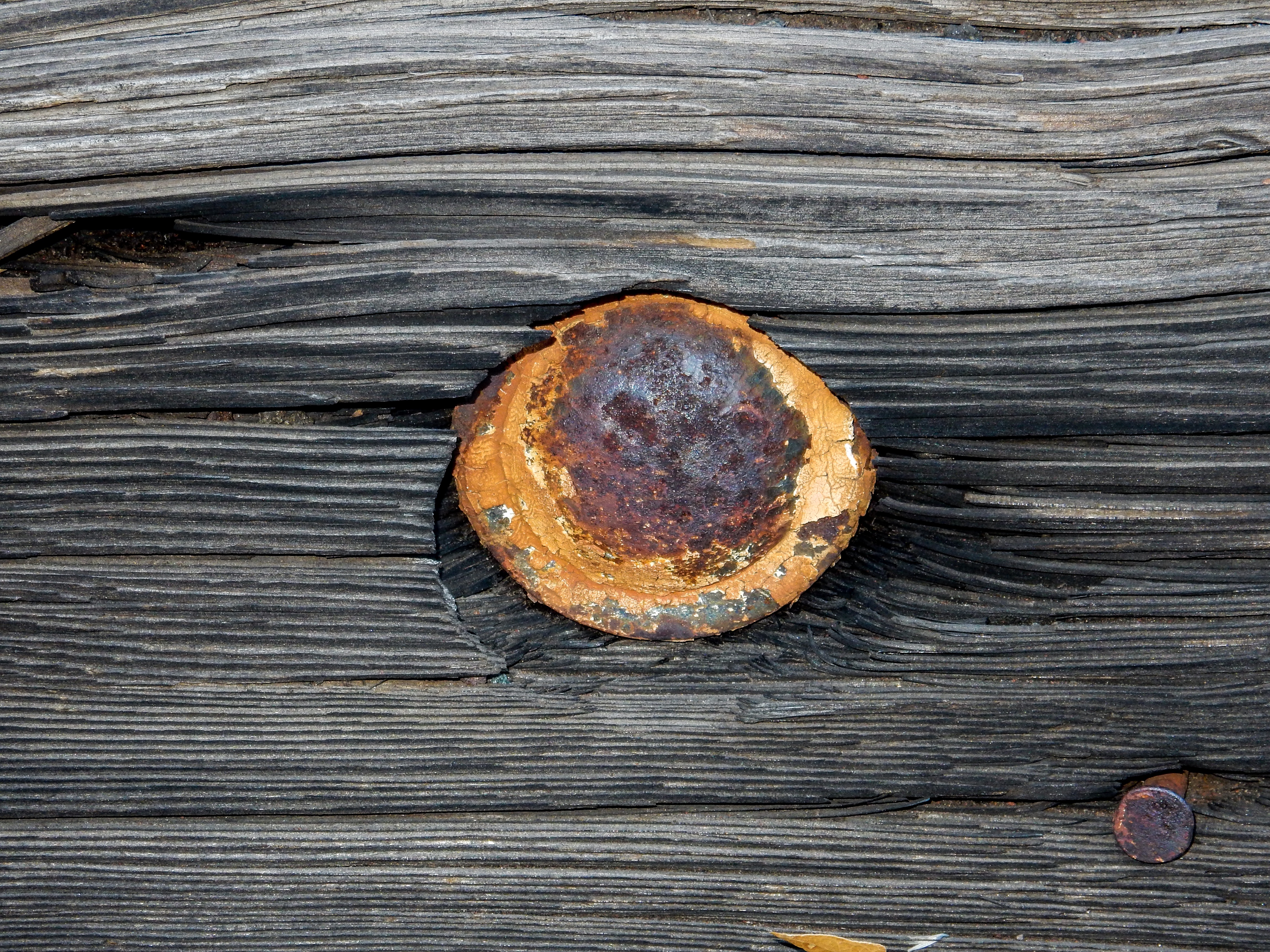
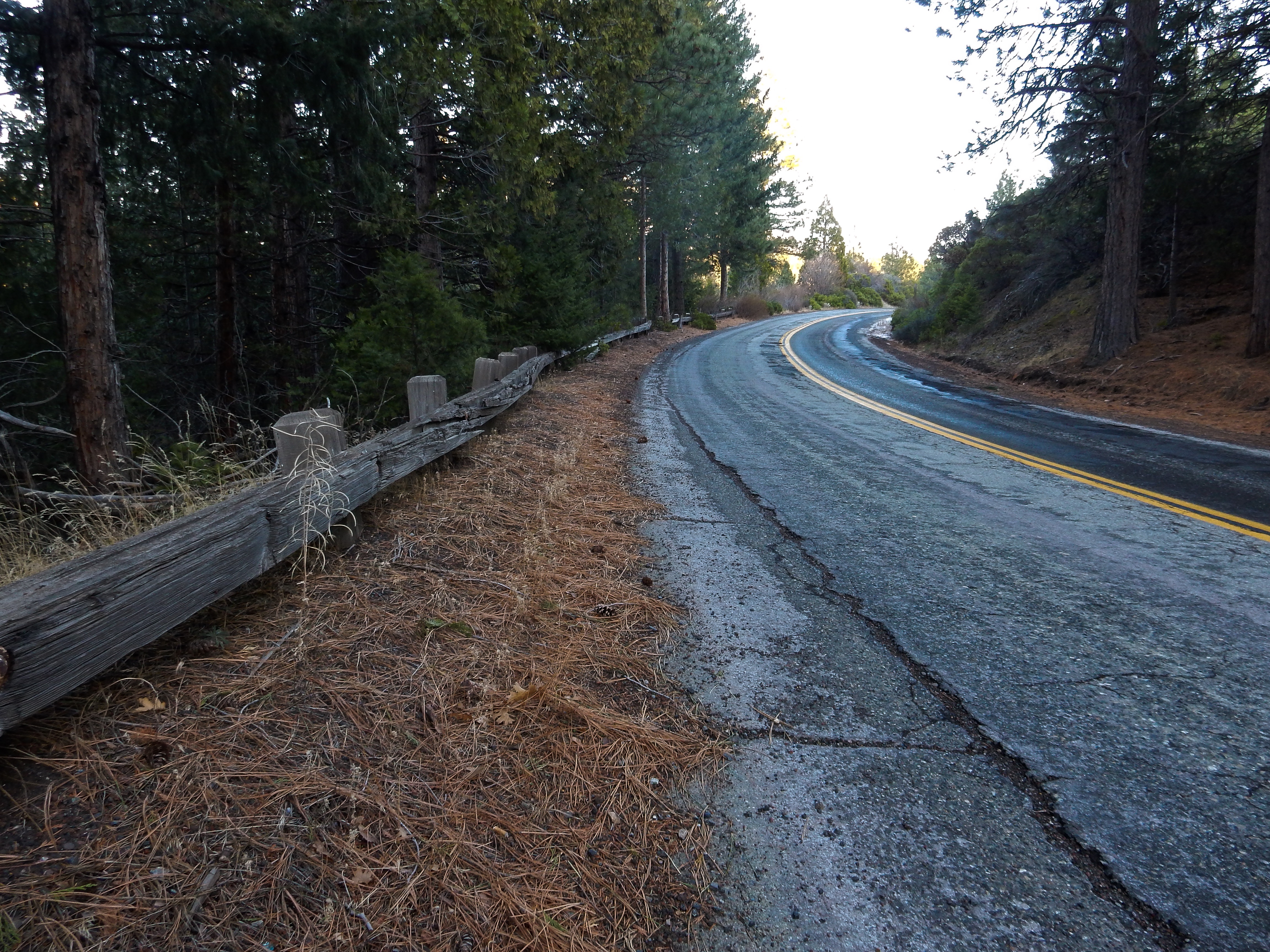
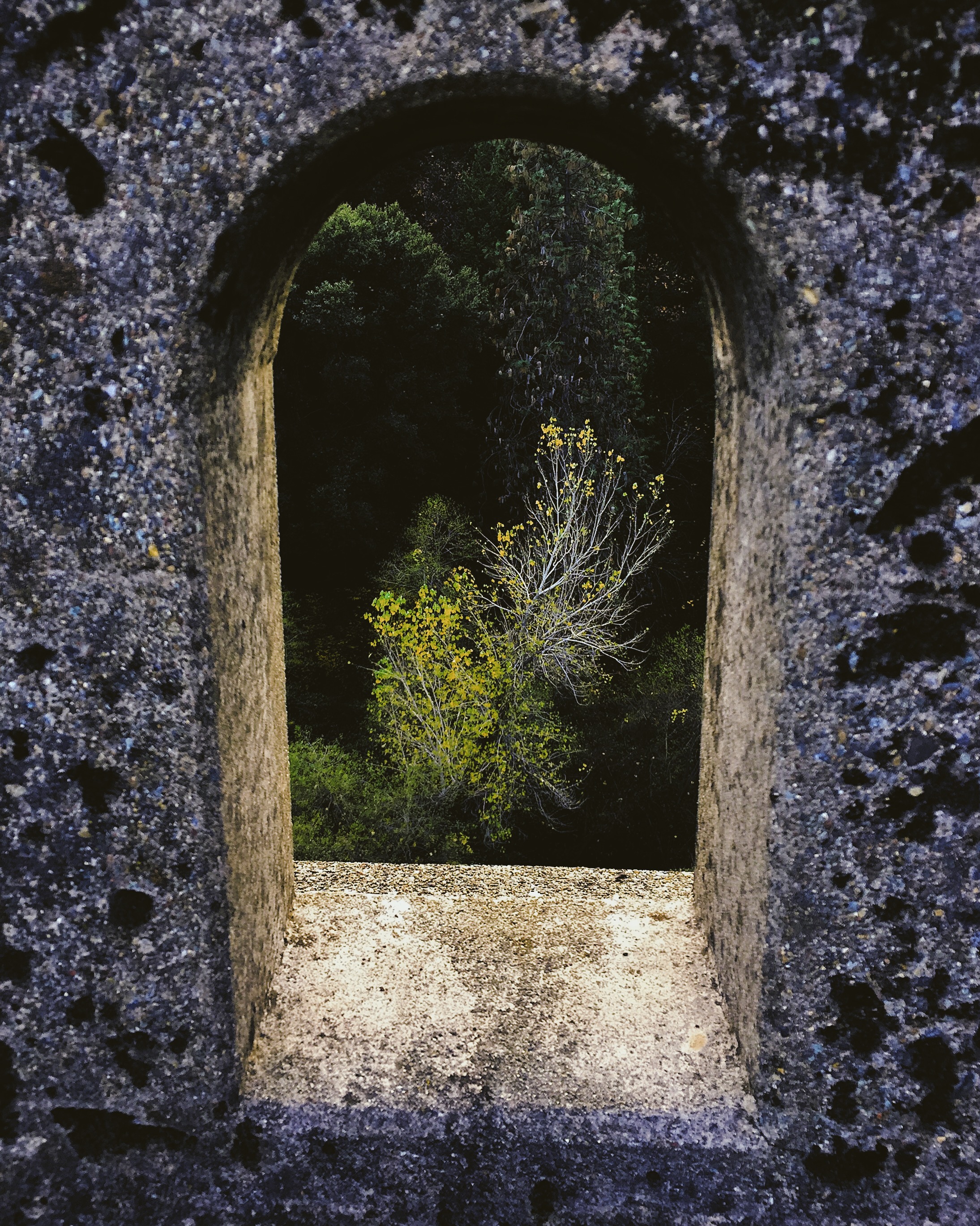
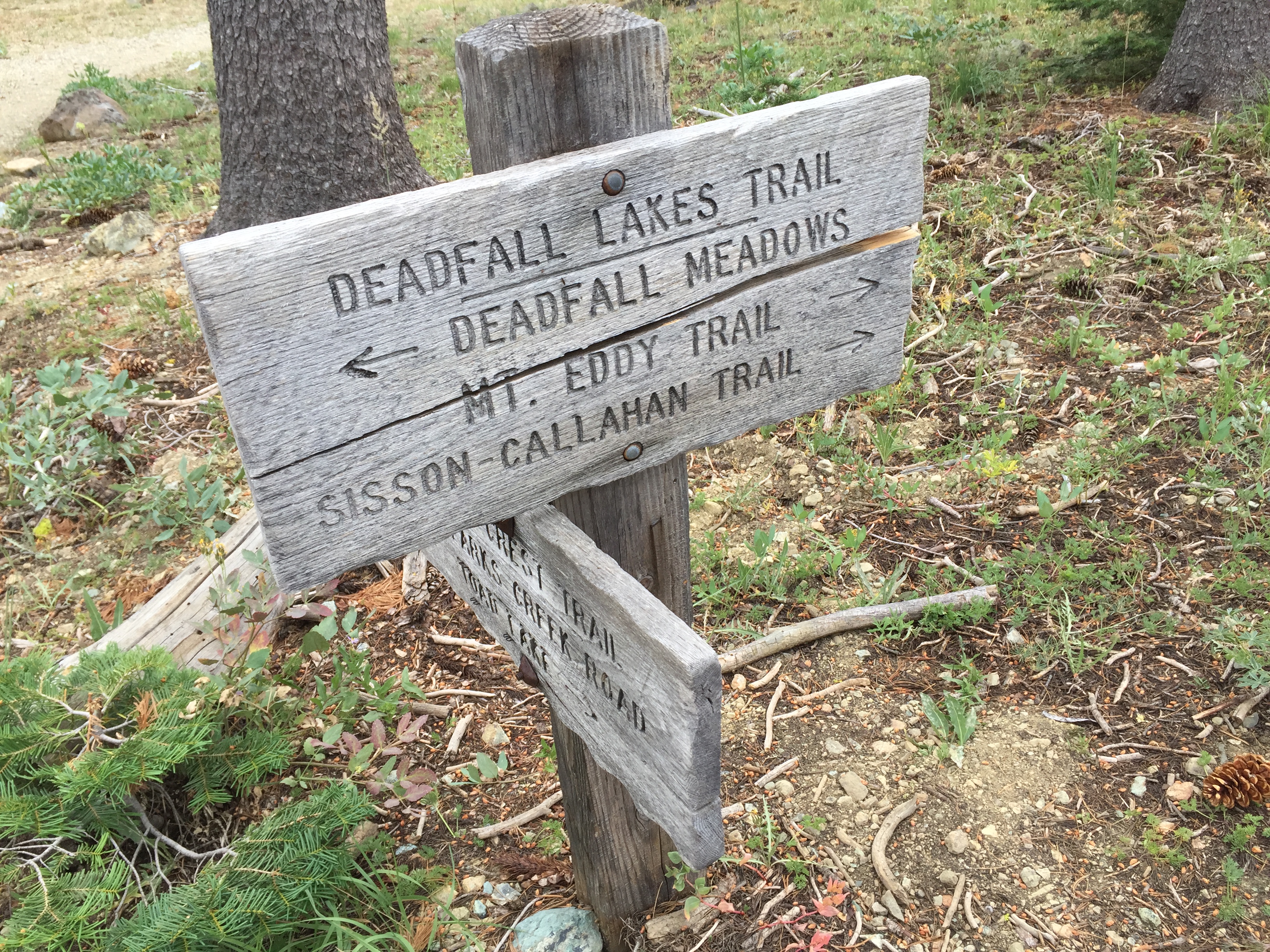
I spent an hour or so this afternoon exploring a small section of Edgewood Road going north out of Weed. This used to be US Route 99, before Interstate 5 was built and replaced Highway 99. I concentrated my efforts on one curved section of the road, examining old wooden guard rails, and looking for “C-blocks”, which are old California Division of Highways survey monuments. I did not find any, but I’ll return and spend a little more time in the brush looking for any that might exist.
The general location of my efforts was 41.43049, -122.39933


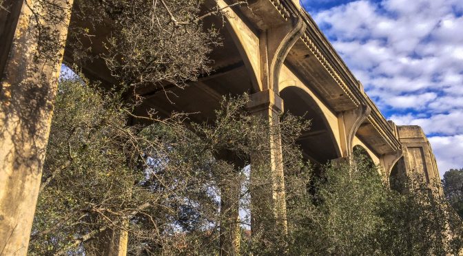
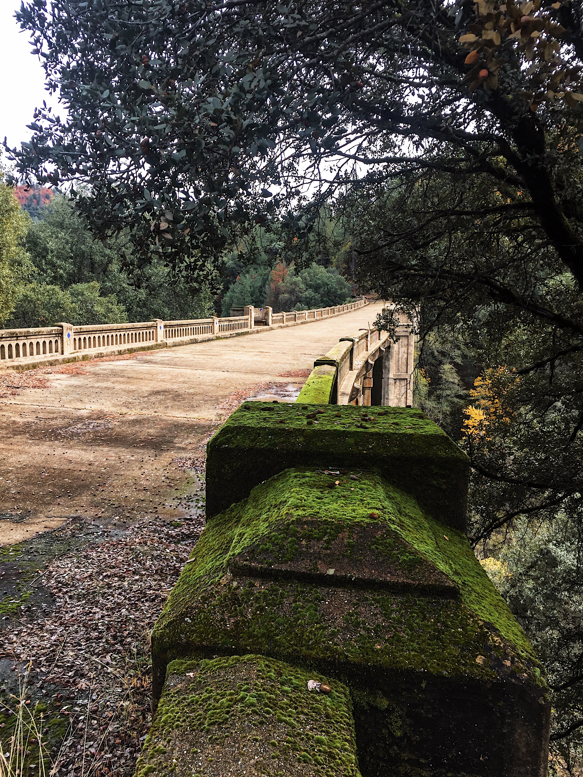
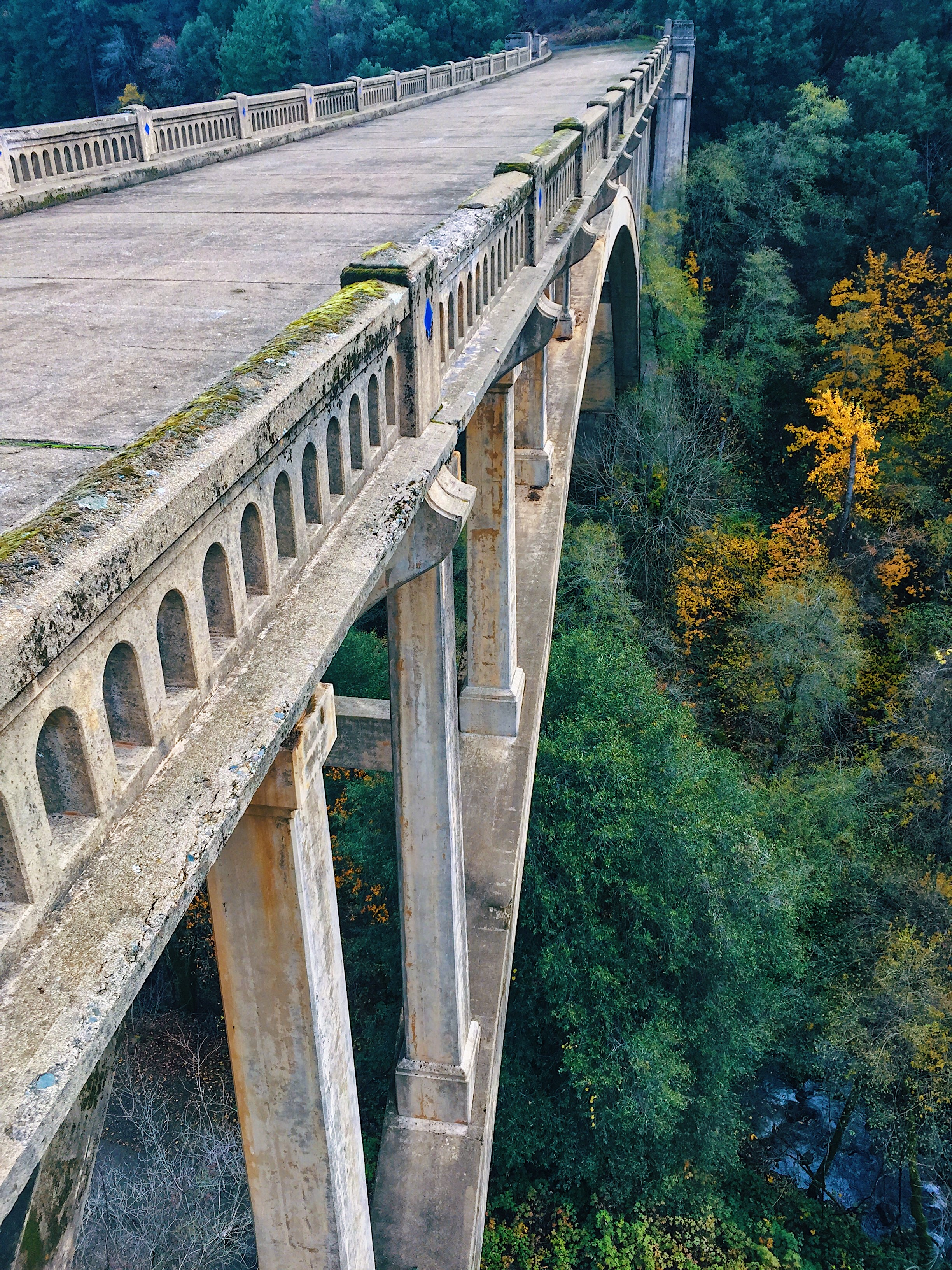
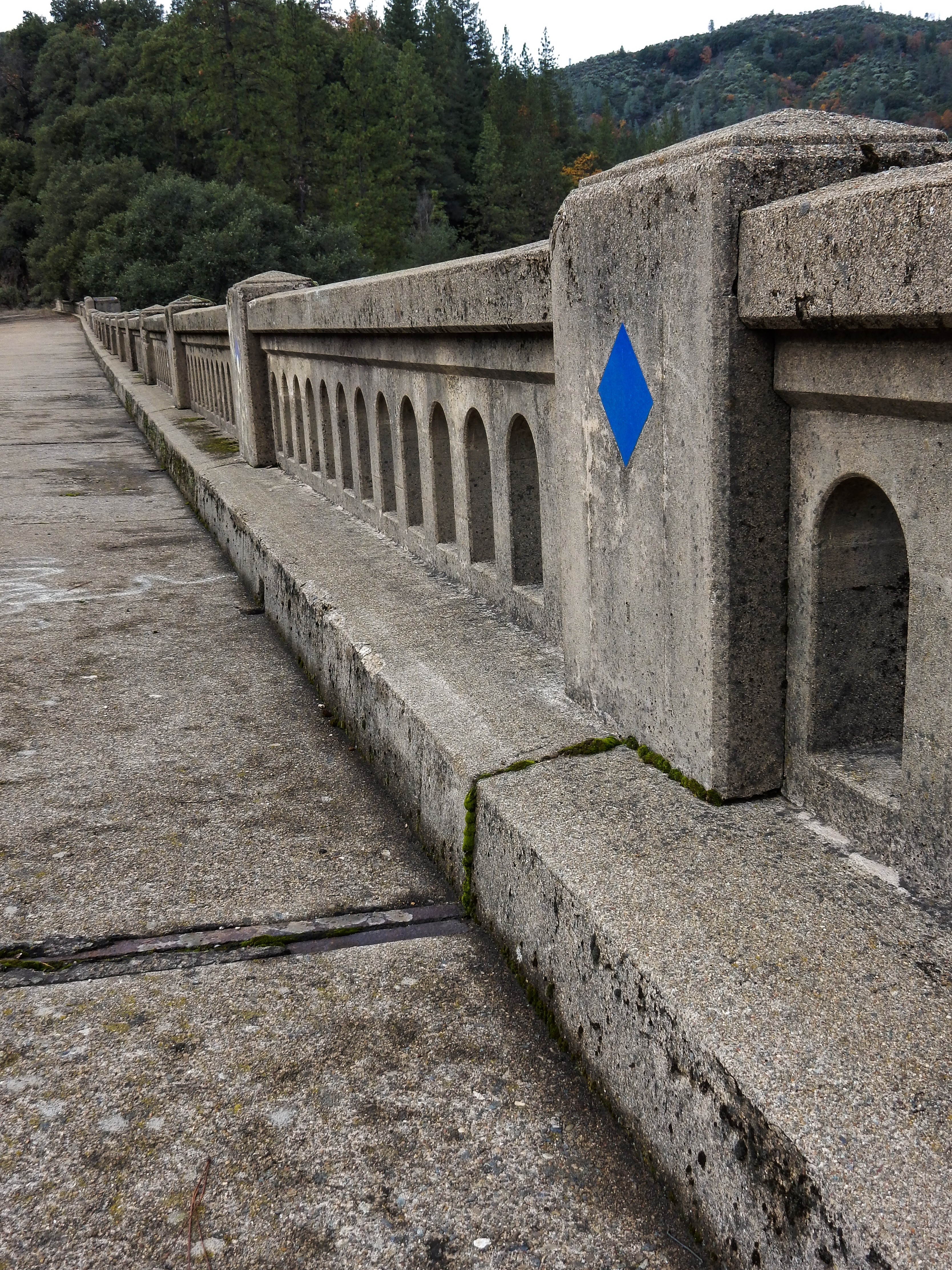
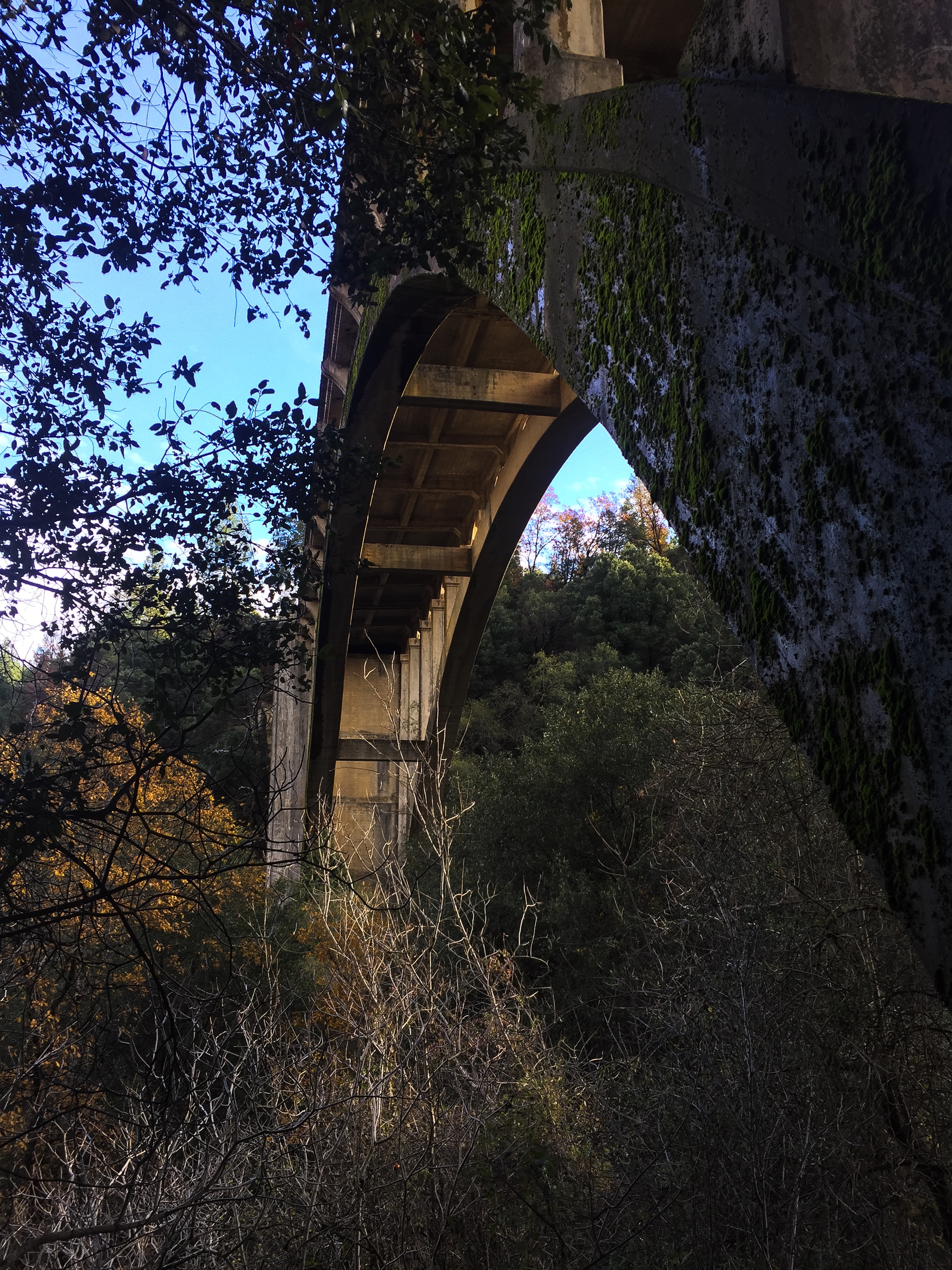
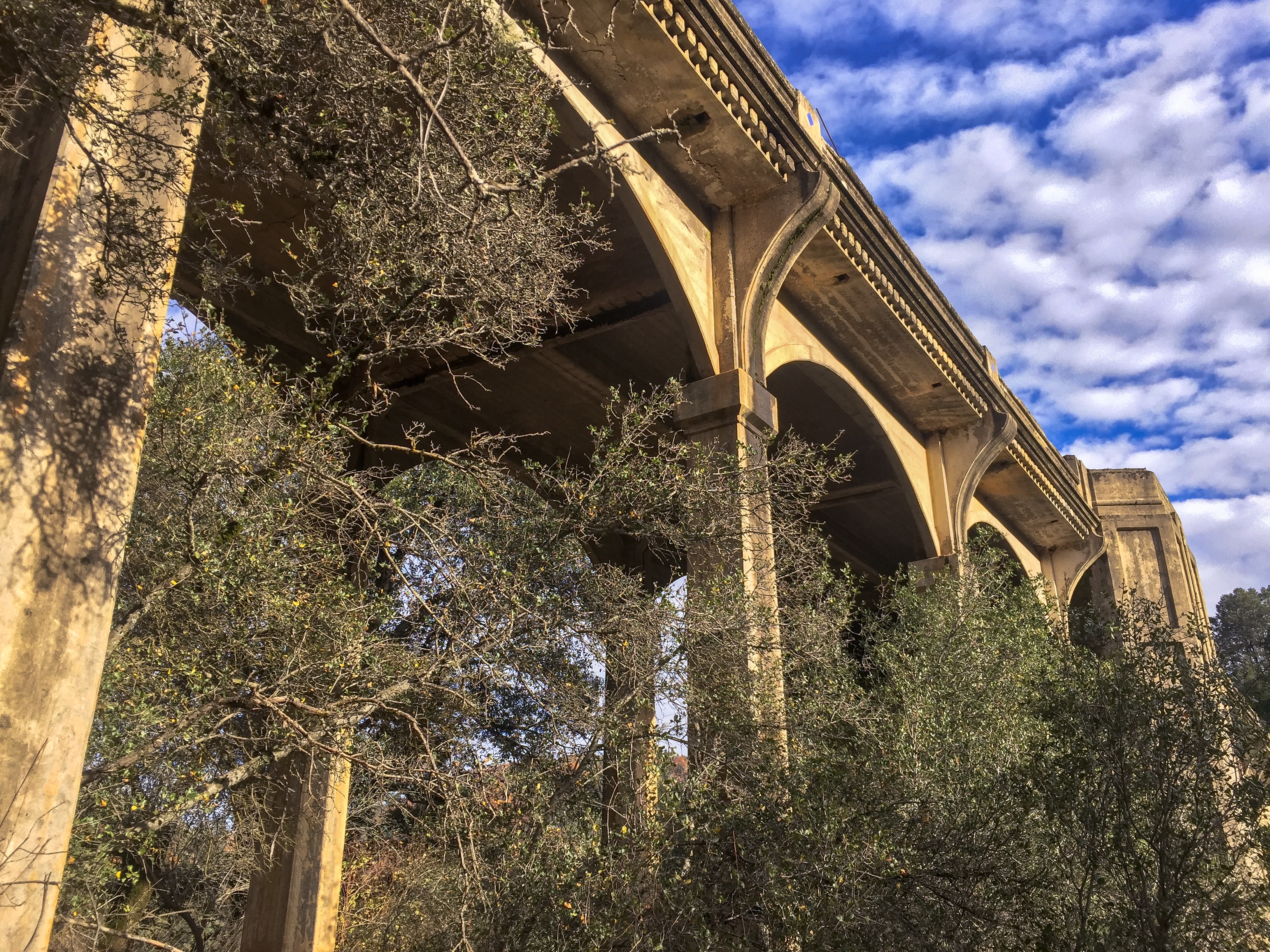
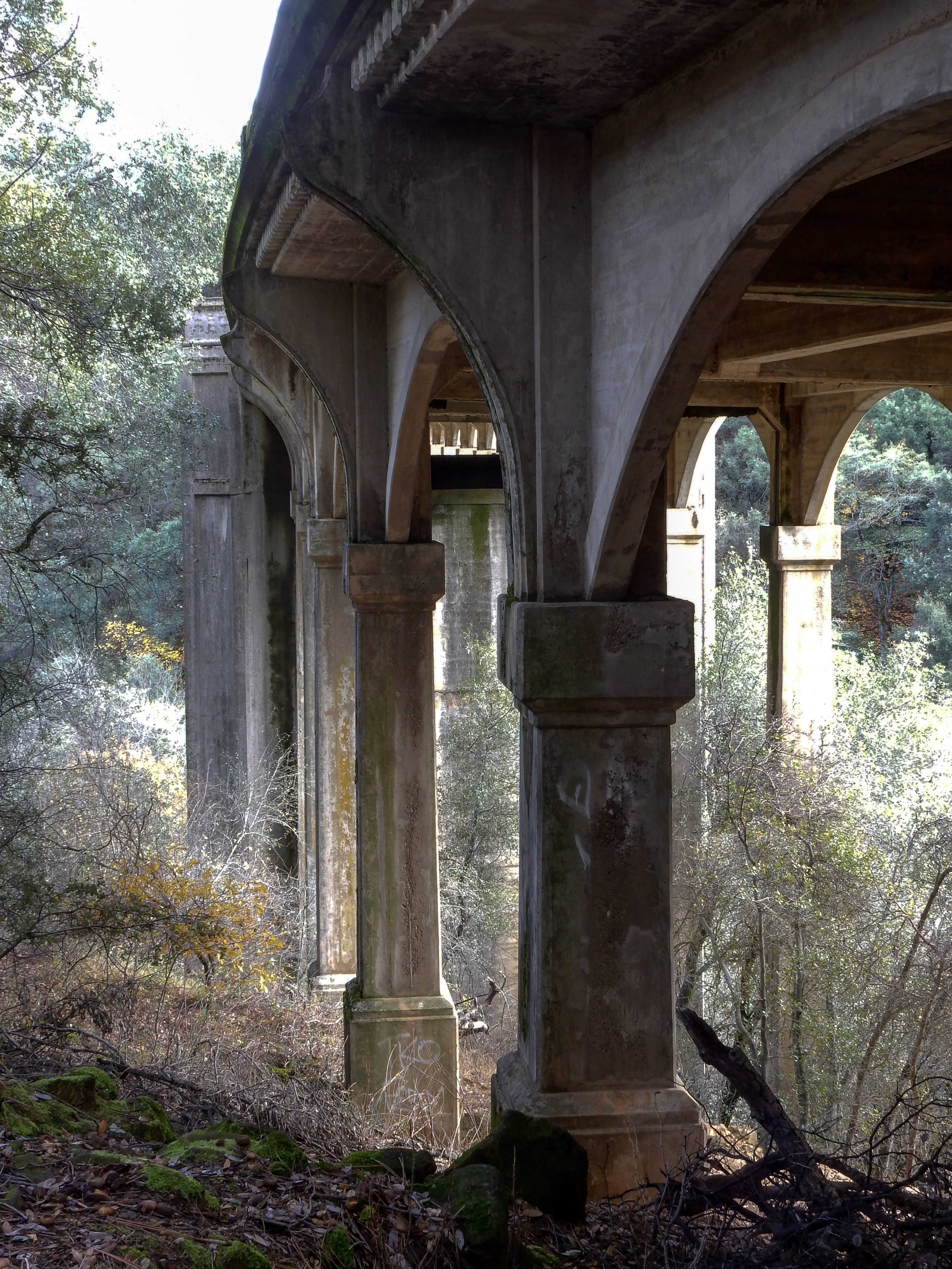
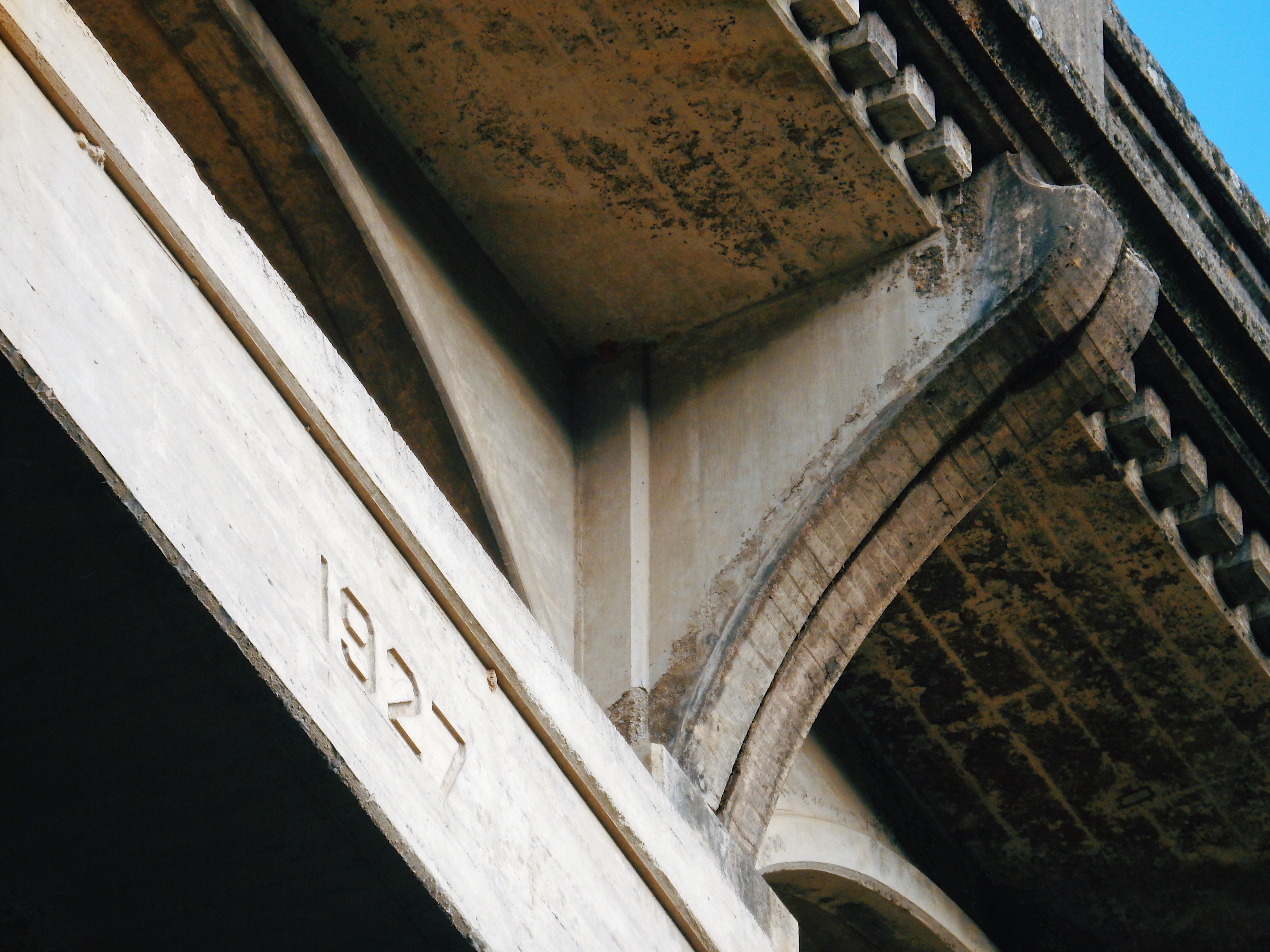
The Harlan D Miller Memorial Bridge, known also as the Dog Creek Bridge, is an abandoned concrete arch bridge completed in 1927 as part of US Route 99 just north of Lakehead, Shasta County, California. After Route 99 was replaced by Interstate 5, it carried traffic as part of Interstate 5 until a bridge to the northwest was expanded to accommodate both directions of traffic in 1974. It was abandoned and slated for demolition, until saved due to efforts of concerned citizens, and is now managed by the US Forest Service.
According to Bridgehunter.com,
Harlan D Miller (1880-1926) was the State Bridge Engineer for the California Highway Department from 1923 until his untimely death in 1926. During his short tenure as State Bridge Engineer he made radical changes to the way California designed bridges. These changes included requiring all highway bridges in the state be designed by the state and designing bridges that matched the geometry of the roadway. The latter often complicated design fork but the final result (skewed or curved bridges) justified the efforts in drivability.
Miller’s most visible effect on California bridges was the consideration given to design aesthetics. His designs were recognized in their own periods as possessing beauty and boldness. Many fine details can be seen on Miller designed bridges including rail and end post details, as well as clean lines and details of the superstructure design.
When my family relocated to the Bar Area in 1963, I remember driving across this bridge as we traveled to the Mount Shasta region to visit relatives several times per year. After the bridge was decommissioned, it had always been my desire to explore the now abandoned structure. I finally had a chance to do so this past week.
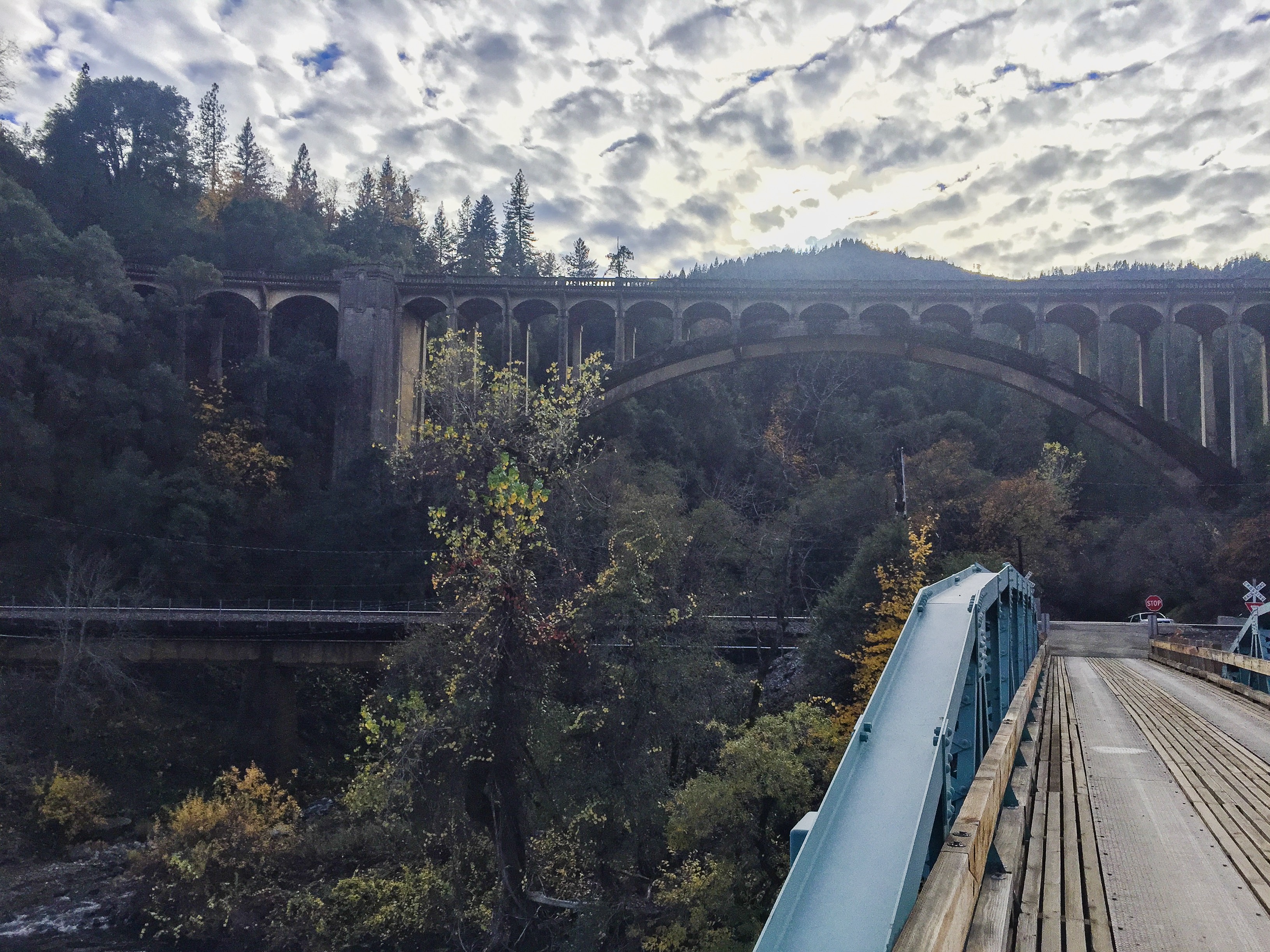
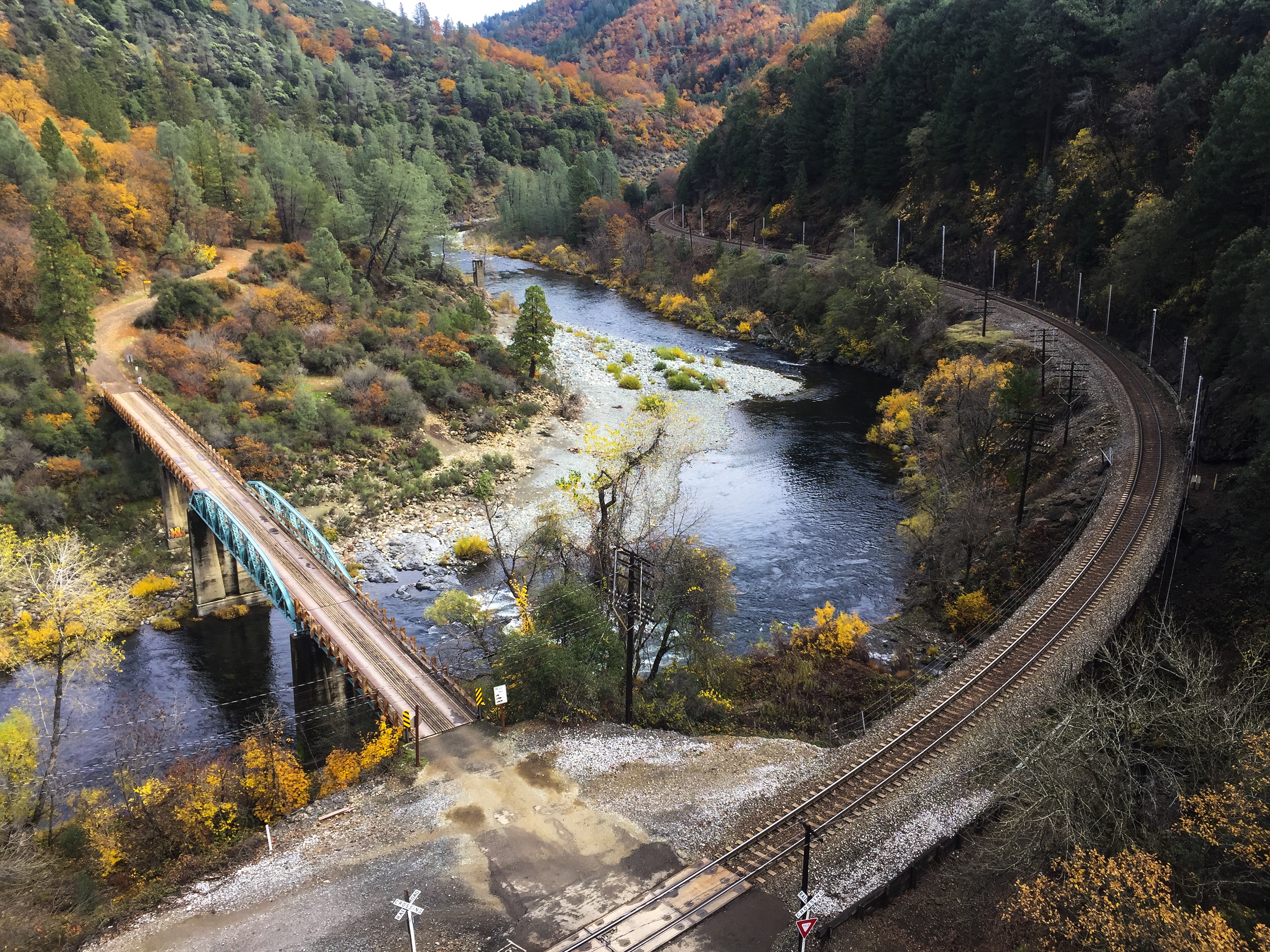
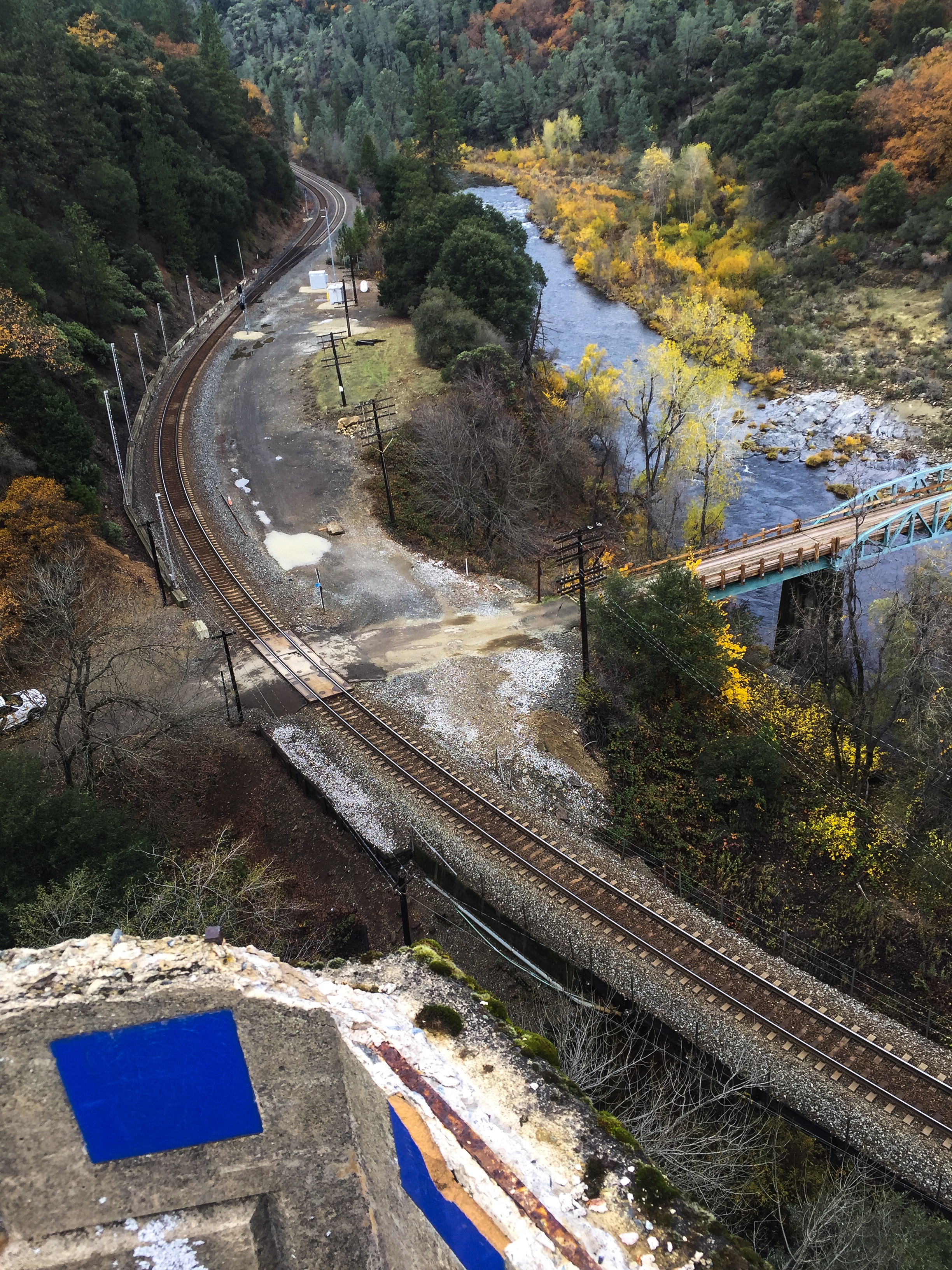
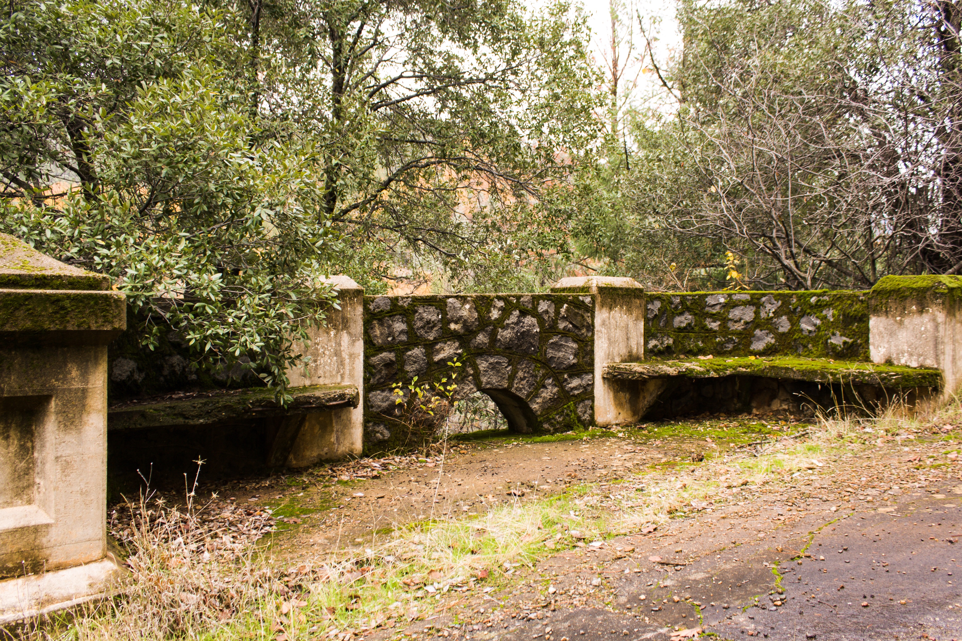

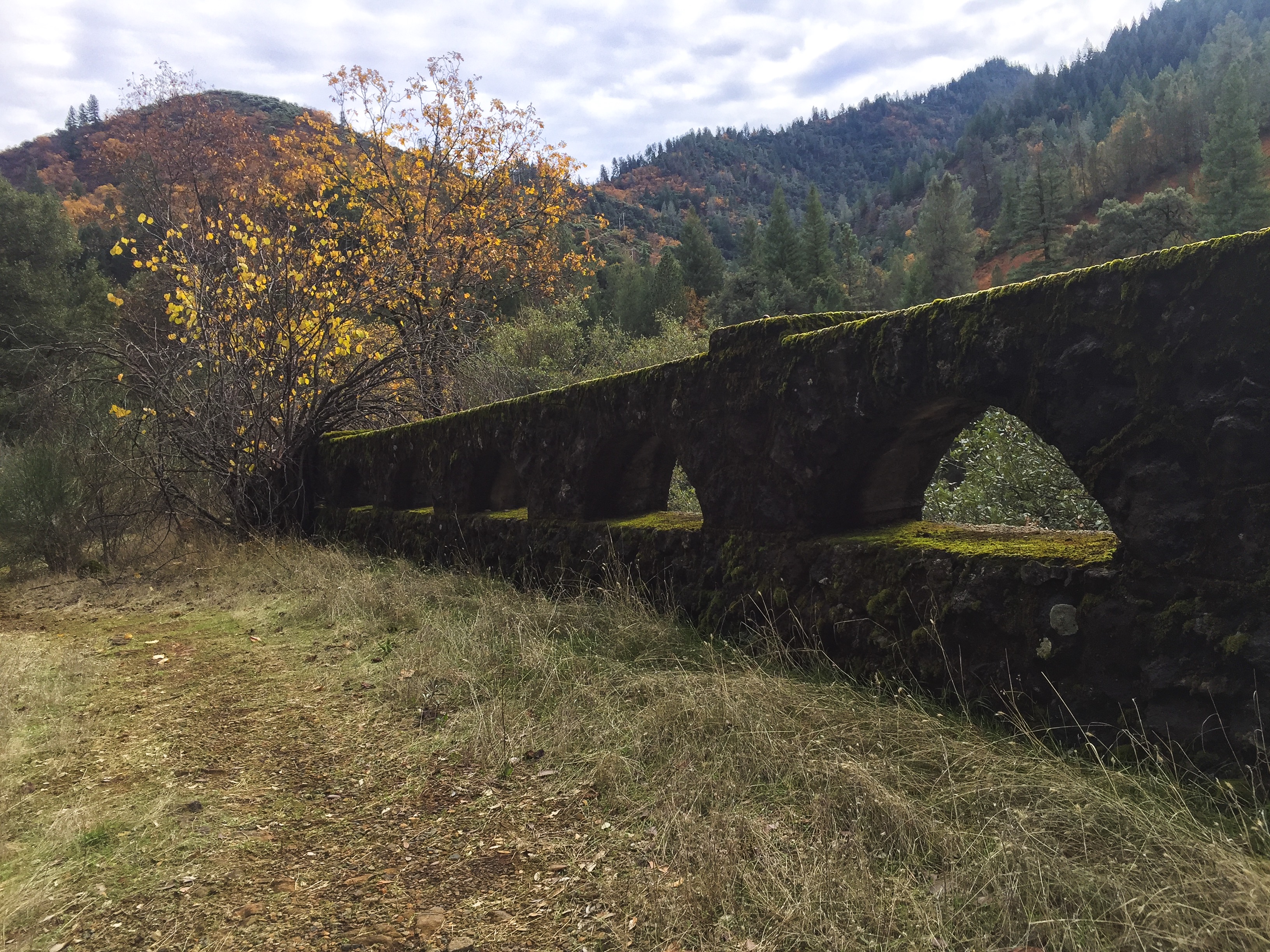
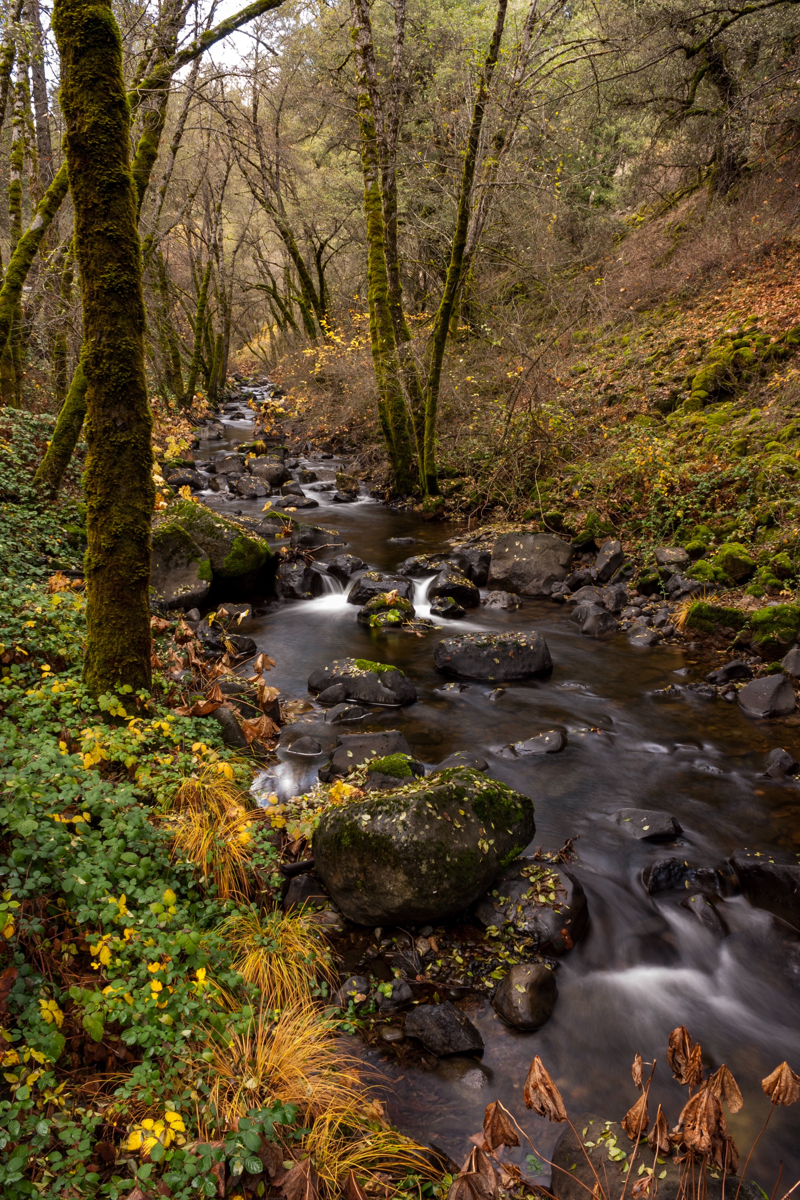
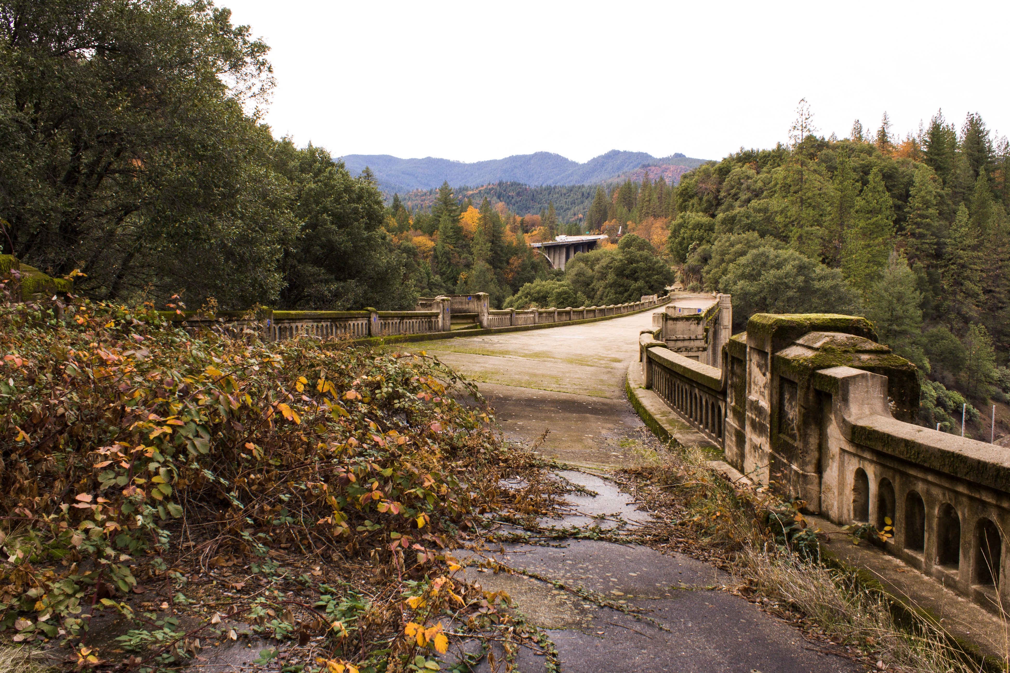
Off Interstate 5, take the Vollmers/Delta exit. Proceed west about a quarter mile and turning left onto Fenders Ferry Road. Drive down along the Dog Creek watershed for about a mile, crossing the creek twice and underneath the I5 span until reaching the historic bridge. Park just before the railroad tracks, and climb up the east side of northern end of the bridge.
According to a couple of other websites, there is supposedly access at the northern end of the bridge from the top, at end of a private road where a Forest Service begins. I checked it out and I’m not comfortable at this time on recommending its use. The adjoining property owners have posted a lot of onerous signage, and have tried to unsuccessfully block the easement. I would be nervous parking my vehicle here. Check this post for updates, as I will attempt to get clarification from the Forest Service regarding use of this easement.
redding.com (Redding Searchlight newspaper website) article Travelin’ in Time: Dog Creek Bridge, a work of art, was almost demolished, posted June 26, 2008
CalTrans Digital Collections, Historic Bridges and Tunnels: Dog Creek

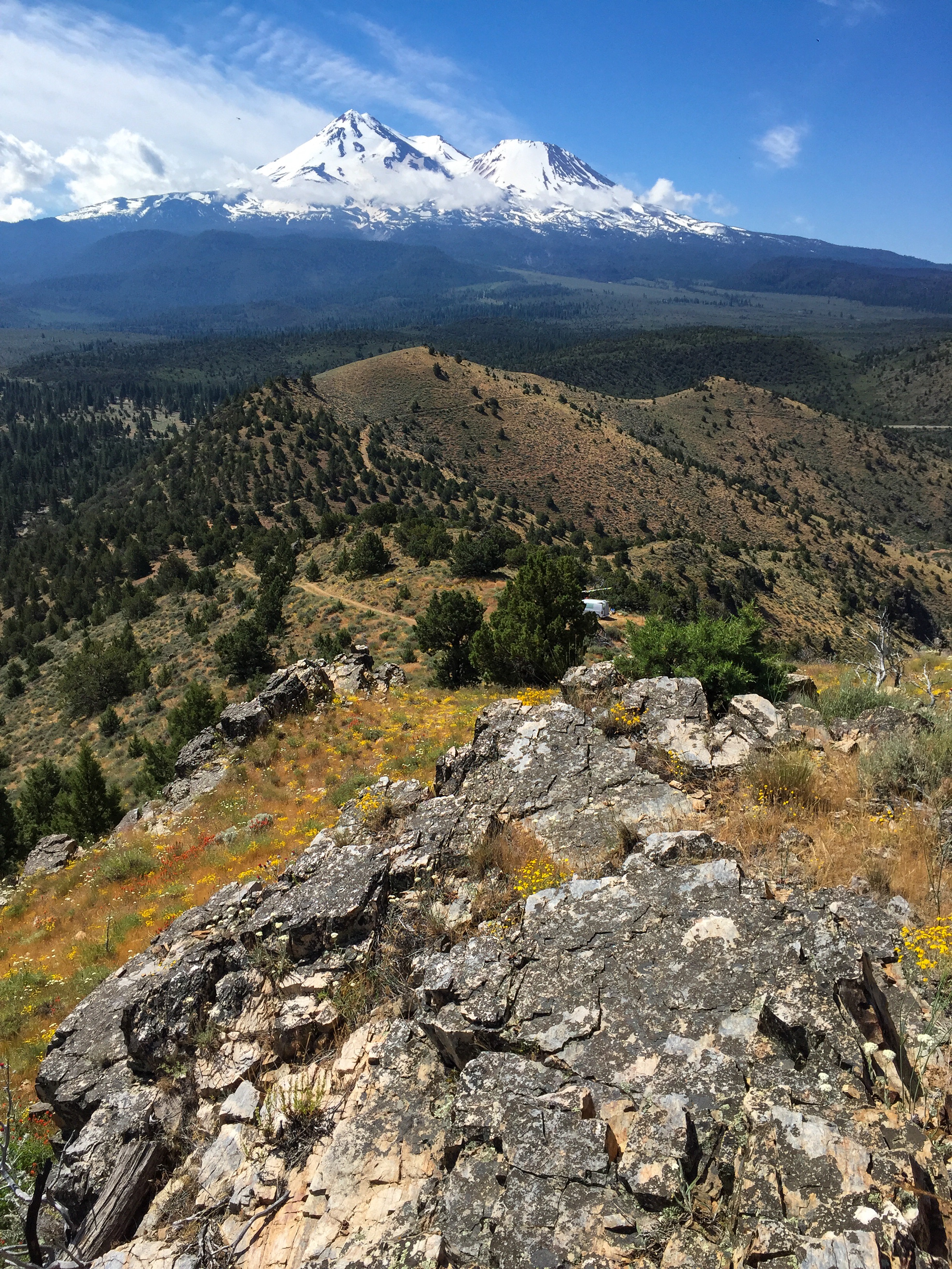
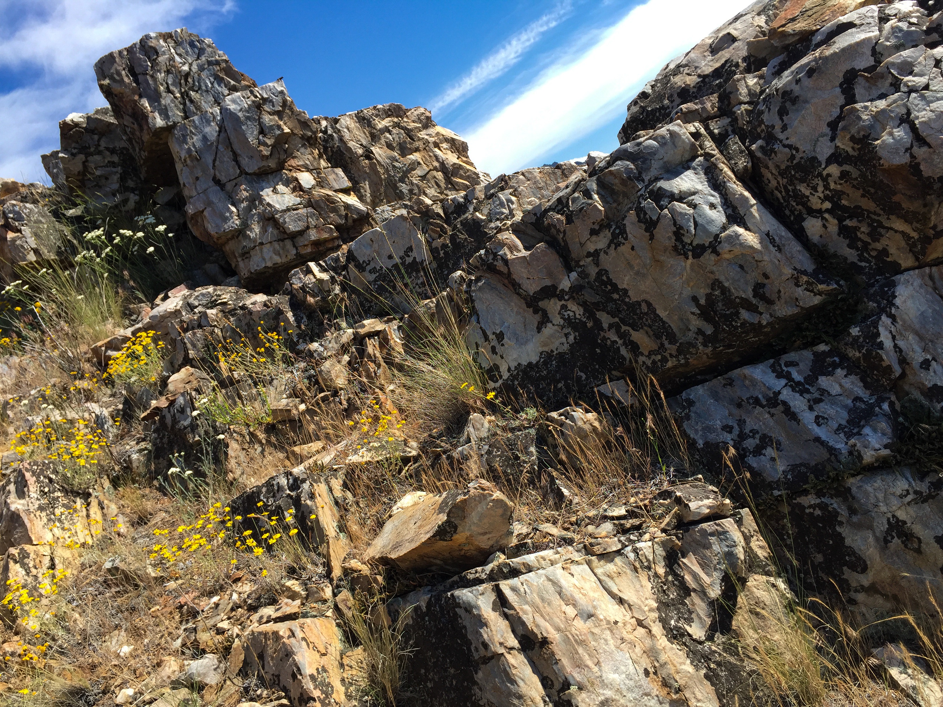
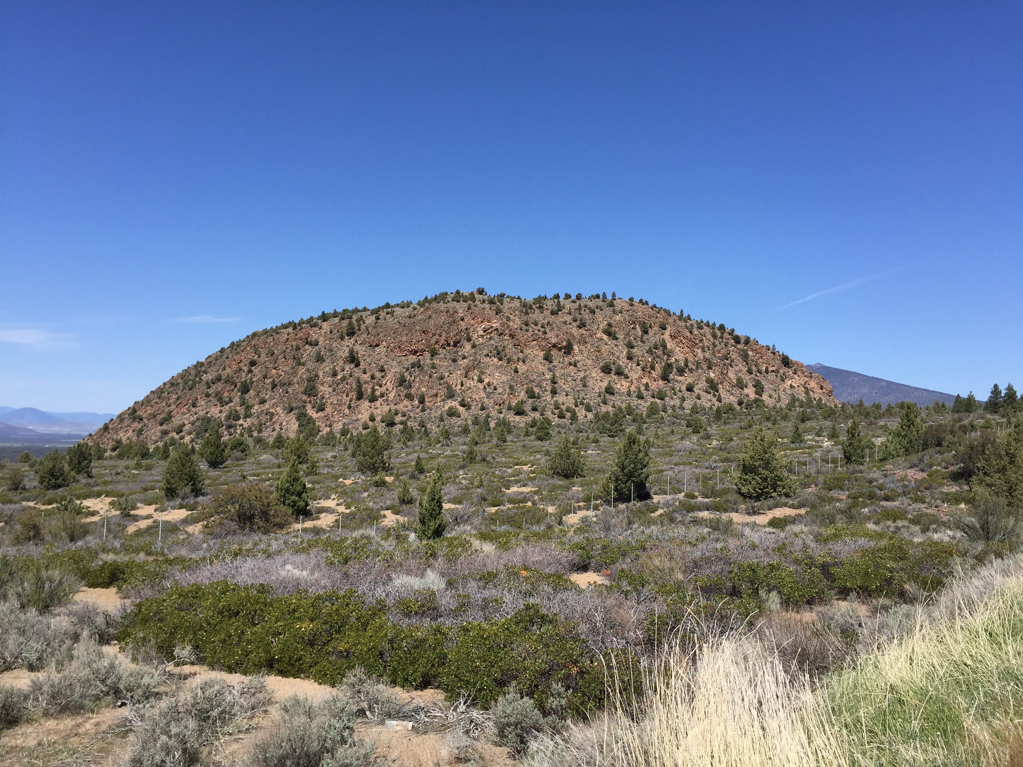
Yellow Butte is a hill on the north side of US Highway 97 about 12 miles northeast of Weed. Unlike other nearby peaks which are some kind of volcanic feature (dome, cinder cone or shield volcano), Yellow Butte is an uplifted complex of intrusive igneous and metamorphic rocks. This makes for some interesting quartzite outcrops on the top of the hill, and the unexpected diorite pluton along the first third of this route I hiked today.
Yellow Butte is actually more of a ridge, with three distinct peaks, the northernmost being the highest. The route I’ve seen described elsewhere is a 3 mile round trip starting inside a Forest Service gate alongside Highway 97 that traverses the west side of the hill. Because my available time was short, I chose a shorter route on the east side of the hill on Yellow Butte Road, a narrow, dusty two-track off of 97. This route proceeds up to saddle area between the middle and north peaks. Truth be told, both routes to the peak are old two tracks themselves – in fact, one could drive to the summit in a 4WD high clearance vehicle. But, as I got near the top, I encountered a guy camping in a beat-up, 30 year old, 2WD, low clearance Chevy van at the top – so don’t I guess I don’t know what I’m talking about.


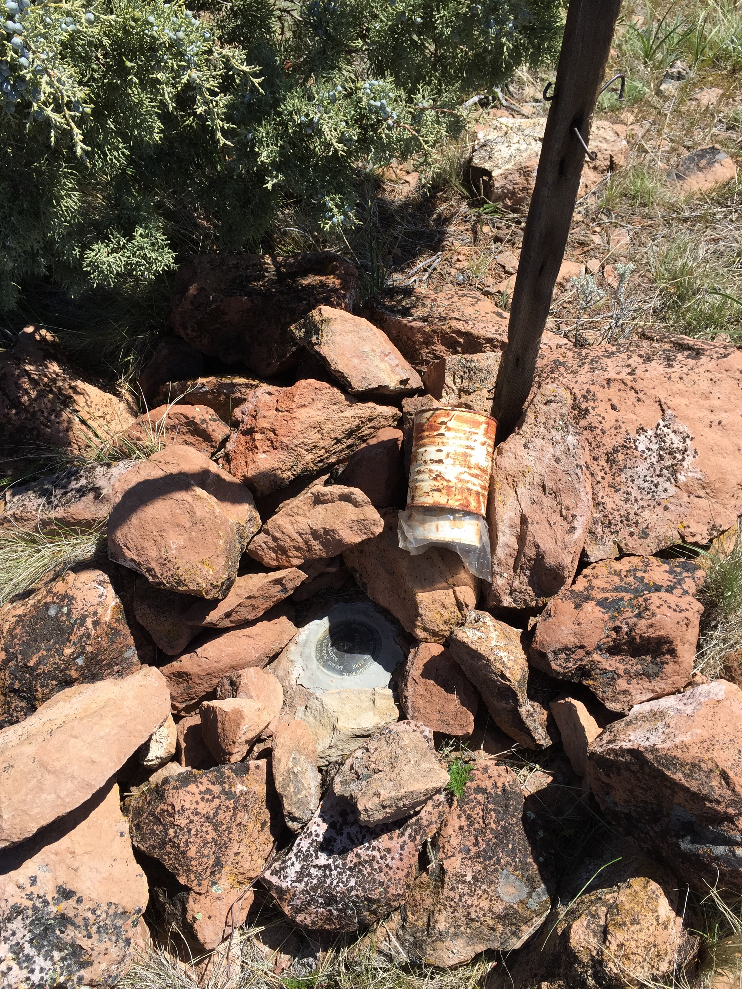
I could not locate a survey triangulation mark indicated on some older topo maps. Neither could I find a summit log, so I left a new one behind.
Trip time is about 25 to 30 minutes each way.
For an excellent discussion of the geology of the lower Shasta Valley, see a masters thesis by Joseph Holliday, “The bedrock geology of the southeastern Shasta Valley, Siskiyou County, California”
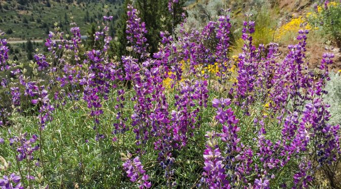
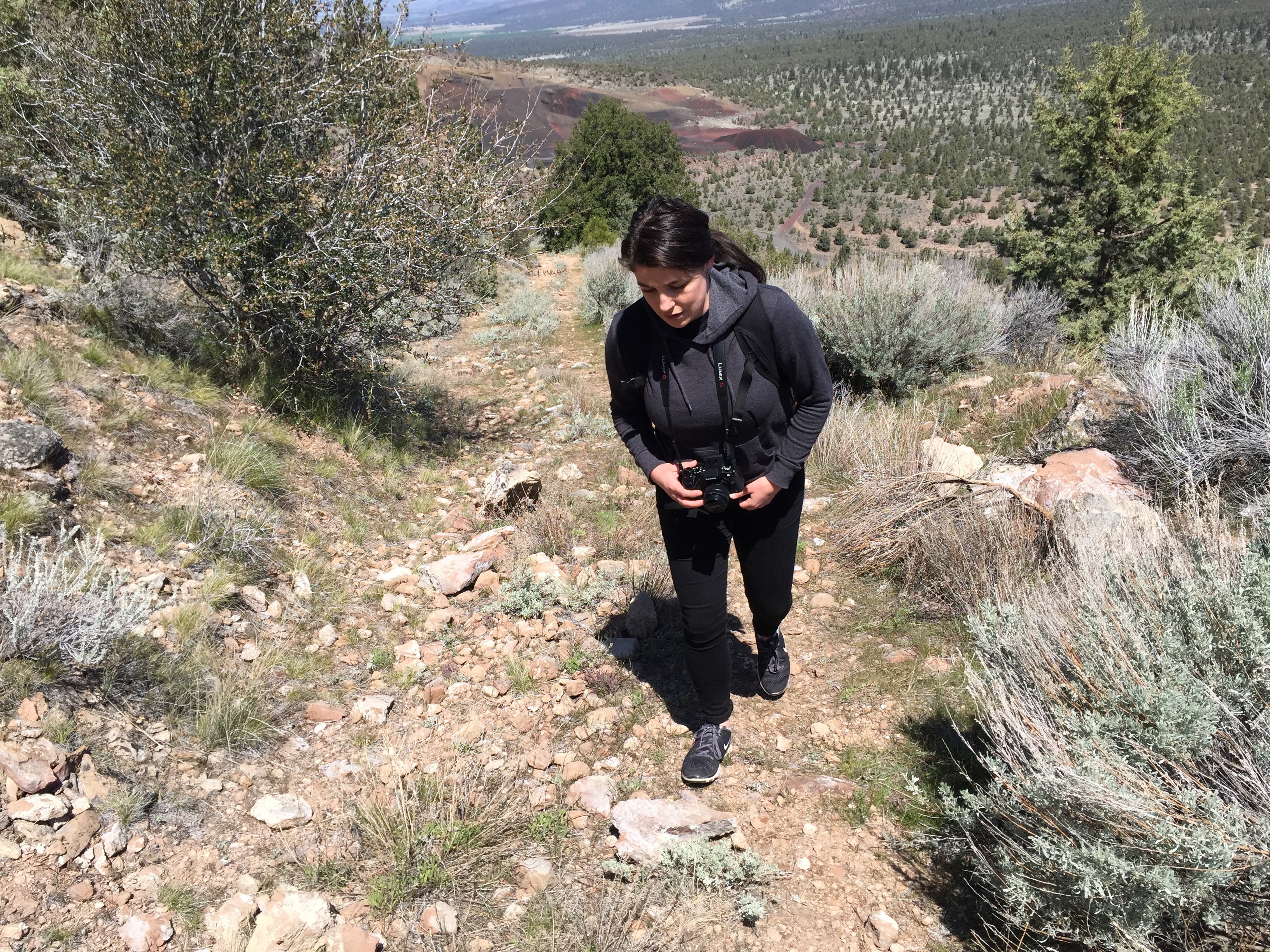
Photos from a hike this past Memorial Day on Haystack, a volcanic dome north of Mount Shasta (see the previous post “Haystack” for a brief description of the Haystack hike).

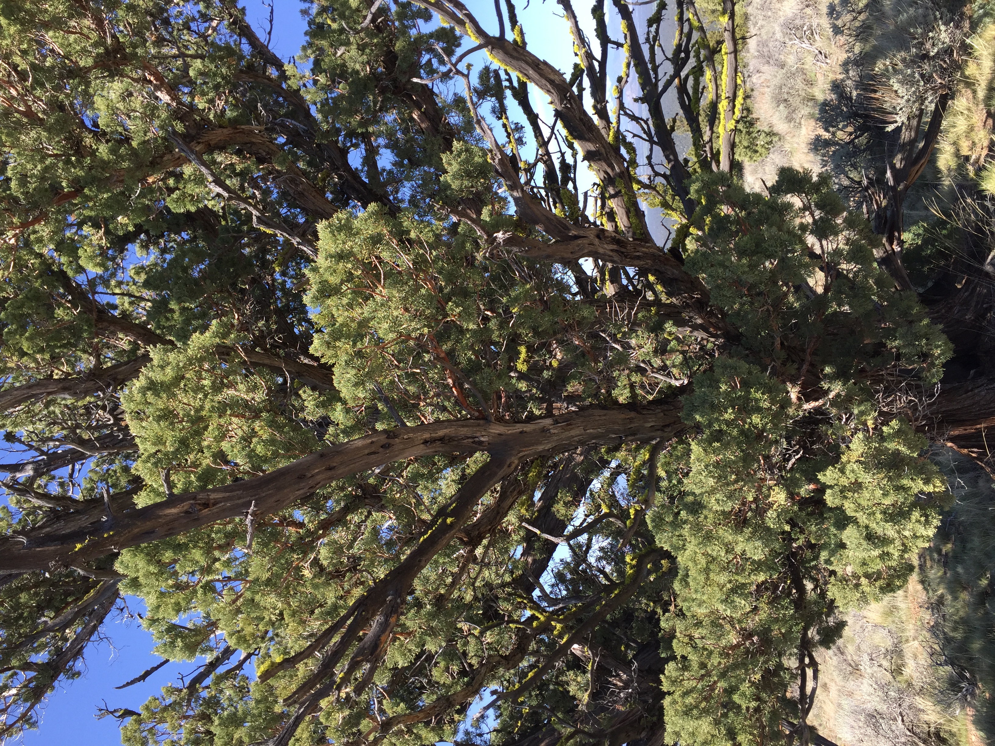
Haystack is a volcanic feature rising above US Route 97 11 miles northeast of Weed. The peak offers wonderful views of Mount Shasta to the south, the Trinity Mountains to the east, and the Mount Shasta Valley to the north. The trail is an overgrown 4WD trail to the top. Good parking is just off the highway inside a Forest Service gate. One walks about .4 mile before reaching the actual trail that starts the climb up the east flank of Haystack. The short climb takes a moderate effort to reach the top. The trail circles the rather flat, open top. Vegetation is typical high desert scrub with the scattered juniper tree. There is a high point marked with a cairn with a survey mark underneath and a summit log. The summit log revealed that Haystack is visited every few days by hikers. The distance from the parking area to the high point is about one mile.
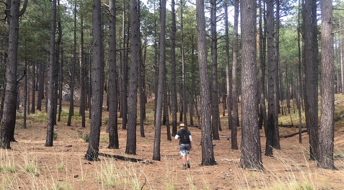
This was my first backpacking trip in over 10 years. I went with my buddy Joe, who’s about the same age as I, and we took the 15 year old son of a friend who couldn’t go due to back problems. Ryan is a good kid, in great shape, and has a great attitude. And who has a fondness for aluminum foil.
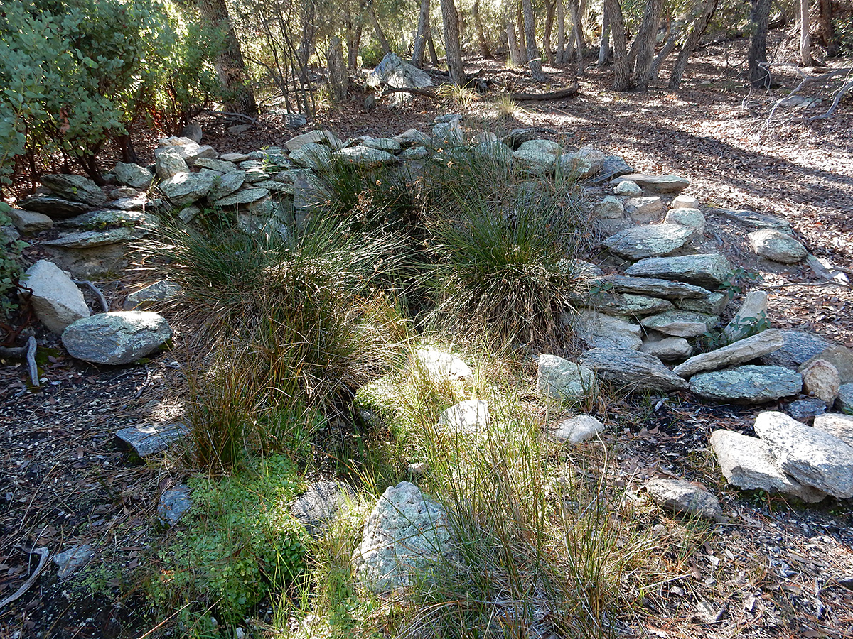
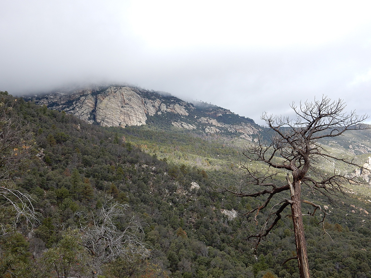
Our destination was the Spud Rock Spring campsite by way of the Turkey Creek Trail, located in the eastern side of the Rincon Mountains, in the Saguaro Wilderness Area of Saguaro National Park. From the eastside of Tucson, it’s about a 2 hour drive east towards Benson, getting off Interstate 10 at Mescal. From there, you head north into the Coronado National Forest to the Happy Valley area on Forest Service road 35. If you don’t have a high clearance four wheel drive, you have to park at Miller Flat and walk an extra 1.5 miles or so up FS 4408; otherwise, you can proceed through a gate and park at the end of FS 4408 to start the hike.


We left Tucson at 6:30 on Friday morning and arrived at the trail head in Happy Valley around 8:20 AM. Joe has a Jeep Liberty, so we were able to get the end of Forest Service road 4408 to start our journey, rather than having to park down the ridge and hike another 1.5 miles in. The weather was great, though still chilly at this time of morning – 36 degrees and clear. We hit the trail at 8:45, quickly shedding a couple of layers as we warmed up from the sun and exertion.
For the first couple of miles, the trail climbs slowly through savanna grasslands and oaks. After that, it was a slog for pretty much the next 3 miles. It was like doing Blackett’s Ridge in Sabino Canyon twice. We stopped frequently to catch our breath, as well as to enjoy the view and take photos. At Mud Hole Spring, we ate lunch and took a half hour nap.
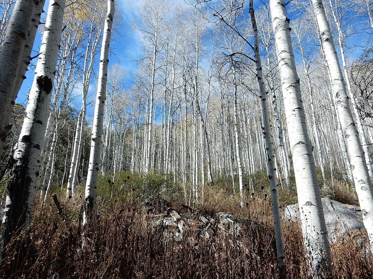
It was evident that this trail doesn’t get much use. It was overgrown almost all the way up, and in many spots, felled trees crossed our path. Near the end, about 3/8 mile from Spud Rock Spring, we spent about 20 minutes trying to follow the trail, due to overgrowth and debris on the trail. We finally arrived at the campsite at 5 PM. Of the three sites available, we made ours nearest the pit toilet and the bear box, which served double duty as a camp table. There was ample firewood about, but the no water at the spring, just a wet bog, surrounded by a large grove of aspen trees. Even if there had been a flow, the ranger had told Joe it was not good for drinking.
The ranger had also told Joe that we would be by ourselves on Friday night, but that the other two sites would be occupied on Saturday. We thought this odd, given it was November, it was the far side of the Rincons, and the threat of inclement weather loomed.
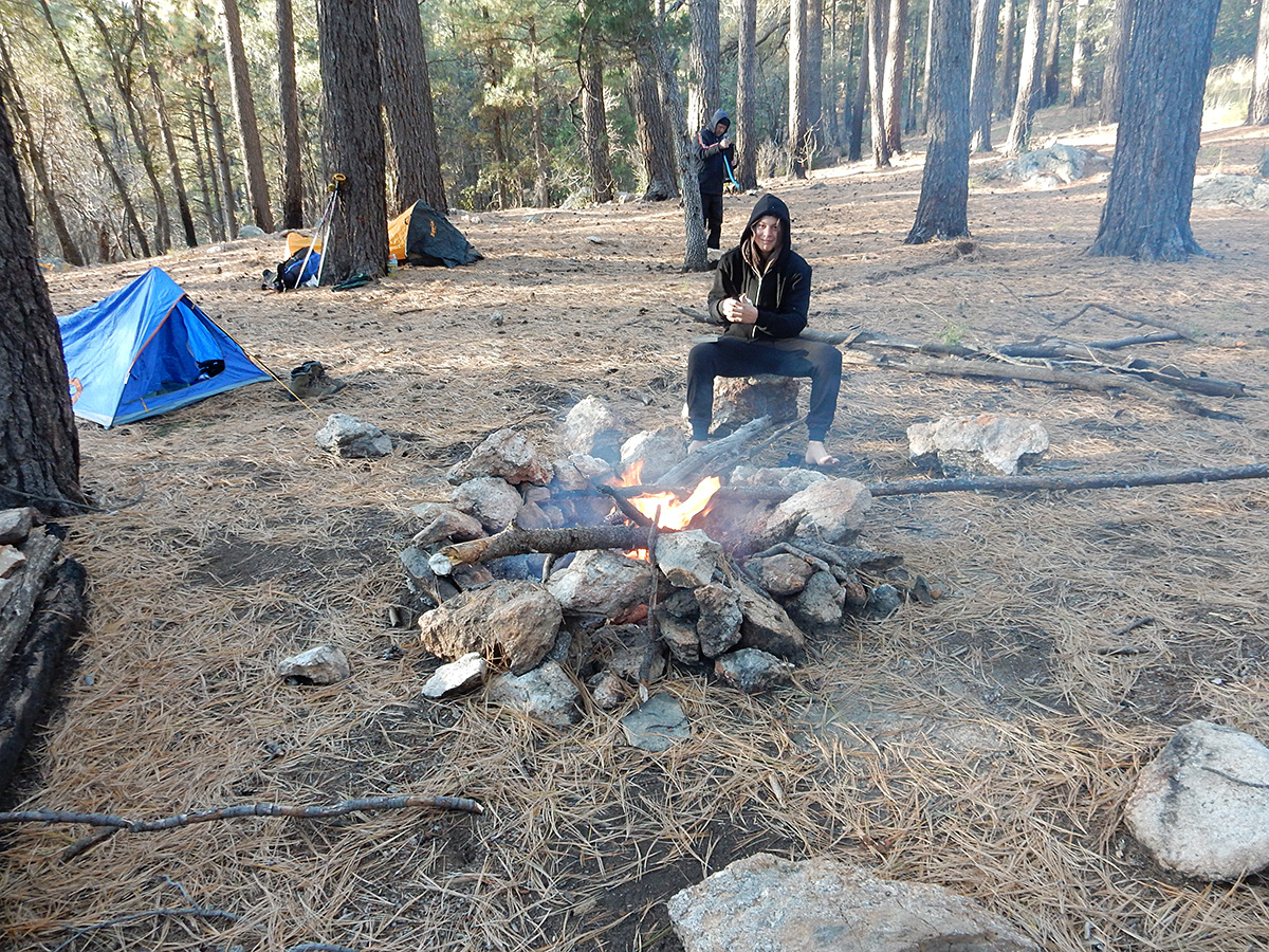
All of us had frozen meat with us (2 steaks and 2 chicken breasts) that had thawed out nicely during the day. We cooked these on small wire we had brought along, and supplemented these with baby carrots, dinner rolls, potatoes, and nuts. Ryan had not brought any plateware. Rather, he had a roll of aluminum foil. He took a flat piece of rock, and covered it with foil, using this as his plate. After dinner we made hot chocolate while a roaring fire danced before us. Ryan did not have a cup. Using mine as a mold, he fashioned one out of foil. We called it a night around 7:30. The night time temperature was quite pleasant, with almost no wind during the night.
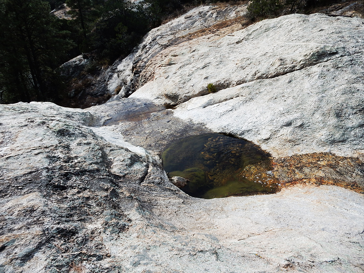
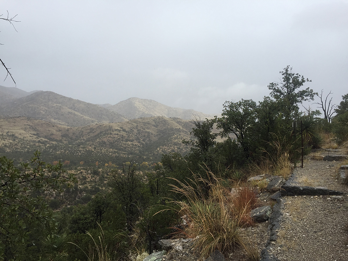
Saturday morning found us getting up around 7 AM. Quickly Ryan made a fire (he being 15, the fire was much larger than it needed to be, but boys will be boys) and we went about making coffee and breakfast. We spent most of the morning sitting around the fire, taking a nap mid morning, before getting our act together and heading over to Devil’s Bathtub to procure water. We missed the trail for the most direct route, taking a route that led us to a farther south meeting with the Heartbreak Ridge Trail, causing us to have to climb back up 500 feet, rather than staying fairly level.
At Devil’s Bathtub, we filled our bottles and bladders, ate lunch, and napped again in the warm rays of the sun on the gently sloping granite at the top of the falls. We didn’t go to the bottom of the falls, as we just didn’t want to do any more climbing than we had. After about an hour and a half, we made our back on the correct route to Spud Rock Spring.
As evening approached, we prepared dinner and built another roaring fire. The temperature dropped, but it was still comfortable. Ryan threatened to make a jacket out of, you guessed it, aluminum foil. Joe and I convinced him that he would be better served by just climbing into his sleeping bag. The skies overhead were clear, with no wind whatsoever. We began to doubt any arrival of rain during the night. Too, no other campers appeared either, though around 8 PM both Joe and myself thought we heard voices in the distance, but we never saw any lights or smelled smoke from other fires. About that time, we called it a night.
The rain came at 1:45 AM on Sunday.
It drizzled most of the night. Joe and I stayed dry, but neither of us noticed that Ryan had not put a rain fly on his tent, so he got a bit wet. By the time we got up at 7, the rain had abated, allowing us to eat some breakfast bars and break camp without too much fuss. We made our way out at 8:25 AM.
To make your way in or out of Spud Rock Spring, you climb a small ridge. As we went over and down that ridge, we came across 5 women in 3 tents in the area of the poor trail marking/overgrowth/felled trees. These were the hikers that held the permits for the other 2 sites, and the ones we had heard the night before. They had fought their way up the Turkey Creek Trail the day before, only to be stymied by the poor trail conditions and impending nightfall. The apparent leader walked over to us, inquiring about our campsite and water, as they had run out and were in the process of collecting what they could off their tent rainflies. Then, as panic set manifest itself in her eyes, she said “Perhaps this wasn’t the best trail or time to bring a couple of newbies on.” I think some friendships were damaged that day.
We made our way down through almost constant drizzle in four hours, without slipping and breaking anything. It was actually a pleasant experience. Sunlight shone upon us for the last mile, allowing us to dry somewhat before getting into the Jeep.
We enjoyed a late and large lunch at Reb’s Café in Benson before heading back to Tucson.
QUESTION: Why is Spud Rock Spring not even close to to Spud Rock? They are not even on the same ridge.
GEAR NOTES: I had checked out my old Coleman Peak 1 gas stove (dating back to 1982) last May, and it worked fine. When I tested it out before this trip, it was evident that it had developed bad seals, because the flames were burning yellow, and I couldn’t get new parts in time to rebuild it for use on this trip. So I bought an Optimus Crux Lite canister stove and the Optimus Terra Solo Cook Set. A small canister sits inside the cook set, along with the stove, and the cook set comes with a mesh stuff bag that doubles as a scrub cloth. The stove worked perfectly, and the cook set was just right for what I needed (making hot drinks and boiling water for instant oatmeal, a pouch dinner, and clean-up).

I also needed to get some shelter at the last minute. An offer of a borrowed bivy did not come through, and I didn’t want to pack my Mountain Hardware Optic 3.5 up the mountain, so I ended up getting a $39.99 1 person tent at Big Five at 8:55 PM on Thursday night. It worked great. It’s actually pretty well made for the price, with a generously sized mesh side panel to get in and out of, mesh panels on the other sides, a rainfly, and a fitted footprint. It was vented well, and I didn’t get any condensation. Both the tent and rainfly have good zippers, reinforced tie-down points, and the weight is 3 pounds. The factory sealed seams did not leak in the rain. Not a bad deal for back up or light duty bivy. Branded “Golden Bear”, one of the Rec-Out brands (Rugged Exposure, Columbus).