CONTENTS
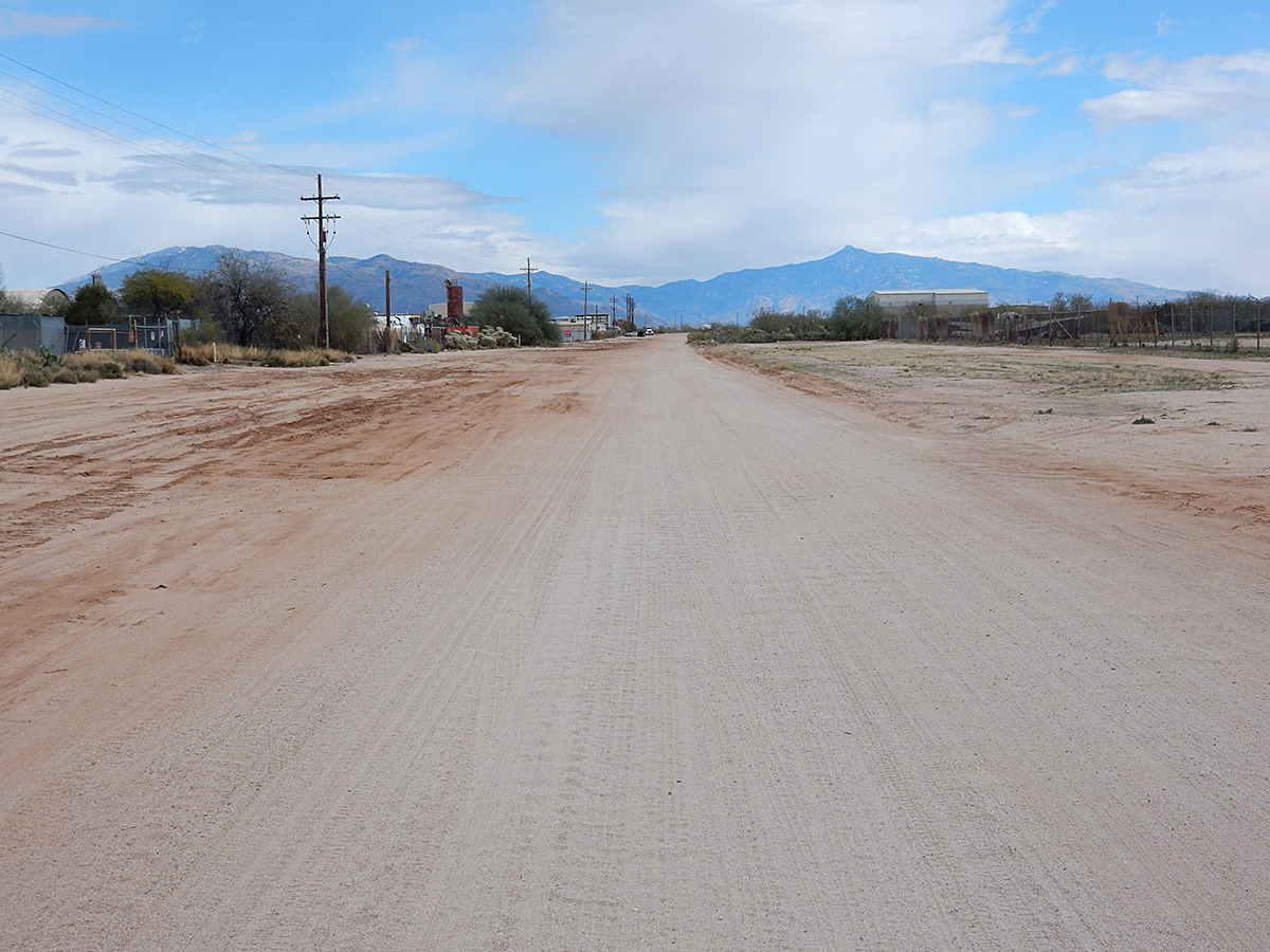
Allied Airstrip
Benson Intermediate Field/Benson Airport (original)
Davis-Monthan Air Force Base
Allied Airstrip
(last edit 11 March 2017)
Location: Tucson
Coordinates: 32.148583, -110.853222
Status: Closed; repurposed as a city street (as E Drexel road between S Wilmot Rd & S Mann Ave)
Opened: Early 1960’s (source: Abandoned & Little-Known Airfields)
Note that the airstrip is noted on the 1977 edition of the topo map below, but not on any previous edition of that map
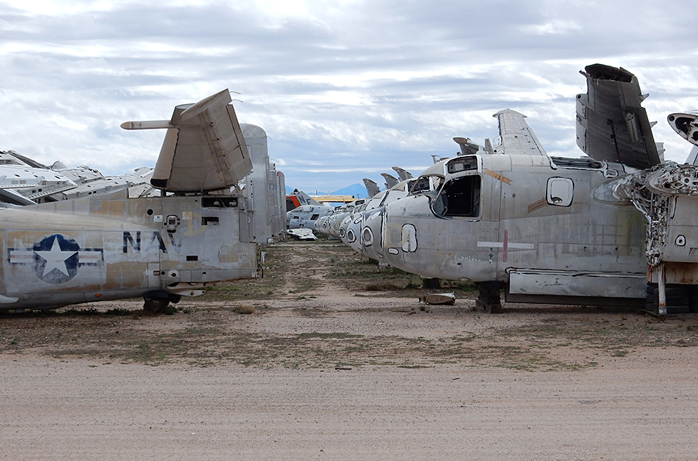
Purpose: Used to service it’s namesake aircraft scrapyard, as well as others adjacent to Davis-Monthan Air Force Base
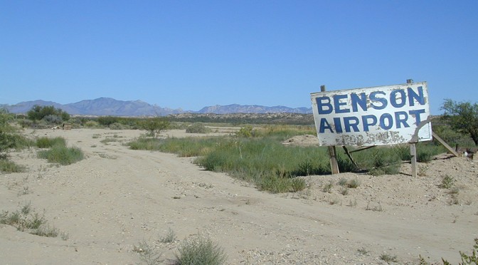
Benson Intermediate Field/Benson Airport (original)
(last edit: 8/2/15)
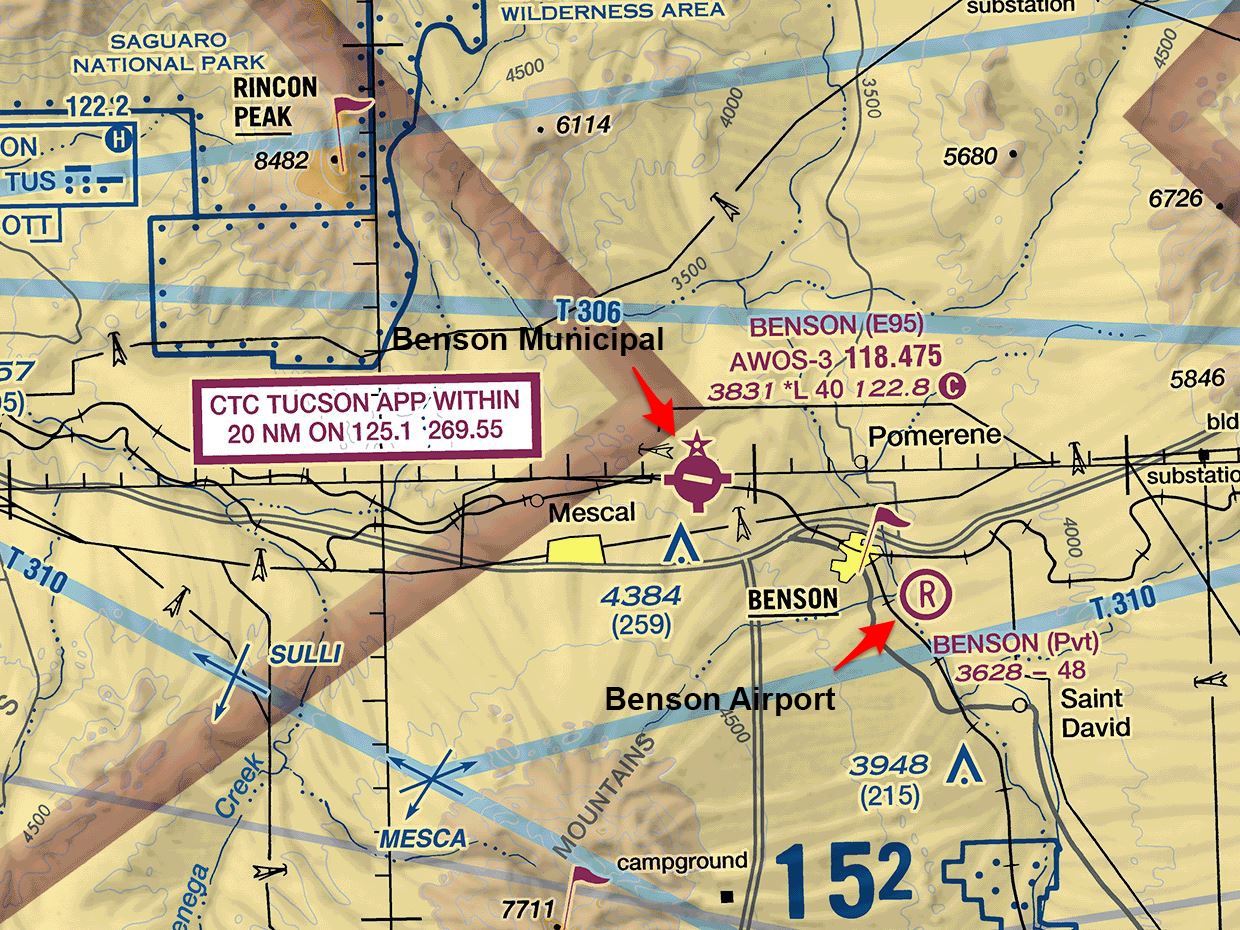
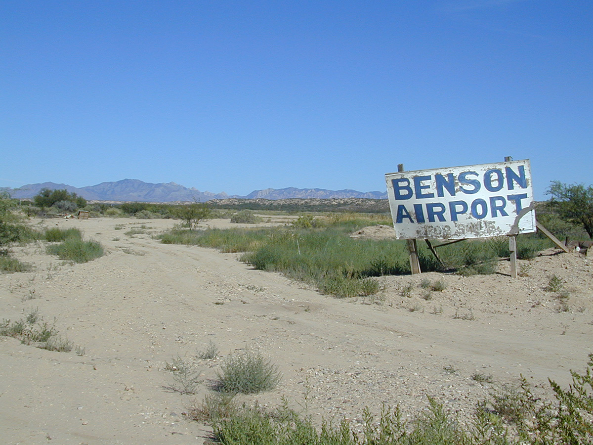
Location: Benson
Coordinates: 31°57’49.2984″, -110°15’35.2434″
Status: Closed; runways evident but unusable; site undeveloped (as of 13 February 2017)
Opened: 1930-1931 (source: Abandoned & Little-Known Airfields)
Closed: After 1999 and before 2004 (source: Abandoned & Little-Known Airfields; personal visit in 2004)
Last surface: Unpaved
Of note, the Phoenix Sectional Aeronautical Chart, 30 April 2015, still shows this field as active.
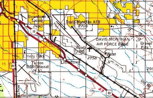
Davis-Monthan Air Force Base
(last edit: 8/2/15)
Location: Tucson
Coordinates: 32°09’59”, -110°52’59”
Status: Active Military
1927: Became Tucson’s new municipal airport, replacing the one at the current site of the Tucson Rodeo Grounds (6 October). Dedicated on 23 September 1927 as Davis-Monthan Field. A small military aviation presence was established on-site.
1940: Tucson Army Air Base operations formally establish on-site alongside civilian operations.
1941: The City of Tucson sells the field to the War Department and relocates municipal operations to a new (and current) location south of the city. Tucson Army Air Base formally becomes Davis-Monthan Army Air Field on 1 December 1941
1948: Became Davis-Monthan Air Force Base (13 January, 1948 to present)

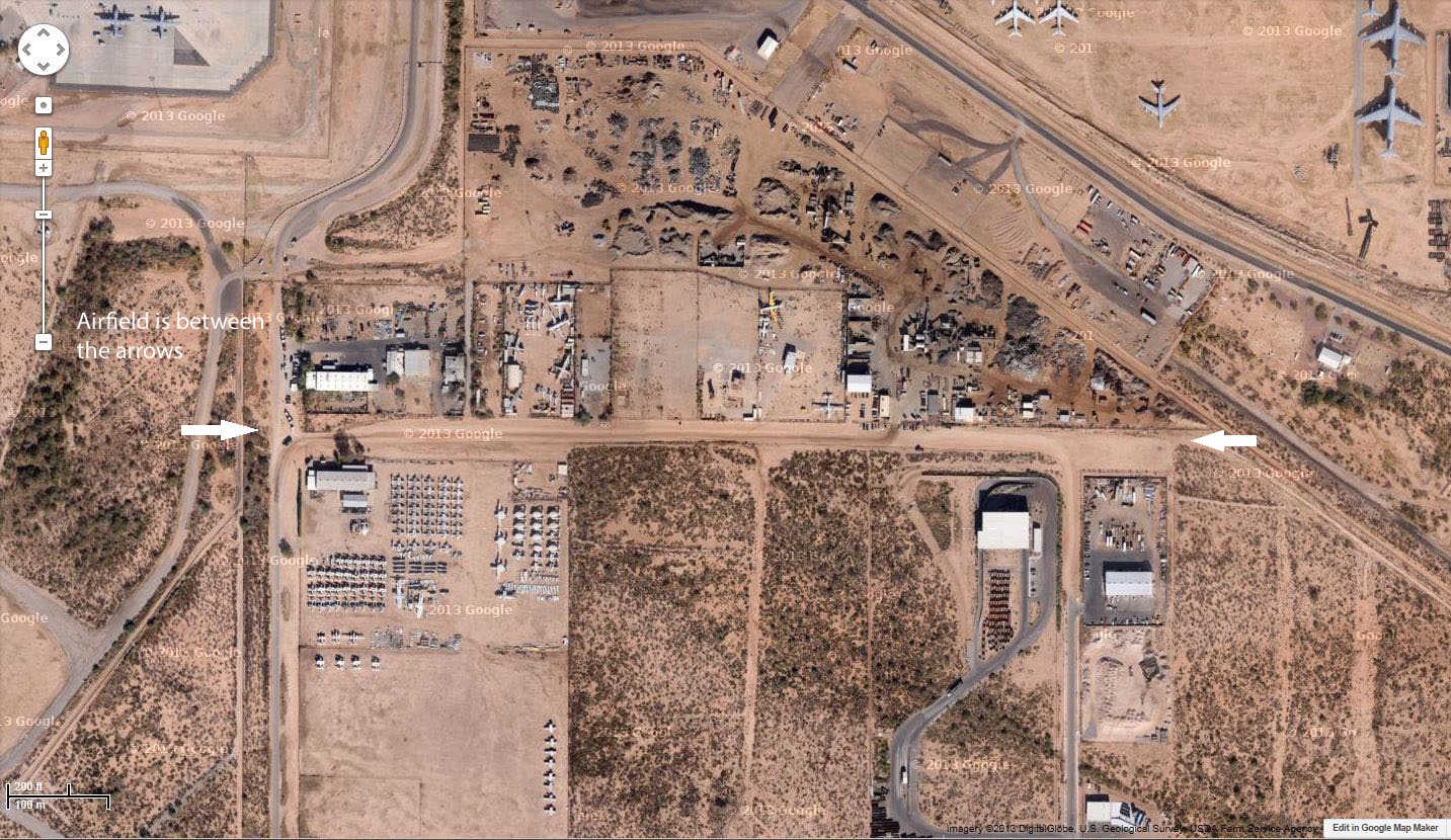
At present, Davis-Monthan has only one runway (12/30), 13,643 feet in length. Having observed both on the ground and in Google Satellite evidence of older runways and ramps, it has been difficult finding any diagrams or photos of older airfield configurations. Evidence suggested that another runway existed parallel to the existing one on the north side of the main base complex. Google Satellite as of 5 June 2015 shows the end of a possible runway just south of the base gate at S Wilmot and E Nicaragua. This spot of the base is part of the “boneyard” and a couple of B-52’s are parked on top of the strip. One white and two yellow X’s can be discerned in the image.

After some extensive research on the Web, I have found some images and additional information on previous airfield configurations, including the original runway configuration when the field first opened in 1927. I’ll post those images if and when I can get clearances to do so.
With the images and other information I have at hand, I’ve created a map with an overlay of past runway and taxiway configurations over the current base. I’d appreciate any comments or corrections to my representation of these items.
Click on any line to get a description.
REFERENCES
Davis-Monthan Air Force Base website, Davis-Monthan Air Force History, page published 2 June 2009
Tucson Airport Authority website, History, accessed 11 February 2017